

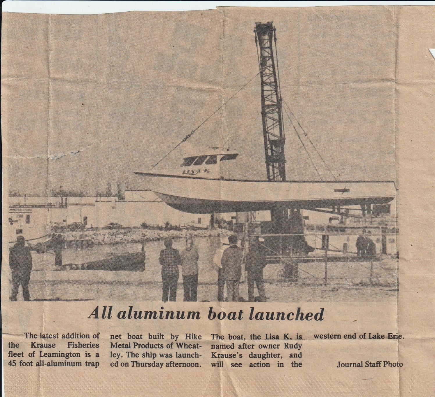
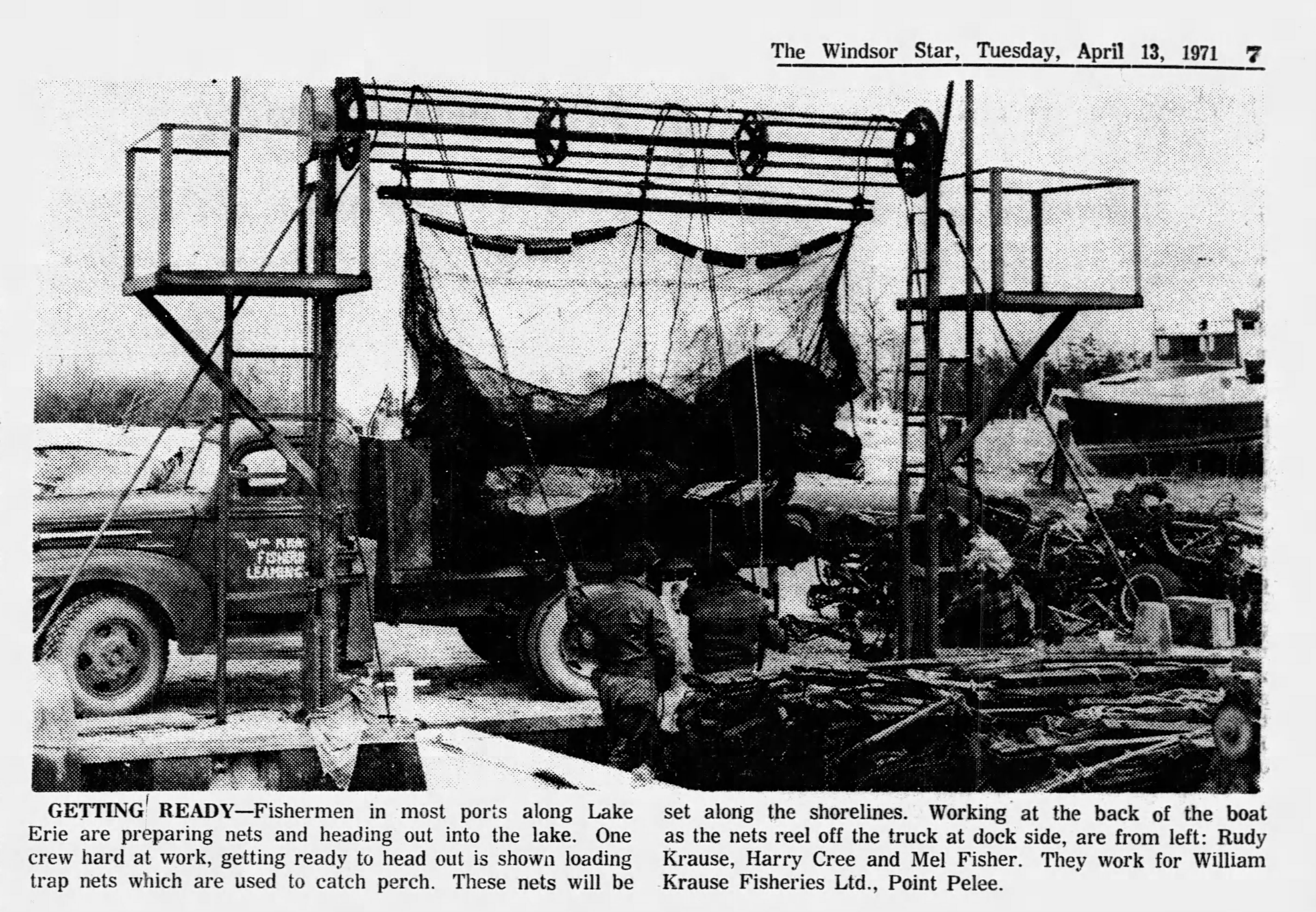
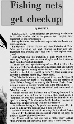
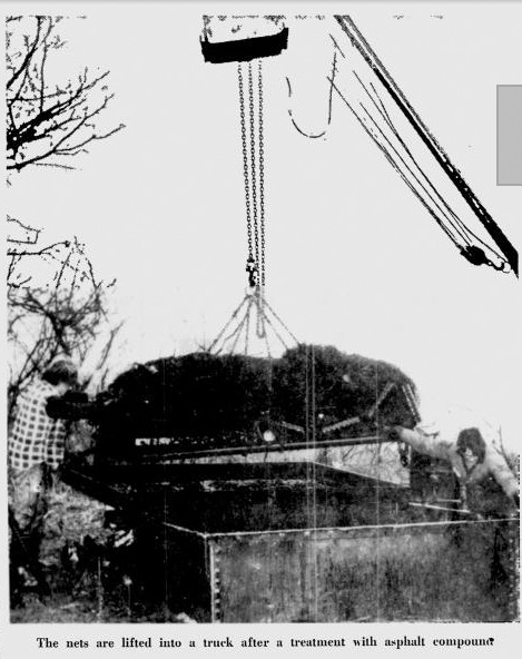
Krause Fisheries Inc.
|
|
||||||||||||||||||||||||||||||
ERIC KRAUSE
In
business since 1996
_____________________________________________________________________________________
ERIC KRAUSE GENEALOGY
_____________________________________________________________________________________
![]()
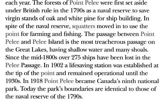
THE FISHERIES OF POINT PELEE (A) INTRODUCTION Fishing
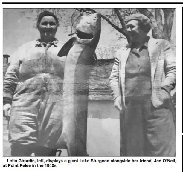
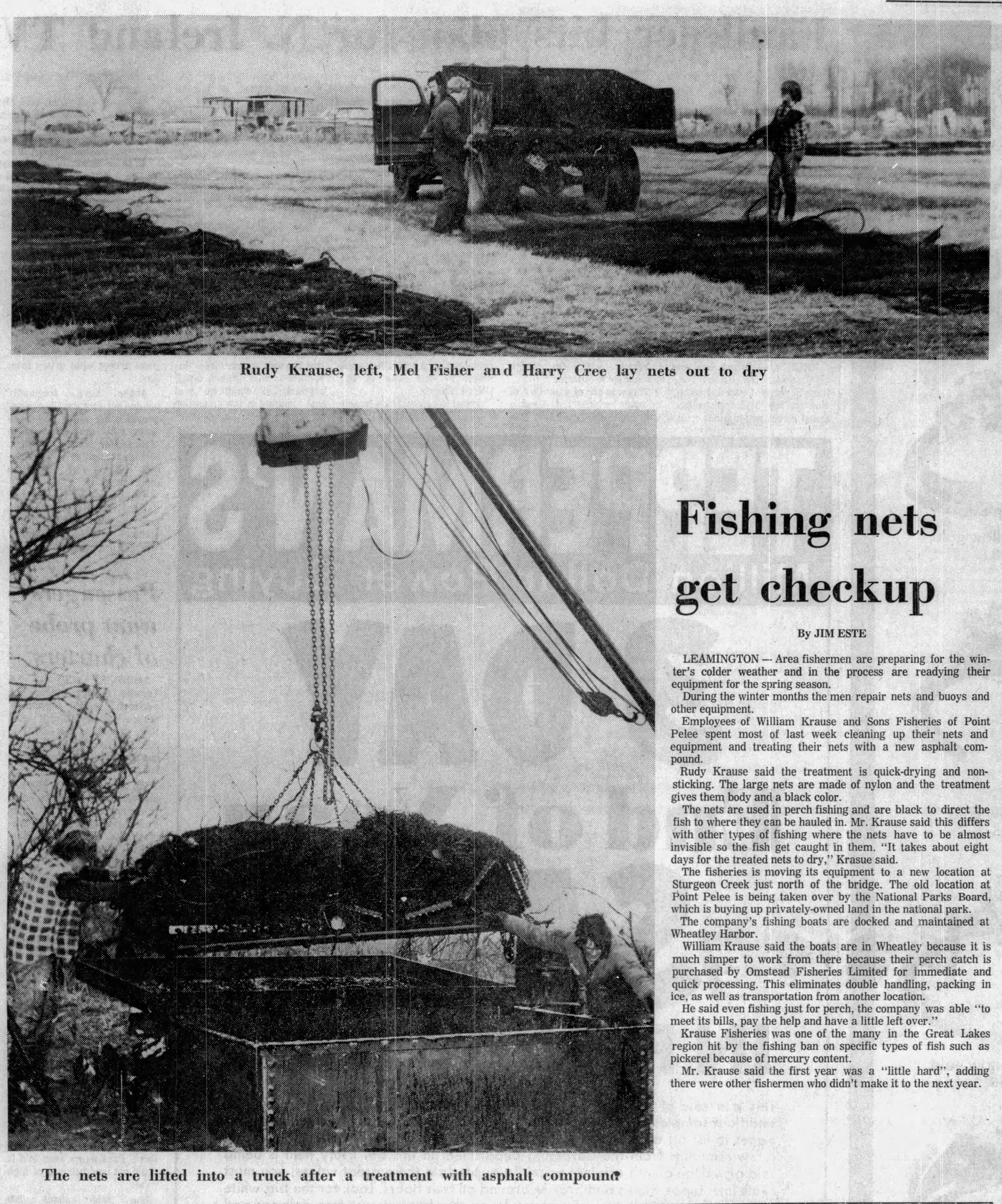
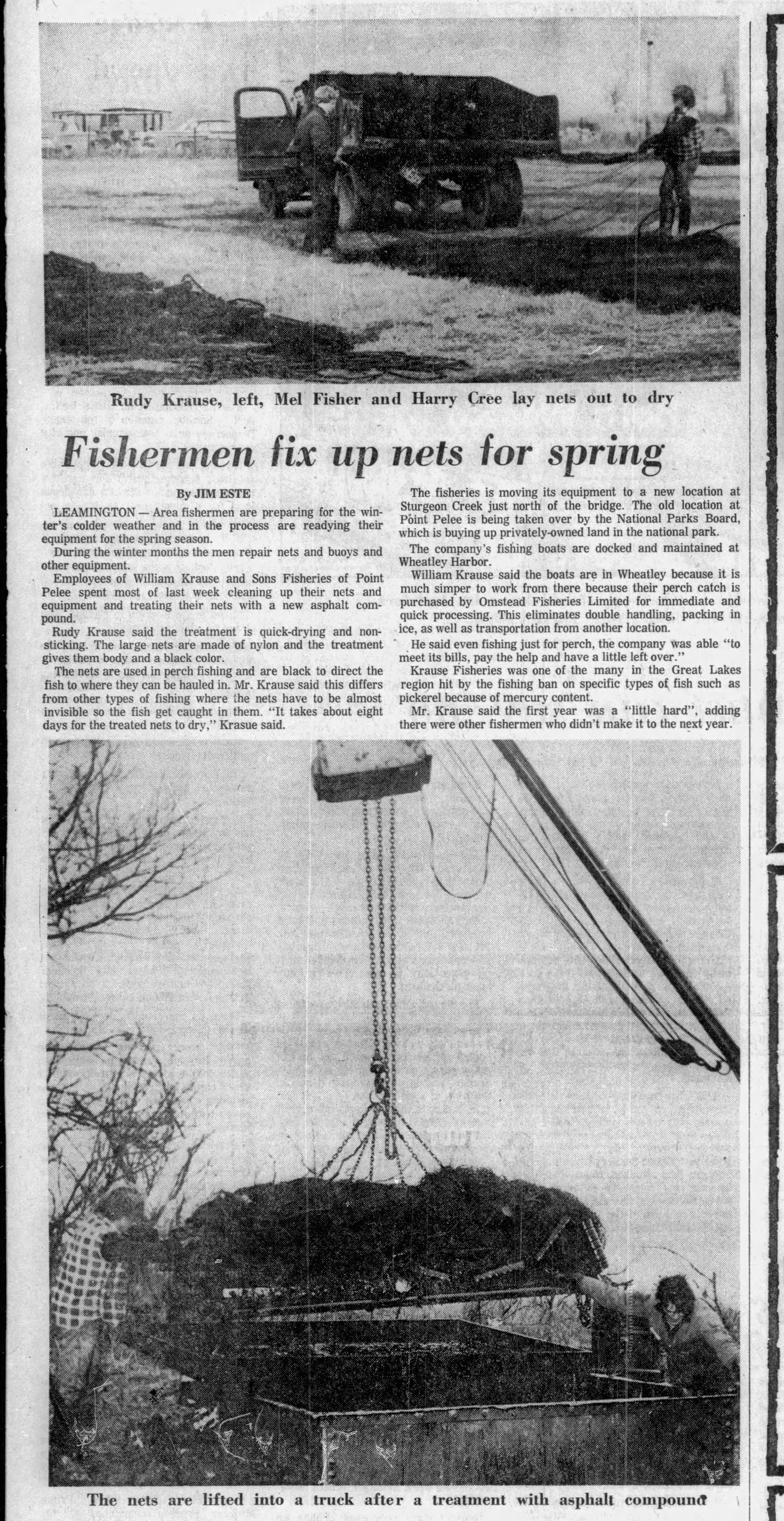
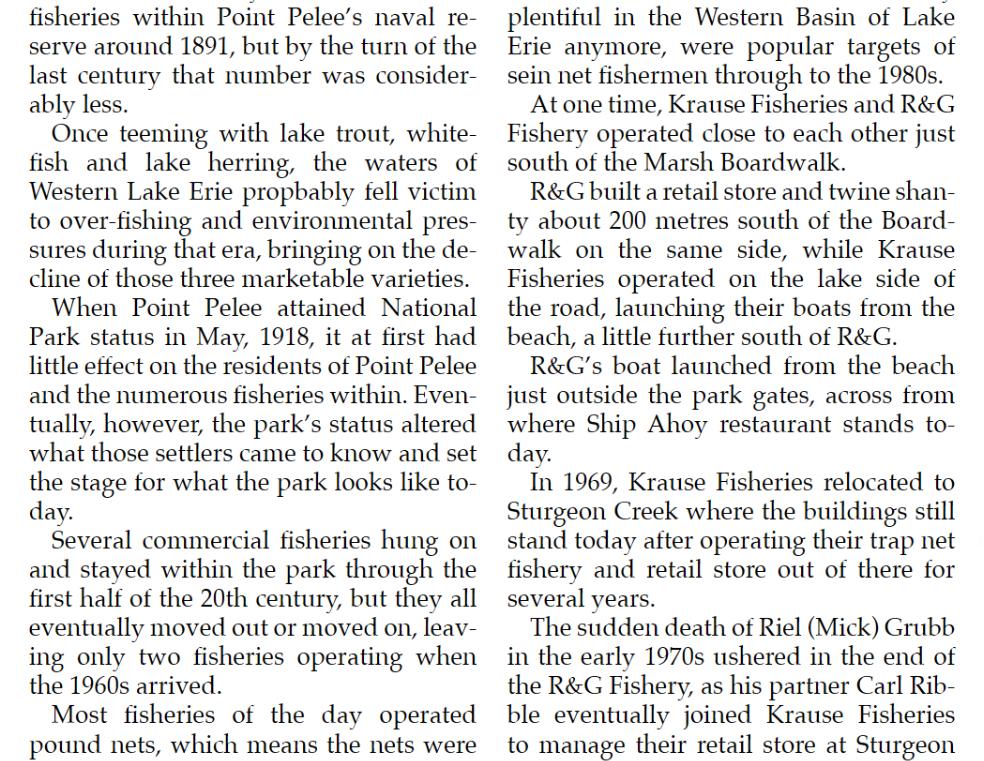
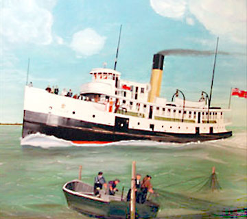
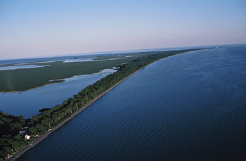
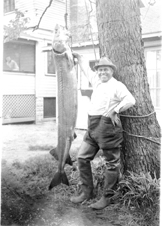
Letia Girardin, left, displays a giant Sturgeon alongside her
friend,
Jen O'Neil, at Point Pelee in the 1940s
![]()
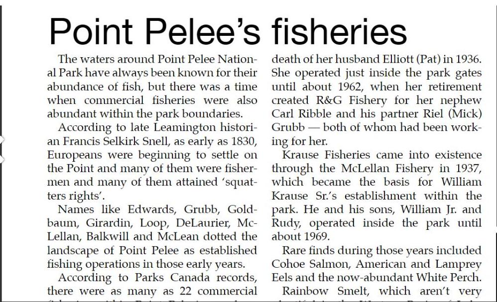
The waters around Point Pelee National Park have always been known for their abundance of fish, but there was a time when commercial fisheries were also abundant within the park boundaries.
According to late Leamington historian Francis Selkirk Snell, as early as 1830, Europeans were beginning to settle on the Point and manv of them were fishermen and many of them attained 'squatters rights'.
Names like Edwards, Grubb, Goldbamn, Girardin, Loop, DeLaurier, McLellan, Balkwill and McLean dotted the landscape of Point Pelee as established fishing operations in those early years.
According to Parks Canada records, there were as many as 22 commercial fisheries within Point Pelee's naval reserve around 1891, but by the turn of the last century that number was considerably less.
Once teeming with lake trout, whitefish and lake herring, the waters of Western Lake Erie propbably [sic probably] fell victim to overfishing and environmental pressures during that era, bringing on the decline of those three marketable varieties.
When Point Pelee attained National Park status in May, 1918, it at first had little effect on the residents of Point Pelee and the numerous fisheries within. Eventually, however, the park's status altered what those settlers came to know and set the stage for what the park looks like today.
Several commercial fisheries hung on and stayed within the park through the first half of the 20th century, but they all eventually moved out or moved on, leaving only two fisheries operating when the 1960s arrived.
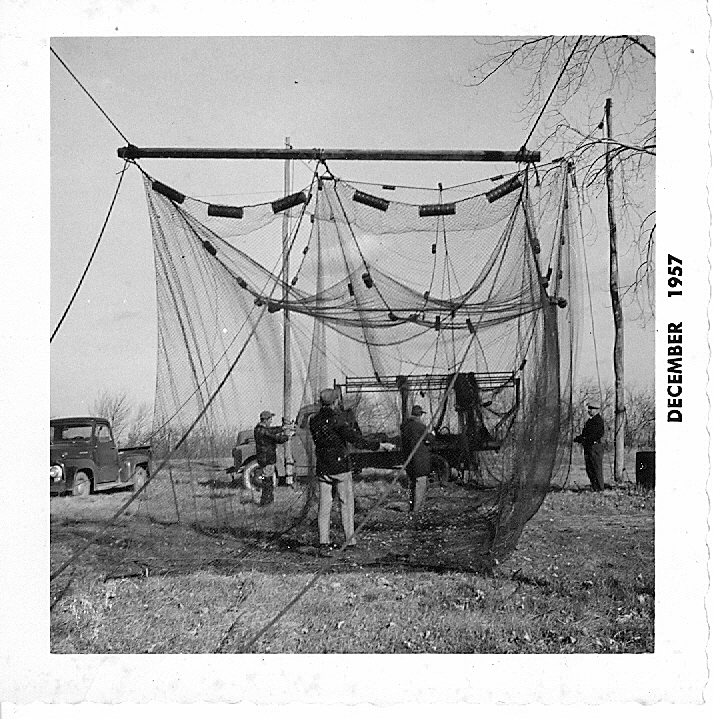
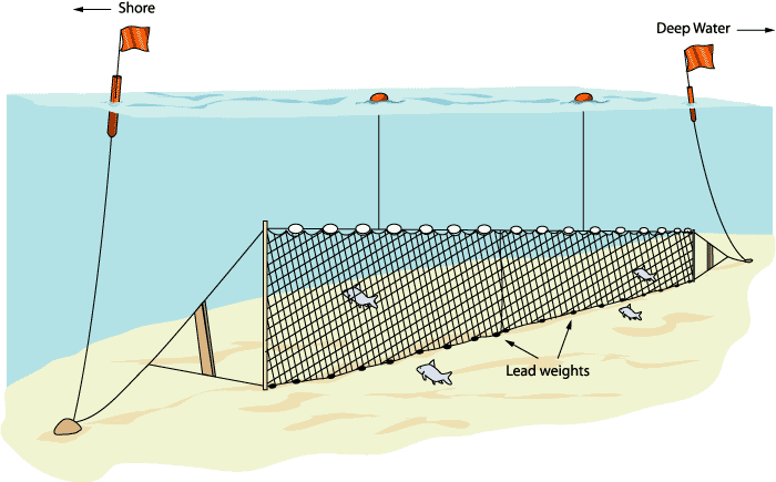
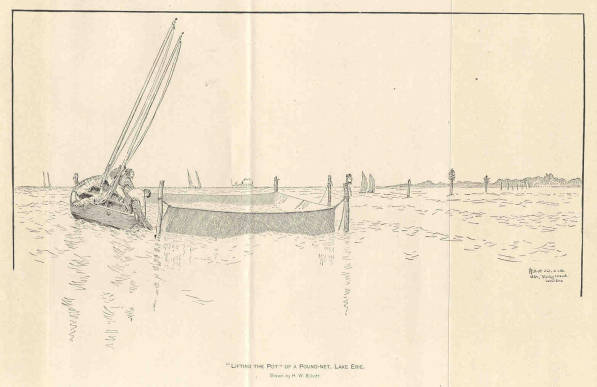
Most fisheries of the day operated pound nets, which means the nets were suspended in the water by long poles or posts. That eventually gave wav to trap netting, which was the method used by the final two fisheries inside the park.
The Girardin Fishery - first established in 1911 - was taken over and run by Leita Girardin after the untimely death of her husband Elliott (Pat) in 1936. She operated just inside the park gates until about 1962, when her retirement created R&G Fishery for her nephew Carl Rubble and his partner Riel (Mick) Grubb - both of whom had been working for her.
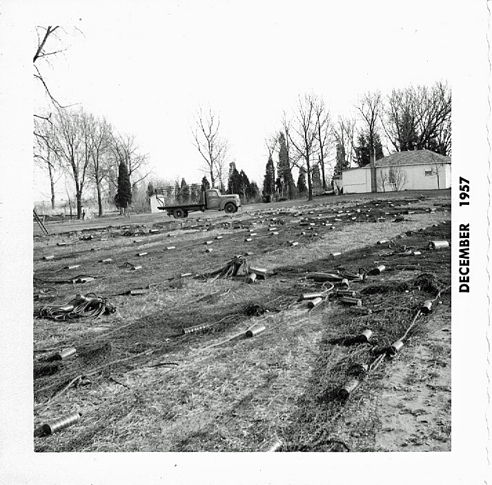
Krause Fisheries came into existence through the McLellan Fishery in 1937, which became the basis for William Krause Sr.'s establishment within the park. He and his sons, William Jr. and Rudy operated inside the park until about 1969.
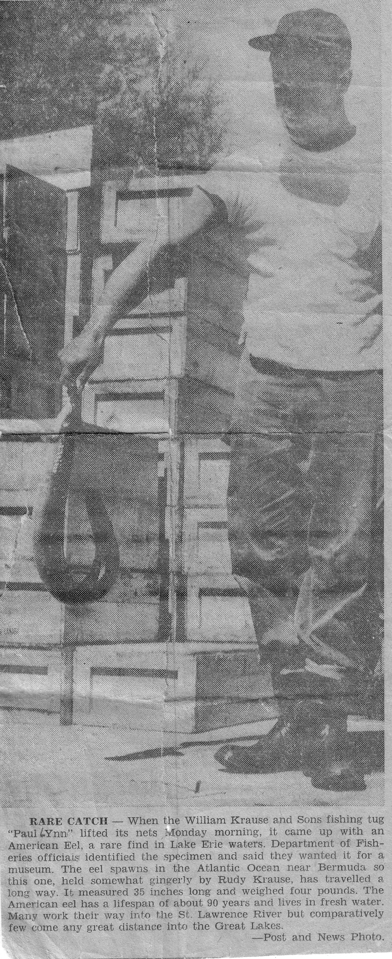
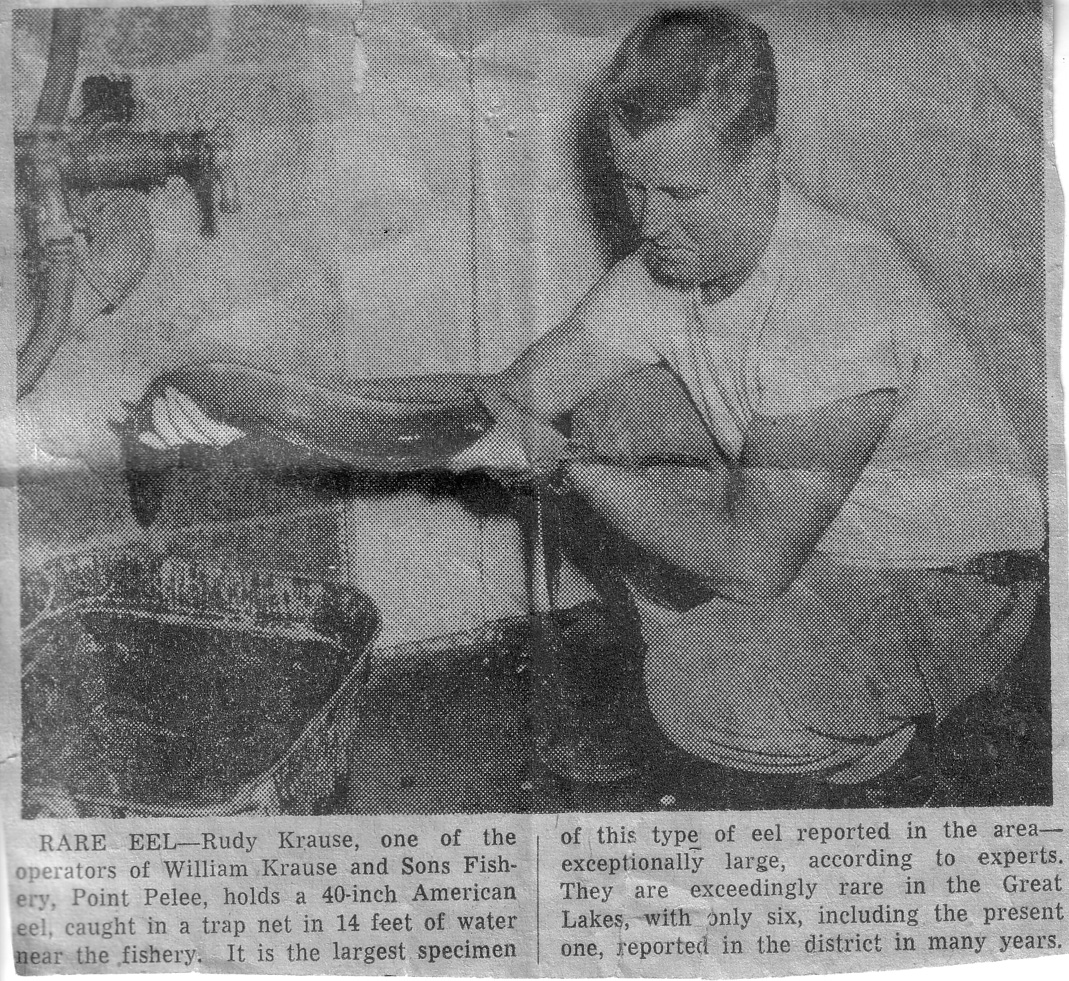
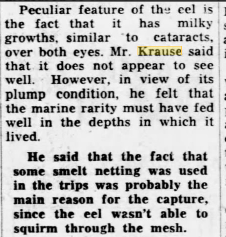
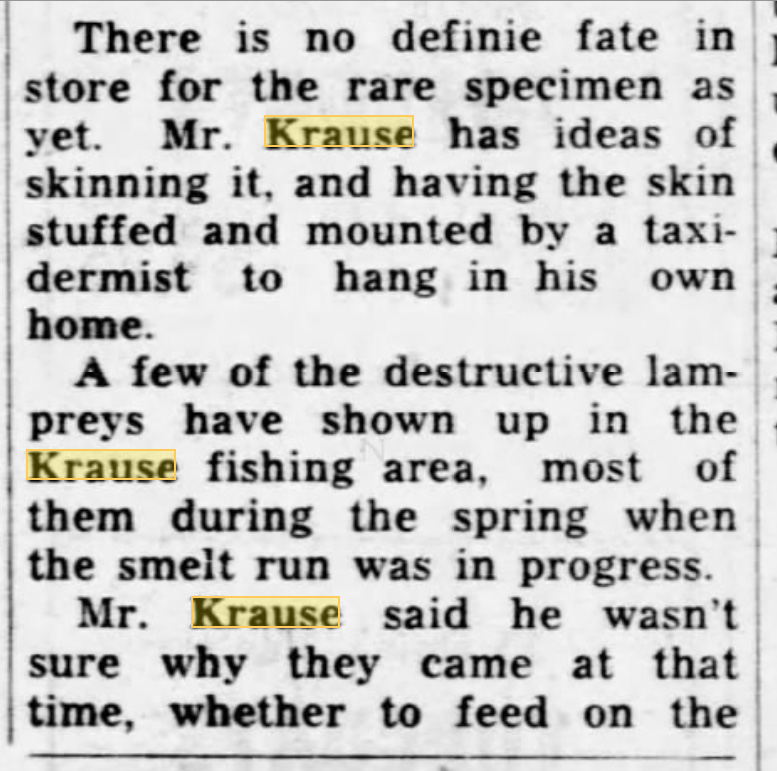
Rare finds during those years included Cohoe Salmon, American and Lamprey
Eels and the now-abundant White Perch.
Rainbow Smelt, which aren't very plentiful in the Western Basin of Lake Erie
anymore, were popular targets of sein net fishermen through to the 1980s.
At one time, Krause Fisheries and R&G Fishery operated close to each other just south of the Marsh Boardwalk.
R&G built a retail store and twine shanty about 200 metres south of the Boardwalk on the same side, while Krause Fisheries operated on the lake side of the road, launching their boats from the beach, a little further south of R&G.
R&G's boat launched from the beach just outside the park gates, across from where Ship Ahoy restaurant stands today.
In 1969, Krause Fisheries relocated to Sturgeon Creek where the buildings still stand today after operating their trap net fishery and retail store out of there for several years.
The sudden death of Riel (Mick) Grubb in the early 1970s ushered in the end of the R&G Fisherv, as his partner Carl Ribble eventually joined Krause Fisheries to manage their retail store at Sturgeon Creek.
Letta Girardin, who owned the land on which R&G operated inside the park, sold the property to the federal government in 1974 - making it the last of the fisheries of Point Pelee.
Southpoint Sun, February 5, 2025, p. 16
https://issuu.com/southpointsun/docs/southpoint_sun_-_february_5_2025
The waters around Point Pelee were well known for their abundance of fish. The "pointers," as the squatters came to be known, took full advantage of this. At first their catch went mostly to fill their own needs, but later they followed the example of the Americans and began commercial fishing.
By 1891, 22 commercial fisheries were operating from the naval reserve, but many were short-lived. Ten years later, over-fishing and other environmental stresses had brought about the decline of the most marketable fish: the lake trout, whitefish, and lake herring.
[Source: http://www.pc.gc.ca/pn-np/on/pelee/natcul/natcul2_2_e.asp ]
... National Park Status and its Effects
At first, National Park status probably had little effect on the day-to-day lives of the naval reserve residents. Eventually it dramatically altered all the pre-Park use of the area, setting the stage for what Point Pelee has become today. For example, by the 1960s, several commercial fisheries still operated from the Park. But the government's decision to acquire private land within the Park partly to "... improve the scenic drive" drove all but the [Leita] Girardin and Krause fisheries out. In 1962, the Girardin fishery moved north of the Park. Seven years later, the Krause fishery's lease expired, and they too left. The demise of this, the last commercial fishery in the Park brought an end to an era which had lasted more than 100 years ...
[Source: http://www.pc.gc.ca/pn-np/on/pelee/natcul/natcul2_4_e.asp ]
As early as 1830, some Europeans had started moving onto Point Pelee. The original settlers were fishermen ... When the land was transferred to Canada, the agreement stipulated that the rights of these squatters be recognized and protected ...
[Source: Frances Selkirk Snell, compilier, Leamington's Heritage 1874-1974, Town of Leamington, 1974, Point Pelee, pp. 178-189 ]
A gill net has attached floats along its top and weights along its bottom causing its stretched netting to stand 6- to 12-foot-high tall in a line either floating or set along the lake Erie bottom. Smaller fish swim through a netting of fine twine with openings of an approved size. Larger fish too big in their girth to swim through the netting, try to back out, but then get caught by the gills in the netting. After "pulling" the gill net to extract the fish, the fisherman either reset it, or set it in another location.
[Source: http://www.miseagrant.umich.edu/nets/largegill.html ]
[Source: http://www.seagrant.umn.edu/fisheries/nets ]
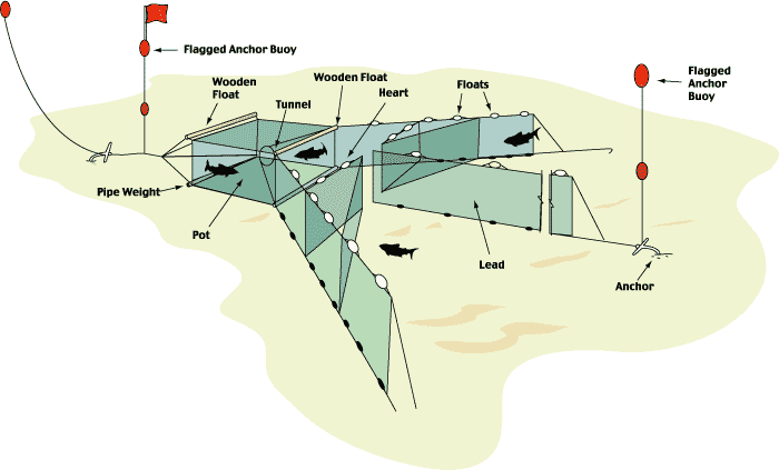
A pound net has a long lead net that hangs from floats on the surface down to the bottom of Lake Erie, and two wing nets connected to an open-top heart and "pot" or pound. Posts that stick above the water surface anchored the system in place for the fishing season. Fish swam along either side of the lead net, directing them into a narrow opening between the ends of the two wing nets. The wing nets curled inward to form a heart-shaped enclosure ("heart") that ensured that the fish moved toward a tunnel into the net's pot. An open boat was then used to float into the pound after lowering one side of the net slightly; the net then gathered into the boat, and the fish then corralled into a small area and scooped up.
[Source: http://www.bobdoxsee.com/Bright%20Eye%20Items_POUND_FISHING/Bright%20Eye%20Icons%20Page.htm ]
In Leamington, a note to a " flat bottom pound boat (fishing boat used for pound net fishing) then 24 feet long" was recorded in 1899.
It had returned from a wood sawing bee in the country with my man-sized brothers (Herm & Aub Robson) and cousin Jack. We owned a flat bottom pound boat (fishing boat used for pound net fishing) then 24 feet long. We called her "The Daisy" and a daisy she was - single cat rig, tight set to the sea, fat and quick on the tiller as a gull on the wing. The toast of our shores was our Daisy - she and the two men who sailed her, Jack and Herm. It took precious time to unstow the Daisy's winter stored canvas and fit out the stripped craft ... Her great sail reefed and set, the Daisy slipped into the winter water, With a free sheet she swept out and away, like something frightened.
http://familytreemaker.genealogy.com/users/r/o/b/George-Robson/PDFBOOK1.pdf - The Descendants of Gaven Robson by George M. Robson)
SS Pelee - http://www.chicheemaun.com/jii/french/about.html
[Source: http://content.lib.washington.edu/index.html ]
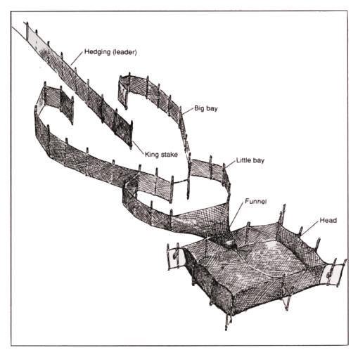
A tarred trap net likewise had a long lead net, a heart, and a tunnel leading into a pot that was later "lifted" to bring the fish to the surface. Submerged however was the heart, tunnel, and pot, and floats and anchors replaced the poles. If necessary (few or no fish), the net(s) could be "pulled" and re-set in another location in a day or less depending upon the number moved.
[Source: http://www.miseagrant.umich.edu/nets/trapnets.html ]
_________________________________________________________________
(B) GENERAL CHRONOLOGY
Naval Reserve to Today
" ... In spite of the naval reserve, squatters moved in to use the point for farming and fishing ..."
Guide to Sea Kayaking on Lakes Huron, Erie, and Ontario: The Best Day Trips ... By William Newman, Sarah Ohmann, Bill Newman, p. 132.
http://books.google.ca/books?id=3RXfQC7C0-cC&pg=PA132&lpg=PA132&dq=
squatters++point+pelee&source=bl&ots=vT9gDjZOwq&sig=
JgCKALv3isnGH5A4efntWEa63T4&hl=en&sa=X&ei=
SD-zUebuBsTI0wHPmoDQBw&ved=0CEUQ6AEwBQ
See also: Parks Canada Acquired Land at Point Pelee and My Life at Point Pelee National Park - 1943-1968
1789 - 1859
![]()
![]()
"In 1789 Thomas McKee took possession of the land in question as a squatter without legal title, and in 1823 his family sold the land to William McCormick. When McCormick dies he left the land to his children. After sixty years of unchallenged occupation the crown sought to recover the unsurrendered land ..."
Thomas McKee and William McCormick
White Man's Law: Native People in Nineteenth-Century Canadian Jurisprudence By Sidney L. Harring, pp. 74-75.
http://books.google.com/books?id=hDogK
SCOmYC&pg=PA75&dq=squatters+pelee&hl=en&sa=X&ei=IzqzUcXVLoW64AOTioCYAQ&ved
=0CCsQ6AEwADgU
____________________
1850
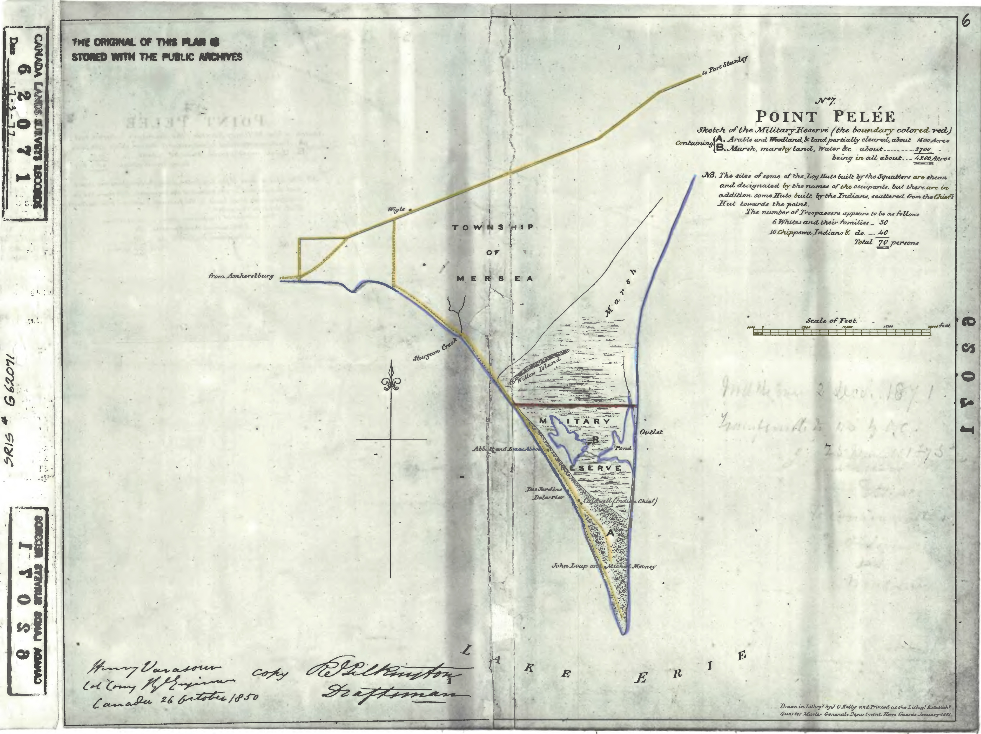
Only Names: Abbot and Issac Abbot, Des Jardins [Girardin?], Delarrier [Delaurier],
John Loup [Loop] and Michael Mooney, Caldwell (Indian Chief)
Total Families: 6 whites and their families (30 people); 10 Chippewa Indians and their families (40 people)
October 26, 1850
Published: J. G, Kelly, 1851
Natural Resources, Canada, www.nrcan.gc.ca - Canada Lands Survey System
http://satc.rncan.gc.ca/plansearch-rechercheplan-eng.php
NOTE:
1851 CENSUS
Province of Canada, Mersea Township, Point Pelee
John Loop: Age 60, Labourer;
Warren
Loop, Age: 24, Labourer; John Loop: Age 40, Labourer;
William Loop: Age 18, Labourer;
Michael Monie [Mooney],
Age 30, Labourer;
Chs.
delorier [Delaurier], Age: 52, Labourer; Baptiste delorier [Delaurier], Age: 20,
Labourer;
Clovis delorier [Delaurier], Age: 18, Labourer;
Issac Abbot, Age 28, Labourer; 23 Pagans
http://data2.collectionscanada.gc.ca/e/e094/e002347810.jpg
https://www.bac-lac.gc.ca/eng/census/1851/Pages/1851.aspx
____________________
Point Pelee in 1851
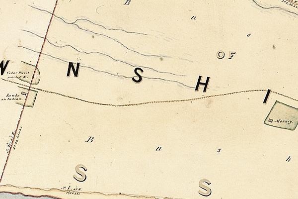
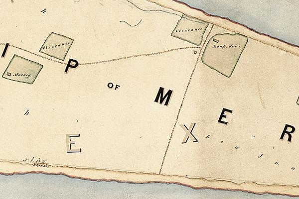
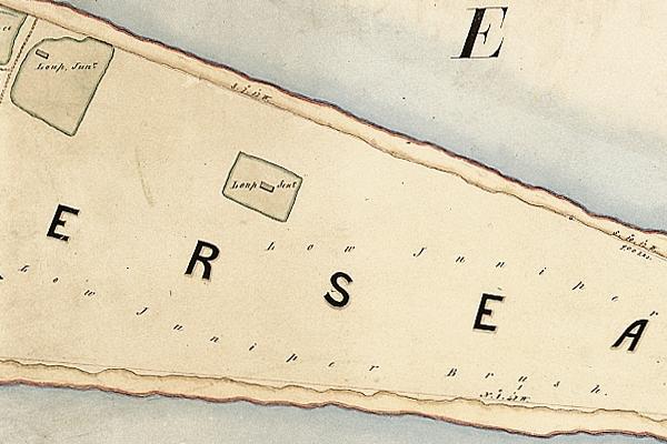
Click on the 1851 Images above to enlarge them
[Saube?] du Indian; Mooney; Loop Senr; Loop Junr
ENTIRE MAP - PDF
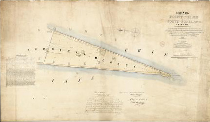
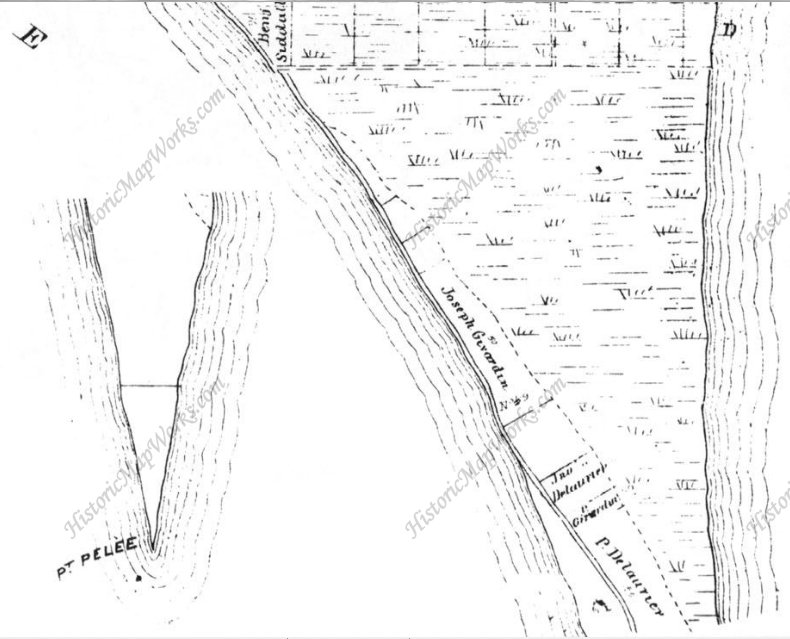
Canada. Point Pelee or South Foreland, Lake Erie. Plan
shewing the Boundaries
as marked on the ground, of the Land to be vested in the Ordnance at Point Pelèe,
on Lake Erie,
in the County of Essex & Township of Mersea, as surveyed by Mr. John A.
Wilkinson Provl.
Land Surveyor in the month of May, 1851. [cartographic material].
SOURCE: 1851- Library and Archives of Canada: ROYAL ENGINEERS OFFICE Wilkinson, John A. Wilkinson, Berdoe A. Gordon, Alexander. Canada. Point Pelee or South Foreland, Lake Erie. Plan shewing the Boundaries as marked on the ground, of the Land to be vested in the Ordnance at Point Pelèe, on Lake Erie, in the County of Essex & Township of Mersea, as surveyed by Mr. John A. Wilkinson Provl. Land Surveyor in the month of May, 1851. Microfiche Number: 16794 Ecopy Number(s): n0016794 n0016794k Call Number: H1/440/Point Pelee/1851 Record No.: 14339
[See also: Plan of the Reserve at Point Pelee in the township of Mersea, surveyed by Alexander Baird, Provincial land surveyor, dated September 10, 1851]
____________________
1852 - 1859
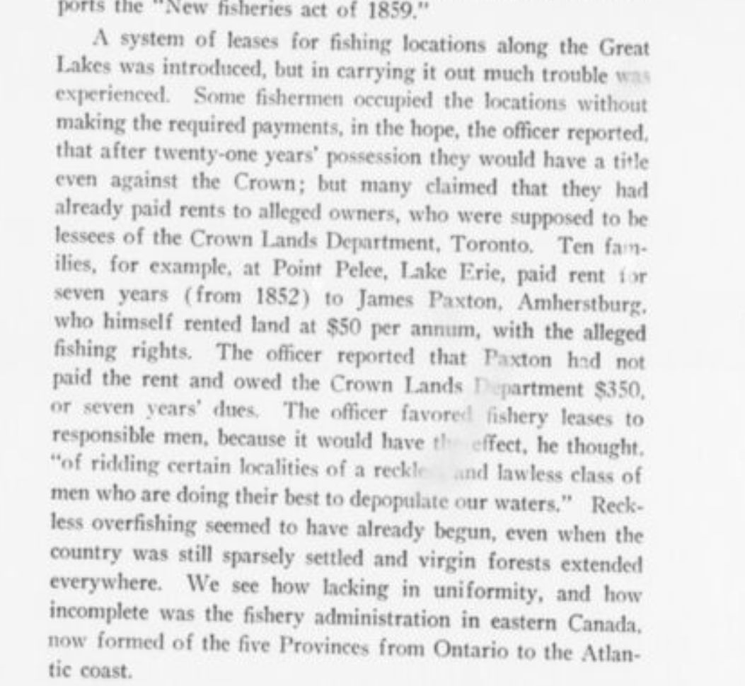
T
Fifty years of fishery administration in Canada / by Edward E. Prince [United States? : s.n., 1920], - Page 168
https://www.canadiana.ca/view/oocihm.77863
____________________
c. 1874 - 1881
Point Pelee
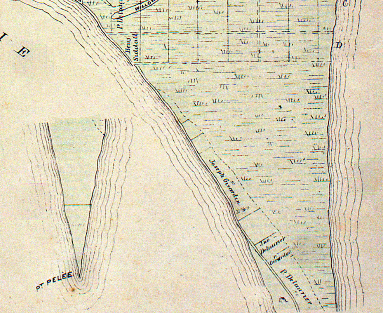
P. Delaurier; Benj Sidall; Joseph Girardin; Jav Delaurier; P. Girardin; P. Delaurier;
| Last Name | Delaurier |
| First Name | John E. |
| Nativity | Mersea Tp., Essex Co., Canada |
| Business | Farmer; Fisherman |
| Year Settled | 1854 |
| Post Office | Leamington |
| Township | Mersea |
| County | Essex |
| Source Date | b. 1854 |
| Atlas Date | 1881 |
| Last Name | Delaurier |
| First Name | Philip |
| Nativity | Mersea Tp., Essex Co., Canada |
| Business | Farmer; Fisherman |
| Year Settled | 1835 |
| Post Office | Leamington |
| Township | Mersea |
| County | Essex |
| Source Date | b. 1835 |
| Atlas Date | 1881 |
| Concession and Lot | Lot size |
| PP, 7 | 50 |
| C, 14 | 100 |
| Last Name | Girardin |
| First Name | David |
| Nativity | Mersea Tp., Essex Co., Canada |
| Business | Farmer; Fisherman |
| Year Settled | 1879 |
| Post Office | Pelee |
| Township | Pelee Island |
| County | Essex |
| Source Date | b. 1838 |
| Atlas Date | 1881 |
| Last Name | Girardin |
| First Name | Joseph |
| Nativity | Mersea Tp., Essex Co., Canada |
| Business | Farmer; Fisherman |
| Year Settled | 1852 |
| Post Office | Leamington |
| Township | Mersea |
| County | Essex |
| Source Date | b. 1852 |
| Atlas Date | 1881 |
| Concession and Lot | Lot size |
| PP, 9 | 50 |
| Last Name | Girardin |
| First Name | Peter |
| Nativity | Mersea Tp., Essex Co., Canada |
| Business | Farmer; Fisherman |
| Year Settled | 1820 |
| Post Office | Leamington |
| Township | Mersea |
| County | Essex |
| Source Date | b. 1820 |
| Atlas Date | 1881 |
| Concession and Lot | Lot size |
| PP, 7 | 50 |
http://digital.library.mcgill.ca/countyatlas/default.htm
JOSEPH GIRARDIN
____________________
1880
Ontario Essex County 1880 H. Beldon and Co., 1880
http://www.historicmapworks.com/Map/CA/746/County+Map/Essex+County+1880/Ontario/
Ontario Essex County 1880 H. Beldon and Co., 1880
Joseph Girardin, N[o. 9 ?]; Jav. Delaurier; P. Girardin; P. Delaurier
http://www.historicmapworks.com/Map/CA/750/Mersea+Township/Essex+County+1880/Ontario/
____________________
1881
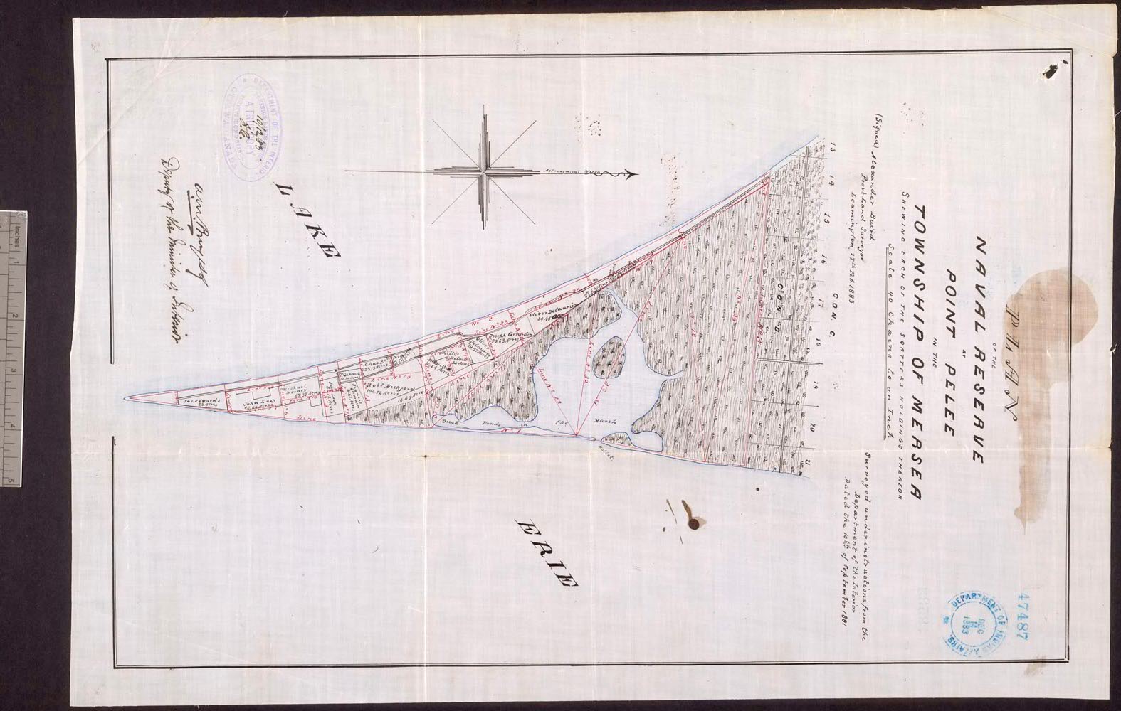
"However, in 1881 the federal government recognized the claim of thirteen families of squatters who had inhabited the region as far back as the 1920s to 560 acres of the point's land base. The Ordnance and Admiralty Lands Branch granted the Point Pelee residents formal title over this land ten years later ..." [Some of the 13 would have been fishermen ?]
http://www.erudit.org/revue/jcha/2005/v16/n1/015735ar.pdf
____________________
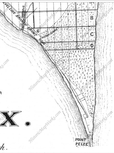
1883
Point Pelee
![]()
http://collectionscanada.gc.ca/pam_archives/public_mikan/index.php?fuseaction=
genitem.displayItem&lang=eng&rec_nbr=3670979&rec_nbr_list=
2072678,3700116,3670995,3670979,3670898,2218773,880937,3523685,157540,1353860
-
Plan of the naval reserve at Point Pelee in the township of Mersea shewing
each of the sqatters holdings thereon - RG10M 78903/78
Map Description
Some names that I can see on the internet copy (all are difficult to read at this resolution):
Jos Edwards
John Loop [Loup?]
Michael Mooney?
John Loop [Loup?]
Desjardins? [Girardin?]
Joseph Girardin
Cha Abot?
Robt Bienford?
Oliver Deslauriers
Joseph Girardin
Oliver Deslauriers
____________________
1883
Point Pelee
| 7 Item: |
Promotion, William Crosser, to be Fishery overseer on Lake Erie form [sic: from] Detroit River to Point Pelee, Actg. Min. Mar. Fish. [Acting Minister of Marine and Fisheries], 1883/05/07, recd. [recommends] |
| Order-in-Council Number: | 1883-1124 |
| Date Introduced: | 1883/05/14 |
| Date Considered: | 1883/05/19 |
| Date Approved: | 1883/05/19 |
| Reference: | RG2 , Privy Council Office , Series A-1-a, For Order in Council see volume 432 , Reel C-3344 , Access code: 90 |
| Register Number: | Series A-1-d , Volume 2767 |
The following images are associated with this entry: |
|
|
[Source: http://data2.collectionscanada.ca/e/e097/e002406662.jpg ] |
____________________
1886
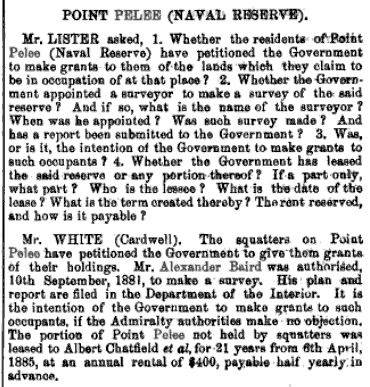
... the residents of Point Pelee (Naval Reserve) have petitioned the Government to make grants to them of the lands which they claim to be in occupation of at that place ....
The squatters on Point Pelee have petitioned the Government to give them grants to their holdings . Mr. Alexander Baird was authorized, 10th September, 1881, to make a survey. His plan and report are filed in the Department of the Interior. It is the intention of the Government to make grants to such occupants. if the Admiralty authorities make no objection. The portion of Point Pelee not held by squatters was leased to Albert Chatfield et al, for 21 years from 6th April, 1885, at an annual rental of $400, payable half yearly in advance. ...
Official Report of the Debates of the House of Commons, Volume 21, 1886, March 15, p. 120
http://books.google.ca/books?id=OKcgAQAAMAAJ&pg=PA120&lpg=
PA120&dq=%22Alexander+Baird%22+pelee&source=bl&ots=s0fIpzH3w2&sig=F8g33pIdywIs_
t9gFzYRK8bh6E8&hl=en&sa=
X&ei=uzGzUYOgMM3C0AHV54CAAQ&ved=0CC0Q6AEwAA
____________________
1890s?
ALBERT GIRARDIN (1864 - ) / MAXON GIRARDIN (1867 - )
PHOTO: Albert and George Maxon Girardin
CATEGORY: Portrait
TAKEN: 1890s? - Point Pelee, Essex, Ontario, Canada
ATTACHED TO: Albert Pierre Girardin (born 1864)
CATEGORY: Portrait
PHOTO DATE: 1890s?
PHOTO LOCATION: Point Pelee, Essex, Ontario, Canada
DESCRIPTION: Swan/goose hunting off the point with his brother George
Maxon.
____________________
1891
[Source: http://www.pc.gc.ca/pn-np/on/pelee/natcul/natcul2_2_e.asp ]
____________________
1905
____________________
1908
Number 59, Page 38: And lastly, though not least, to the various residents on the Point whose good will and kindness made our trips, if not possible, at least comfortable ; and among these especially to Mr. Albert Gardner, whose information on various birds we have found most reliable and valuable, especially in regard to the water fowl, of which it is most difficult to gather data on short and desultory trips.
Number 59, Page 50: At other times they can generally be found on the stakes of the pound nets that stretch for some distance out into the lake on both sides of the Point ..
Number 60, Page 82: About four o'clock in the afternoons, both in spring and fall, numbers of them can be seen winging their way from the marshes, where they have been spending the day, to the stakes of the pound nets off shore on either side of the Point ...
Number 60, Page 83: But it was not until Sept. 2, 1907, that we were able to remove the Night Heron from the hypothetical list when Bert Gardner brought one in that he had killed on the marsh while duck shooting.
Number 63, Page 93: One of the interesting features of the fall trip of 1907 was the unprecedented number of this species [Water-Thrushes] present. We arrived August 24, and the 26th several were noted, and the next day the species became abundant, remaining so until the 1st of September, when then; was a falling off in numbers, increasing to several the 3d and two the 4th; the species seems then to have departed. During the height of their abundance they were the most conspicuous bird on the Point, and were seen in all kinds of places, and at all times. They were in the low, damp spots in the woods, in the high walnut timber, and in the red cedar thickets. They were common everywhere. We found them in the last outlying brush pile near the end of the final sand spit, and in patches of weeds and cottonwoods along the eastern sand dune, near Grubb's fish house.
Number 64, Page 120-121: Great flocks of Swallows, Barn, Bank, Tree and Rough-winged, were congregating at the end of the Point, and the loth a flock of one hundred Martins was seen resting on the ridge of the fish house near the end of the Point.
Percy Algernon Taverner and B. H. Swales, "The Birds of Point Pelee", in Wilson Bulletin, Numbers 59-64, June, 1907-September, 1908 [All are reprints]
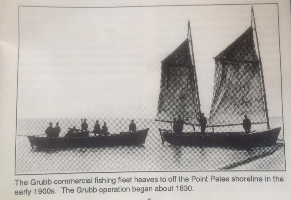
Grubb Commercial Fishing Fleet
. From Township of Mersea History booklet.
____________________
1911
All Mersea Township Residents
1911 CENSUS
Essex South 25: Mersea, Essex South, Ontario
Some Being Fishermen, Some Being Point Pelee
|
ALPHABETICAL LIST
|
HEADS OF HOUSEHOLD
|
http://automatedgenealogy.com/census11/Test17.jsp?sdid=5483
http://automatedgenealogy.com/census11/EnumerationDistrict.jsp?id=5483
____________________
1916
MARCH 13
WILLIAM EARNEST KING
FISHERMAN
Name: William Earnest King
Residence: Point Pelee, Ontario
Birth Date: 20 Oct 1894
Birth Location: Belfast, Ireland
Relative: Alfred Owen
Relationship: Mother
Regiment Number: 214128
What is your trade or Calling? Fisherman
http://search.ancestry.com/search/db.aspx?dbid=1086 - Canada, Soldiers of the First World War, 1914-1918
____________________
1918
____________________
Point Pelee Since 1918
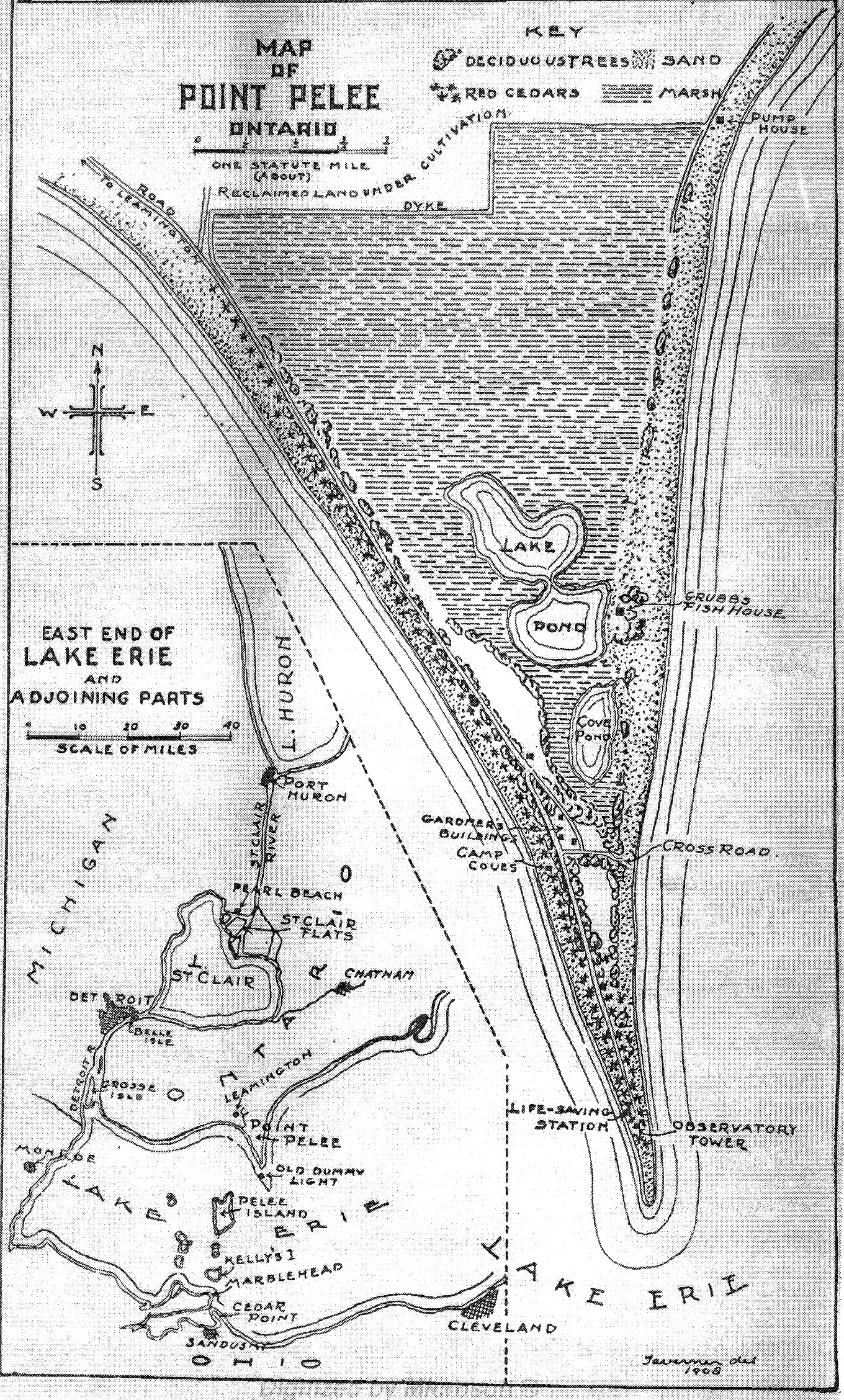
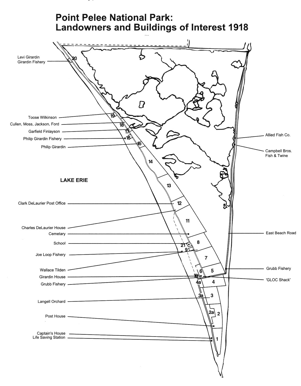
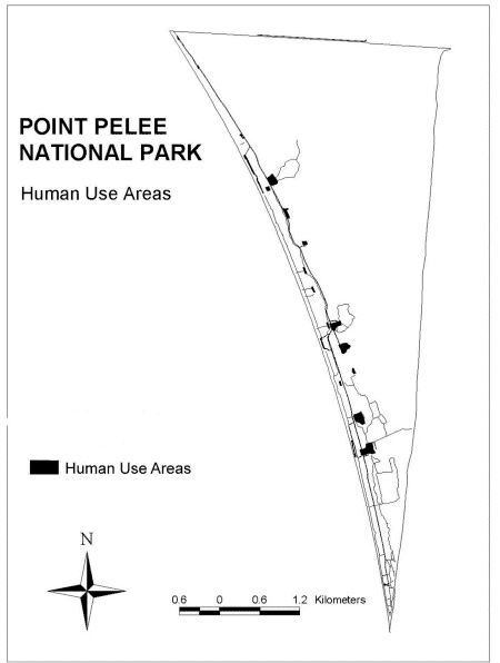
Landowners and Buildings: (20) Levi Girardin Girardin Fishery; (19) Toose Wilkinson; (18) Cullen, Moss, Jackson, Ford; (17) Garfield Finlayson; (16) Philip Girardin Fishery; (15) Philip Girardin; (12) Clark DeLaurier Post Office and Charles DeLaurier House; (11) Cemetery; (21) School; (9) Joe Loop Fishery; (8) Wallace Tilden; (6) Girardin House and 'Gloc House'; (10) Grubb Fishery; (3) Langell Orchard; (2) Post Office; (1) Captain's House and Life Saving Station; (East Beach Road) Grubb Fishery; (East Beach Road) Campbell Bros. Fish & Time; (East Beach Road) Allied Fish Co.
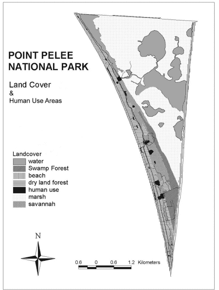
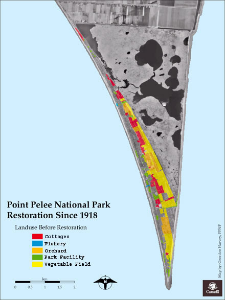
Since 1933, over 50% of Point Pelee's dryland habitat has been
restored.
More than 100 hectares of agricultural fields and orchards have been removed,
along with 6 commercial fisheries, 20 kilometres of roads and nearly 400
buildings.
Map of Point Pelee depicting land use before restoration
©
Parks Canada / H. Bishop, M. Smith, 2002; / G. Harvey, 2005 -
http://www.pc.gc.ca/docs/v-g/ie-ei/at-ag/sec6/page7_e.asp
____________________
1918 - 1972
LOT NUMBERS
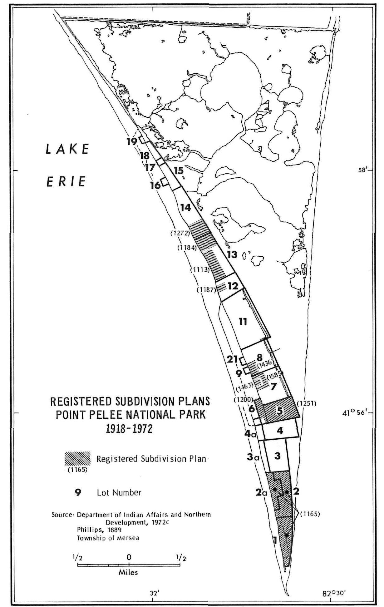
REGISTERED SUBDIVISION PLANS
POINT PELEE NATIONAL PARK
1918 - 1972
[Krause is located on Lot 15]
J. G. Battin & J. G. Nelson, Man's Impact On Point Pelee National Park, National Provincial Parks Association, 1978, p. 141
http://parkscanadahistory.com/publications/nppac-cpaws/point-pelee.pdf
____________________
POINT PELEE FISHERMAN FAMILIES
1921 CENSUS
Ontario Essex South Sub-District 22 - Mersea (Township)
FISHERMEN
FAMILY 79
Willington Harris
Name: Willington Harris
Gender: Male
Marital Status: Single
Age: 17
Birth Year: abt 1904
Birth Place: Ontario
Relation to Head of House: Laborer
Father Birth Place: Ontario
Mother Birth Place: Ontario
Racial or Tribal Origin: English
Province or Territory: Ontario
District: Essex South
District Number: 78
Sub-District: Mersea (Township)
Sub-District Number: 22
City, Town or Village: Mersea Township
Street or Township: Mercia
Municipality: Mercia
Occupation: Fisherman
Income: 1200
Neighbors: View others on page
Household Members:
Name Age
George E Penfold 51
Emma Jane Penfold 45
George H Penfold
Percy Penfold 12
Myrtle Penfold 10
Morley Penfold 5
Russel Penfold 5/12
Willington Harris 17
FAMILY 98
William S Ives
Claud Ives
Name: Claud Ives
Gender: Male
Marital Status: Single
Age: 30
Birth Year: abt 1891
Birth Place: Ontario
Relation to Head of House: Brother
Father Birth Place: Ontario
Mother Birth Place: Ontario
Racial or Tribal Origin: English
Province or Territory: Ontario
District: Essex South
District Number: 78
Sub-District: Mersea (Township)
Sub-District Number: 22
City, Town or Village: Mersea Township
Street or Township: Mercia
Municipality: Mercia
Occupation: Fisherman
Income: 2700
Neighbors: View others on page
Household Members:
Name Age
William S Ives 48 [Fisherman]
Mary Ives 44
Laura Ives 19
Josephine Ives 16
Nina May Ives 14
Fredrick Ives 11
Erie Ives 7
Delbert Ives 6
Claud Ives 30
FAMILY 99
James A. Horton
Name: Jame A Horton
Gender: Male
Marital Status: Single
Age: 57
Birth Year: abt 1864
Birth Place: Ontario
Relation to Head of House: Head
Father Birth Place: Ontario
Mother Birth Place: Ontario
Racial or Tribal Origin: Scotch (Scotish)
Province or Territory: Ontario
District: Essex South
District Number: 78
Sub-District: Mersea (Township)
Sub-District Number: 22
City, Town or Village: Mersea Township
Street or Township: Mercia
Municipality: Mercia
Occupation: Fisherman
Neighbors: View others on page
Household Members:
Name Age
Jame A Horton 57
FAMILY 112
Levi Girardian
Elliot Girardian
Name: Levi Girardeau
Gender: Male
Marital Status: Married
Age: 55
Birth Year: abt 1866
Birth Place: Ontario
Relation to Head of House: Head
Spouse's Name: Mary Girardeau
Father Birth Place: Ontario
Mother Birth Place: Ontario
Racial or Tribal Origin: French
Province or Territory: Ontario
District: Essex South
District Number: 78
Sub-District: Mersea (Township)
Sub-District Number: 22
City, Town or Village: Mersea Township
Street or Township: Mercia
Municipality: Mercia
Occupation: Fisherman
Income: 1148
Neighbors: View others on page
Household Members:
Name Age
Levi Girardeau 55
Mary Girardeau 43
Elliott Girardeau 26 [Fisherman]
FAMILY 114
Phillip Girardian
Name: Phillip Girardin
Gender: Male
Marital Status: Married
Age: 65
Birth Year: abt 1856
Birth Place: Ontario
Relation to Head of House: Head
Spouse's Name: Marta Girardin
Father Birth Place: Ontario
Mother Birth Place: Ontario
Racial or Tribal Origin: French
Province or Territory: Ontario
District: Essex South
District Number: 78
Sub-District: Mersea (Township)
Sub-District Number: 22
City, Town or Village: Mersea Township
Street or Township: Mercia
Municipality: Mercia
Occupation: Fisherman
Income: 500
Neighbors: View others on page
Household Members:
Name Age
Phillip Girardin 65
Marta Girardin 65
FAMILY 115
George McLean
Name: George McLain
Gender: Male
Marital Status: Married
Age: 29
Birth Year: abt 1892
Birth Place: Ontario
Relation to Head of House: Head
Spouse's Name: Floren McLain
Father Birth Place: Ontario
Mother Birth Place: Ontario
Racial or Tribal Origin: Scotch (Scotish)
Province or Territory: Ontario
District: Essex South
District Number: 78
Sub-District: Mersea (Township)
Sub-District Number: 22
City, Town or Village: Mersea Township
Street or Township: Mercia
Municipality: Mercia
Occupation: Fisherman
Income: 3??
Neighbors: View others on page
Household Members:
Name Age
George McLain 29
Floren McLain 29
Richard McLain 5
Emily McLain 4
George McLain 1/12
FAMILY 125
John T. Loop
Robert Livingston
Name: John Toop [John Loop]
Marital Status: Married
Age: 42
Birth Year: abt 1879
Birth Place: Ontario
Relation to Head of House: Head
Spouse's Name: Ella Toop
Father Birth Place: Ontario
Mother Birth Place: Ontario
Racial or Tribal Origin: English
Province or Territory: Ontario
District: Essex South
District Number: 78
Sub-District: Mersea (Township)
Sub-District Number: 22
City, Town or Village: Mersea Township
Street or Township: Mercia
Municipality: Mercia
Occupation: Fisherman
Income: 3000
Neighbors: View others on page
Household Members:
Name Age
John Toop 42 [John Loop]
Ella Toop 42 [Ella Loop]
Ida Toop 17 [Ida Loop]
Freda Toop 15 [Freda Loop]
Madeline Toop 7 [Madeline Loop]
Robert Livingstone 25 [Fisherman]
Marjorie Kimbol 2
Maxon Girardiner [Girardin]
Name: Maxin Girardiner [Maxon Girardin]
Gender: Male
Marital Status: Married
Age: 53
Birth Year: abt 1868
Birth Place: Ontario
Relation to Head of House: Head
Spouse's Name: Bertha Girardiner
Father Birth Place: Ontario
Mother Birth Place: Ontario
Racial or Tribal Origin: French
Province or Territory: Ontario
District: Essex South
District Number: 78
Sub-District: Mersea (Township)
Sub-District Number: 22
City, Town or Village: Mersea Township
Street or Township: Mercia
Municipality: Mercia
Occupation: Fisherman
Income: 1000
Neighbors: View others on page
Household Members:
Name Age
Maxin Girardiner 53
Bertha Girardiner 39
Thomas Girardiner 16
Barbra Girardiner 14
Grace Girardiner 12
George Girardiner 10
Esther Girardiner 8
Everett Girardiner 4
Sarah Girardiner 2
Emile Furman 71
FAMILY 127
Robert S. Howe
Name: Robert S Howe
Gender: Male
Marital Status: Married
Age: 27
Birth Year: abt 1894
Birth Place: Ontario
Father Birth Place: Ontario
Mother Birth Place: Ireland
Racial or Tribal Origin: English
Province or Territory: Ontario
District: Essex South
District Number: 78
Sub-District: Mersea (Township)
Sub-District Number: 22
City, Town or Village: Mersea Township
Street or Township: Mercia
Municipality: Mercia
Occupation: Fisherman
Income: 1000
Neighbors: View others on page
Household Members:
Name Age
Albert Girardiner 58
Robert S Howe 27
Louise Howe 17
FAMILY 129
James Grubb
John Murphy
Harold McLellan
Thomas Epplett
Filiman Mooney
Name: James W Grubb
Gender: Male
Marital Status: Married
Age: 43
Birth Year: abt 1878
Birth Place: Ontario
Relation to Head of House: Head
Spouse's Name: Sarah Flossie Grubb
Father Birth Place: Ontario
Mother Birth Place: Ontario
Racial or Tribal Origin: Scotch (Scotish)
Province or Territory: Ontario
District: Essex South
District Number: 78
Sub-District: Mersea (Township)
Sub-District Number: 22
City, Town or Village: Mersea Township
Street or Township: Mercia
Municipality: Mercia
Occupation: Fisherman
Income: 8000
Neighbors: View others on page
Household Members:
Name Age
James W Grubb 43
Sarah Flossie Grubb 28
Jame Douglas Grubb 11
Ryall Arther Grubb 10
Hellen Grubb 8
John Murphy 69 [Fisherman]
Harold McMillan 18 [Fisherman]
Thomas Epplett 17 [Fisherman]
Fileman Mooney 5 [Fisherman]
http://interactive.ancestry.ca/8991/1921_057-e002924236?backurl=http%3a%2f%2fsearch.ancestry.ca
%2fsearch%2fdb.aspx%3fdbid%3d8991%26path%3d&ssrc=&backlabel=ReturnBrowsing
http://www.ancestry.ca/census?s_kwcid=1921%20canadian%20census
http://search.ancestry.ca/search/db.aspx?dbid=8991&o_iid=53636&o_lid=53636&o_sch=Web+Property
http://www.ancestry.ca/1921census
____________________
1927
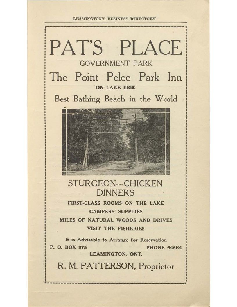
1927 Souvenir History And Business Directory of Leamington City of Leamington
The Point Pelee Park Inn ...
VISIT THE FISHERIES
https://scholar.uwindsor.ca/cgi/viewcontent.cgi?article=1066&context=swoda-windsor-region
https://scholar.uwindsor.ca/swoda-windsor-region/34/
____________________
1928
Tourist Guidebook Of Ontario 1928
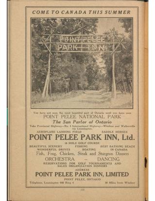
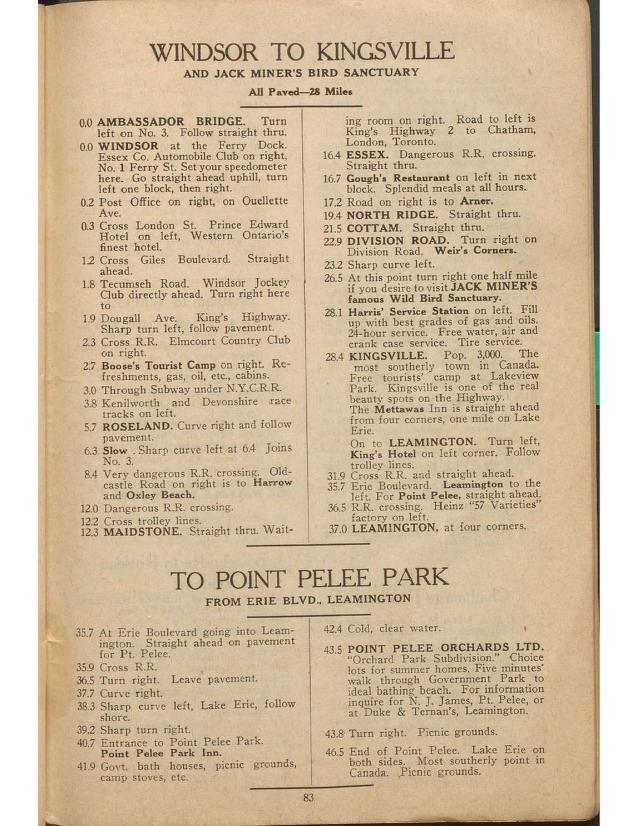
Point Pelee Park Inn
https://archive.org/details/TouristGuidebookOfOntario1928/page/n109/mode/2up
____________________
1930
Tourist Guidebook Of Ontario 1930
Point Pelee Park Inn
https://archive.org/details/TouristGuidebookOfOntario1930
____________________
1931
1931 CANADA CENSUS
Province: Ontario District Name: Essex South District
number: 103
Sub-district name: Mersea (Township), No. 26 Sub-district number: 26, Page 21
POINT PELEE FISHERMEN FAMILIES
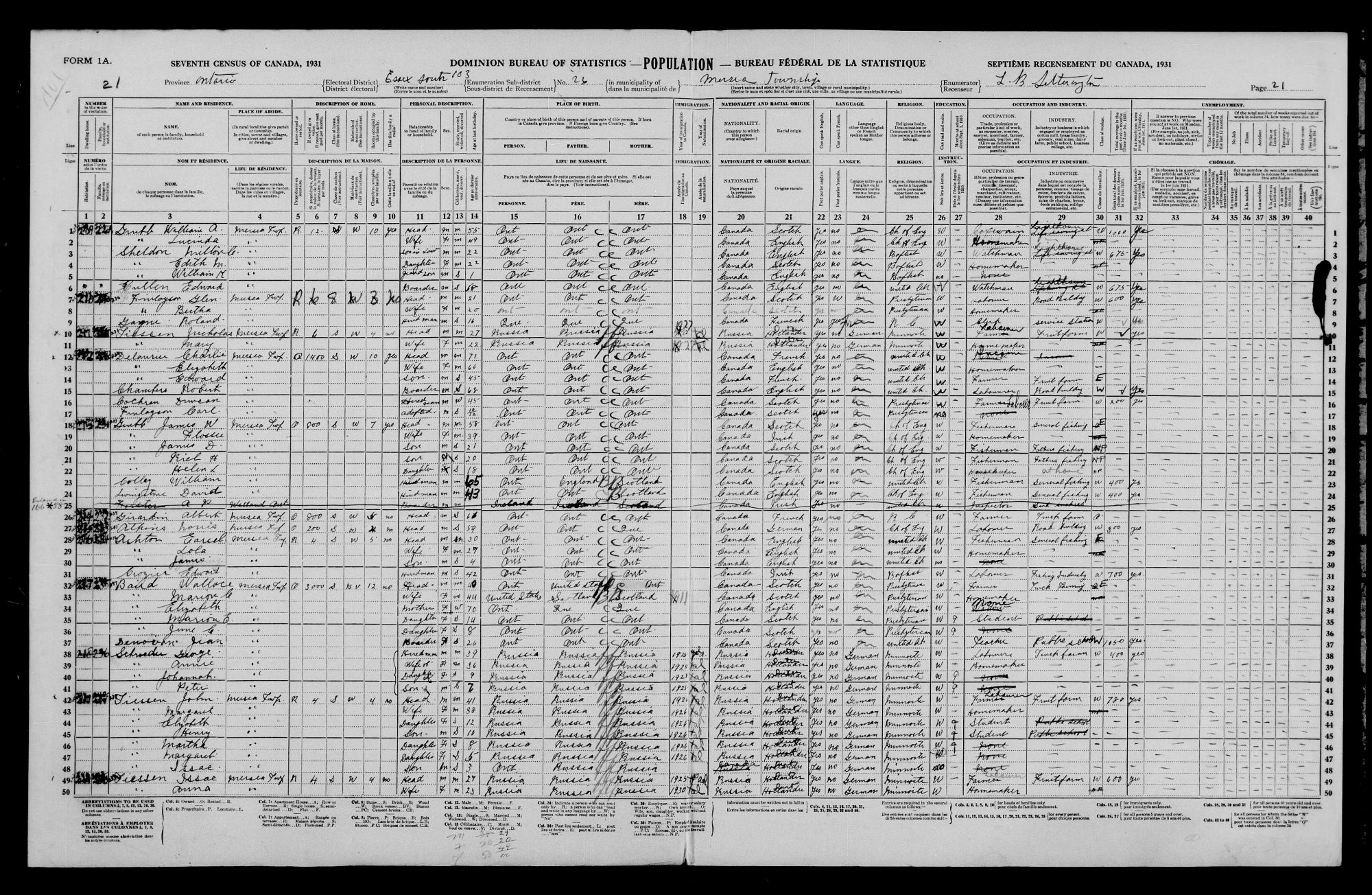
https://central2.bac-lac.gc.ca/.item/?id=e011636924&app=census1931&op=img - Page 21
Ernest Arthurton, Fisherman, Pound net Fishing
Harold McClellan, Fisherman, Pound Net
Everett Balkwell, Fisherman, Pound Nets
Levi Girardin, Fisherman, Pound Net
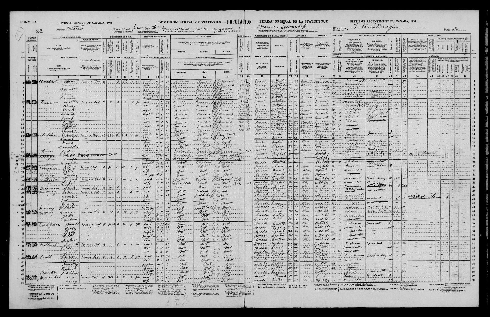
https://central2.bac-lac.gc.ca/.item/?id=e011636925&app=census1931&op=img - Page 22
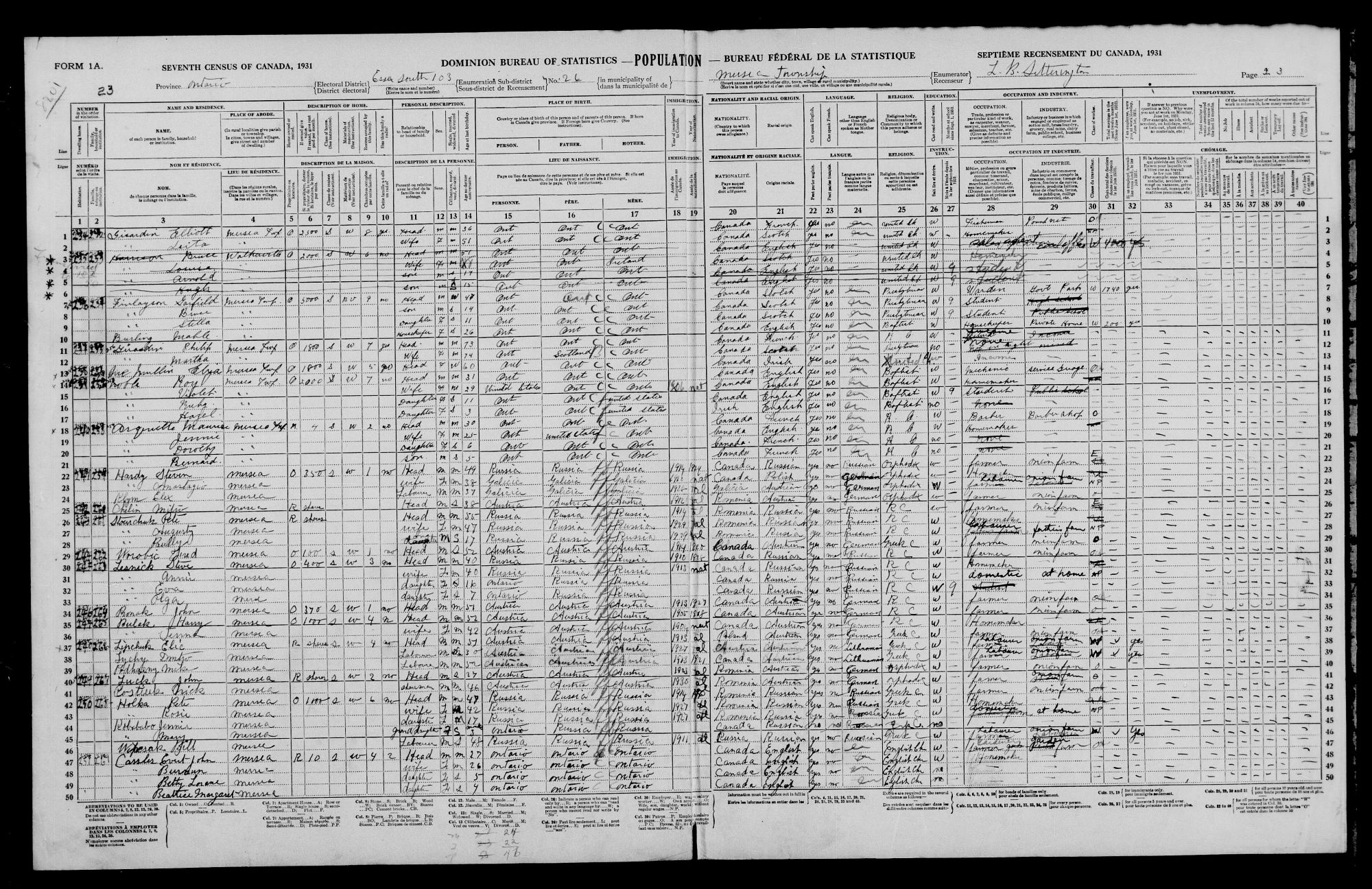
Elliott Girardin, Fisherman, Pound Net
https://central2.bac-lac.gc.ca/.item/?id=e011636926&app=census1931&op=img - Page 23
_________________
1942
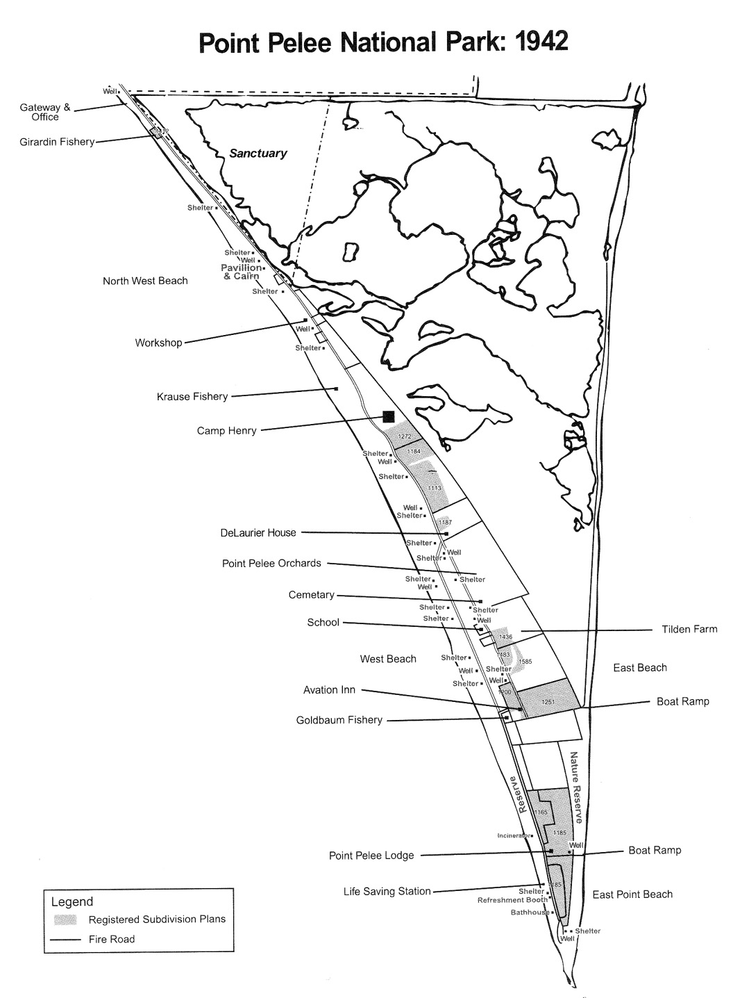
Girardin Fishery; Krause Fishery; Goldbaum Fishery
[Henrietta O'Neill, In Search of a Heart (Friends of Point Pelee, 2000), p. 70]
 (1) |
 (2) |
 (3) |
(1)
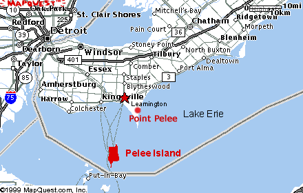
http://www.pelee.com/transportation_point.asp - 1999 Map.Quest.com Inc.
(2)
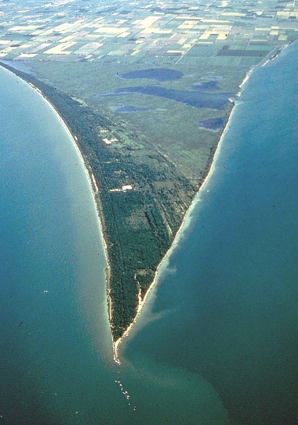
http://www.ec.gc.ca/EnviroZine/images/Issue55/aerial_l.jpg
(3)
http://www.soto.on.ca/national_parks_of_southern_ontario/point_pelee.html

![]()
http://www.pc.gc.ca/pn-np/on/pelee/visit/visit2_E.asp
http://www.pc.gc.ca/apprendre-learn/prof/itm2-crp-trc/htm/peleegeo_e.asp
[Henrietta O'Neill, In Search of a Heart (Friends of Point Pelee, 2000), p. 22]
Fishing
... James Edwards settled and began fishing on the Point in the early 1840's His son-in-law William Grubb took over and by 1870 the Grubb fishery had expanded to include both the east and west sides of the Point. Natinsky, Young and Goldbaum fished consecutively from this site. Goldbaum sold his fishing rights to Olmstead around 1957. Olmstead never used Goldbaum's buildings which were later torn down by the Park.
Levi Girardin established a fishery in 1911 which was eventually run by his son Elliot, better known as Pat. Upon the unexpected death of Pat in 1936, his wife Leita took over. She managed the Girardin fishery until 1962 when she sold the fishing rights to Ribble and Grubb who operated north of the Parks gates until the death of Riel [Rile]Grubb in 1972. The Park removed the Girardin buildings in 1963.
Around 1903, Philip Girardin began fishing near Lot 15. His fishing rights were sold to McLean, then McLellan and in 1937, became the basis for the Krause fishery. John Ellis DeLaurier, brother of Charles and son of Oliver, began a fishery in the early 1900's which after changing hands several times, was also bought by Krause. Though fishing ceased from this particular site, the buildings were not removed until 1959.
Other fisheries came and went but these three were originals which remained active until the early 1960's when Park regulations forced them to relocate.
Although the government leased the lake lots to the fishermen, no agreement had been made concerning the beaches from which they were operating, therefore, all fisheries were effectively trespassing on government property. When the Park was established, legal issues needed to be clarified, so the Commissioner of National Parks offered leases to the fisheries which would include the land occupied by their buildings. The fishermen ignored the Commissioner and, in 1921, agents from the Minister of Justice were appointed to negotiate with them. The efforts were ineffectual. A final attempt to get the fishermen to lease the land on which their buildings stood failed again in 1934. This muddle continued to go unresolved until 1951 when the three remaining fisheries, Girardin, Goldbaum and Krause, were requested to obtain licenses required by National Parks Business Regulations. Krause claimed squatter's rights and the Attorney General of Canada took action against him, going to the Supreme Court of Ontario. Krause won the first judgment on this dispute in 1955. The following year, in a court of appeal, the decision was reversed in favor of the Crown. Due to overwhelming legal expenses, Krause was unable to continue the court battle. He was granted permission to work out of his buildings until a lease agreement with the park ran out in 1968. In 1969 the fishery was moved to Sturgeon Creek and the buildings were removed from the Park ...
The [Point Pelee] orchards spread out from the Tilden farm all the way up to the [H William] Krause family's fisheries [residence] ...
[Henrietta O'Neill, In Search of a Heart (Friends of Point Pelee, 2000), pp. 45-48, 59]
"There were many pound net fishermen at that time [when Everett H. Omstead of Wheatley was about 14 years of age]. Starting from the end of the Point would be: Jimmy Grubb, McLeans', Manse Campbell, Al Long, Omsteads (of Wheatley), Bailey's, Smith and Hodgson and the Crewes' further east ..."
Rita Lobzun [Karen Adamson-Editor], Open Books, A Historical Sketch of Commercial Fishing in Wheatley - Ontario, After 1980, pp. 9-10] - http://images.ourontario.ca/Partners/CKPL/CKPL0027490551T.PDF
Spawning runs of smelt were reported on the beaches of Point Pelee in the Western basin during the early 1940s (R. Krause personal communication). It was 1945 before smelt were first noticed from pound net catches in the western portion ...
Journal of the Faculty of Science, Niigata University: Biology, ...: Volume 33, Issues 1-3, Niigata Daigaku. Rigakubu
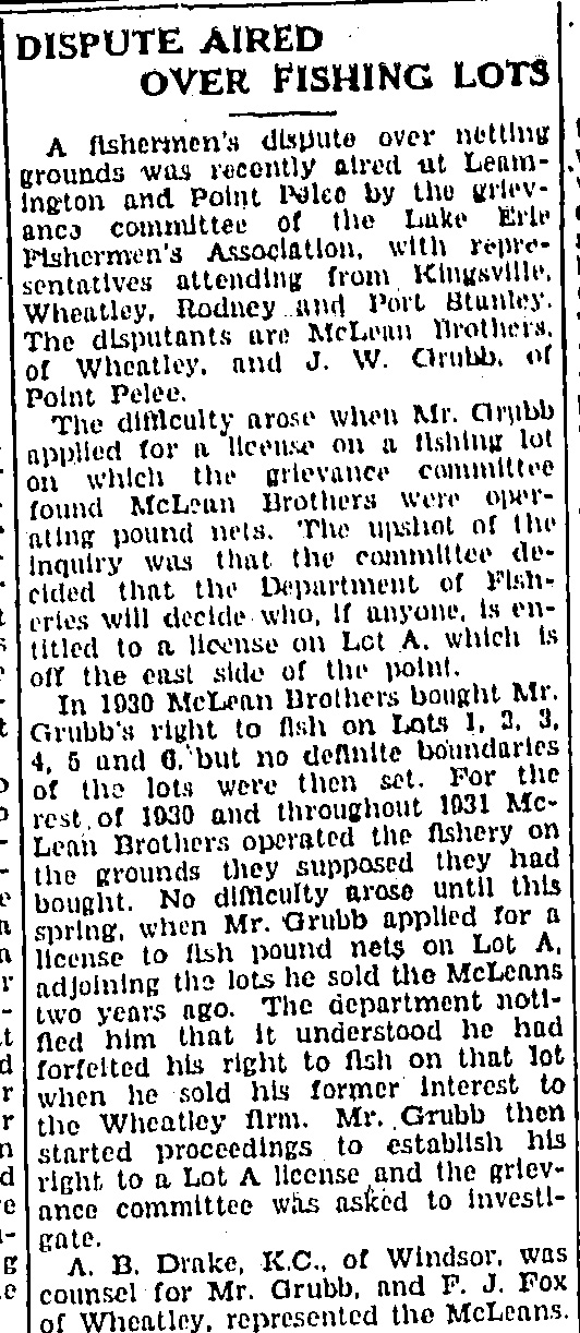
DISPUTE AIRED OVER FISHING LOTS
June 2 1932: : Mclean Brothers of Wheatley and J. W. Grubb
of Point Pelee -
Dispute on the east side of the point over lot A and adjoining Lots 1, 2, 3, 4,
5, 6
http://ink.ourontario.ca/browse/lp -Leamington Post, June 2, 1932, p. 8
ALLIED FISH CO.
Located by 1918 on the east side, Lake Pond.
[Source: Henrietta O'Neill, In Search of a Heart (Friends of Point Pelee, 2000), p. 22]
ERNEST ARTHURTON
1931
1931 CANADA CENSUS
1931 Census - Family 244 Ernest Arthurton, Fisherman, Pound net Fishing
https://central2.bac-lac.gc.ca/.item/?id=e011636925&app=census1931&op=img - Page 22
EVERETT BALKWELL
1931
1931 CANADA CENSUS
1931 Census - Family 249 Everett Balkwell, Fisherman, Pound Nets
https://central2.bac-lac.gc.ca/.item/?id=e011636925&app=census1931&op=img - Page 22
CAMPBELL BROS. FISH AND TWINE
Located by 1918 on the east side, Lake Pond, to the south of the Allied Fish Co.
[Source: Henrietta O'Neill, In Search of a Heart (Friends of Point Pelee, 2000), p. 22]
[(Perhaps Manse Campbell) - Rita Lobzun [Karen Adamson-Editor], Open Books, A Historical Sketch of Commercial Fishing in Wheatley - Ontario, After 1980, p. 9] - http://images.ourontario.ca/Partners/CKPL/CKPL0027490551T.PDF
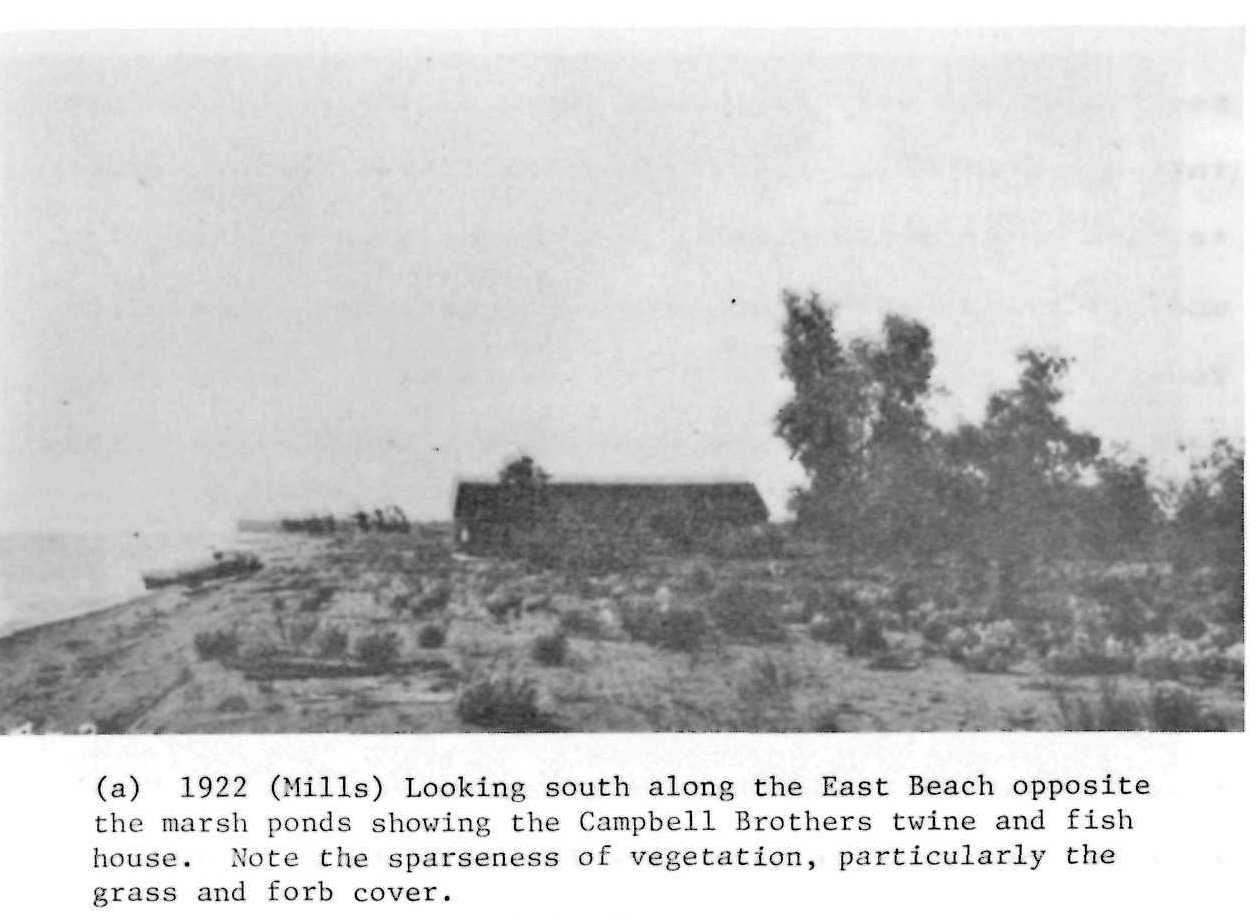
(a) 1922 (Mills) Looking south along the East Beach opposite the marsh ponds showing the Campbell Brothers twine and fish house. Note the sparseness of vegetation, particularly the grass and forb cover ...
J. G. Battin & J. G. Nelson, Man's Impact On Point Pelee National Park, National Provincial Parks Association, 1978, p. 26
http://parkscanadahistory.com/publications/nppac-cpaws/point-pelee.pdf
CHAMBERS
1911
The 1911 Census:
Chambers, Alfert http://data2.collectionscanada.ca/1911a/e080/e001985788.pdf
Province/Territory: Ontario, District Name: Essex South, District Number: 68, Sub-district: Mersea, Sub-district Number: 25 - Page 1 - Point Pelee
JOHN ELLIS DELAURIER and PHILIP DELAURIER and CHARLES DELAURIER
NMC 021481, Section E3
1871
The 1871 Census:
DELAURIER, PHILIP
Sex: Male
Age: 36
Place of Birth: Ontario
Religion: Roman Catholic
Origin: FRENCH
Occupation: FISHERMAN
District: ESSEX (001)
Sub-district: Mersea (F)
Division: 2
Page: 76
Microfilm reel number: C-9889
Reference: RG31 — Statistics Canada
[
http://www.collectionscanada.gc.ca/databases/1871-ontario/index-e.html?PHPSESSID=90ah8jgab17tdovoi0k25vpvn3
;
http://www.collectionscanada.gc.ca/archivianet/020151_e.html ;
http://www.collectionscanada.gc.ca/databases/1871-ontario/001016-130-e.html
]
c. 1874 - 1881
Point Pelee
| Last Name | Delaurier |
| First Name | John E. |
| Nativity | Mersea Tp., Essex Co., Canada |
| Business | Farmer; Fisherman |
| Year Settled | 1854 |
| Post Office | Leamington |
| Township | Mersea |
| County | Essex |
| Source Date | b. 1854 |
| Atlas Date | 1881 |
| Last Name | Delaurier |
| First Name | Philip |
| Nativity | Mersea Tp., Essex Co., Canada |
| Business | Farmer; Fisherman |
| Year Settled | 1835 |
| Post Office | Leamington |
| Township | Mersea |
| County | Essex |
| Source Date | b. 1835 |
| Atlas Date | 1881 |
| Concession and Lot | Lot size |
| PP, 7 | 50 |
| C, 14 | 100 |
John Ellis DELAURIER, 45, widower, fisherman, Point Pelee, same, s/o Cal--? DELAURIER & Esther ABBOTT, married Clara Amelia TESTER, 21, of Leamington, d/o Thomas TESTER & Mary COUTTS, witn: R. M. YOUNG & Mrs. N. D. KEITH, both of Leamington, 18 Sept 1900 at Leamington
1901
The 1901 Census, Sub district Mersea, Essex (South/Sud), Ontario, District 60, Subdistrict Number: K-1:
John E. Delaurier, fisherman, p. 16
Philip Delaurier, fisherman, p. 16
John P. Delaurier, fisherman, p. 16
[Source: http://www.collectionscanada.gc.ca/databases/census-1901/index-e.html ]
Chas DeLaurier had the misfortune to have his boat swamped while landing
with a heavy catch of fish, which resulted in considerable loss to him.
[Charles Delaurier's Fishing Boat]
http://ink.ourontario.ca/browse/lp -Leamington Post, July 28, 1910, p. 1
John Ellis DeLaurier, brother of Charles and son of Oliver, began a fishery in the early 1900's which after changing hands several times, was also bought by Krause. Though fishing ceased from this particular site, the buildings were not removed until 1959 - Henrietta O'Neill, In Search of a Heart (Friends of Point Pelee, 2000, pp. 45-48.
John Ellis DeLaurier started a Fishery on Lot 9 and sold it to John Loop - Henrietta O'Neill, In Search of a Heart (Friends of Point Pelee, 2000), p. 27.
Delaurier, Charles
http://automatedgenealogy.com/census11/SplitView.jsp?id=89086&frag=e080/e001985791&dir=1911a
- 1911 Census
Province/Territory: Ontario, District Name: Essex
South, District Number: 68, Sub-district: Mersea,
Sub-district Number: 25 - Page 4 - Fishing
Lot 12, Point Pelee
Delaurier, John, Province/Territory: Ontario, District Name: Essex South, District Number: 68, Sub-district: Mersea, Sub-district Number: 25 - Page 5 - 1911 Census
1911 Census: John DeLaurier, Lot 30, Point Pelee - http://automatedgenealogy.com/census11/SplitView.jsp?id=89087&frag=e080/e001985792&dir=1911a - Fisherman fishing - Identified as being of as the same family group as Levi Girardin and on the same Lot
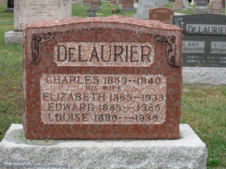
Charles DeLAURIER
1859-1940
Lakeview Cemetery,
Section: C
Leamington, Mersea Township (Concession 16, Lot 6)
Essex County, ON
Street Address: 233 Erie St S
Community: Leamington
Township: Mersea Township (Concession 16, Lot 6)
Locality: Essex County
Municipality: Leamington
Province: ON
GPS: 42.041572,-82.602184
Photos: Bob Garant [2010, 2012, 2015],
Additions from Doug & Donna Gammon [2014]
Indexed by Kate Ford, Patricia Green
http://geneofun.on.ca/names/photo/1673523
JAMES EDWARDS
James Edwards settled and began fishing on the Point in the early 1840's
[Henrietta O'Neill, In Search of a Heart (Friends of Point Pelee, 2000), pp. 45-48]
![]()
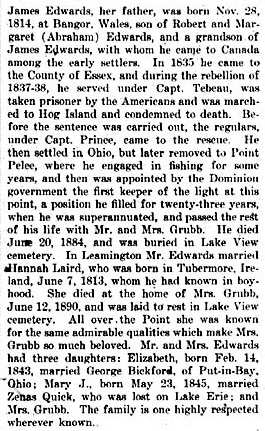
James Edwards .... He settled in Ohio, but later removed to Point Pelee,
where he engaged in fishing for some years ....
Commemorative biographical record of the county of Essex,
Ontario :
containing biographical sketches of prominent and representative
citizens and
many of the early settled families (Toronto, 1905), p. 580
GEORGE MAXON GIRARDIN
1901
CENSUS
Fisherman
| 4 | 172 | Girardin George M. | M | Head | M | Dec 12 | 1867 |
|
|
| 5 | 172 | Girardin Bertha | F | Wife | M | Jan 25 | 1884 |
|
One immediate Neighbour was the Light House Keeper William J. Grubb (Age 25)
http://automatedgenealogy.com/census/ViewFrame.jsp?id=50653&highlight=4
1911CENSUS
Fisherman
|
|
44 | Girardin George | M | Head | M | Dec | 1867 | 43 |
|
|
44 | Girardin Bertha | F | Wife | M | Dec | 1884 | 27 |
|
|
44 | Girardin Pearl | F | Daughter | S | Aug | 1903 | 8 |
|
|
44 | Girardin Louise | F | Daughter | S | Jan | 1904 | 7 |
|
|
44 | Girardin Thomas | M | Son | S | Sep | 1906 | 4 |
|
|
44 | Girardin Barby | F | Daughter | S | Sep | 1908 | 2 |
|
|
44 | Girardin Grace | F | Daughter | S | Dec | 1910 | 1 |
http://automatedgenealogy.com/census11/SplitView.jsp?id=89087
[Editor: I see that George Maxon Girardin (wife Bertha), fisherman [at Point Pelee], was born in Ontario on December 12, 1867, making him 43 years of age in 1911. Thus, in the 1901 Census he was 33 years of age, in the 1891 Census he would have been c. 23 years of age, in the 1881 Census c 13 years of age, and in the 1871 Census c. 3 years of age. Therefore in one or more of these censuses one would expect him to appear in a Girardin family. I took a quick look and other than in 1911 and 1901, he does not appear. Odd. ]
The following George Maxon Girardin Family Members are identified as born at Point Pelee:
Name: George Maxon Girardin Birth: 12 Dec 1867 - Point Pelee, Ontario, Canada; Death: 13 Jul 1948 - Point Pelee, Ontario, Canada OR Name: George Maxon Girardin Birth: 12 Dec 1867 - Point Pelee, Ontario, Canada; Death: 1948 - Point Pelee, Ontario, Canada
Name: Pearl Victoria Girardin Birth: 22 Aug 1902 - Point Pelee, Ontario, Canada
Name: Eva Louisia May Girardin Birth: 31 Jan 1904 - Point Pelee, Ontario, Canada; Death: 10 Dec 1980 - Leamington, Ontario, Canada
Name: Grace Elizabeth Girardin Birth: 20 Feb 1910 - Point Pelee, Ontario, Canada
Probably This Family As Well
Name: Thomas William Girardin Birth: 29 Oct 1905 - Point Pelee, Ontario, Canada
Name: Barbara Susan Girardin Birth: 13 Jul 1907 - Point Pelee, Ontario, Canada
1921
CENSUS
1921 Census - Family 126
Girardin, Maxon, fisherman
JOSEPH
GIRARDIN (d. August, 1899)c. 1874 - 1881
Point Pelee
| Last Name | Girardin |
| First Name | Joseph |
| Nativity | Mersea Tp., Essex Co., Canada |
| Business | Farmer; Fisherman |
| Year Settled | 1852 |
| Post Office | Leamington |
| Township | Mersea |
| County | Essex |
| Source Date | b. 1852 |
| Atlas Date | 1881 |
| Concession and Lot | Lot size |
| PP, 9 | 50 |
http://digital.library.mcgill.ca/countyatlas/default.htm
When a young man he moved to Point Pelee, took up land by squatter's right, and engaged in farming and fishing. He passed the remainder of his life in that place, dying at the age of seventy-six, in August, 1899, and being buried in Point Pelee Cemetery ...
[Commemorative biographical record of the county of Essex, Ontario : containing biographical sketches of prominent and representative citizens and many of the early settled families ( Toronto, J.H. Beers, 1905), p. 657] - http://www.ourroots.ca/toc.aspx?id=3107&qryID=7812a62b-c8a9-43a4-8924-f51b6c8db63a
Garardin - Map dated 1905
LEITA GIRARDIN
[Leita Girardin - Operator and Owner of GIRARDIN FISHERIES - http://ink.ourontario.ca/browse/lp -The Leamington Post. September 11, 1941 - pg. 14]
Levi Girardin established a fishery in 1911 which was eventually run by his son Elliot, better known as Pat. Upon the unexpected death of Pat in 1936, his wife Leita took over.- Henrietta O'Neill, In Search of a Heart (Friends of Point Pelee, 2000), pp. 45-48.
Leita Girardin and Jen O'Neil show off a giant sturgeon caught in the Girardin Fisheries nets off Point Pelee c. 1940 PC/PPNP - Julie Macfie Sobol, Ken Sobol, Macfie Sobol, Lake Erie: A Pictorial History (Boston Mills Press, 2004) , p. 197 - http://books.google.com/books?id=rMccye5JhIoC&pg=PA197&dq [Note: It was a Lena Girarardin, daughter of Joseph Girardin (b. November 25, 1852, who married Louis Levingston - [Commemorative biographical record of the county of Essex, Ontario : containing biographical sketches of prominent and representative citizens and many of the early settled families ( Toronto, J.H. Beers, 1905), p. 657 - http://www.ourroots.ca/toc.aspx?id=3107&qryID=7812a62b-c8a9-43a4-8924-f51b6c8db63a ]
In 1962, the Girardin fishery moved north of the Park. ( http://pks-intrnet-www.parkscanada.gc.ca/pn-np/on/pelee/natcul/natcul2_4_E.asp )
"Council accepted a request of Mrs. Leita Girardin to sell three acres of property in Point Pelee Park in two parcels ..."
http://ink.ourontario.ca/browse/lp -Leamington Post, November 7, 1963, p. 1
Thursday, November 13, 2008, 6:26 PM [NOTE FROM KATHLEEN HAACK]
hello, i am writing to you in hope that someone somewhere knows what i am talking about!
my great grandfather built a cottage along the highway into pelee park in the 1920's, it was located near what was then called the bluebird cottages, which were located across the road with the beach access on the lake, and a small string of cottages, perhaps 3 or 4, owned by another english family named ives. as a little girl my family and i could look out from our cottage and see the commercial fishing nets out in the lake, sometimes my mother would swim all the way out to them, and oftentimes with binoculars we could watch the huge fishing boat and her crew pull in the catch of the day; the fish house was further down the road closer to the gates to the national park and the lady, if i remember this correctly, who owned the place was a german lady name leda. as a child i watched the men roll the huge boat across the beach and inside the fish house unload the catch and on the wall was a picture of leda and the crew and a huge fish which i have come to believe must have been a sturgeon. do you have any information and/or pictures of this fishery? my mother's family immigrated to brantford from houghton le spring county durham england in 1909. i now live in the north georgia mountains usa and have spent the last year developing a family history/ancestry website full of memories like this one. any help you might be able to lend would be deeply appreciated. i spent my first 20 summers at the little cottage as my mother before me did. thank you, kathleen [Photo provided by Kathleen Haack - This is a photo of her brother Dan - Regarding Ives: Possibly Bud Ives, who in October 1929 was on the life-saving crew for Point Pelee - Frances Selkirk Snell, Compilier, Leamington's Heritage, 1874-1974 (University of Toronto Press, 1974), p. 180. ]
Sun, 23 Nov 2008 20:50:38 [NOTE FROM KATHLEEN HAACK]
hi eric, to make a very long story short, my great grandfather built a summer home about 2 miles back from the entrance to the park
 |
 |
|
| Earlier (CardCow.com
|
Later |
[Photos Provided By Kathleen Haack]
and i spent my first 19 summers as a beach brat at the point; wonderful memories. in front of our cottage there were fishing nets with the pole pilings and my mother would swim out to them and climb on the pilings and we would watch her through the binocs. as a very small girl we would go to the fish house just inside the park and i have wonderful memories of it. i am forwarding an email i sent not long ago to inquire about it, i do ancestry work and when i googled the subject your story came up. if you have any info about the place or it rings a bell and you know where i might go for more info please let me know. really enjoyed your site. sincerely kathleen
hi eric me again, i found a painting that holds the key to a memory of the men moving the fishing boat over the sand on rollers down and up from the lake, also one of the earliest known photos of the point. k
Hi Eric
I just talked to Rib and Leita Girardin was Grandma Ribbles's sister and she was a Campbell and very scotch !!! The rolling of the boat itself into the fish house to unload fish Dennis says the boat was pulled on shore on rollers and loaded onto a company truck and taken to the fishery. He remembers Bluebird Cottages but I am going to e-mail Carlene to see if she remembers. Den does not remember the Ives but he remembers the rest.
hi eric thank you again for the information; in my child's mind leita became leda and she became german because my dad was and he loved the fish house and fishing and pickerel fish fry for dinner. leita was one of my first "strong women" role models and fishing has been a major part of my life to this day. i was an infant when the family first started taking me to watch the process at the fishery and if i am remembering this part right we used to buy fresh fish wrapped in butcher paper tied with string as they were cleaning them and weighing them out on silver coloured metal scales. they floor was, i think, made of cement and almost always wet. this is so exciting! k
hi eric, i remember her presence was very strong. the picture is one, if my mind is remembering this right, that was hanging on the wall at the place. what a gift!! THANK YOU. k
- [Picture referred to is: Leta Girardin and Jen O'Neil show off a giant sturgeon caught in the Girardin Fisheries nets off Point Pelee c. 1940 Photo - http://books.google.com/books?id=rMccye5JhIoC&pg=PA197&dq ]
Hi Eric:
Dennis and Shirley passed this on to me, so I'll give you what I know.
Aunt Leita wasn't German to my knowledge. Her maiden name was Campbell, she was my grandma Ribble's sister. She died about 1985 or so, as far as I can remember. I know where her grave is and can check the date if you need it. The rolling of the boat into the water was done by a winch and pulley system around a tree from what I can remember. Being the youngest of the Ribble clan, I didn't see
it as much as Dennis and Pat and Carlene.
Aunt Leita's daughter is still alive and full of information if you need anything else. Her name is Mary Jane Barnet and her phone number is ..... She had an active role in the fishery prior to Aunt Leita's retirement and my dad's subsequent running of the business.
Hope this helps.
Mark Ribble [Eric: There may be early photos of Mary Jane: See St. Thomas Times Journal , 7 May 1949, Second Section, page 20, Alma College Queen of the May and Attendants - Miss Mary Jan Girardin, daughter of Mrs Leita Girardin; See also 23 May 1949 Second Section, page 10, May Day at Alma College - Mary Jane Girardin http://www.elginogs.ca/newsindexes/timesjournal/sttj1949aprthrujune.htm ]
More Research is fun !!! A little note from Carlene. Also, Aunt Leita's daughter is Mary Jane Barrnett and is still alive. Shirl -----
Hi Shirley.. Aunt Leita Girardin was married to Elliot (known as Pat). He died in 1936 and Aunt Leita took over the fishing business, where dad worked until 1962 when Aunt Leita retired and the park took over her fishing buildings.... dad then built the fishery on the other property close to our house (along with Mick Grubb). Joseph Girardin born Nov 25 1852 was the son of Francis Girardin and Susan DeLaurier. Levi Girardin actually established the fishery in 1911 eventually being run by Elliott who had a nervous break down (I believe) and then Aunt Leita took over the business. Carlene
Shirley the manchesters live in the big house where the cottages used to be also sov may have some information on this Pat
No problem at all Eric. I've attached a picture that ran on the front page of the Leamington Shopper back in May, 2008. It is Elliott Girardin, in 1935, standing at the edge of point pelee drive with a sturgeon. The fish weighed 182 lbs and measured 7'7" according to Mary Jane Barnet, his daughter. The house in the background looks a lot like the big white house that used to be just north of Mick Grubb's place. Mark
https://www.facebook.com/groups/22916359039/
---------------------------------------
On http://www.ancestry.com/ are the some other Girardins who are identified as born at Point Pelee:
- Name: Alex Girardin Birth: 1915 - Point Pelee, Ontario, Canada; Death: 1918 - Point Pelee, Ontario, Canada
- Name: Charles Robert Girardin Birth: 1923 - Point Pelee, Ontario, Canada; Death: 31 Jul 1986 - Leamington, Ontario, Canada
- Name: Everett Girardin Birth: 10 Oct 1917 - Point Pelee, Ontario, Canada; Death: 14 Feb 1980 - Leamington, Ontario, Canada OR Name: Harry Everett Girardin Birth: 10 Oct 1917 - Point Pelee, Ontario, Canada; Death: 14 Feb 1983 - Leamington, Ontario, Canada
- Name: George Harvey Girardin Birth: 07 Aug 1911 - Point Pelee, Ontario, Canada; Death: 10 Oct 1981 - Leamington, Ontario, Canada
- Name: Joseph A. Girardin Birth: 25 Nov 1851 - Point Pelee, Ontario, Canada; Death: 06 Jun 1941 - Leamington, Ontario, Canada OR Name: Joseph Girardin Birth: 25 Nov 1852 - Point Pelee, Ontario, Canada Death: 04 Jun 1941 - Leamington, Ontario, Canada.
- Name: Olive Girardin Birth: 30 Jan 1888 - Point Pelee, Ontario, Canada; Death: 22 Feb 1937
- Name: Theres Girardin Birth: 28 Nov 1855 - Point Pelee, Ontario, Canada; Death: 25 Mar 1939 - Leamington, Ontario, Canada
- Name: Willard Charles Girardin Birth: 04 Dec 1890 - Point Pelee, Ontario, Canada; Death: 30 Oct 1918 - Essex, Ontario, Canada
---------------------------------------
1901
The 1901 Census, Sub district Mersea, Essex (South/Sud), Ontario, District 60, Subdistrict Number: K-1:
Francis Girardin, fisherman, p. 16
Fredrick Girardin, fisherman, p. 16
Angus Girardin, fisherman, p.16
George M. Girardin, fisherman, p. 17
[Source: http://www.collectionscanada.gc.ca/databases/census-1901/index-e.html ]
1962 - The Girardin Fishery - The End of the Fisheries at the Point
[http://www.pc.gc.ca/pn-np/on/pelee/natcul/natcul2_4_e.asp ]
Memories of Point Pelee still Linger..... [by] Mark Ribble ... Rib's Ramblings ..
.... My parents moved to the Point after WW11 when my dad took a full time fishing job with his aunt Leita Girardin, who was known in fishing circles as 'The Lady of the Lake' . She had taken over the family fishing business after her husband died suddenly a few years earlier.
My dad began working for her and eventually, with co-worker Riel "Mick" Grubb, they purchased the fishery from her and changed the name from Girardin Fishery to R&G Fishery about 1961, the year I was born ...
... causing my dad's old pickup to go into a stall and sending freshly caught perch flying all over the back of the truck ...
Aunt Leita Girardin (my grandmother's sister) owned the land that our house was on, as well as the land the fishery buildings were on, just south of the boardwalk.
After pressure from the feds to sell, she finally gave in and we moved out in July 1974. The buildings, including our house, were all demolished by the end of that summer. R&G Fishery was no more ...
Sun, May 11, 2016
LEVI GIRARDIN
Levi Girardin established a fishery in 1911. - Henrietta O'Neill, In Search of a Heart (Friends of Point Pelee, 2000), pp. 45-48.
Levi Girardin owns Lot 20 and runs a fishery there with his son Pat. - Henrietta O'Neill, In Search of a Heart (Friends of Point Pelee, 2000), p 28.
Girardin, Leui
http://data2.collectionscanada.ca/1911/pdf/e001985792.pdf
Province/Territory: Ontario, District Name: Essex
South, District Number: 68, Sub-district: Mersea,
Sub-district Number: 25 - Page 5 - Fishing
1901
1901 Census: Girardin Levi J., Male, Head, Married, born Jun 22 1867, age 34 - http://automatedgenealogy.com/census/View.jsp?id=50651&highlight=45&desc=1901+Census+of+Canada+page+containing+Levi+J.+Girardin
1911
1911 Census: Levi Girardin, Lot 30, Point Pelee - http://automatedgenealogy.com/census11/SplitView.jsp?id=89087&frag=e080/e001985792&dir=1911a - Fisherman fishing
1911
1911 Census: John Delaurier, Lot 30, Point Pelee - http://automatedgenealogy.com/census11/SplitView.jsp?id=89087&frag=e080/e001985792&dir=1911a - Fisherman fishing - Identified as being of as the same family group as Levi Girardin and on the same Lot
Lees?, Stanley -
http://automatedgenealogy.com/census11/SplitView.jsp?id=89088&frag=e080/e001985793&dir=1911a
Province/Territory: Ontario, District Name: Essex
South, District Number: 68, Sub-district: Mersea,
Sub-district Number: 25 - Page 6 - Fisherman Fishing
- Living with Levi Girardin or John Delaurier
1921
1921 Census: Family 112
Girardin, Levi, fisherman
Girardian, Elliot, fisherman
1931
1931 CANADA CENSUS1931 Census: Family 251
Levi Girardin, Fisherman, Pound Net
https://central2.bac-lac.gc.ca/.item/?id=e011636925&app=census1931&op=img - Page 22
Levi GIRARDIN
1866-1950
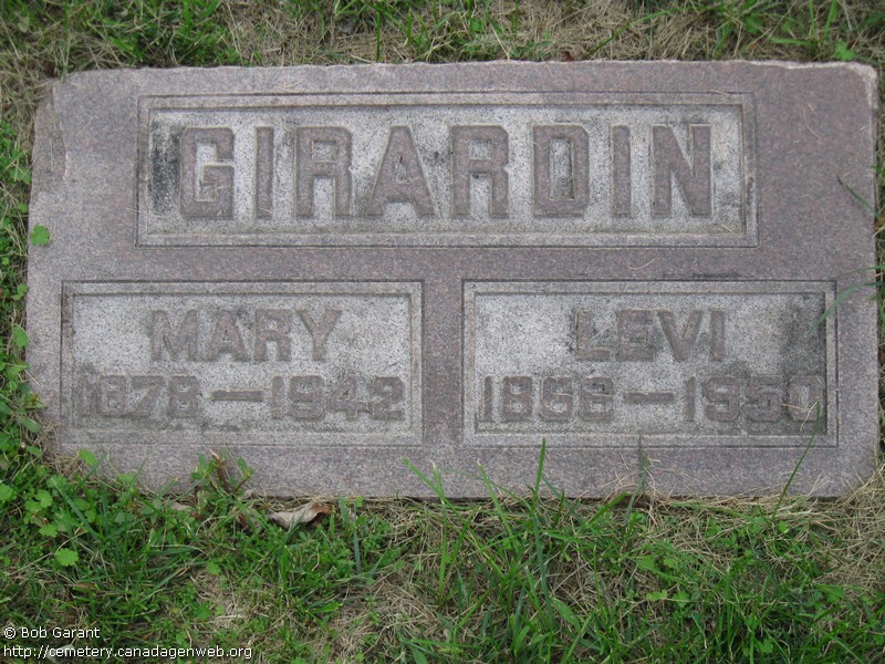
Lakeview Cemetery, Section: D
Leamington, Mersea Township (Concession 16, Lot 6)
Essex County, ON
Photos: Bob Garant
[2010, 2012, 2015], Additions from Doug & Donna Gammon [2014]
Indexed by Kate Ford, Patricia Green
Street Address: 233 Erie St S
Community: Leamington
Township: Mersea Township (Concession 16, Lot 6)
Locality: Essex County
Municipality: Leamington
Province: ON
GPS: 42.041572,-82.602184
http://geneofun.on.ca/names/photo/1675766
c. 1874 - 1881
Point Pelee
Girardin, Peter
| Last Name | Girardin |
| First Name | Peter |
| Nativity | Mersea Tp., Essex Co., Canada |
| Business | Farmer; Fisherman |
| Year Settled | 1820 |
| Post Office | Leamington |
| Township | Mersea |
| County | Essex |
| Source Date | b. 1820 |
| Atlas Date | 1881 |
| Concession and Lot | Lot size |
| PP, 7 | 50 |
http://digital.library.mcgill.ca/countyatlas/default.htm
[ELLIOT] PAT GIRARDIN
Levi Girardin established a fishery in 1911 which was eventually run by his son Elliot, better known as Pat. Upon the unexpected death of Pat in 1936, his wife Leita took over.- Henrietta O'Neill, In Search of a Heart (Friends of Point Pelee, 2000), pp. 45-48.
1901
1901 Census: Girardin Elliot J., Male, Son, Single, Born Oct 1 1895, Age 5 - http://automatedgenealogy.com/census/View.jsp?id=50651&highlight=45&desc=1901+Census+of+Canada+page+containing+Levi+J.+Girardin
1911
1911 Census: Girardin Elliott, Male, Son, Single, Born Oct 1895, Age 15 - http://automatedgenealogy.com/census11/View.jsp?id=89087&highlight=48&desc=1911+Census+of+Canada+page+containing+Elliott+Girardin
1921
Elliott Girardeau [Mersea Township], Essex South, Ontario abt 1895 Ontario Son
1931
1931 CANADA CENSUS
1931 Census - Family 252
Elliott Girardin, Fisherman, Pound Net
https://central2.bac-lac.gc.ca/.item/?id=e011636926&app=census1931&op=img - Page 23
PHILIP GIRARDIN
c. 1874 - 1881
Point Pelee
http://digital.library.mcgill.ca/countyatlas/default.htm
Around 1903, Philip Girardin began fishing near Lot 15.
[Henrietta O'Neill, In Search of a Heart (Friends of Point Pelee, 2000), pp. 45-48]
http://automatedgenealogy.com/census11/SplitView.jsp?id=89086&frag=e080/e001985791&dir=1911a - 1911 Census
Lot 15, Point Pelee
1921
1921 Census: Family 114
Girardin, Philip, fisherman
GOLDBAUM
Goldbaum ...
[Henrietta O'Neill, In Search of a Heart (Friends of Point Pelee, 2000), pp. 45-48]
JAMES GRUBB [JIM OR JIMMY GRUBB]
[Grubb, James W.
http://automatedgenealogy.com/census11/SplitView.jsp?id=89083&frag=e080/e001985788&dir=1911a
- 1911 Census
Province/Territory: Ontario, District Name: Essex
South, District Number: 68, Sub-district: Mersea,
Sub-district Number: 25 - Page 1 - Fishing]
1921
1921 Census - Family 129
Grubb, James, fisherman
John Murkly, fisherman
Harold McLellan, fisherman
Thomas Epplett, fisherman
Filiman Mooney, fisherman
1931
1931 CANADA CENSUS
1931 Census - Family 233
- James W Grubb, Fisherman, General Fishery
- James D Grubb, Fisherman, Father's Fishery
- Riel H Grubb, Fisherman, Father's Fishery
- William Colley, Fisherman, General Fishing
- David Livingstone, Fisherman, General Fishing
- Eariel Ashton, Labourer, General Fishing
- Edward Crozier, Labourer, Fishing Industry
Lots 2 & 4 are now managed by James Grubb - Williams son of
course. Jim Grubb married Flossie Mooney 1909 and they run a fishery on both
the east and west sides of the Point ...
In damp open ground at Point Pelee near Grubb's fishery buildings ...
Geological Survey of Canada, The Survey, Memoir, Issue 54, 1914, p. 37.
James Grubb, pioneer fisherman of Point Pelee ... The Grubb Fishery near the southerly end of the Point has been lifting very heavy catches of White Fish while Fisheries near the north-west end of the Point have been receiving very light lifts ...
http://ink.ourontario.ca/browse/lp -The Leamington Post. May 22, 1941 - pg. 2
[Henrietta O'Neill, In Search of a Heart (Friends of Point Pelee, 2000), p. 27.
[In the 1940s] Tom Epplett, a former employee of the James Grubb fisheries at Point Pelee, was a partner in the Epplett family firm ...
Rita Lobzun [Karen Adamson-Editor], Open Books, A Historical Sketch of Commercial Fishing in Wheatley - Ontario, After 1980, p. 5] - http://images.ourontario.ca/Partners/CKPL/CKPL0027490551T.PDF
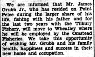
We are informed that Mr. James Grubb Jr., who has resided on Point Pelee during the larger share of his life, fishing with his father and for the last two years with the Tilbury Fishery, will move to Wheatley where he will be employed by the Omstead Fisheries. We take this opportunity of wishing Mr. Grubb and his family health, happiness and success in their new homes and occupation
http://ink.ourontario.ca/browse/lp -
Leamington Post, June 12, 1941, p. 18 [Actually January 16, 1941, p. 11]
WILLIAM A GRUBB SR. (b. March 2, 1850)
William Grubb took over and by 1870 the Grubb fishery had expanded to include both the east and west sides of the Point - Henrietta O'Neill, In Search of a Heart (Friends of Point Pelee, 2000), pp. 45-48.
Grubb's Fish House - Map dated 1905
------
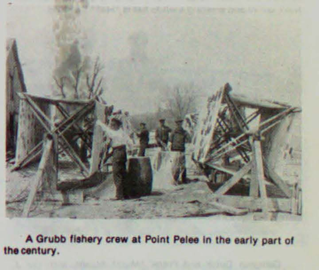
A Grubb Fishery Crewe at Point Pelee in the early part of the century
Rita Lobzun [Karen Adamson-Editor], Open Books,
A Historical Sketch of Commercial Fishing in Wheatley - Ontario, After 1980,
p. 43 -
http://images.ourontario.ca/Partners/CKPL/CKPL0027490551T.PDF
Grubb's fish house East Side, picture dated 1906 - Henrietta O'Neill, Birding at Point Pelee: A Birder's History of One of Canada's Most Famous Birding Spots (James Lorimer & Company, 2006), p. 26. - "On the return trip, about opposite Grubb's fish house on the East shore ..." http://books.google.com/books?id=9aILzHAirCgC&pg=PA26&dq=%22Grubb%27s+fish+house%22
When he was sixteen years of age, he left home to make his own way in the world, crossing to Pelee Island, in search of employment. Here he found work on a fishing-boat belonging to Thomas and Arthur McCormick, and was engaged at wages of $20 a month during the busy season. His winters were spent in cutting wood and in other work. After three years he embarked in fishing on his own account, coming then to Point Pelee, where he followed this industry for five years, buying his own fishing ground and finding his market in Sandusky, Ohio. This business he still continues, now on a large scale with the assistance of his three sons, operating seventeen fish pounds. The products of this large fishery are contracted for by Post & Co of Sandusky, Ohio, with whom Mr. Grubb has had business dealings for thirty-two years ... [Commemorative biographical record of the county of Essex, Ontario : containing biographical sketches of prominent and representative citizens and many of the early settled families ( Toronto, J.H. Beers, 1905), p. 580 - http://www.ourroots.ca/toc.aspx?id=3107&qryID=7812a62b-c8a9-43a4-8924-f51b6c8db63a]
[United States, v. Post Fish Co., (Nos. 1167 and 1212) Fish from the Canadian waters of lake Erie. In all essentials the equipment put in place by the importer in the Canadian ... From the testimony produced at the hearing by the importers it appears that the Post Fish Co. is a corporation organized and existing under the laws of the State of Ohio. The corporation is engaged in the business of catching fish off Pelee Point in the Canadian waters ... state of facts, which was met by the Government by no competent evidence to the contrary, warranted, we think, a finding that the stakes, nets, pounds, fishing gear, tackle, and other essentials for the taking of fish established by the Post Fish Co. on both sides of Pelee Point were either wholly the property of the Post Co. ... Treasury decisions under the customs, internal revenue, industrial alcohol ... United States. Dept. of the Treasury, United States. Customs Court, United States. Court of Customs and Patent Appeals, Volume 26, 1914, pp. 261-263] See also: Reports, Documents, and Journals of the U.S. Senate and House of Representatives. 1915, New York Times, May 2, 1914 and The Evening Independent, Aug 10, 1936 (Joseph Wright Post of the Post Fish Company). The original owner was Halsey C. Post, who founded the company in 1856. His Company operated out of Sandusky and Cleveland in 1914]
The children born to Mr. and Mrs. Grubb were: James Walter, born Nov. 24, 1873, who is engaged in operating three fish pounds, makes his home with his parents; William A., born Jan. 6, 1875, who operates six fish pounds ... [Commemorative biographical record of the county of Essex, Ontario : containing biographical sketches of prominent and representative citizens and many of the early settled families ( Toronto, J.H. Beers, 1905), p. 581 - http://www.ourroots.ca/toc.aspx?id=3107&qryID=7812a62b-c8a9-43a4-8924-f51b6c8db63a]
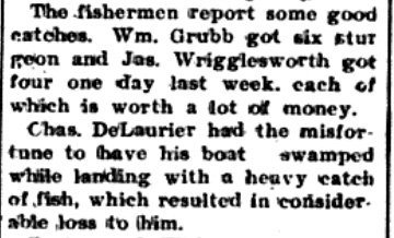
The fishermen report some good catches. Wm. Grubb got six sturgeon
and Jos. Wriggiesworth got four one day last week, each of which is worth a lot
of money ...
http://ink.ourontario.ca/browse/lp -Leamington Post, July 28, 1910, p. 1
1911
CENSUS
Grubb, William
Province/Territory: Ontario, District Name: Essex
South, District Number: 68, Sub-district: Mersea,
Sub-district Number: 25 - Page 5 - Fisherman
Stevenson, George
Province/Territory: Ontario, District Name: Essex
South, District Number: 68, Sub-district: Mersea,
Sub-district Number: 25 - Page 5 - Fishing - Living
with William Grubb
|
|
46 | Grubb William | M | Head | M | Mar | 1849 | 60 | ||
|
|
46 | Grubb Hellen | F | Wife | M | Mar | 1847 | 64 | ||
|
|
46 | Grubb Hellen E. | F | Daughter | S | Dec | 1896 | 16 | ||
|
|
46 | Winney Brown | F | Servant | S | Sep | 1894 | 16 | ||
|
|
46 | Stevenson George | M | Labourer | S | Apr | 1870 | 40 |
http://automatedgenealogy.com/census11/SplitView.jsp?id=89087&frag=e080/e001985792&dir=1911a - Census 1911
"W. A. Grubb is erecting a fine concrete block house on Point Pelee ..."
http://ink.ourontario.ca/browse/lp -Leamington Post, September 24, 1931, p. 2
William A. Grubb .... After three years he embarked in fishing on his account, coming then to Point Pelee, where he followed this industry for five years, buying his own fishing ground and finding his market at Sandusky, Ohio. This business he still continues, now on a large scale, with the assistance of his three sons, operating seventeen fish pounds. The products of this large fishery are contracted for by Post & Co., of Sandusky, Ohio, with whom Mr. Grubb has had business dealings for thirty-two years ....
The children born to Mr. and Nrs. Grubb were: James Walter, born Nov. 24, 1973, who is engaged in operating three fish pounds ....
Commemorative biographical record of the county of
Essex, Ontario :
containing biographical sketches of prominent and
representative citizens
and many of the early settled families (Toronto,
1905), pp. 580 and 581
http://www.ourroots.ca/e/page.aspx?id=640974
PETER/WILLIAM/WILLIAM S/CLAUDE IVES
1901
The 1901 Census, Sub district Mersea, Essex (South/Sud), Ontario, District 60, Subdistrict Number: K-1:
Peter Ives, fisherman, p. 15
[Source: http://www.collectionscanada.gc.ca/databases/census-1901/index-e.html . See also: http://automatedgenealogy.com/census/District.jsp?id=60 ]
1911
The 1911 Census, Province/Territory: Ontario, District Name: Essex South, District Number: 68, Sub-district: Mersea, Sub-district Number: 24
Ives, William, fisherman - Works for Self, Page 6
[Source: http://automatedgenealogy.com/census11/SplitView.jsp?id=89071 - 1911 Census]
1921
The 1921 Census, sub-district 22: Family 98
Ives, William S
Ives, Claude
[Source:
http://search.ancestry.ca/search/db.aspx?dbid=8991 ]
WILLIAM KRAUSE AND SONS FISHERIES (1938-1969)
1918 - 1972
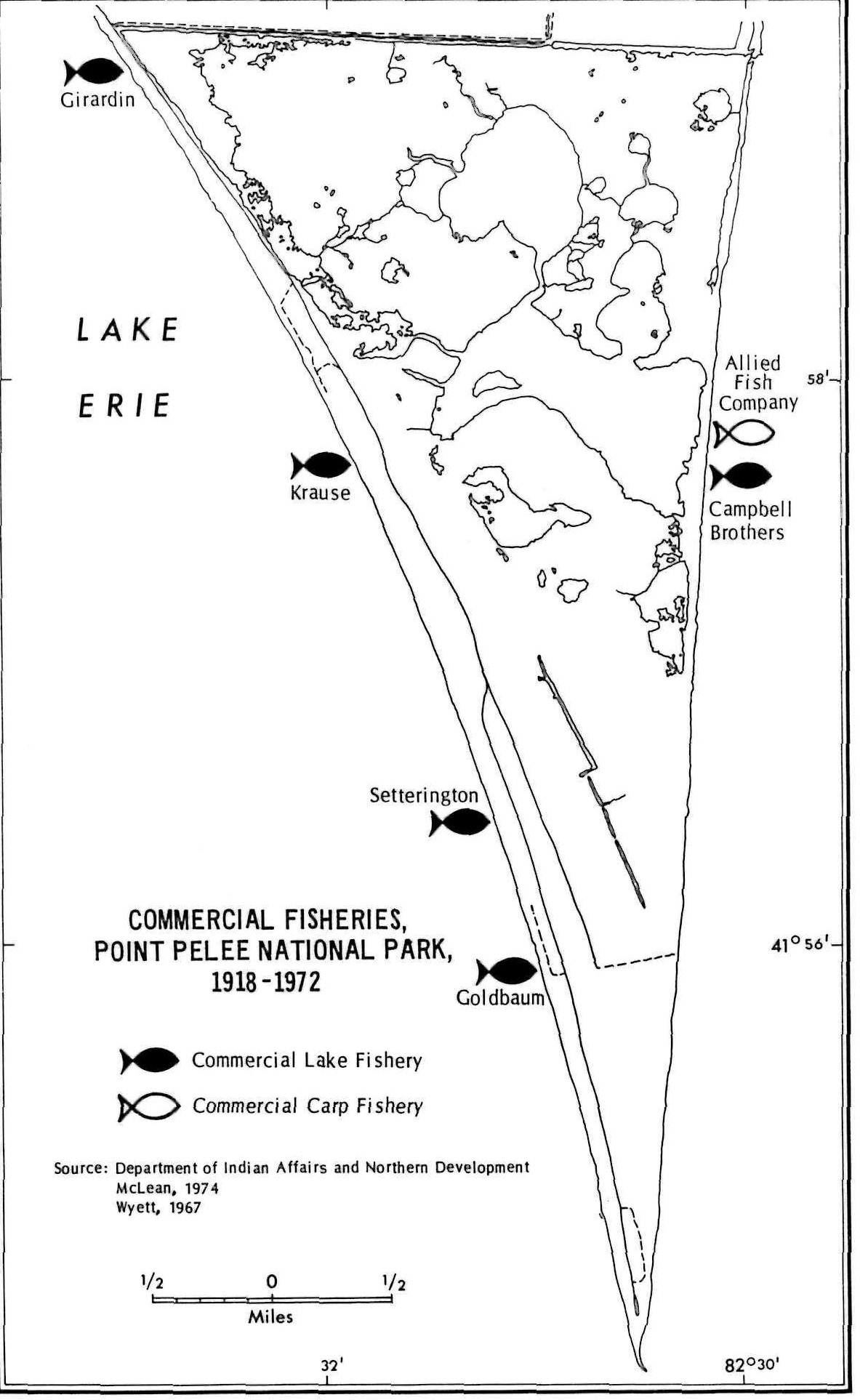
COMMERCIAL FISHERIES,
POINT PELEE NATIONAL PARK, 1918 - 1972
Fisheries Identified:
Commercial Lake Fishery:
Girardin (west side), Krause (west side),
Setterington
(west side), Goldbaum (west side),
Campbell Bros (east side)
Commercial Carp Fishery: Allied Fish Company (east side)
J. G. Battin & J. G. Nelson, Man's Impact On Point Pelee National Park, National Provincial Parks Association, 1978, pp. 101
http://parkscanadahistory.com/publications/nppac-cpaws/point-pelee.pdf
-------------------------------------------------------------------------
1937
Krause Fisheries came into existence through the McLellan Fishery in 1937, which became the basis for William Krause Sr,'s establishment within the park. He and his sons, William Jr. and Rudy operated inside the park until about 1969.
Southpoint Sun, February 5, 2025, p. 16
https://issuu.com/southpointsun/docs/southpoint_sun_-_february_5_2025
Krause had purchased the fishery business and part of the disputed lot in December, 1937, from James E. and Harry McLellan and in that contract certain buildings are described as "erected on government lands adjacent to the fishery."....
Windsor Star, May 17, 1956, p. 5 -
https://www.newspapers.com/image/501484420/?terms=%22windsor%2Bstar%22%2B%22krause%22
In 1937. "Mac", having operated his own fishery for a number of years, sold his business to William Krause of Point Pelee, and moved to Wheatley to operate a feed mill and coal business.
Rita Lobzun [Karen Adamson-Editor], Open Books, A Historical Sketch of Commercial Fishing in Wheatley - Ontario, After 1980, p. 16
http://images.ourontario.ca/Partners/CKPL/CKPL0027490551T.PDF
Karl Rudy Krause recalls that the his father first purchased the license of McLellan and then further north that of Sid Tilbury where they operated their Fishery until 1969.
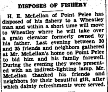
DISPOSES OF FISHERY ...
H. E. McLellan of Point Pelee has disposed of his fishery to a Wheatley man ... [License of H. E. McLellan]
http://ink.ourontario.ca/browse/lp -The Leamington Post. December 23, 1937 - Page: 5
-------------------------------------------------------------------------
1938
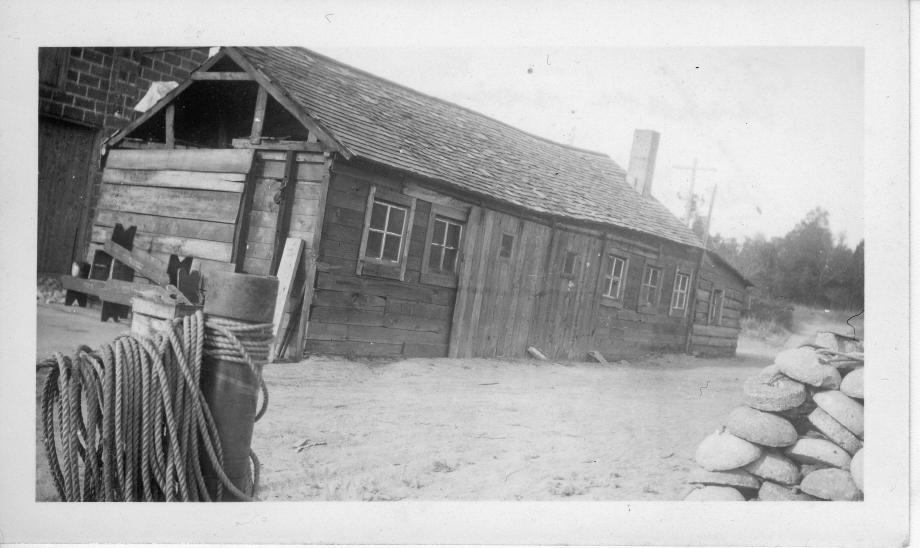
Original Fish House
1940
February
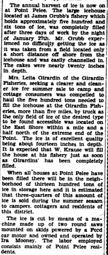
Krause Ice House
The annual harvest of ice is now on at Point Pelee...
Mrs. Leita Girardin of the Girardin Fisheries, seeking a clearer and cleaner ice for summer sale to camp and cottage consumers was compelled to haul the five hundred tons needed to fill the icehouse at the Girardin Fisheries. more than five miles, by truck as the only field of ice of the desired type to be found accessible was located on the East Shore within a mile and half north of the extreme end of the point. The ice is of excellent quality being about fourteen inches in depth. It is expected that W. Krause will fill the house at his fishery just as soon as the Girardins' has been completely filled.
When all houses at Point Pelee have been filled there will be in the neighbourhood of thirteen hundred tons of ice in storage here and it is estimated that three-quarters of this amount is sold during the summer season to campers, cottages and residents of this district ...
http://ink.ourontario.ca/browse/lp -The Leamington Post. September 26, 1940 - pg. 4 [Misfiled: This is February 1, 1940, p. 5]
-------------------------------------------------------------------------
1941
JUNE 12
[JANUARY 16]
Mr. James Grubb Jr., ... fishing with his father and for the last two years with the Tilbury Fishery .... [Property of Sid Tilbury]
http://ink.ourontario.ca/browse/lp -
Leamington Post, June 12, 1941,
p. 18 [Actually January 16, 1941, p. 11]
At first, the Krauses - William, and sons Bill and Rudy- fished using pound net technology. Here, at the beginning of the season, using a pile driver, they drove stakes into the lake bottom. They then suspended lines and nets from them. The fish caught were of higher quality than those (often dead or even rotting) caught in gill nets, as they were kept alive in the "pound" of the net. When they emptied the pound using hand dip nets, they immediately placed the live fish on ice.
JULY 10
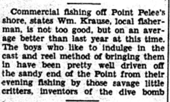
Commercial fishing off Point Pelee's shore, states Wm. Krause, local
fisherman, is not too good,
but on an average better than last year at this time. The boys who like to
indulge in
the cast and reel method of bringing them in have been pretty well driven off
the sandy end of the
Point from their evening fishing by those savage little critters inventors of
the dive bomb
http://ink.ourontario.ca/browse/lp -Leamington Post, July 10, 1941, p. 5
-------------------------------------------------------------------------
1942
POINT PELEE NATIONAL PARK: 1942
"Krause Fishery" [Lot 15]
-------------------------------------------------------------------------
1944
On April 1, 1944, a building permit was issued to Krause to build on the government land ...
Windsor Star, May 17, 1956, p. 5 - https://www.newspapers.com/image/501484420/?terms=%22windsor%2Bstar%22%2B%22krause%22
-------------------------------------------------------------------------
c. 1946
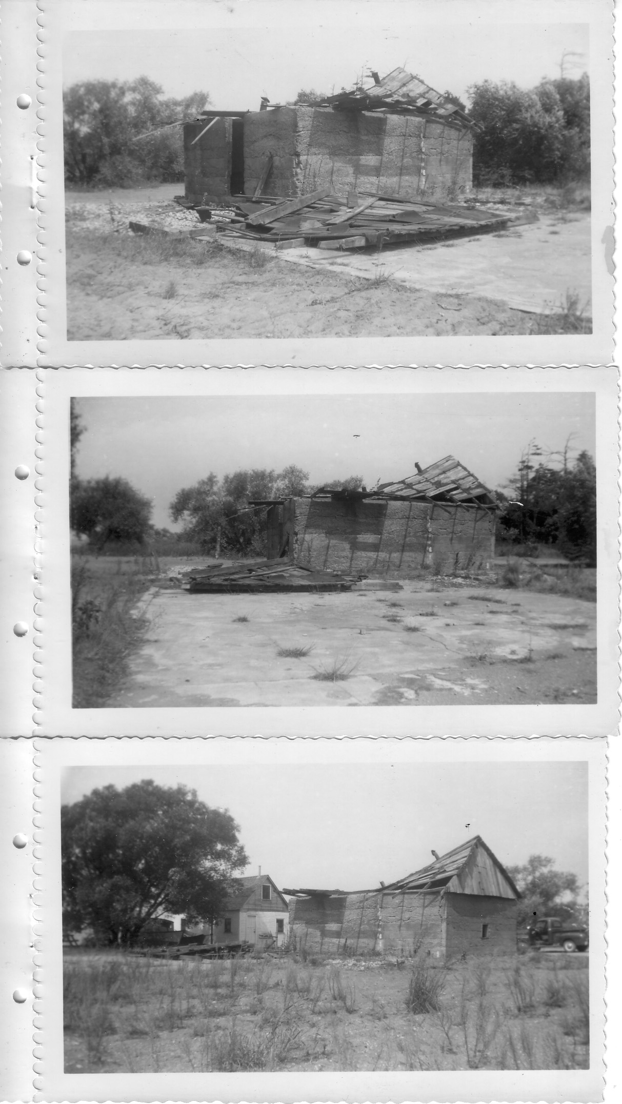
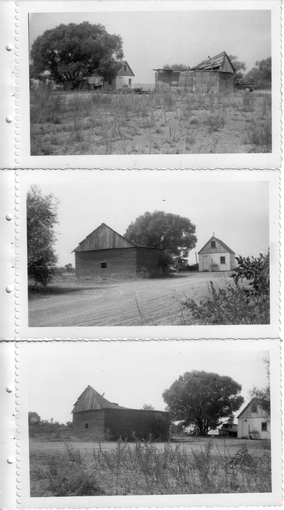
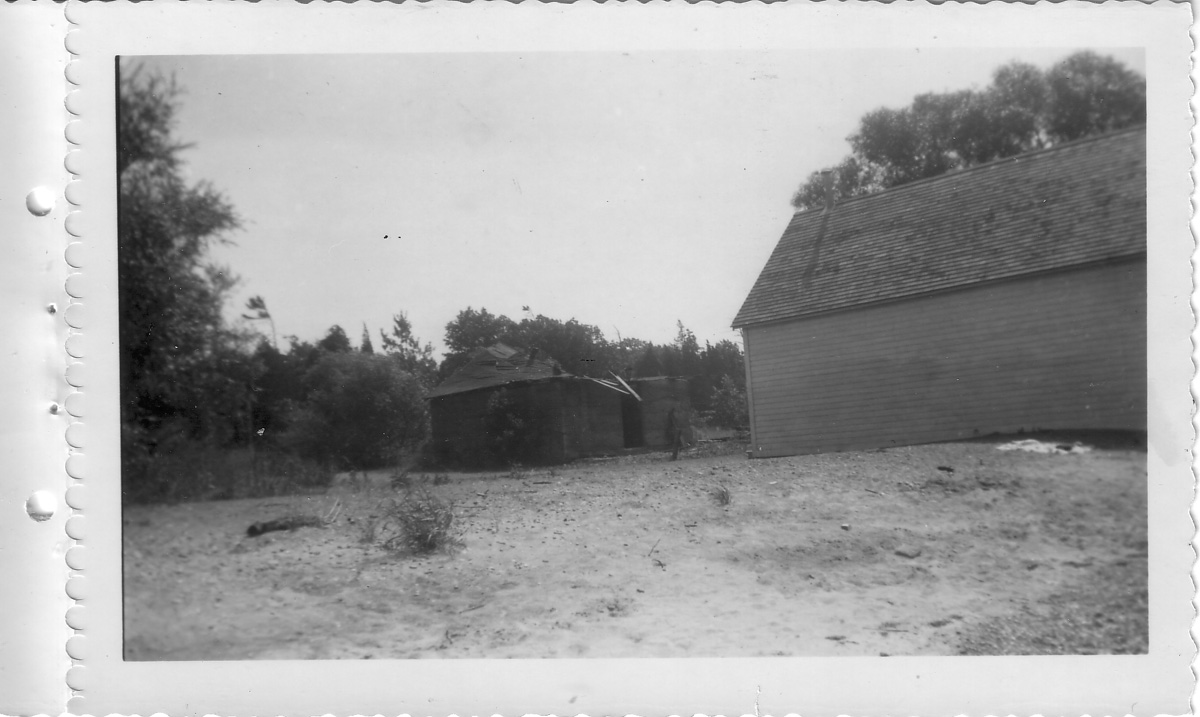
"Tilbery Fish[ery]"
NOTE: The "Mercury Album Prints" jacket cover has a 1949 copyright date.
-------------------------------------------------------------------------
c. 1947 - c. 1949
CATCHING THE FISH
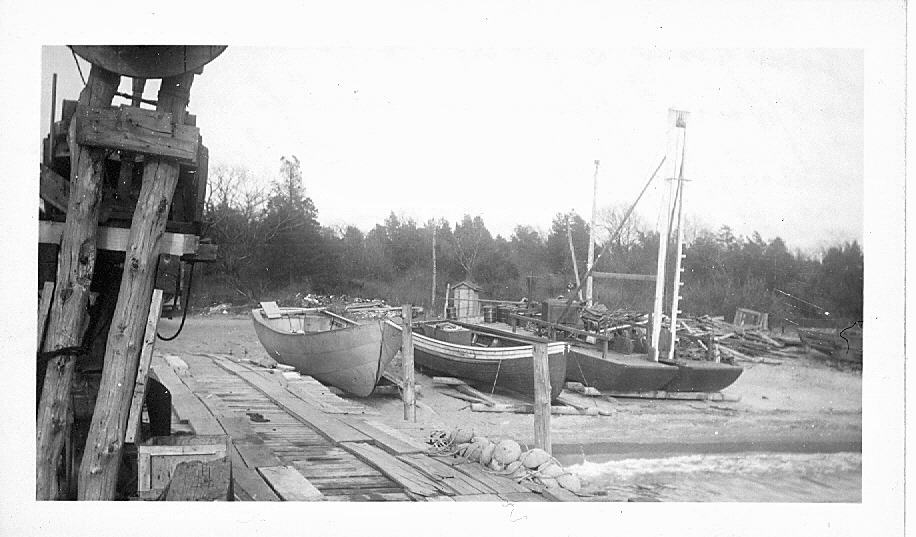
Photos kindly provided by Karl Uwe Pullmann, Dresden, German
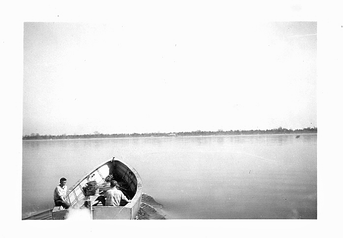
Photos kindly provided by Karl Uwe Pullmann, Dresden, German
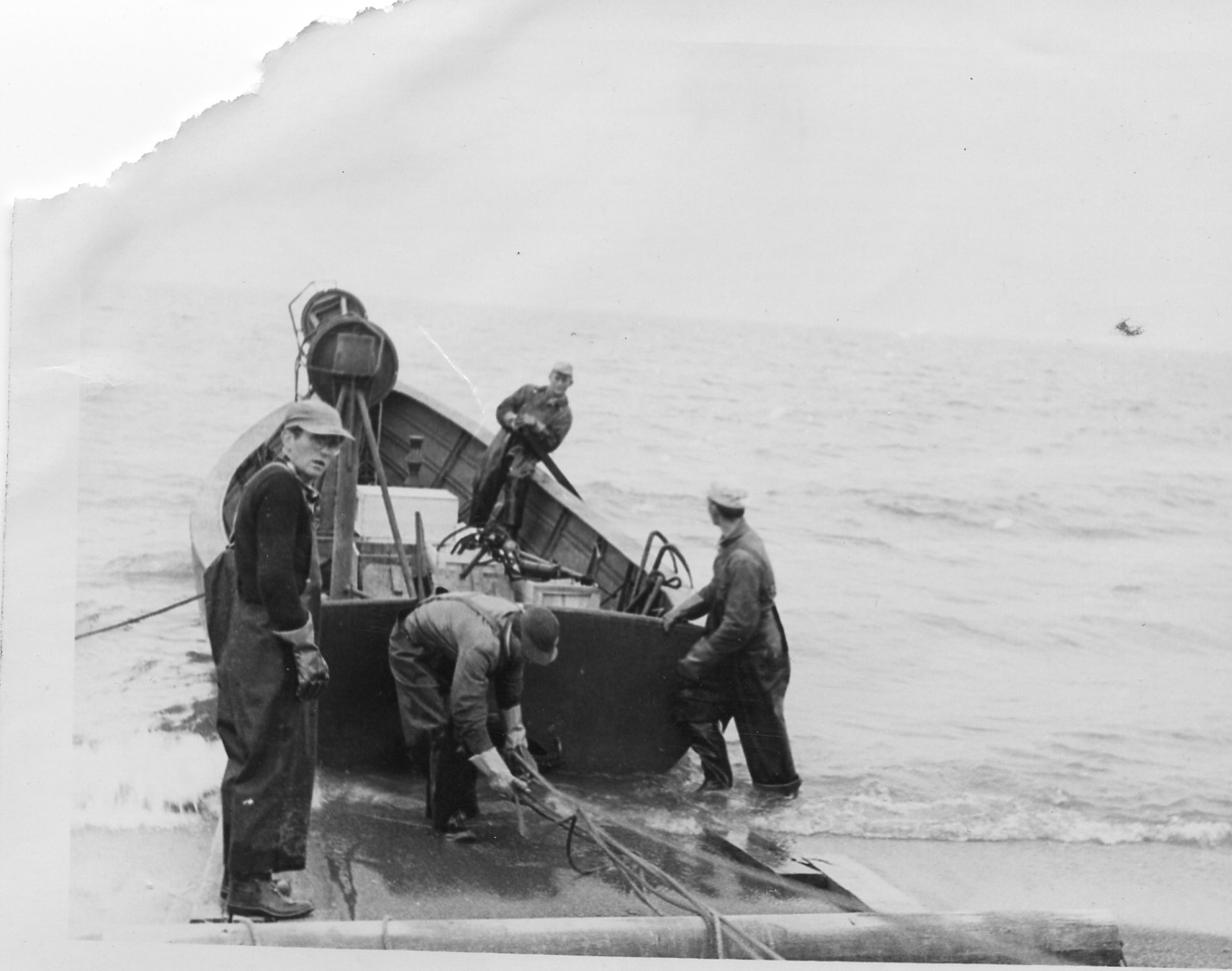
Photo Supplied by Alisa (Krause) McClurg
Krause Fisheries - H. William (Bill) Krause (rear).
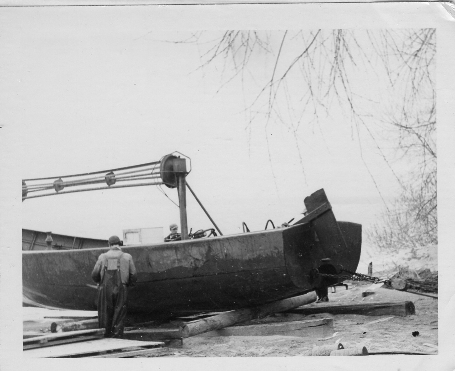
Photo Supplied by Alisa (Krause) McClurg
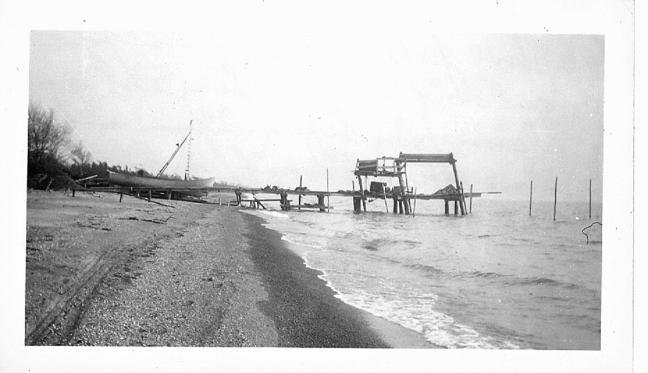
Photos kindly provided by Karl Uwe Pullmann, Dresden, German
--------------------------------------
THE FISHERMEN AND THEIR FISH
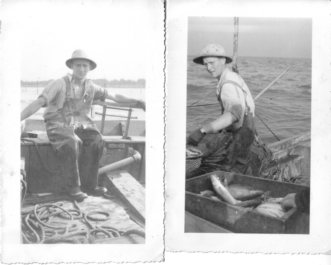
H. William (Bill) Krause
(Left Picture) Pound Net Posts To The Rear
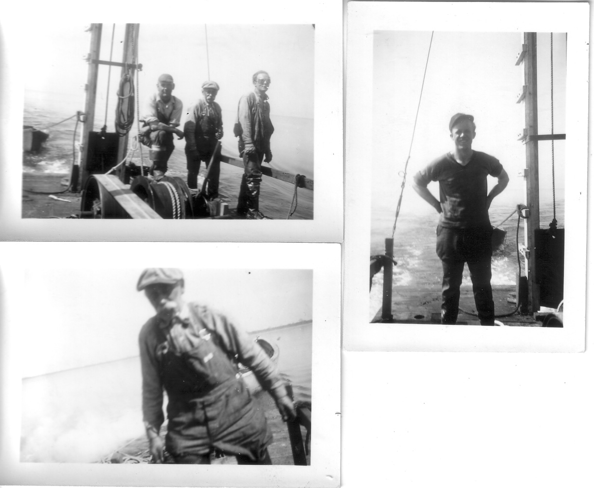
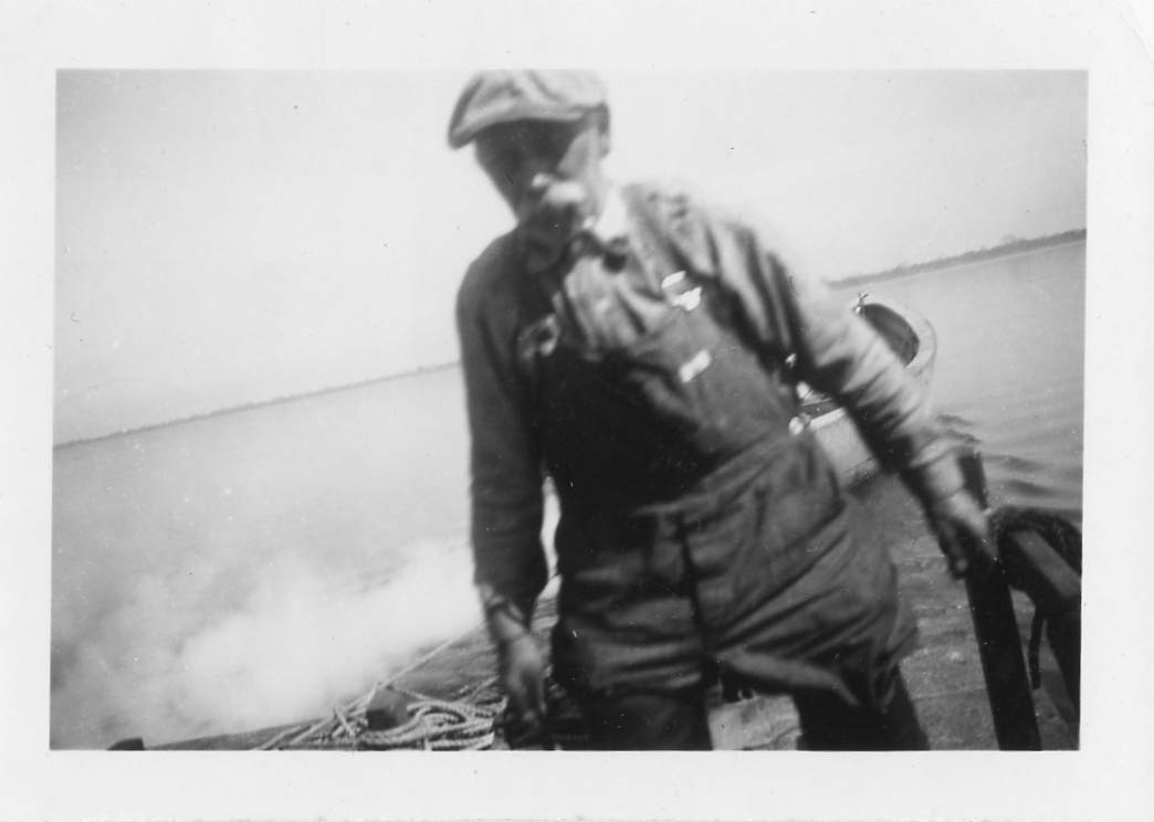
(Photo Supplied by Alisa Krause (McClurg))
"On the way home." (Upper Left)"
"Henry Thiessen on the scow. I [H. William (Bill) Krause] took the picture
going home, from driving stakes. " [Upper Right]
"This [lower left] is Fy Henry [.] Tried to get the boat,
and Fy stepped in front of camera, on the scow. "
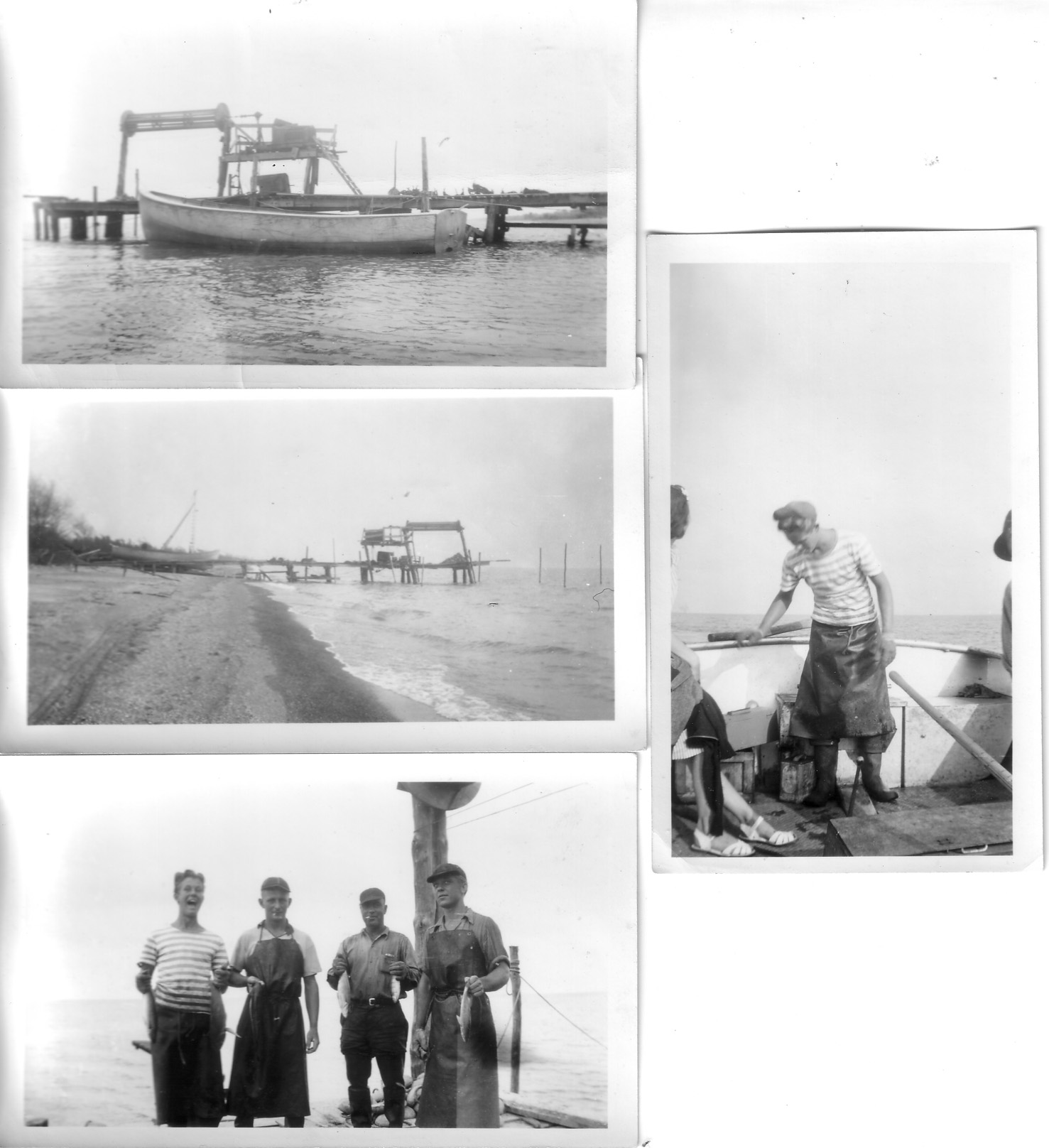
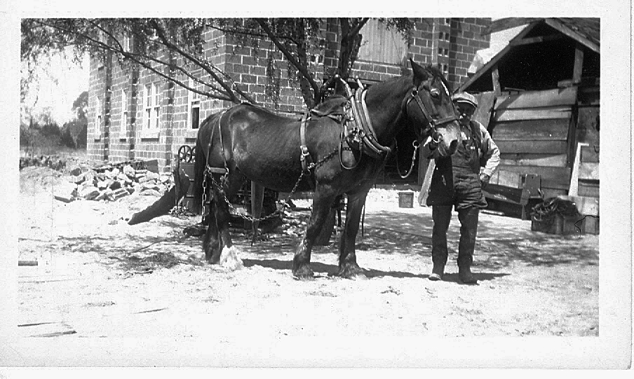
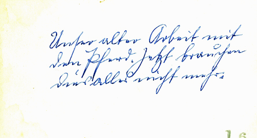
Photos kindly provided by Karl Uwe Pullmann, Dresden, German
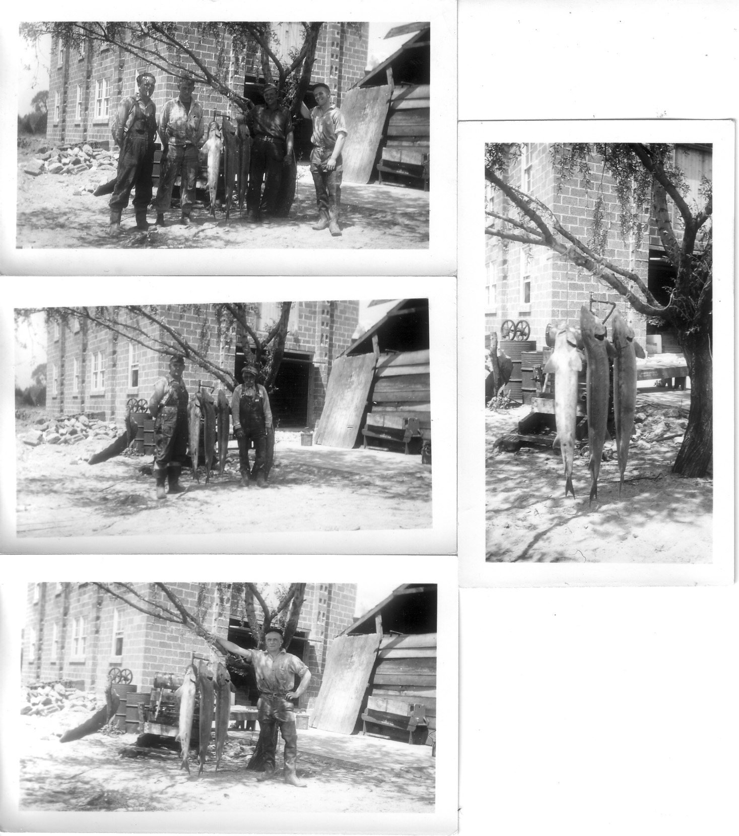
Sturgeons
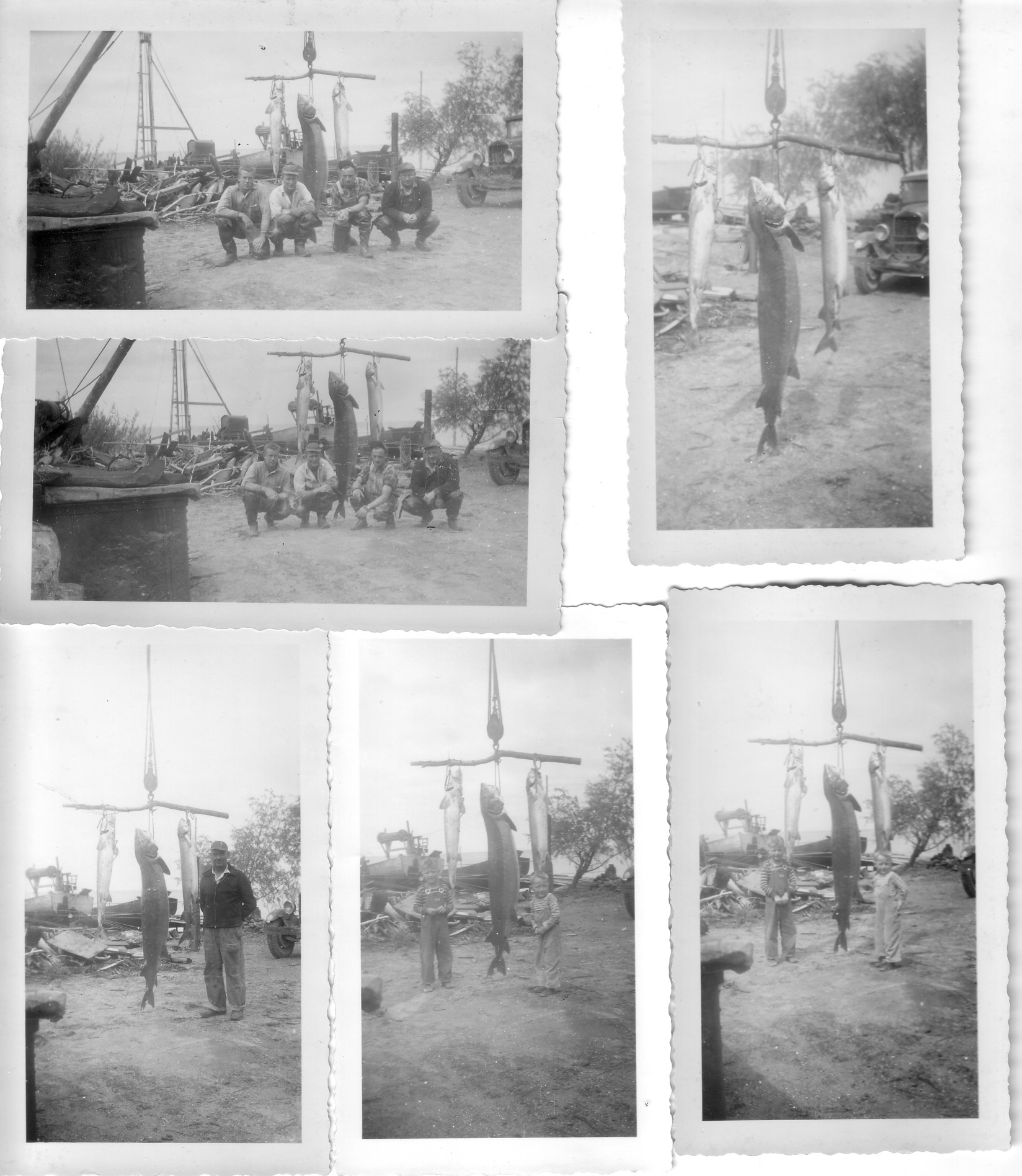
Top Left: Karl R. Krause - "Rudy", H. William (Bill) Krause, Unidentified, F. William Krause
Bottom Right: Eric R. Krause, William A. Krause (Billy)
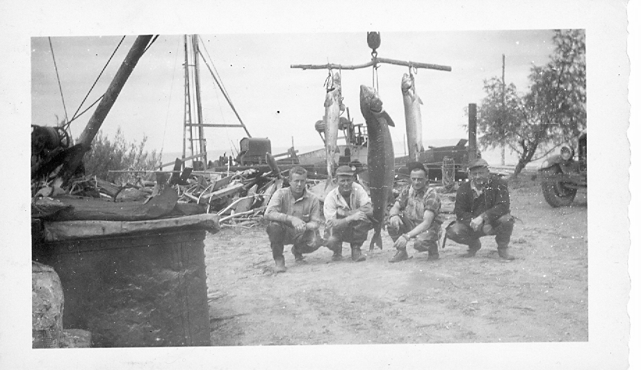
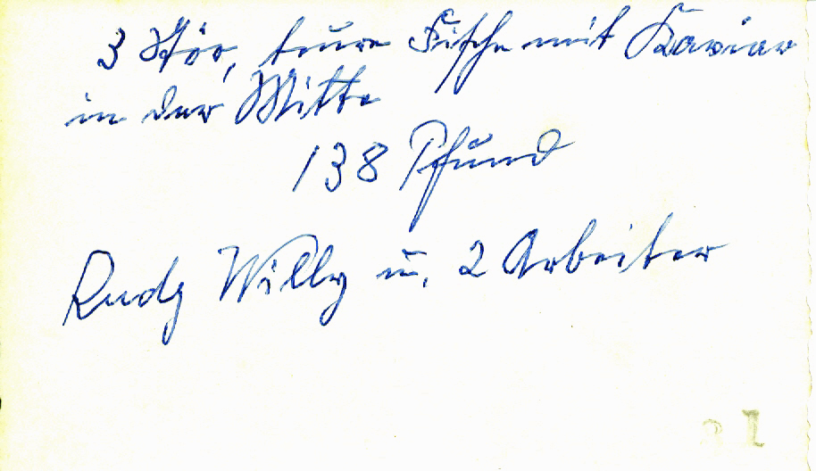
Photos kindly provided by Karl Uwe Pullmann, Dresden, German
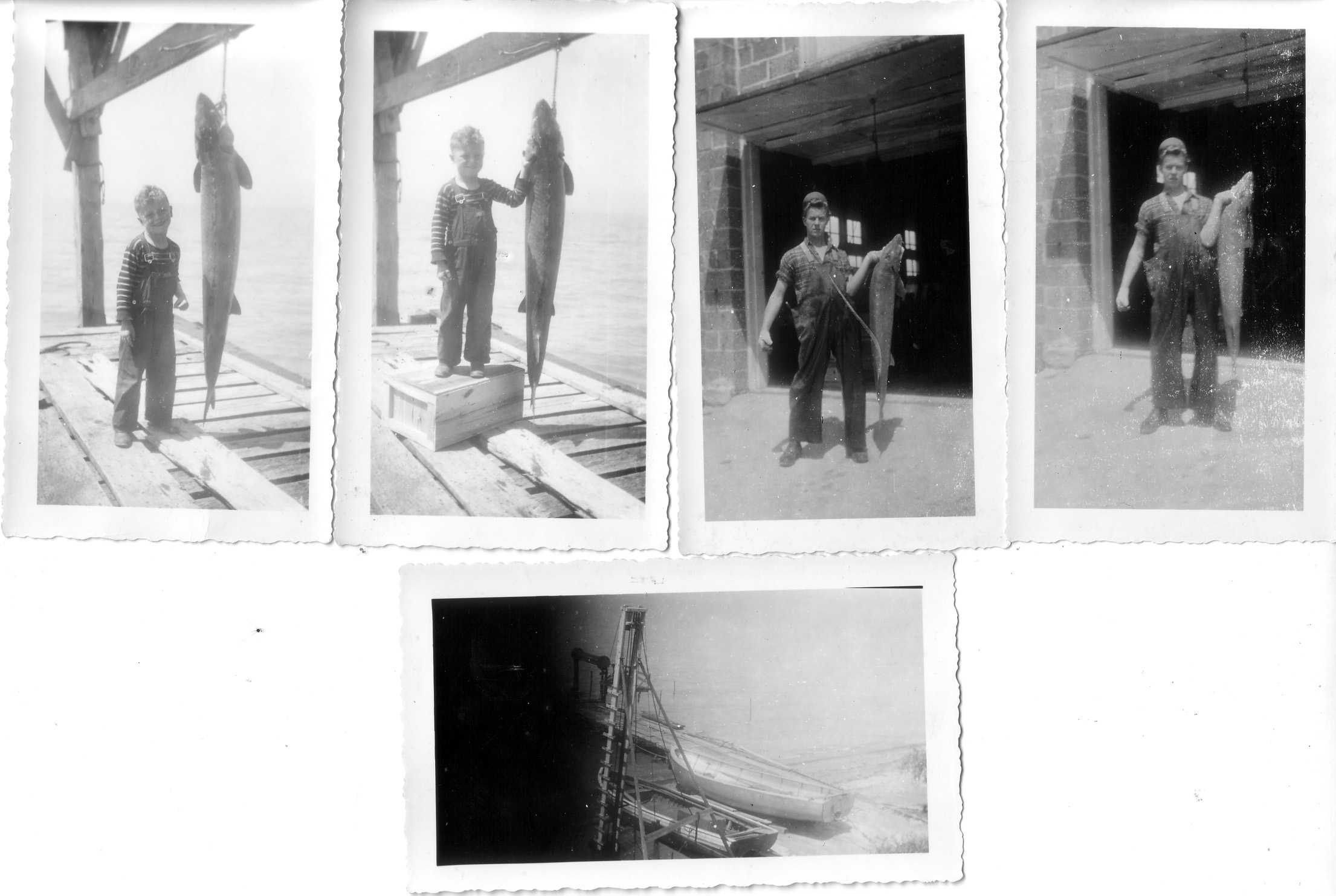
Eric R. Krause (6 Years Old) / Karl R. Krause - "Rudy"
THE ENTERPRISE
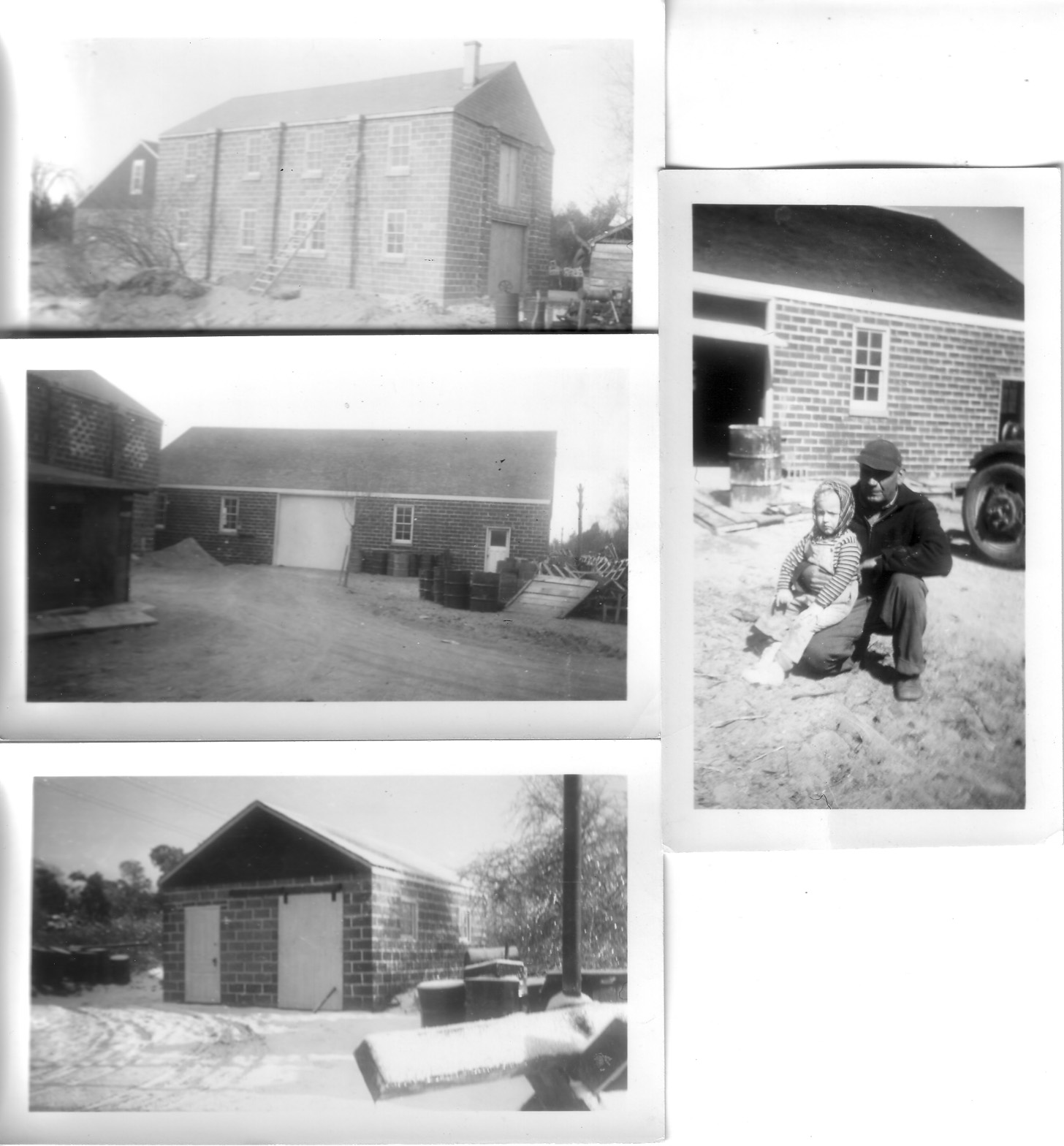
Left, Top to Bottom: Fish House, Twine House, Garage
Right: New Twine House
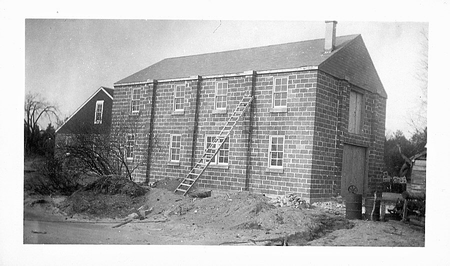
The Fish House
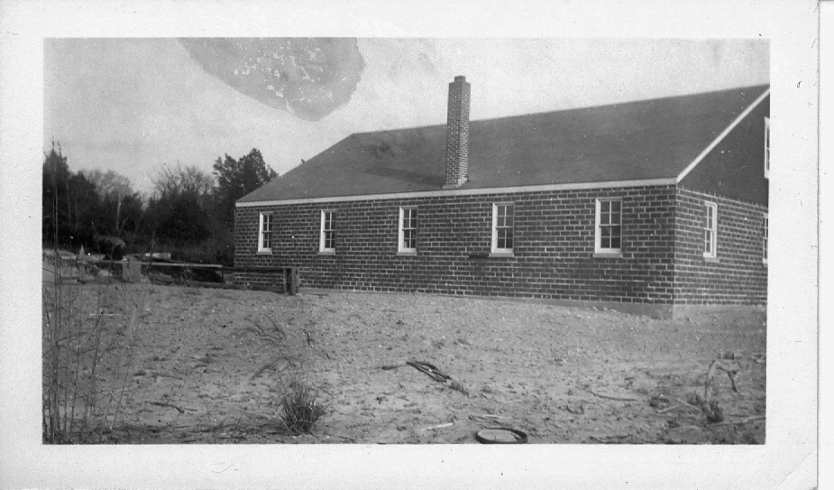
The Twine House
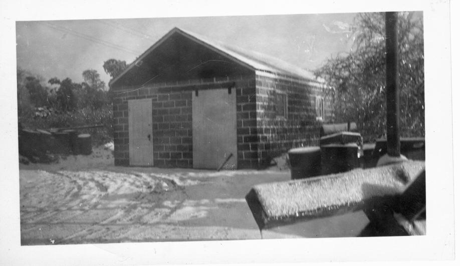
The Garage


The Old Fish House
Photos kindly provided by Karl Uwe Pullmann, Dresden, Germany
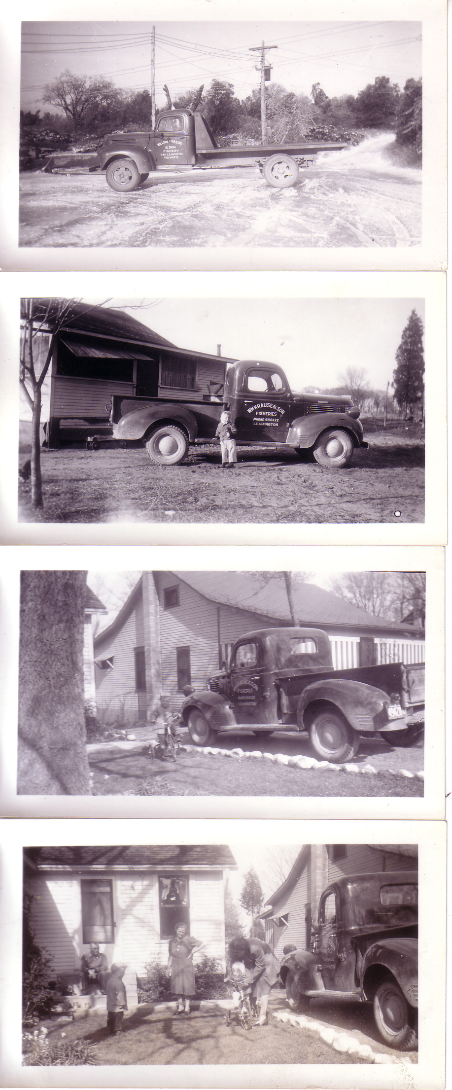
Vehicles
"William Krause & Son Fishery R. R. 1 Leamington PHO. 646 R 22"
Dodge: "Wm Krause & Son Fisheries Phone 646 R 22 Leamington"
-------------------------------------------------------------------------
1949
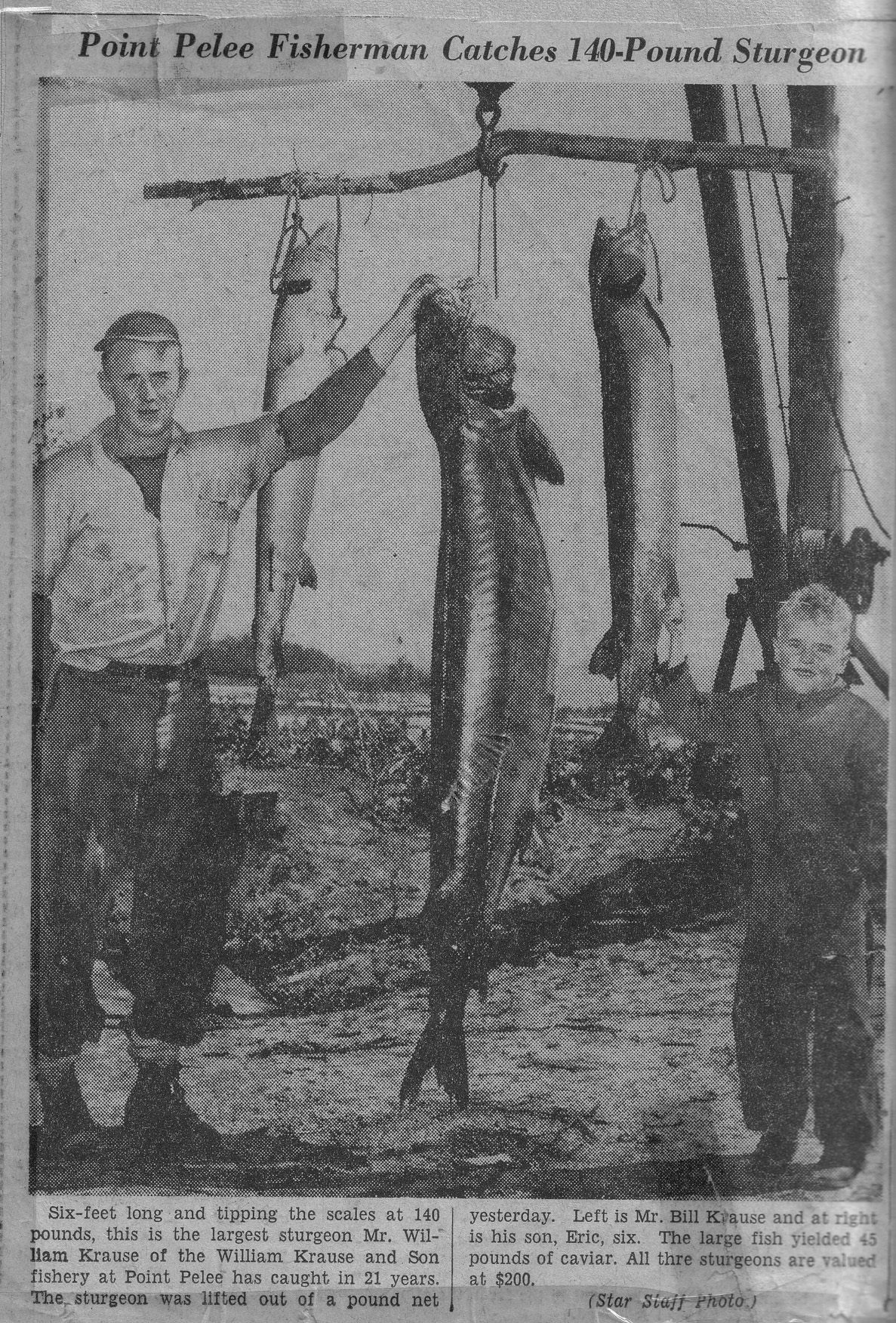
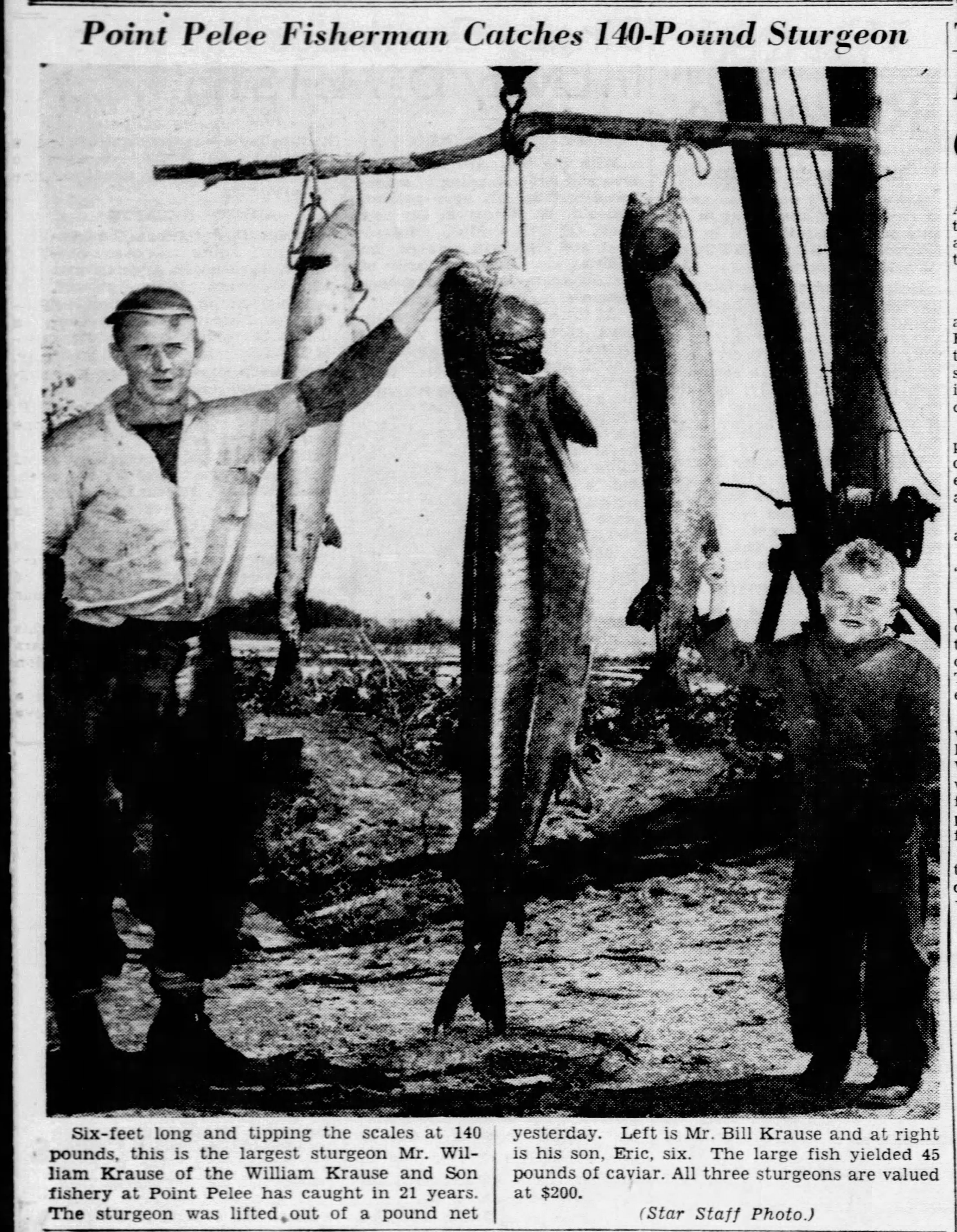
H. William (Bill) Krause and Eric R. Krause
Windsor Daily Star Staff Photo
Point Pelee Fisherman Catches 140-Pound Sturgeon
Six-feet long and tipping the scales at 140 pounds, this is the largest sturgeon Mr. William Krause of the William Krause and Son fishery at Point Pelee has caught in 21 years. The sturgeon was lifted out of a pound net yesterday. Left is Mr. Bill Krause and at right is his son, Eric. The large fish yielded 45 pounds of cavier. All three sturgeons are valued at $200.
The Windsor Star, May 21, 1949, p. 7
https://www.newspapers.com/image/501071147/
A large sturgeon weighing 140 pounds, was hauled in by the William Krause and Son's fishery at Point Pelee last week-end. Caught in a pound net, it was the largest sturgeon caught at Point Pelee in many years. The large fish yielded 45 pounds of cavier. Mr. Krause says the fish was the largest caught by him in the past 21 years.
Source: Unknown
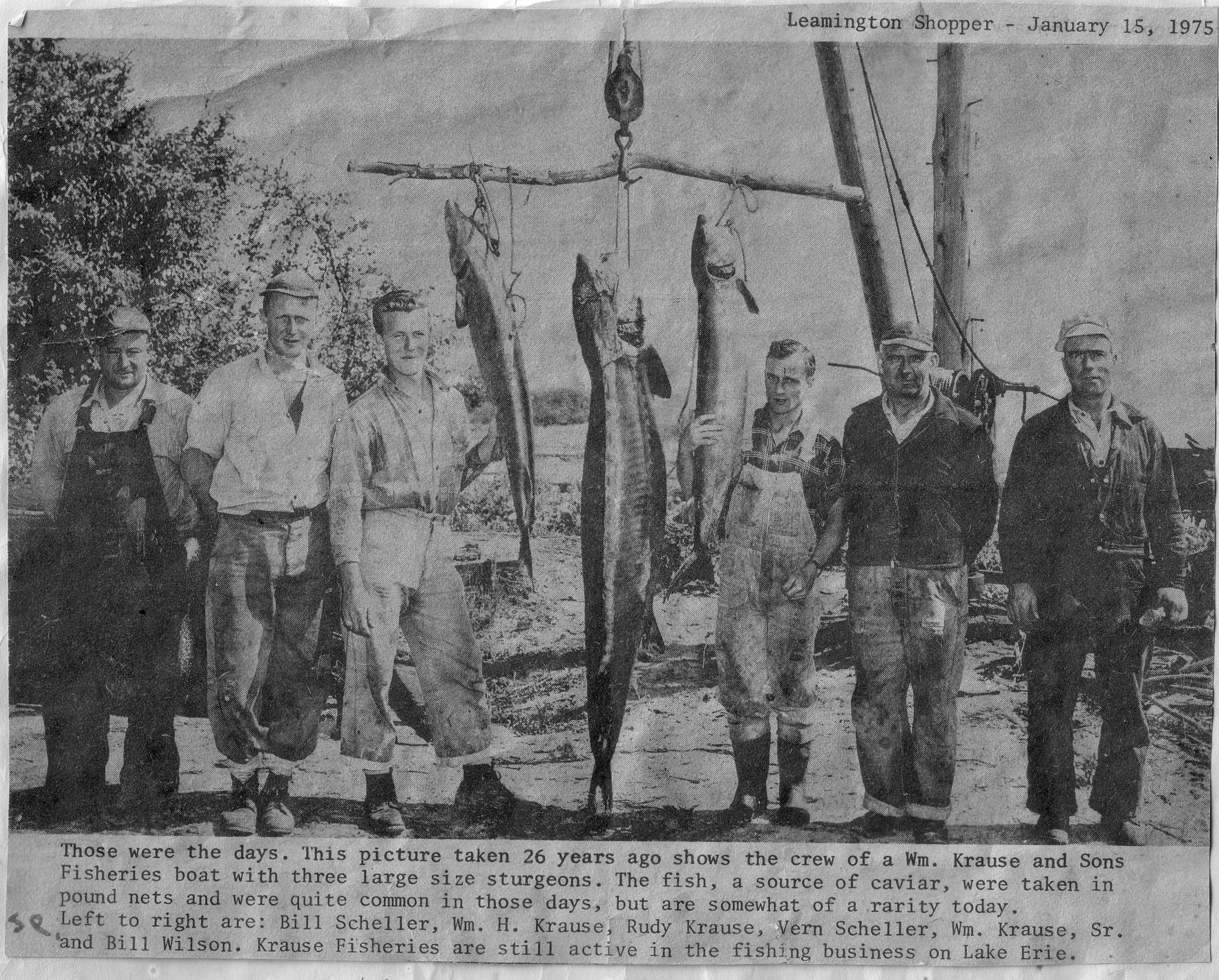
Krause Fisheries - L-R: Bill Sheller, Wm. H. Krause, Rudy Krause, Vern Scheller, Wm. Krause Sr., Bill Wilson
Those were the days. This picture taken 26 years ago shows
the crew of a Wm Krause and Sons Fisheries boat with three large size
sturgeons. The fish, a source of caviar, were taken in pound nets and were
quite common in those days, but are somewhat of a rarity today.
Left to right are: Bill Scheller, Wm. H. Krause, Rudy Krause, Vern Scheller,
Wm. Krause Sr. and Bill Wilson. Krause Fisheries are still active in the
fish business on Lake Erie.
Leamington Shopper, January 15, 1975
-------------------------------------------------------------------------
1950
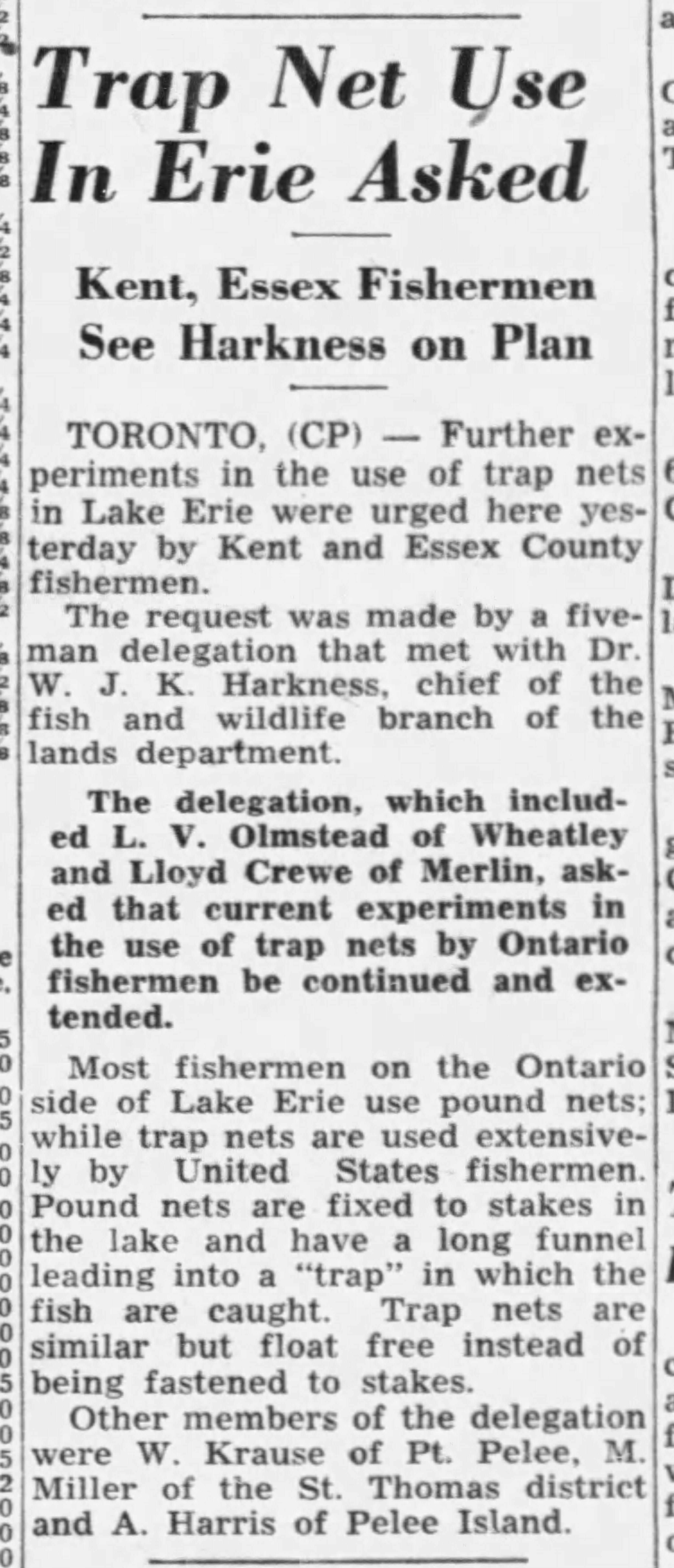
Trap Net Use in Erie Asked ...
Further experiments in the use of trap nets in Lake Erie were urged ....
The request was made by a five-man delegation ...
asked that current experiments in the use of trap nets by Ontario fishermen be continued and extended ...
Other members of the delegation were W. Krause of Pt. Pelee ...
The Windsor Star, August 2, 1959, p. 14
https://www.newspapers.com/image/500967046
-------------------------------------------------------------------------
EARLY 1950s

Photo Supplied by Alisa (Krause) McClurg
F. William Krause (foreground, middle)
Karl Rudy Krause (rear, 3rd from left), H. William (Bill) Krause (rear, far right)
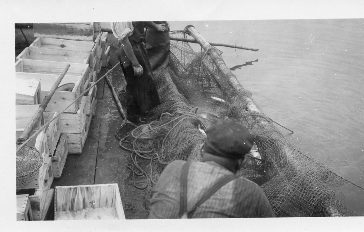
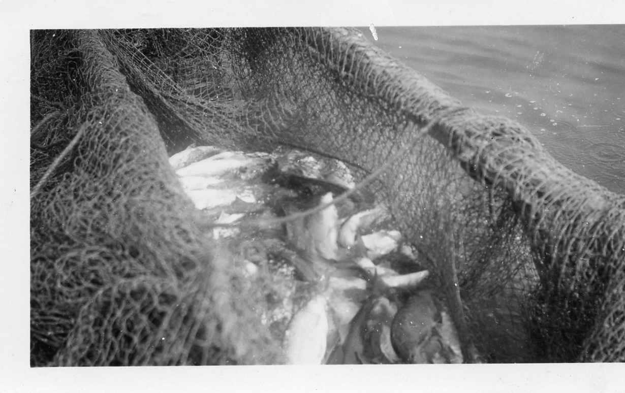
Photo Supplied by Alisa (Krause) McClurg
Krause Fisheries. Perhaps Bill Wilson in the foreground. Appears to be yellow perch in the net.
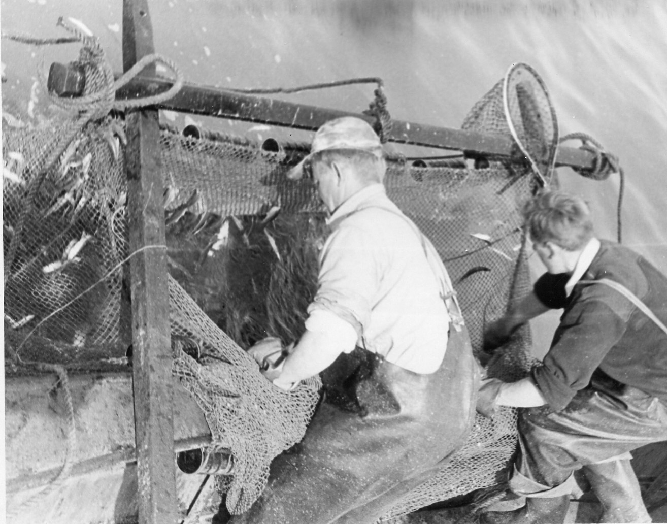
Photo Supplied by Alisa (Krause) McClurg
H. William (Bill) Krause (foreground). Appears to be smelt in the net.
-------------------------------------------------------------------------
1951
In 1951 officers of the national parks branch of the Department of Mines and Resources found that Krause was occupying additional land.
By a letter June 5, 1951, permit of occupation was cancelled and a new licence of occupation of an area large enough to include the site of the buildings and land was offered to Krause. He refused. taking the position that he had title by squatter's rights ...
Windsor Star, May 17, 1956, p. 5 - https://www.newspapers.com/image/501484420/?terms=%22windsor%2Bstar%22%2B%22krause%22
-------------------------------------------------------------------------
KRAUSE FISHERIES TAKES ON A LIFE OF ITS OWN
The use of trap nets was permitted in 1950 and within a few years they completely replaced pound nets. [http://www.erudit.org/revue/scientia/1987/v11/n1/800242ar.pdf - Scientia Canadensis: Canadian Journal of the History of Science, Technology and Medicine / Scientia Canadensis : revue canadienne d'histoire des sciences, des techniques et de la médecine , vol. 11, n° 1, (32) 1987, A. B. McCullough, "Commercial Fishing on the Great Lakes: Resource Management and Technological Efficiency", p. 15
In the 1950's the Krauses adopted a trap net technology (deploying anchors rather than stakes) using nets of another's design. Increasingly, they employed traps which Bill Krause refined through redesign and trial and error. These traps proved superior to any others in catching and holding superiority. Bill also experimented with many treatments to increase netting longevity. Although others turned to trap nets for mainly catching smelt, the Krauses proved that their nets could trap any fish in great quantities.
"In 1948, following a poor fishing season, the more mobile trap net came into increased usage on Point Pelee. The utilisation of the trap net also reduced the amount of shoreline area required by each fishery for equipment storage and repair. For example, the shoreline area used by the Krause fishery dropped from 1,000 feet to some 350 feet .... " [...R. Krause, Personal Communication. (July 23, 1974); Attorney General of Canada v. Krause. [1955] O.W.N. 830 ...]"
"...While the Girardin fishery was moved north of the park in 1962, the Krause fishery continued to operate until 1968 when the lease on its 1.6 acre site expired .... [ ... See, for example, Attorney General of Canada v. Krause [1955] O.W.N. 830; Attorney General of Canada v. Krause. [1956] O.R. 675 (C.A.) ...]
J. G. Battin & J. G. Nelson, Man's Impact On Point Pelee National Park, National Provincial Parks Association, 1978, pp. 101, 123
http://parkscanadahistory.com/publications/nppac-cpaws/point-pelee.pdf

Left - Bill Krause
(Photo Supplied by Alisa Krause (McClurg))
Bill Krause also experimented with "trawling" with a technology also of his own design. Wooden planks called otter doors helped to keep the mouth of the net open while being towed behind the boat. Though trawling also proved successful, it nevertheless was inferior to trap netting, and the Krauses quickly dropped its use.
The Krause sons also built a number of steel trap boats, of great power, of their own design, with, on board, technology current to the period.

Bill Krause, 1967, lifting the trap pot of the trap net to the surface. The boxes of ice are out of sight.
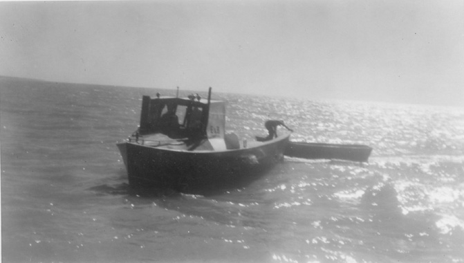
Krause's E&B named after Eric and Billy
http://static.panoramio.com/photos/original/687829.jpg -
Photo by Rein Nomm
- After a severe storm with the Krause Fisheries dock destroyed.
The last vertical post to the right is what is left of one of two posts that
held an old reel
for power washing the nets reeled off the boat onto a truck on the dock.
Bill Krause also invented a mechanical fish filleting machine which, though often finicky, was a wonder to behold and be heard in operation.
H. William (Bill) Krause and a part of the said machine in the back of the truck.
To the rear, our Point Pelee house that Dad built and we occupied in c. 1948. (Photo Supplied by Alisa Krause (McClurg))
In his younger days on Point Pelee, Eric Krause participated in all operations of the physical Fishery where the work was hard, but rewarding, both in being and spirit. For example, many late evenings were spent filling trucks sent by Salasnek Fisheries Inc. (Detroit) and Olmstead Brothers (Wheatley) who drooled over the outstanding quality of the that-day freshly trapped-net fish they were receiving for processing. [Salasnek - http://www.electricscotland.com/history/canada/crewe/index.htm In 1967: Arthur 0. Salasnek, Salasnek Fisheries, Inc., 2140-80 Wilkins Street, Detroit, Mich. 48207 - Report Of Commercial Fisheries For The Calendar Year 1967 - http://docs.lib.noaa.gov/rescue/cof/Cof_1967.pdf ]
Fresh sturgeon steak, and salted black caviar produced by the hands of my father - nothing tasted better except for the mounds of fried - lightly battered - trap-net perch that my mother slaved over the stove for us growing boys! That is, when we weren't wolfing down fried-in-butter cottage cheese verenike by the dozen.
Great Lakes fishermen using new compound to treat nets Employees of Wm. Krause & Sons Fisheries, of Point Pelee, are reported preparing their nets for the Spring fishery by treating them with a new asphalt compound. Rudy Krause said the treatment is quick-drying and non-sticking. The nets are made of nylon and the treatment gives them body and a black color ...Used in perch fishing, the nets are black to direct the fish to where they can be hauled in ... Canadian fisherman & ocean science: Volume 58, 1981, Issues 1-4, "Facts on Fish" — Fisheries Association of BC) 4, p. 19.
-------------------------------------------------------------------------
POST 1952
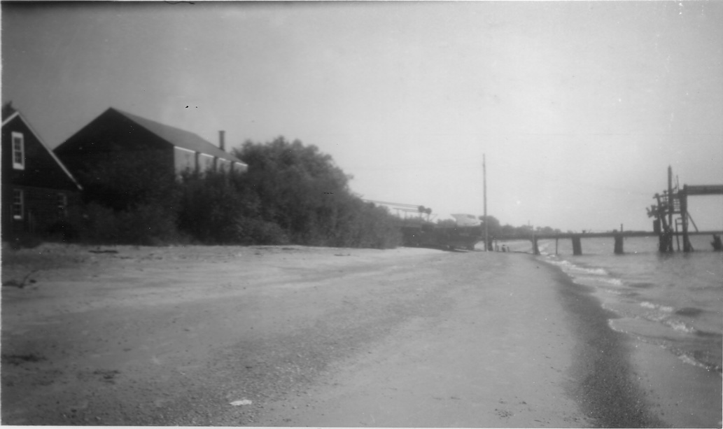
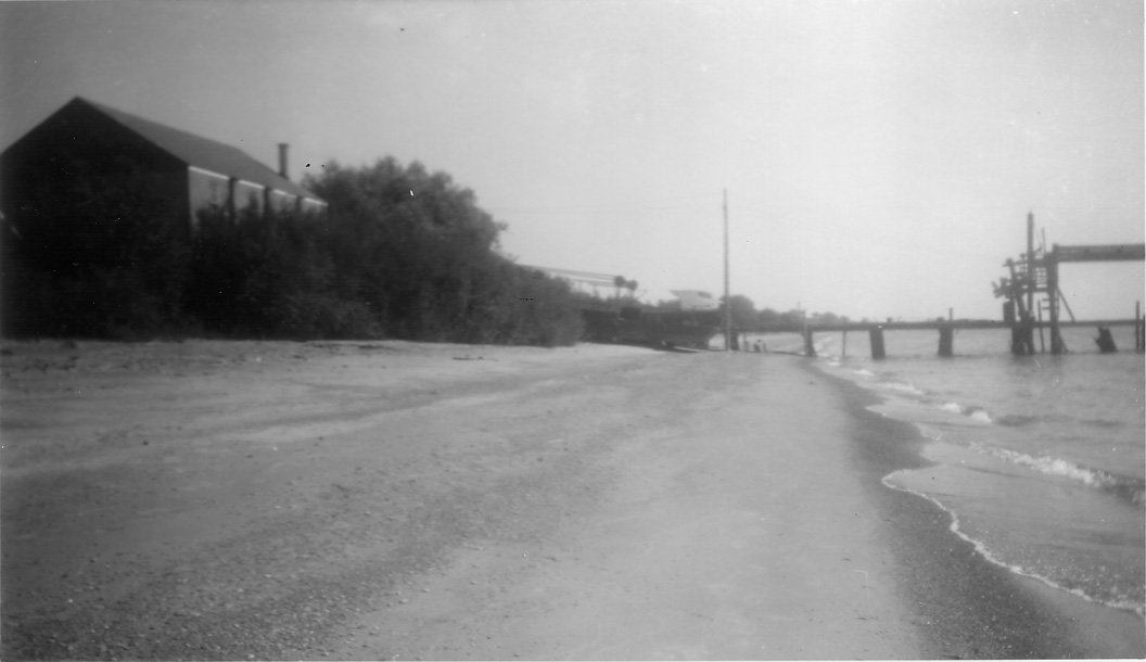
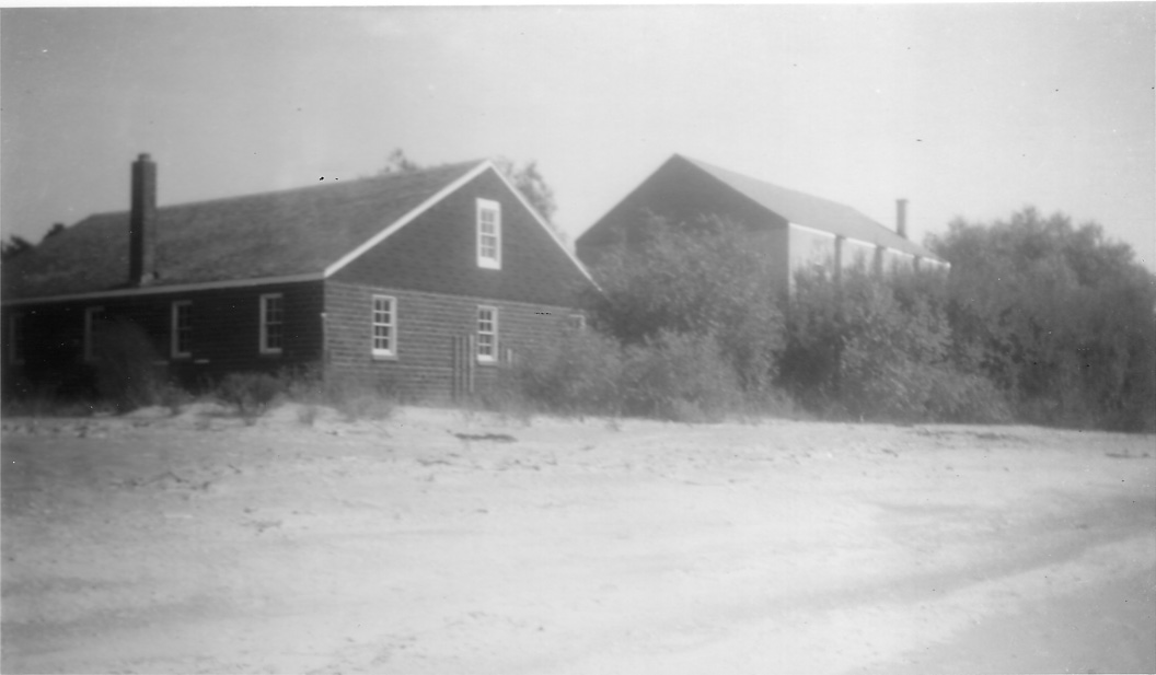
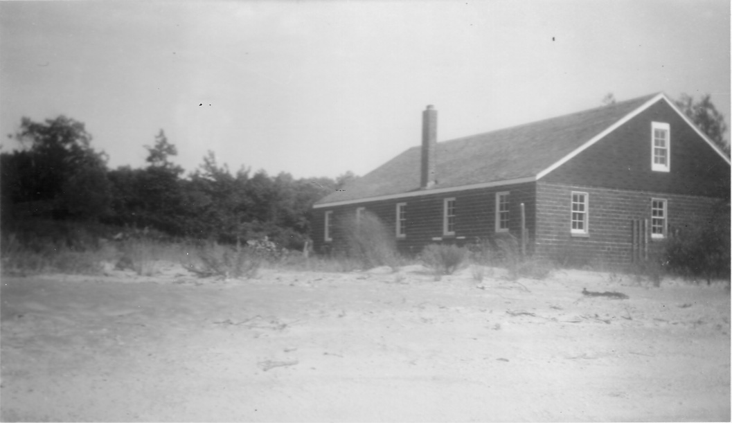
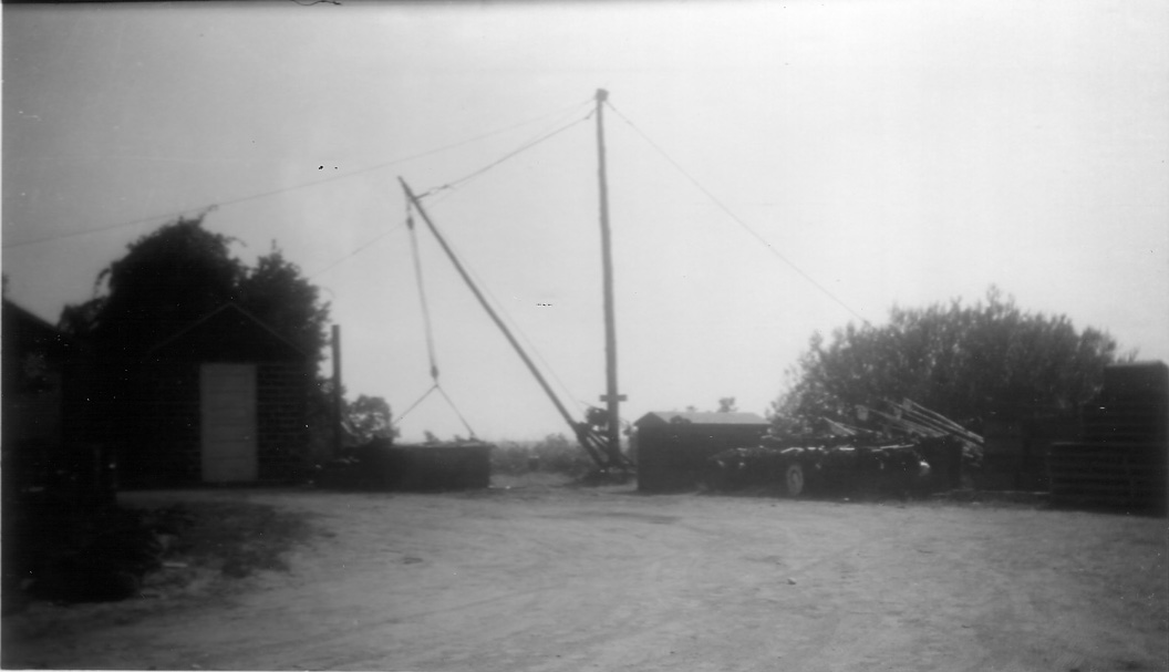
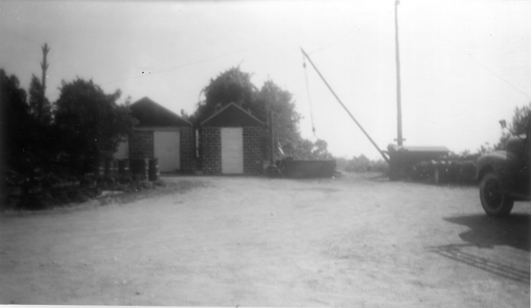
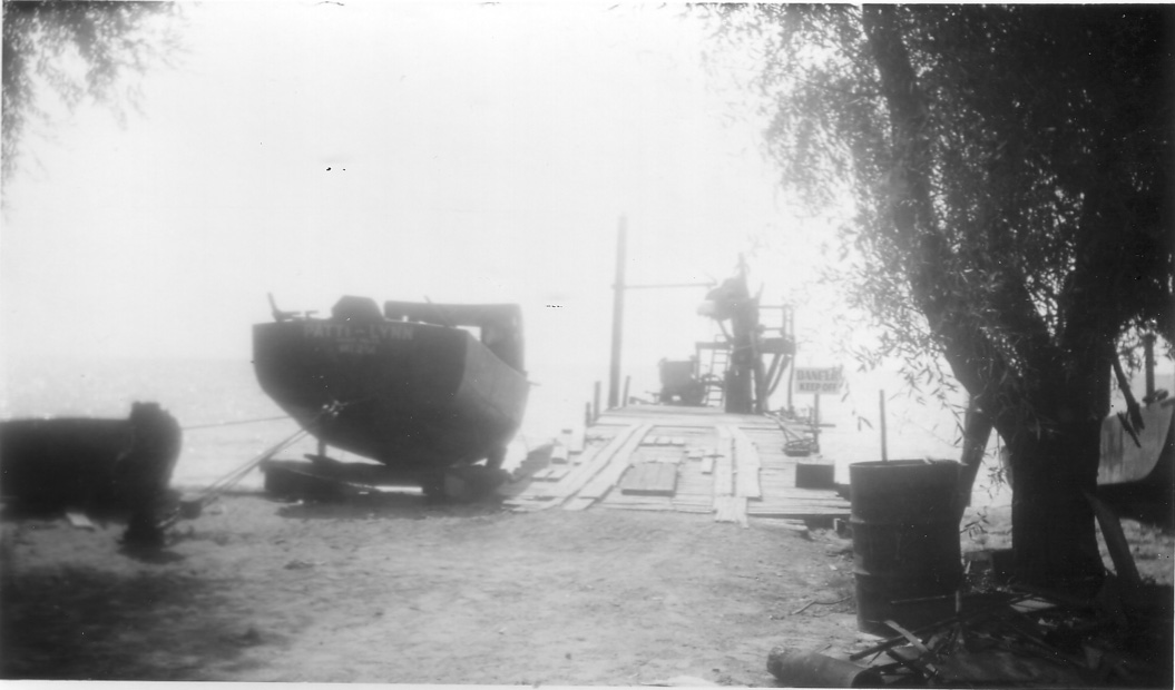
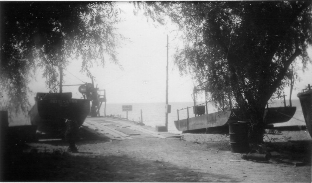
"William Krause and Sons Krause Fishery, Point Pelee"
The Krause fishing tug is named the "Patti Lynn" - Captain Karl Rudy Krause's trap-netting tug
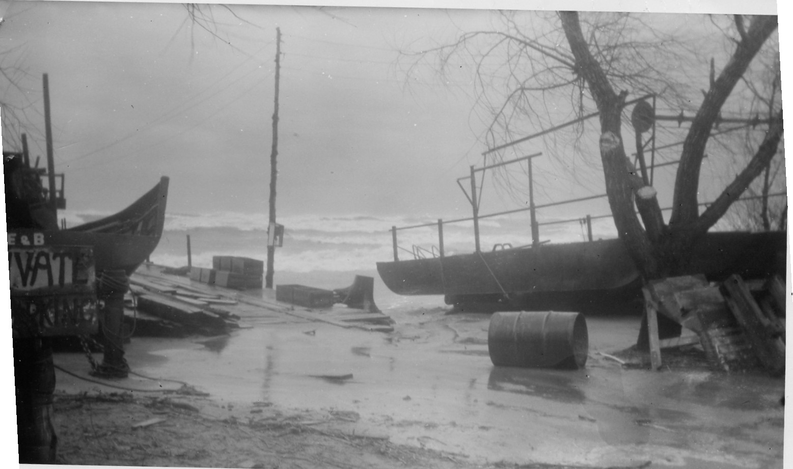
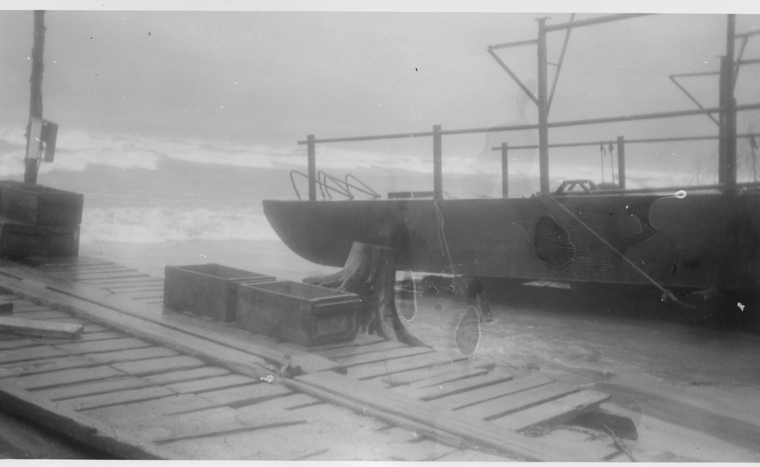
Photo Supplied by Alisa (Krause) McClurg
Krause Fisheries - Captain H. William (Bill) Krause's Trap-netting fishing tug E&B and Krause Fisheries skow (barge)
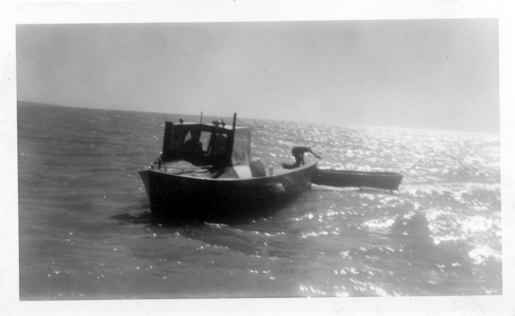
Photo Supplied by Alisa (Krause) McClurg
Krause Fisheries - H. William (Bill) Krause's Trap-netting fishing tug E&B
-------------------------------------------------------------------------
c. 1956
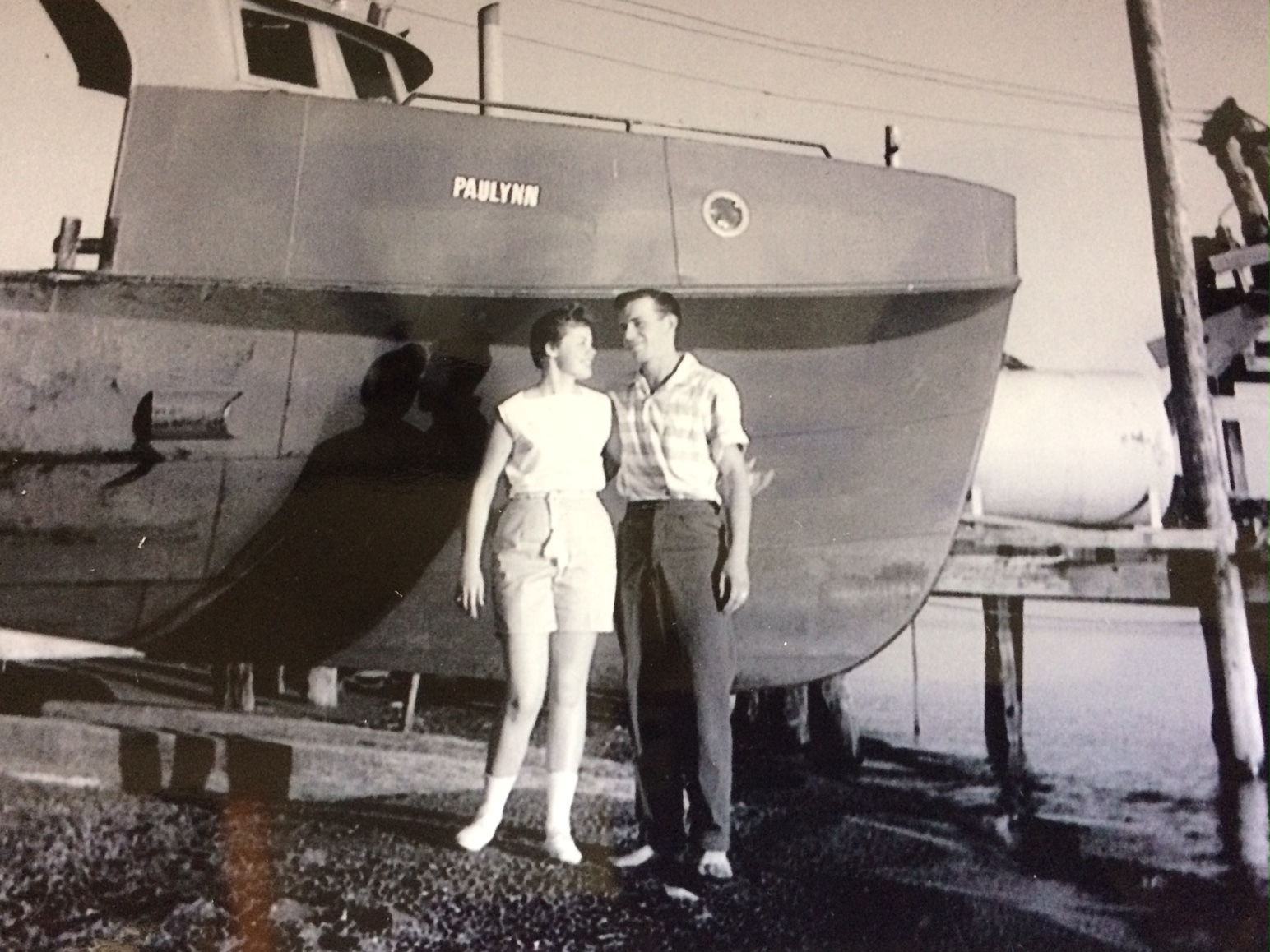
Louise and Bob Cornies standing before the Paulynn,
Captained by Karl Rudy Krause
Photo supplied by Louise Cornies
-------------------------------------------------------------------------
1956
TORONTO — William Krause, Pomt Pelee fisherman, who won legal possession of one and a half acres of land last year at trial, in Windsor, lost it to the Federal Government of Canada in a judgment handed down at Osgoode Hall ......
Windsor Star, May 17, 1956, p. 5 - https://www.newspapers.com/image/501484420/?terms=%22windsor%2Bstar%22%2B%22krause%22
-------------------------------------------------------------------------
1957
Higher Clearance Urged For Leamington Span
Low Structure Small Craft Bar ...
Delegation Appeals for Change In Sturgeon Creek Bridge Plans ...
Other members of the delegation were William Krause of Point Pelee, representing commercial fishermen ...
The Windsor Star, April 4, 1957
https://www.newspapers.com/image/501527269 - p. 5
https://www.newspapers.com/image/501526751 - p. 28
Checking Trap nets
Checking Trap Nets
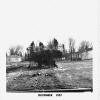
Photos kindly provided by Karl Uwe Pullmann, Dresden, Germany
Loading Trap Nets for Winter Storage
-------------------------------------------------------------------------
1958
MAY 14
Net Squares Unusual Eel
POINT PELEE ... Take, for example, the three-foot-long American eel
caught in the trap nets of William Krause & Sons on Monday ...Bill and Rudy Krause conducted some quick research after they
caught the eel and found that they can live up to 80 years ...The Krause bothers ... Rudy .... Bill Krause ....
The Windsor Star, May 13, 1958, p. 11
https://www.newspapers.com/image/501612479
The Windsor Star, May 14, 1958, p. 6
https://www.newspapers.com/image/501612842

June 1958
Spreading the trap-nets for drying at Point Pelee (Just north of F. William Krause's House)
Rudy Krause
RARE CATCH - When the William Krause and Sons fishing tug "Paul LYnn" lifted its nets Monday morning, it came up with an American Eel, a rare find in Lake Erie waters. Department of Fisheries officials identified the specimen and said they wanted it for a museum. The eel spawns in the Atlantic Ocean near Bermuda so long way. It measured 35 inches long and weighed four pounds. The American eel has a lifespan of about 90 years and lives in fresh water. Many work their way into the St. Lawrence River but comparatively few come any great distance into the Great Lakes." Post and News Photo.
"Rare EEL - Rudy Krause, one of the operators of William Krause and Sons Fishery, Point Pelee ..."
RARE EEL - Rudy Krause, one of the operators of William Krause and Sons Fishery, Point Pelee holds a 40-inch American eel, caught in a trap net in 14 feet of water near the fishery. It is the largest specimen of this type of eel reported in the area -- exceptionally large, according to experts. They are exceedingly rare in the Great Lakes, with only six, including the present eel, reported in the district in many years.
The Windsor Star, July 23, 1958, page 7
https://www.newspapers.com/image/501727494
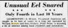
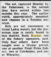
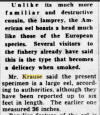
The Windsor Star, July 23, 1958, page 7
Unusual Eel Snared
Only Fourth in Last 10 years
LEAMINGTON—A 40-inch. 5 3/4 pound American eel, caught in 14 feet of water in a trap net operated by William Krause and Sons Fishery, Point Pelee, is arousing a lot of interest among local residents and naturalists.
The eel, captured Monday by the fishermen, is the second they have netted within two months this year. The earlier catch, appropriately mounted, now reposes in a Toronto museum. Eels are not uncommon in Great Lakes waters, but the American type is rarely found in this district, Rudy Krause, one of the fishery operators, said. Only four others have been caught over a 10-year period, one at another Point Pelee fishery, two at Colchester, and one at Wheatley.
Unlike its much more familiar and destructive cousin, the lamprey, the American eel boasts a head much like those of the European species. Several visitors to the fishery already have said this is the type that becomes a delicacy when smoked.
Mr. Krause said the present specimen is a large eel, according to authorities, although they have been reported up to six feet in length. The earlier one measured 36 inches.
Peculiar feature of the eel is the fact that it has milky growths, similar to cataracts, over both eyes. Mr. Krause said that it does not appear to see well. However, in view of its plump condition, he felt that the marine rarity must have fed well in the depths in which it lived. He said that the fact that some smelt netting was used in the trips was probably the main reason for the capture, since the eel wasn't able to squirm through the mesh.
There is no definie fate in store for the rare specimen as yet. Mr. Krause has ideas of skinning it, and having the skin stuffed and mounted by a taxidermist to hang in his own home. A few of the destructive lampreys have shown up in the Krause fishing area, most of them during the spring when the smelt run was in progress. Mr. Krause said he wasn't sure why they came at that time, whether to feed on the smelt or to spawn in the same type of water frequented by the spawning fish.
The Windsor Star, July 23, 1958, page 7
https://www.newspapers.com/image/501727494/?terms=%22windsor%2Bstar%22%2B%22krause%22#
-------------------------------------------------------------------------
1959

Fishermen Urge Ban on Licence Trafficking ....
West Erie Fishermen's Association ....
Directors elected for 1959 are ...
Bill Krause Jr., Point Pelee..The Windsor Star, February 5, 1959, p. 7
-------------------------------------------------------------------------
1960s
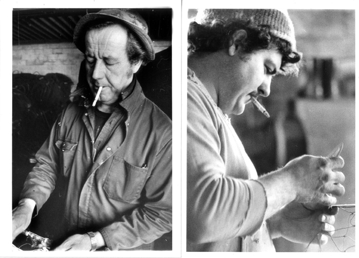
Left: Karl R. Krause - "Rudy"- Working in the Twine House
![]()
George Meixner, [Reinhardt] Gerhardt Ludke [Before death notice of October 5, 1964 -
http://www.windsorpubliclibrary.com/obits/index.php ],
H. William (Bill) Krause
[Possibly George Meixner (1919-1980) wife Anna (1921-2006) -
Lakeview Cemetery, Section: A, Leamington, Mersea Township (Concession 16, Lot
6), Essex County, ON
http://geneofun.on.ca/names/photo/1672325 ]
Krause's E&B named after Eric and Billy
(Photo Supplied by Alisa Krause (McClurg))
Left - Bill Krause
(Photo Supplied by Alisa Krause (McClurg))
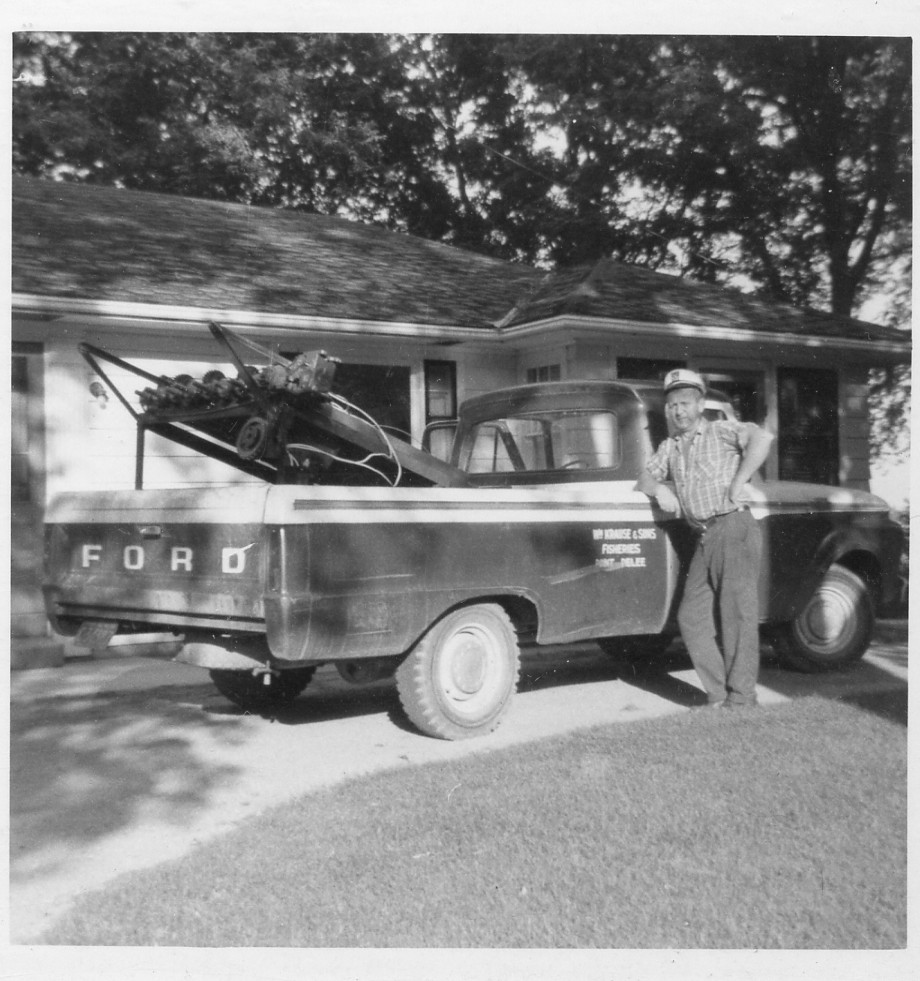
H. William (Bill) Krause
(Photo Supplied by Alisa Krause (McClurg))
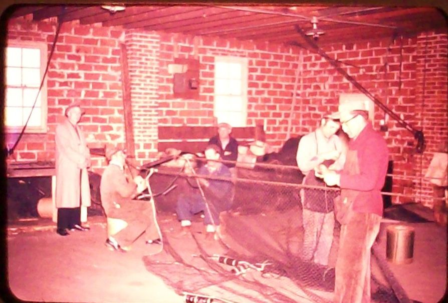
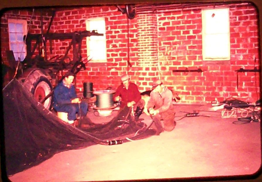
Building a New Net
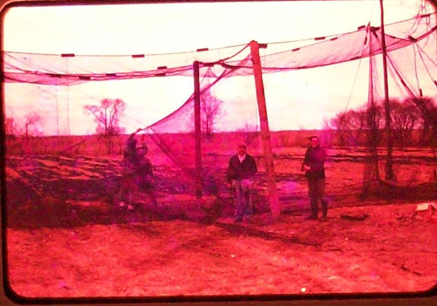
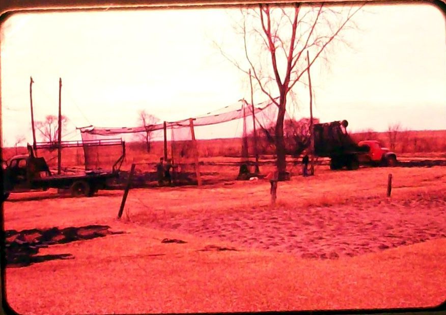
Checking Out Nets
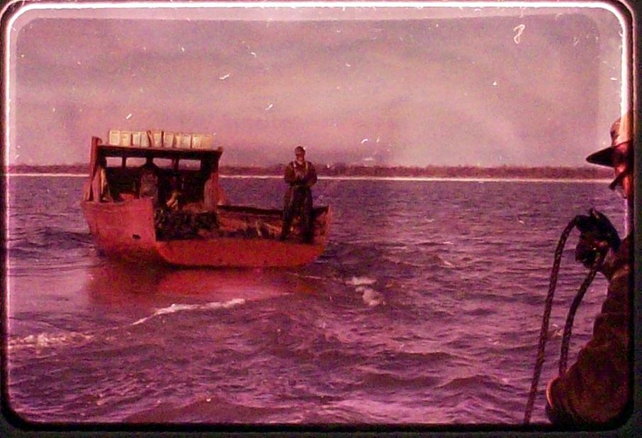
Setting a Net
-------------------------------------------------------------------------
1960
APRIL 14
Body Idnetified
No Inquest in Death of Plane Passenger
No inquest will be held into the death of Peter Colenteno, 25, of Hamilton, who died in an airplane crash last December, and whose body was recovered Tuesday a mile off Point Pelee ....
Positive identification was made Tuesday by the dead man's brother, Thomas Colenteno, of Hamilton, after the body was spotted in Lake Erie by William Krause of Krause Fishery ...
The Windsor Star, April 14, 1960, pp. 2, 3
https://www.newspapers.com/image/501965422
Air Crash Body Found Off Pelee ....
The body was spotted by a Krause Fishery boat about a mile
off the fishery premises.
It was marked by a buoy and later picked up ...
The Windsor Star, April 14, 1960, p. 5
https://www.newspapers.com/image/501965435
JUNE 9
Air Crash Body Found Off Pelee ...
The body was spotted by a Krause Fishery boat about a mile
off the fishery premises.
It was marked by a buoy and later picked up ...
http://ink.ourontario.ca/browse/lp -The Leamington Post. June 9, 1960 - pg. 15
-------------------------------------------------------------------------
1961
Ask Minimum On Perch Size
8-Inch Overall Length Urged by Fishermen ...
William Krause Jr., of Point Pelee, felt that
Trawling disturbed spawning grounds ...
The Windsor Star, February 16, 1961, p. 11
https://www.newspapers.com/image/501645202
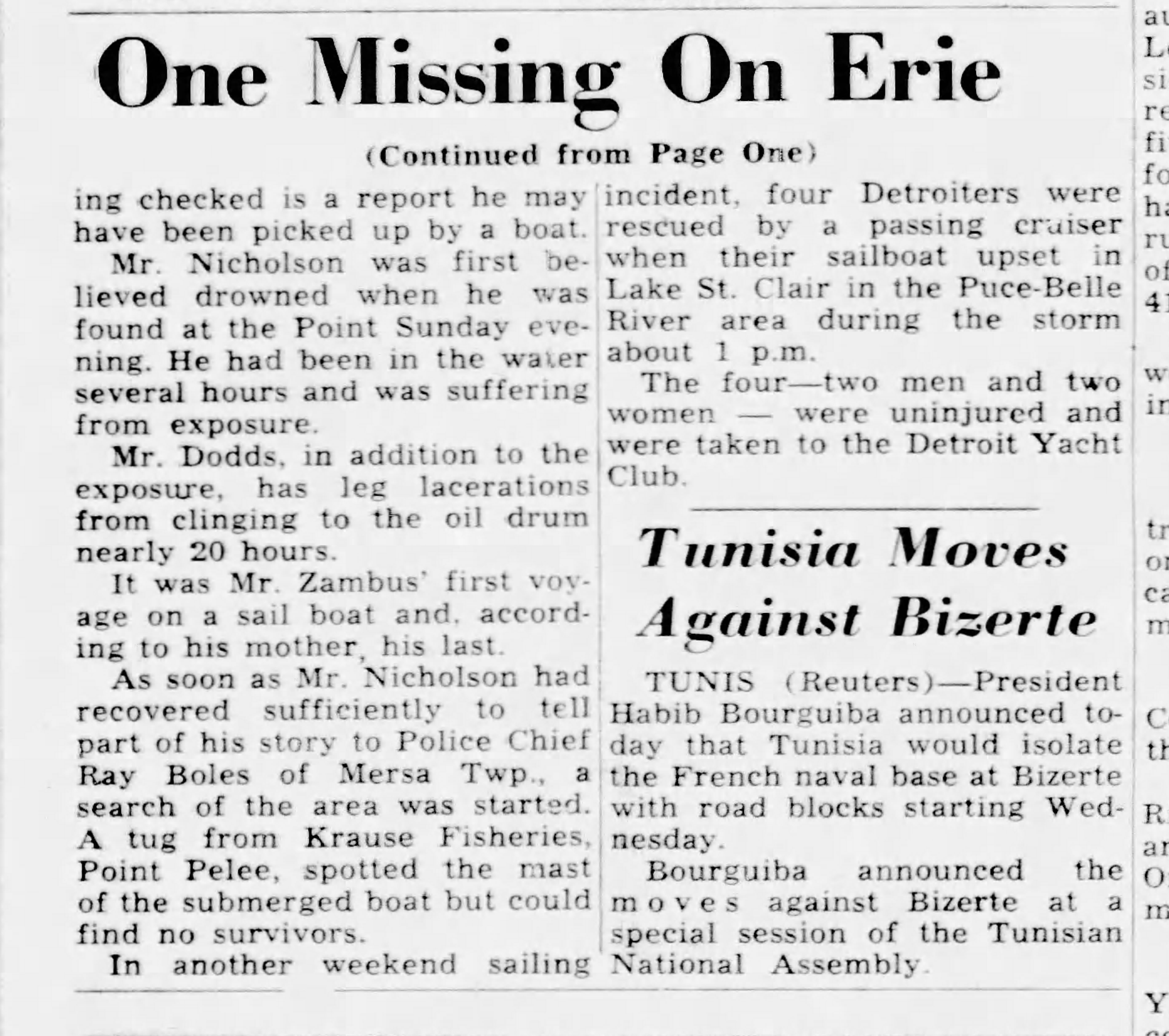
One Missing On Erie ...
A tug from Krause Fisheries, Point Pelee, spotted
the mast of
the submerged boat but could find no survivors ....
The Windsor Star, July 17, 1961, p. 6
https://www.newspapers.com/image/504623059/ - p. 5
https://www.newspapers.com/image/504622787 - p. 6
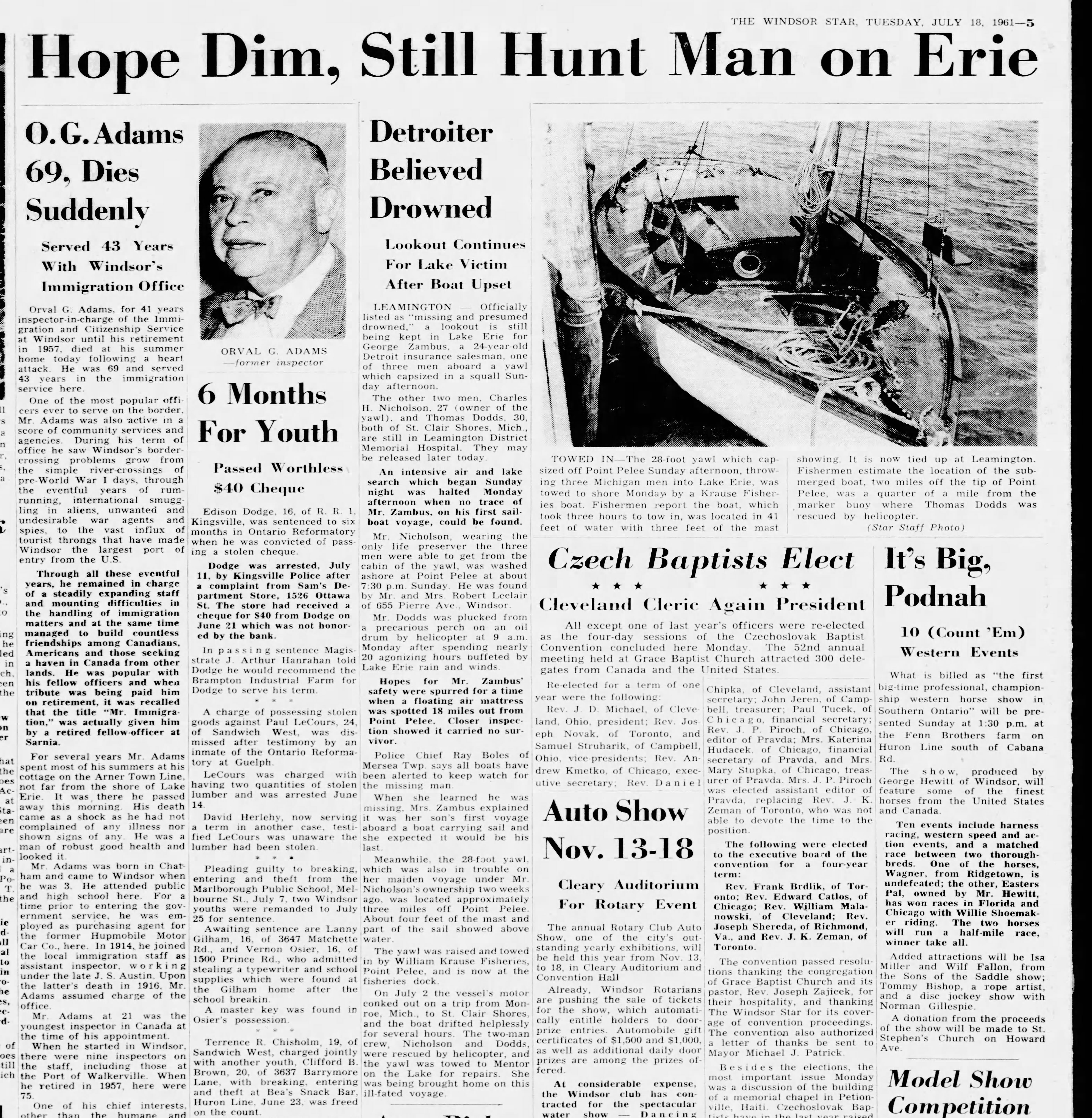
Hope Dim, Still Hope
Detroiter Believed Drowned ....
George Zambus ....
... the 28-foot yawl ... was located approximately three miles off Point Pelee. About four feet of the mast and part of the sail showed above water.
The yawl was raised and towed in by William Krause Fisheries, Point Pelee, and is now at the Fisheries dock ....
TOWED IN - The 28-foot yawl which capsized off Point off Point Pelee Sunday afternoon, throwing three Michigan men into Lake Erie, was towed to Shore Monday by a Krause Fisheries boat ...
The Windsor Star, July 18, 1961, p. 5
https://www.newspapers.com/image/504623364/ - p. 2
ttps://www.newspapers.com/image/504623152 - p. 5
JULY 20
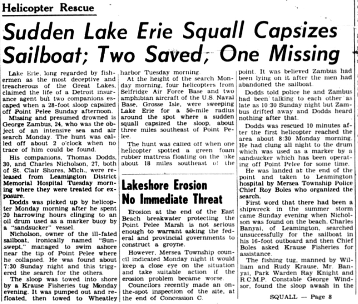
![]()
Krause Fisheries - William Krause and Rudy Krause - Rescue
Sudden Lake Erie Squall Capsizes Sailboat; Two Saved; One
Missing ....
capsized off Point Pelee ...The sloop was towed into shore by a Krause Fisheries
tug Monday evening.
It was pumped pot and refloated, then towed to Wheatley harbor Tuesday morning
...
Chief Boles asked Krause Fisheries for assistance ... The fishing tug, manned by
William and Rudy Krause,
Mr. Banyai, Park Warden Ray Knight and RCMP Constable George Windsor, found the
sloop awash in the
lake soon after it arrived in the area described by Nicholson ....
http://ink.ourontario.ca/browse/lp -The Leamington Post. July 20, 1961 - pg. 1, 8
-------------------------------------------------------------------------
1962
Petition For Harbor ...
LEAMINGTON - - More than 1000 names have been affixed to a petition seeking improvements to Sturgeon Creek for the establishment of a small boat harbor ....
Leamington Chamber of Commerce who have named a small craft committee. The Chamber also advised ....that a committee of three of the chamber's members William Krause .... are ready to assist them in any way they can in getting the project underway ....
The Windsor Star, February 1, p. 14
https://www.newspapers.com/image/506533931
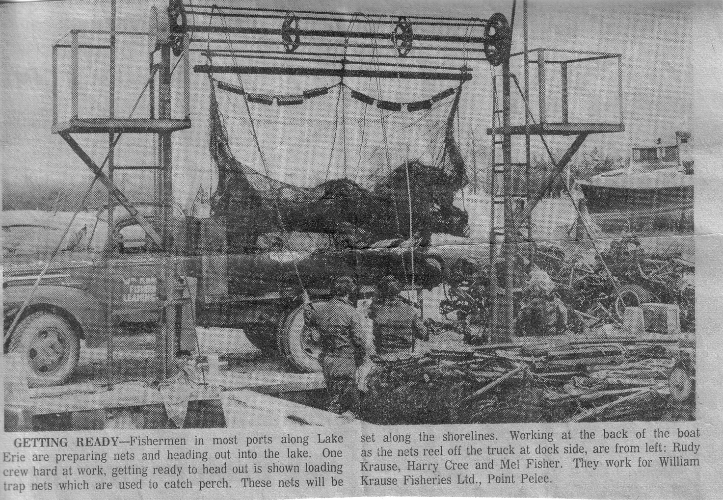
"GETTING READY - Fishermen in most ports along Lake Erie are preparing nets and heading out into the lake. One crew hard at work, getting ready to head out is shown loading trap nets which are used to catch perch. These nets will be set along the shorelines. Working at the back of the boat as the nets reel off the truck at dock side, are from left: Rudy Krause, Harry Cree and Mel Fisher. They work for William Krause Fisheries Ltd., Point Pelee. "
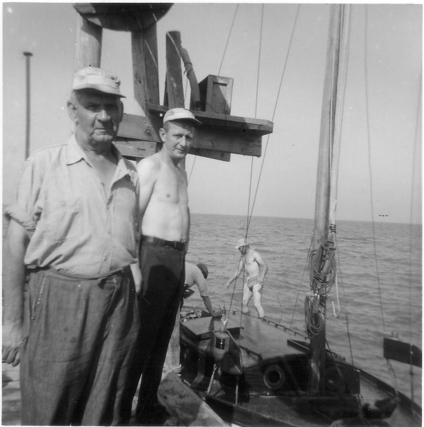
F. William Krause and H. William (Bill) Krause
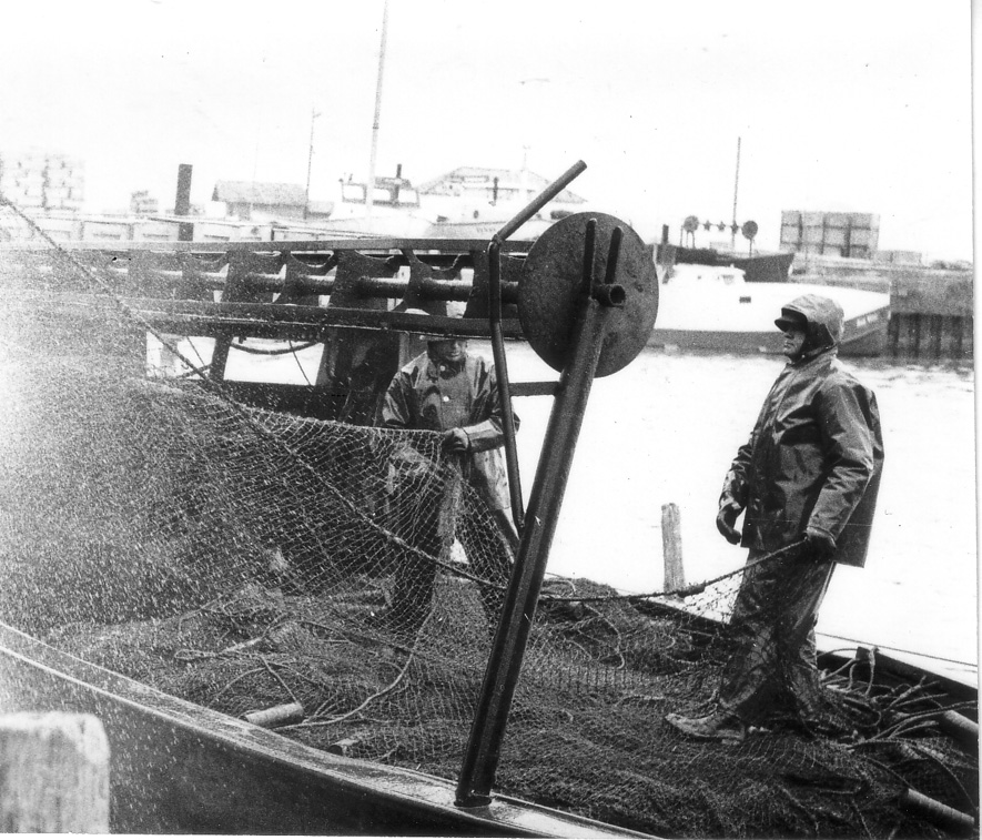
[?]
-------------------------------------------------------------------------
1964 (Revised 1994)
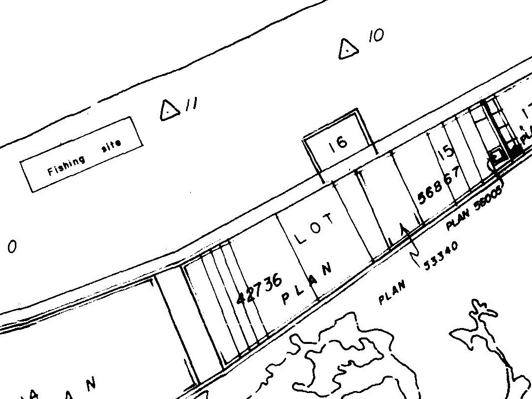
Plan of Lot 15 and Krause Fishery
Lot 15, R.P. 397, Plan 42736
REFERENCE PLAN OF POINT PELEE NATIONAL PARK ... REVISED TO MAY 9, 1994
http://clss-satc.nrcan-rncan.gc.ca/plan-eng.php?id=51914+CLSR+ON
-------------------------------------------------------------------------
1965
No doubt this was payment when my father went to Cape Breton, working out of Point Alder, to demonstrate the use of trap-nets in the ocean:
Public Accounts of Canada, By Canada Dept. of Finance, Published 1966 - Technicians fees ... William Krause Point Pelee Ont $3700 ... p. 1
-------------------------------------------------------------------------
1966
Possible in 1967
Sturgeon Creek marina? ...
Mr. Maxwell added that three property owners, C. J. Casper, Gord Bodle and William Krause, are prepared to build other facilities after the federal government accepts its part of the over-all project ...
The Windsor Star, November 9, 1966, p. 24
-------------------------------------------------------------------------
1967
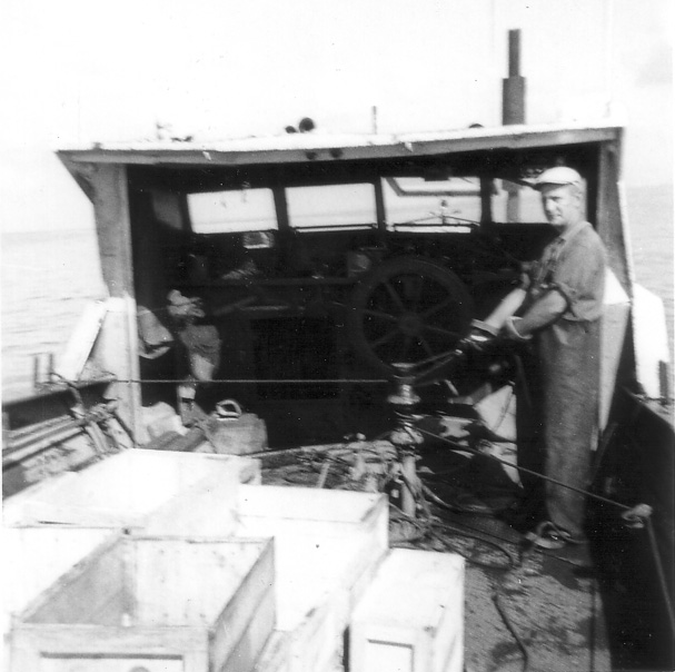
H. William (Bill) Krause
JULY 28
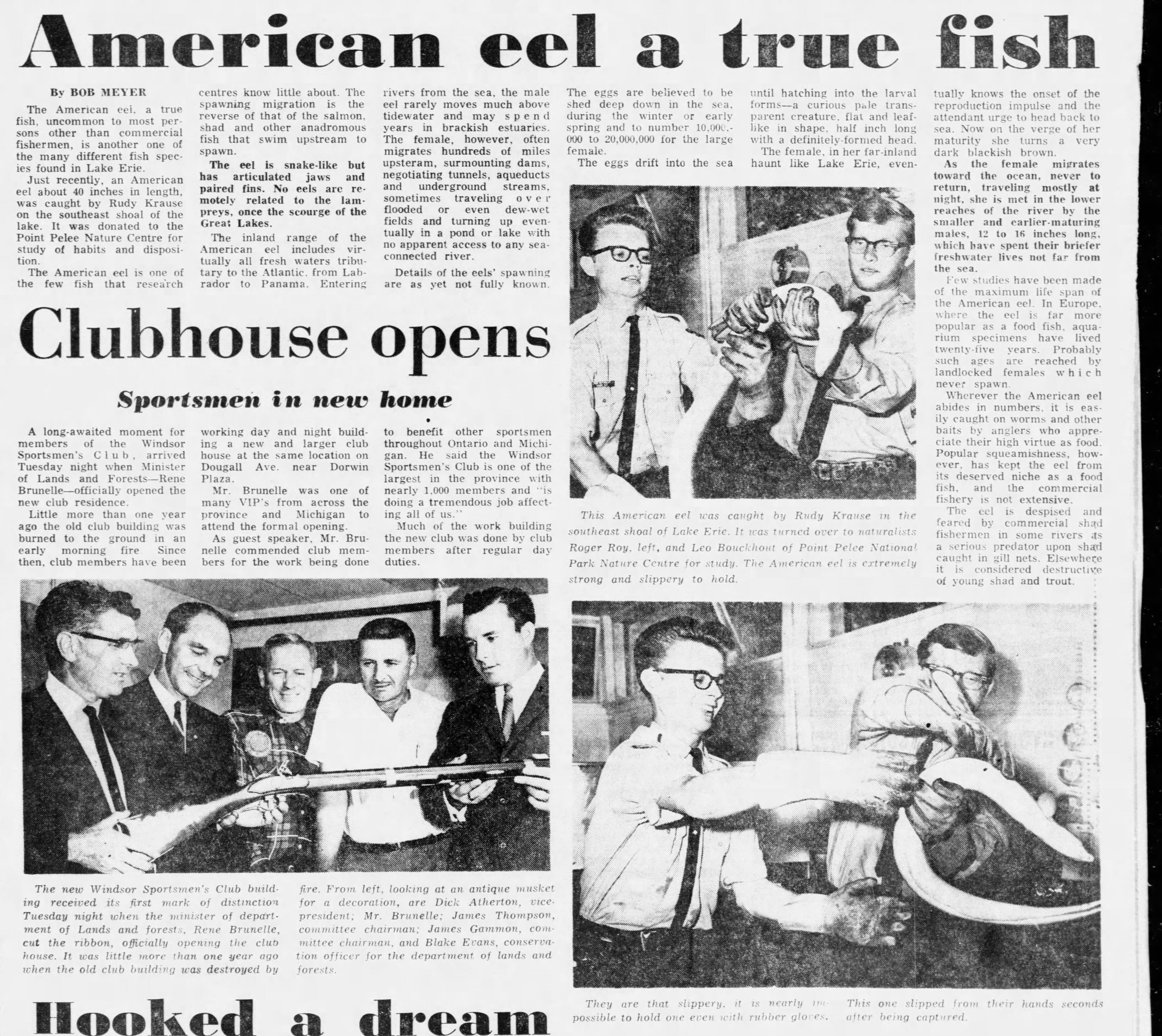
American eel a true fish ....
Just recently, an American eel about 40 inches in length, was caught by Rudy Krause on the southeast shoal of the lake. It was donated to the Point Pelee Nature Centre for study of habits and dispositions ....
The Windsor Star, July 28, 1967, p. 29
https://www.newspapers.com/image/502069034
-------------------------------------------------------------------------
1969
Krause Fishery - The End of all the fisheries at the Point
[http://www.pc.gc.ca/pn-np/on/pelee/natcul/natcul2_4_e.asp ]
![]()
In 1969, Krause Fisheries relocated to Sturgeon Creek where the buildings still stand today after operating their trap net fishery and retail store out of there for several years ...
Carl Ribble eventually joined Krause Fisheries to manage their retail store at Sturgeon Creek ...
Southpoint Sun, February 5, 2025, p. 16
https://issuu.com/southpointsun/docs/southpoint_sun_-_february_5_2025
-------------------------------------------------------------------------
-------------------------------------------------------------------------
POST 1969
OUTSIDE THE POINT, AT STURGEON CREEK
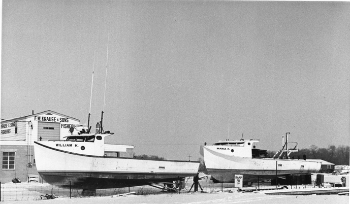
Photo Supplied by Alisa (Krause) McClurg
Krause Fisheries - Sturgeon Creek
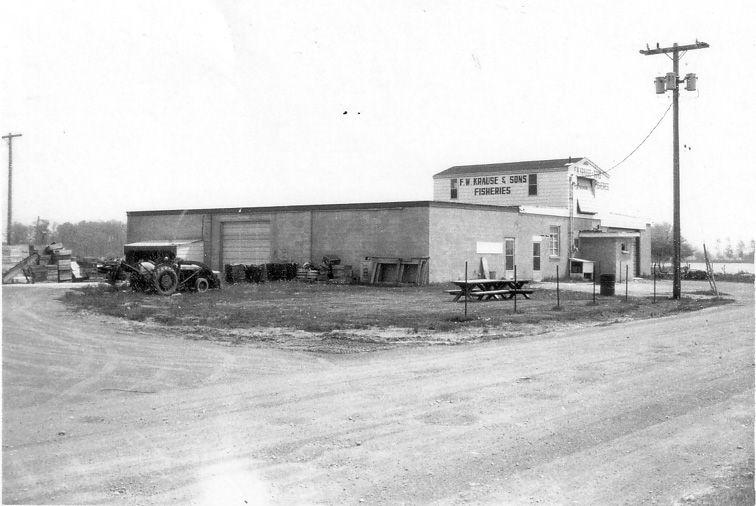
New "F. W. Krause & Sons Fisheries"
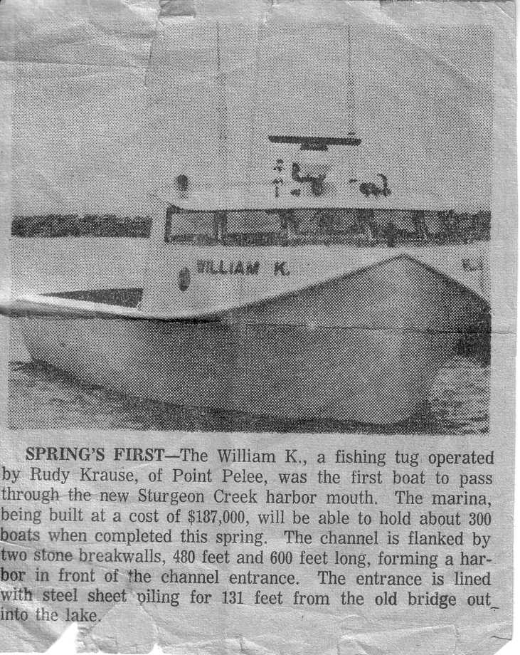
"SPRING'S FIRST - The William K., a fishing tug operated by Rudy Krause, of Point Pelee, was the first boat to pass through the new Sturgeon Creek harbor mouth ..."
...................
Gill Nets: I don't know why, but these are dominant on the Lakes. The mesh diameter is set for a certain species based on size and traps any fish attempting to pass through by the gills and kills it. Smaller fish can't get through, nor can bigger ones. Fish of a specific size are seized by the gills and die.
I have a big problem with this as the net guage [sic] is not species specific. All manner of game fish and fish with no market value are trapped, killed and tossed back to waste. Also, the fish may sit dead for some time till they're harvested.
Trap Nets: This is a maze arrangement where the fish swim up a "hallway" and are later scooped out live. I don't know how many trap netters are left, but if you find one, love him. The last ones I knew of were Krause Fisheries in Leamington and Lidddels out of Pelee Island.
...................
Hy-Lite Powerboats Inc. was incorporated in 1995 as an independent entity associated with 734126 Ontario Limited (o/a Tug Weld Manufacturing) for the purpose of marketing a line of custom built aluminum-hull, high performance, offshore type powerboats.
The parent company, commercially known as "Tug Weld" or "TWM" was established in 1982 for the purpose of manufacturing and repairing marine vessels and equipment on the Great Lakes (primarily Erie and St. Clair). Between 1985 and 1988, five fishing tugs were totally re-engineered, re-built and enlarged. They were the BM CABREIL for Cabreil Fisheries, the MISTY JEAN for Church Fisheries, the A.R. GETTY for Getty Fisheries, the GL SIMMONS for Simmons Fisheries and the LADY K for Krause Fisheries. In addition, the 65 ft. CRYSTAL BLUE was designed and manufactured for Murray Collard Fisheries of Wheatley, Ontario ...
[ http://www.hy-litepowerboats.com/comp.htm ]
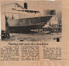
Photos kindly provided by Karl Uwe Pullmann, Dresden, Germany
-------------------------------------------------------------------------
1971
GETTING READY - Fisherman in most ports along Lake Erie are preparing nets and heading out into the lake. One crew hard at work, getting ready to head out is shown loading trap nets which are used to catch perch. These nets will be set along the shorelines. Working at the back of the boat as the nets reel off the truck at dock side are from left: Rudy Krause, Harry Cree and Mel Fisher. They work for William Krause Fisheries Ltd., Point Pelee.
The Windsor Star, April 13, 1971, p. 7
https://www.newspapers.com/image/502091733
Employees of William Krause and Sons Fisheries of Point Pelee ...Rudy Krause said ...
The fisheries is moving its equipment to a new location at Sturgeon Creek just north of the bridge.
The old location at Point Pelee is being taken over by the National Parks Board, which is buying up
privately-owned land in the national park ...
William Krause said ...
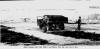
L. - Rudy Krause, left, Mel Fisher and Harry Cree lay nets out to dry [Sturgeon Creek] /
R - The nets are lifted into a truck after a treatment with asphalt compound [Sturgeon Creek]http://news.google.com/newspapers?id=W1lAAAAAIBAJ&sjid=iVIMAAAAIBAJ&pg=2907,
1753546&dq=william-krause+fishery&hl=en - Windsor Star, December 28, 1971, p. 5.
The Windsor Star, Tuesday, December 28, 1971, p. 5
https://www.newspapers.com/image/503673413
Rudy Krause, left, Mel Fisher and Harry Cree lay nets out to dry
------------
The nets are lifted into a truck after a treatment with asphalt compoundFishermen fix up nets for spring
By JIM ESTE
LEAMINGTON -- Area fishermen are preparing for the winter's colder weather and in the process are reading their equipment for the spring season.
During the winter months the men repair nets and buoys and other equipment.
Employees of William Krause and Sons Fisheries of Point Pelee spent most of last week cleaning up their nets and equipment and treating their nets with a new asphalt compound.Rudy Krause said the treatment is quick-drying and non-sticking The large nets are made of nylon and the treatment gives them body and a black color.
The nets are used in perch fishing and are black to direct the fish to where they can be hauled in. Mr. Krause said this differs from other types of fishing where the nets have to be almost invisible so the fish get caught in them. "It takes about eight days for the treated nets to dry," Krause said.
The fisheries is moving its equipment to a new location at Sturgeon Creek just north of the bridge. The old location ay Point Pelee is being taken over by the National Parks Board, which is buying up privately-owned land in the national park.
The company's fishing boats are docked and maintained at Wheatley Harbor.
William Krause and the boats are in Wheatley because it is much simper [sic: simpler] to work from there because their perch catch is purchased by Omstead Fisheries Limited for immediate and quick processing. This eliminates double handling, packing in ice, as well as transportation from another location.
He said even fishing just for perch, the company was able "to meet its bills, pay the help and have a little left over."
Krause Fisheries was one of the many in the Great Lakes region hit by the fishing ban on specific types of fish such as pickerel because of mercury content.
Mr. Krause said the first year was a "little hard", adding there were other fishermen who didn't make it to the next year.
The Windsor Star, Tuesday, December 28, 1971, p. 9
https://www.newspapers.com/image/503672804
-------------------------------------------------------------------------
POST 1972
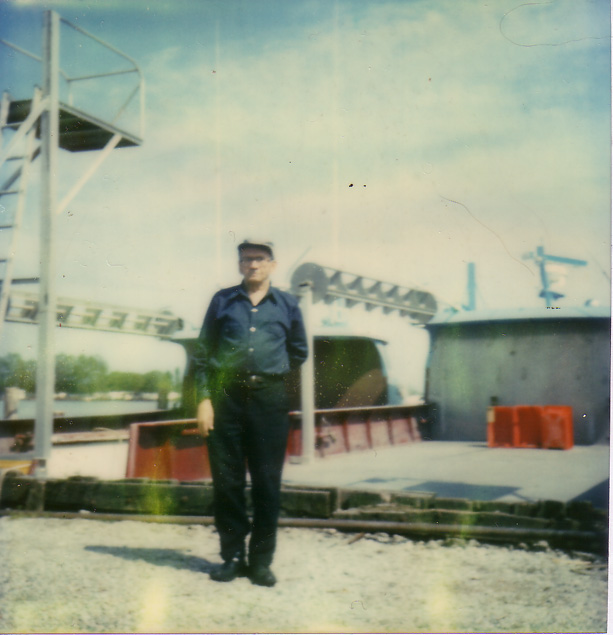
F. William Krause
-------------------------------------------------------------------------
1973
![]()
New Fish Market in Leamington
F. W. Krause and Sons, fishermen in the Leamington area since the 1930's, have opened a new fresh retail market on Point Pelee Drive near the Sturgeon Creek bridge.
The Krause's operated a small retail fresh store until [sic: since] 1950 when they operated from Point Pelee National Park.
The market which currently handles perch and large smelt, will soon be handling bass, catfish and even Coho salmon.
The Windsor Star, June 26, 1973, p. 6
https://www.newspapers.com/image/502049283 - p. 6
https://www.newspapers.com/image/502049319 - p. 8
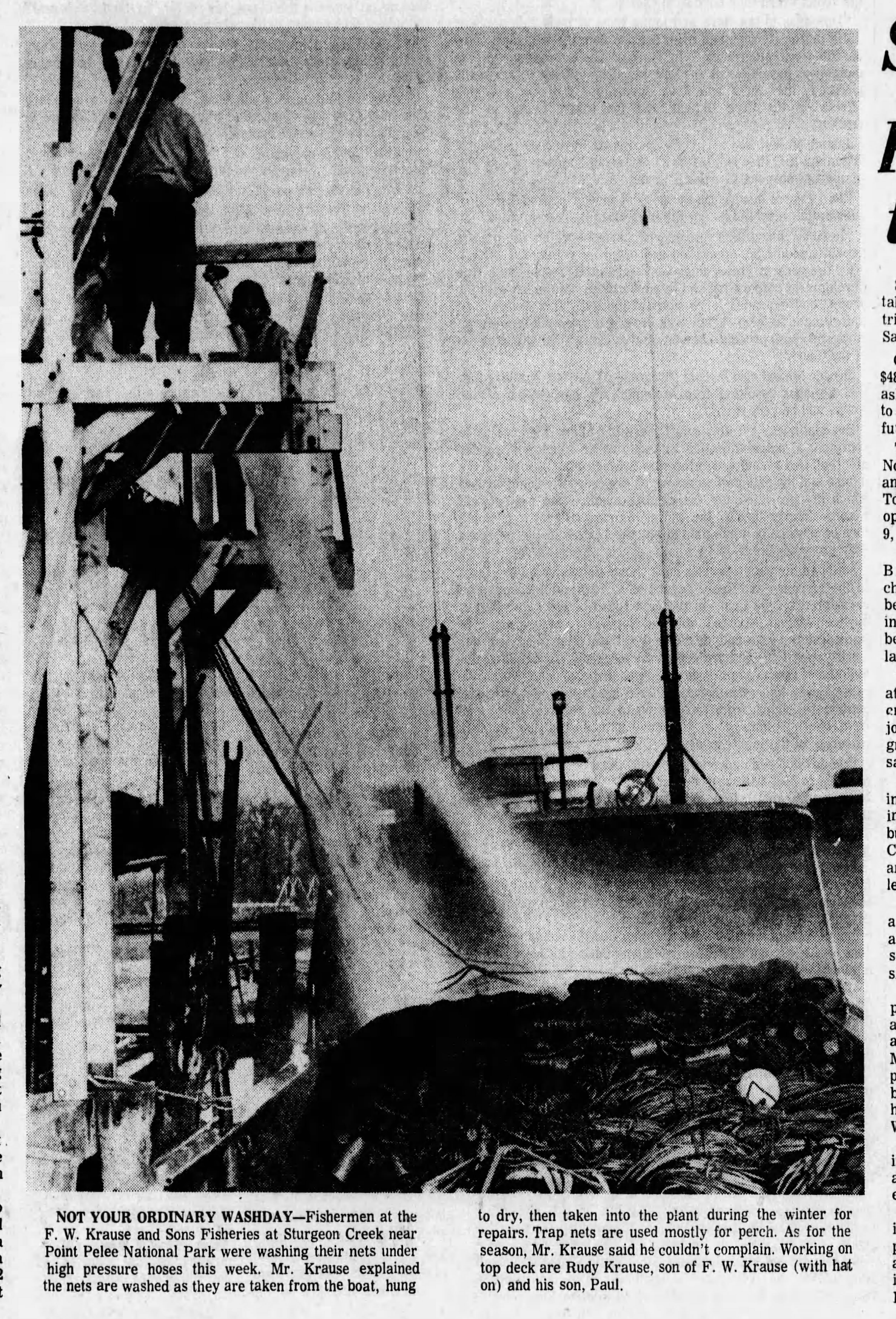
NOT YOUR ORDINARY WASHDAY ---- Fishermen at the F. W. Krause and Sons Fisheries at Sturgeon Creek near Point Pelee National Park were washing their nets under high pressure hoses this week. Mr. Krause explained the nets are washed as they are taken from the boat, hung to dry, then taken into the plant during the winter for repairs. Trap nets are used mostly for perch. As for the season, Mr. Krause said he couldn't complain. Working on top deck are Rudy Krause, son of F. W. Krause (with hat on) and his son, Paul.
The Windsor Star, November 16, 1973, p. 4
https://www.newspapers.com/image/502112107 - p. 4
https://www.newspapers.com/image/502111466 - p. 9
-------------------------------------------------------------------------
1973 - 1974
![]()
Rib's Ramblings Mark Ribble ...
The winters at the Point were long and snowy ....
Eventually, only a few of us remained and I remember that last year down thee, 1973-74, I was one of only a handful of kids being transported to Mill Street school by bus.
That was my Grade 7 year. It was a pretty lonely time at good old Point Pelee because the Knights, Taveirnes, Greenwoods and Girardins had already vacated, leaving us, the Krause Family and old Jack Cleveland down there to represent the 'hood'.
My dad had already started working for the Krauses at their fish plant at Sturgeon Creek ....
William Krause and his wife Maria remained in the park until their deaths. Mrs Kraus [sic] was one of the last residents to live inside the park. Their son, Bill Jr., who predeceased them, built the only home still standing in the park today. The yellow-sided ranch was built in 1949 and is used today as a residence for seasonal park staff ...
Leamington Southpoint Sun, March 14, 2018, p. 4
-------------------------------------------------------------------------
1974
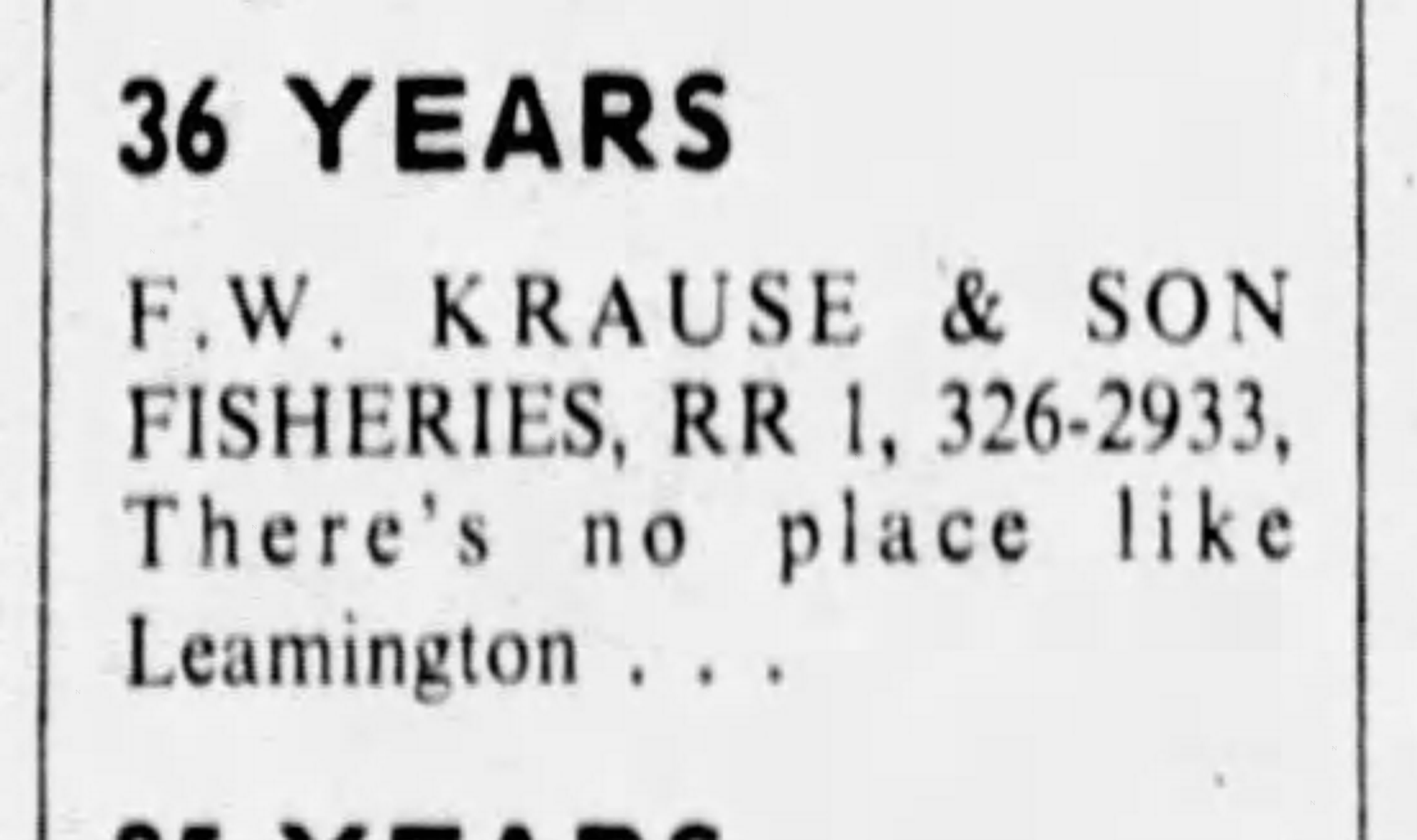
36 YEARS
F. W. KRAUSE & SON FISHERIES, R R 1, 326-2933,
There's no place like Leamington ...
The Windsor Star, June 27, 1974, p. 45
https://www.newspapers.com/image/502120109
-------------------------------------------------------------------------
1975
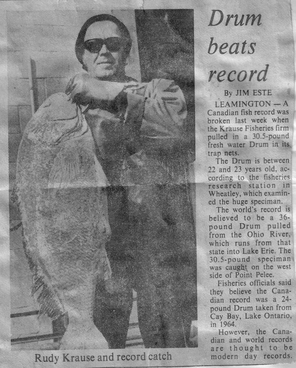
Karl R. Krause - "Rudy"
Rudy Krause and record catch
Drum beats record .... By JIM ESTE
LEAMINGTON -- A Canadian fish record was broken last week when the Krause Fisheries firm pulled in a 30.5-pound fresh water Drum in its trap nets.
.... The 30.5-pound speciman was caught on the west side of Point Pelee ...
The Windsor Star, May 6, 1975, p. 7 Rudy Krause and record catch Drum beats record By JIM Este
http://www.choosewindsoressex.com/locate_expand/directory/display.cfm?id=350
- 2009 Description
LEAMINGTON - A Canadian fish record was broken last week when the Krause
Fisheries
firm pulled in a 30.5-pound fresh water Drum in its trap nets ...
Krause Fisheries Inc.
Address:
582 Bevel Line Rd
Leamington, ON
N8H 3V4
Contacts:
R. Krause (P)
Phone:
519.326.2933
Fax:
n/a
Website:
n/a
Product &
Service Description:
Fresh and frozen fish.
Established:
1939
Employees:
6
Export:
n/a
Certification:
n/a
Business
Category (NAICS):
311710 - Seafood Product
Preparation and Packaging
-------------------------------------------------------------------------
1976
... of Wm. Krause & Sons Fisheries, of Point Pelee, are reported preparing their nets for the Spring fishery by treating them with a new asphalt compound. Rudy Krause said the treatment is quick-drying and non-sticking. The nets are made of nylon and the treatment gives them body and a black color ...
[Canadian fisherman & ocean science, Volume 58, Issues 1-4, 1976, p. 19]
-------------------------------------------------------------------------
1977
APRIL 12
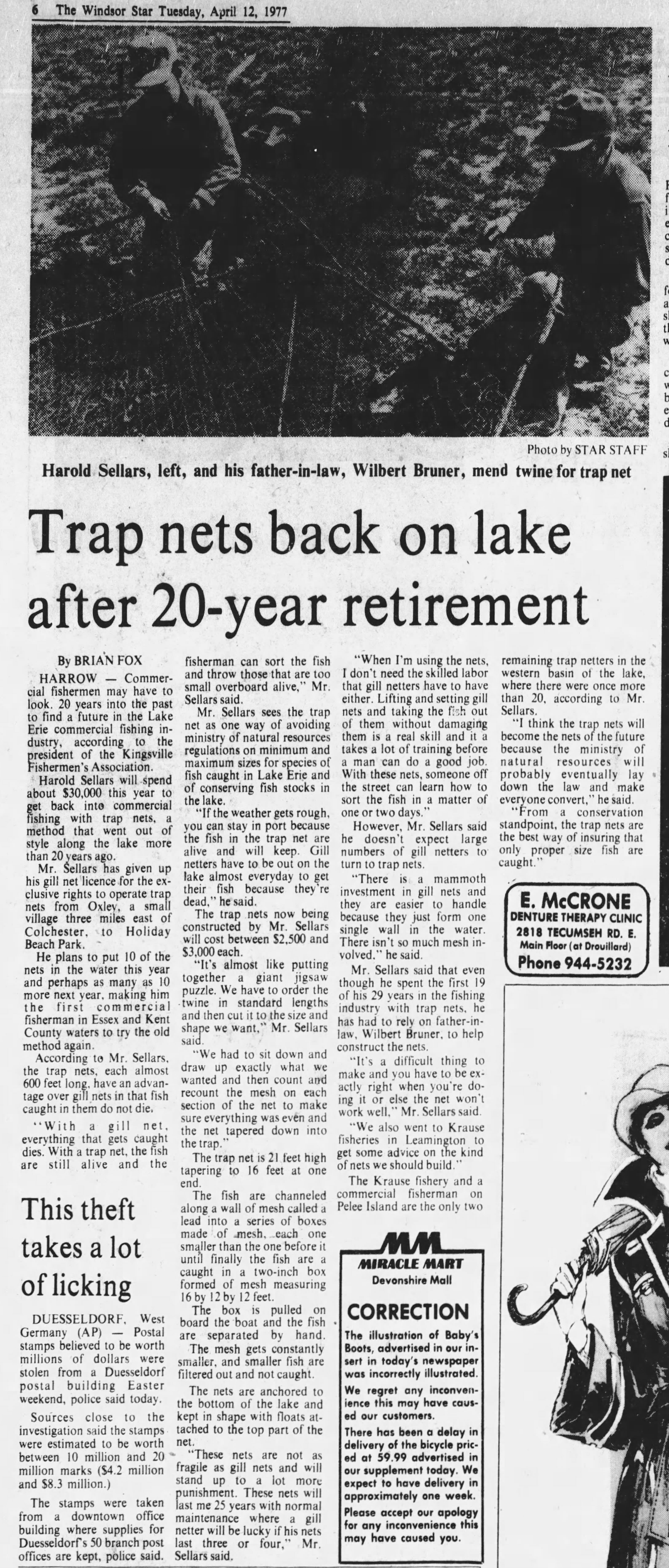
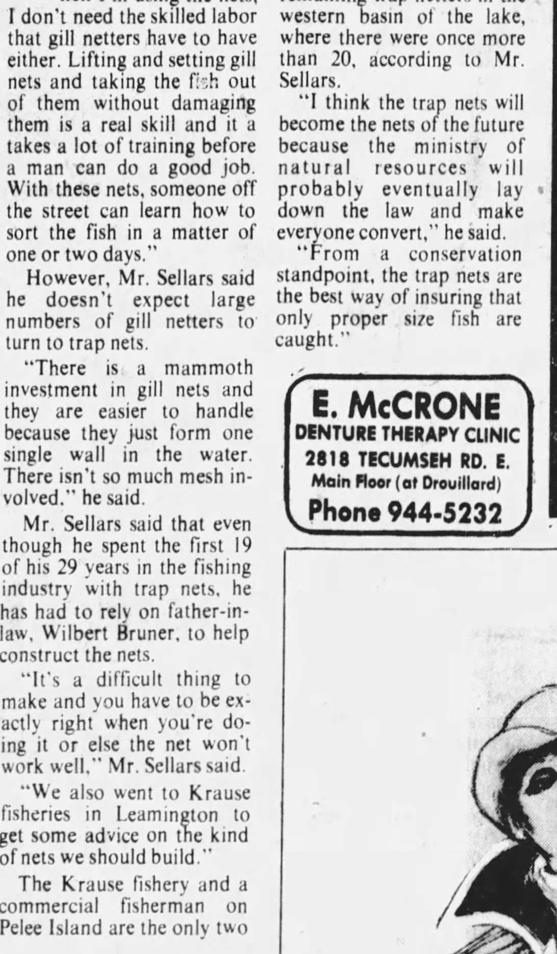
Trap nets back on lake after 20-year retirement ...
.... "We also went to Krause fisheries in Leamington to get some advice on the kind of nets we should build."
The Krause fishery and a commercial fisherman on Pelee Island are the only two remaining trap netters in the western basin of the lake, where there were once more than 20, according to Mr. Sellars ...
The Windsor Star, April 12, 1977, p. 6
https://www.newspapers.com/image/503232462
MAY 18
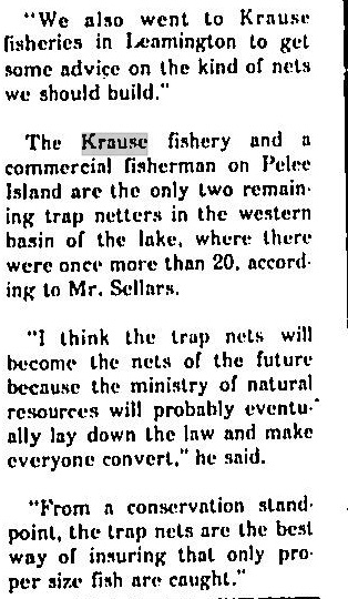
Krause fishery and a commercial fisherman on Pelee Island
are the only two remaining trap netters in the western basin of the lake,
where there were once more than 20 ...
The Amherstburg Echo, Wednesday, May 18, 1977, p. 9
http://ink.scholarsportal.info/viewer/cecil/focus/ink/newspapers/echo/01_
1977/00326-x0-y0-z1-r0-0-0?q=%22krausee%22
-------------------------------------------------------------------------
1977-1978
June 7, 2017, The Wheatley Journal, Sun Editorial
Mark Ribble
My dad was working for Krause Fisheries down at Surgeon Creek when one summer day in 1977, I ventured down there to do some fishing. I caught a few bullheads off the dock down there and Bill Krause came out and asked how I was making out. I showed him my catch and he offered to buy them from me, so I sold them for a quarter apiece. The next day he came out and said he'd talked to my dad and wondered if I'd like to help out inside the fish plant. And so began a summer long adventure of getting up at 6 a.m., seven days a week. I think my first hourly wage there was $1.85, which was likely the minimum wage at that time. I was able to work beside my father, selling fish in the retail section and also hauling fish back and forth to the filleting crew so they didn't have to stop when they ran out. Over that summer and the next, I learned a lot about the fish of Lake Erie and how they were scaled, cleaned, and sold. The retail store sold a lot of fish to Americans, who flocked over to Leamington to pick up fresh fish on a weekly basis. We had an African-American fellow who brought us sweet potato pie on a weekly basis and I looked forward to that pie arriving. He would bring his pies and sell them to us workers, and then turn around and buy catfish and sheep- head to take back home.
-------------------------------------------------------------------------
1978
DECEMBER 27
Signs of Winter
Krause Fisheries at Sturgeon Creek has hauled its two tugs ashore. The pleasure boat slips are empty ...
The Leamington Post, December 27, 1978
http://ink.scholarsportal.info/viewer/cecil/focus/ink/newspapers/lp/reel74/00226
-------------------------------------------------------------------------
1980
JANUARY 26
Rudy Krause, George Horvath
Winter's work seams endless ...
When the lake freezes over and the wind howls through cracks in the storage sheds, the fishermen are kept to the mainland and another job begins - the tedious and meticulous task of stitching and mending the trap nets.
Sections of the nets, which can stretch a mile across the lake's bottom, are often, during the fishing season, mangled and ripped by the wind-whipped water, or sometimes recklessly torn by pleasure boaters catching and driving through them.
During the winter months, or the off-season, the slow, difficult task of mending begins, and fishermen like those in the Krause Fisheries shop near Point Pelee work the endless days stitching the nets into shape with twine made from nylon and polyprophylene.
Rudy Krause (top right), who learned the business from his father William who started it in 1938, is regarded as an expert in the trade. Working on one of the 60 nets Krause Fisheries uses is George Horvath (bottom left). The family business was the first to use trap nets on the Canadian side of the lake.
-------------------------------------------------------------------------
1981
APRIL 3
Fishing Family
The Lisa K was launched at Wheatley harbor Thursday by namesake Lisa Krause, 16, of Leamington - right on top of the bottle of champagne that was supposed to shatter across its bow. On the second try, after failing to break on the first attempt. the bottle went overboard. But it didn't stop the captain. Lisa's father, Rudy, from launching the 13.7-metre-long (45-foot-long) fishing boat anyway. Here, on deck are three generations of the Krause family: (from left) Paul; his grandfather, F. W. Krause; and father, Rudy, in total, they've fished the lake for 94 years.
https://www.newspapers.com/image/503461901
1981
APRIL 29
Had to build aquarium ... Lee Sunshine .. Leamington Dock Restaurant ... And while he has about 12 species in the aquarium now with the help of local fishing firms, McLeans and Krause, he expects the aquarium to slowly fill with all of the lake's fish ..
The Leamington Post, April 29, 1981
http://ink.scholarsportal.info/viewer/cecil/focus/ink/newspapers/lp/reel79/00733
APRIL 29
"Paul Krause (of Krause Fisheries) is quite excited about the aquarium and he is installing a small tank on a fishing boat to keep the species for the aquarium" sais Sunshine.
"the people are thrilled with it - I don't think that you can go anywhere and see all the species of Lake Erie fish in one tank."
The Leamington Post, April 29, 1981, p. 2
http://ink.scholarsportal.info/viewer/cecil/focus/ink/newspapers/lp/reel79/00734
SEPTEMBER 29
Ralph Shuglo, Paul Krause, George Horvath, Rudy Krause
Fish like it clean
Pickerel don't swim into a dirty net, and that means an operation like this every three weeks for Leamington's Krause Fisheries crew. It's especially dirty, wet work for Ralph Shuglo, working beneath the hoses to untangle the mile-long trap net as it is hoisted for its shower. Directing the hoses are Paul Krause (left) and George Horvaith. The catch so far this year has only been fair, according to Rudy Krause, head of the family operation, which is the largest trap-net fishery on the side of Lake Erie, and one of the few remaining.
https://www.newspapers.com/image/504677285
OCTOBER 1
Ralph Shuglo, Paul Krause, George Horvath, Rudy Krause
Fish like it clean
Pickerel don't swim into a dirty net, and that means an operation like this every three weeks for Leamington's Krause Fisheries crew. It's especially dirty, wet work for Ralph Shuglo, working beneath the hoses to untangle the mile-long trap net as it is hoisted for its shower. Directing the hoses are Paul Krause (left) and George Horvaith. The catch so far this year has only been fair, according to Rudy Krause, head of the family operation, which is the largest trap-net fishery on the side of Lake Erie, and one of the few remaining.
Cape Breton Post
-------------------------------------------------------------------------
1982
JULY 14
Rudy Krause -
Use of Trap Nets versus Gill Nets
A lake full of good ..... And when it comes to really fresh fish Rudy Krause of Leamington's Krause Fisheries knows what he's talking about.
Unlike most fishermen on the lake, Krause uses a trap net rather than a gill net ...
"EIGHTY percent of our catch is sold fresh with 95 percent going to the wholesale market, " he says. "I Think the demand is greater because of high beef prices and also the health aspect." ....
OCTOBER 4
Letters to the Editor
In defence of fishermen
I would like to reply to comments made by Marv Sokulsky in a recent letter to the editor.
The first comment made was that commerical [sic commercial] fishermen are thieves
This writer has been in commercial fishing for 35 years, I believe in good standing with the community. I am sure that our reputation does not fall into the category of thieves.
The contributions to the church, hospital. local group, baseball teams, hockey teams, Red Cross, old age homes and many community drives also does not fall into such a category.
We are honest, hard working people and most of all we do care about Lake Eric in the years to come.
As for the comment that we just buy a boat and net and then rape Lake Erie of all the free perch, may I make it clear that our licences are issued by the Queen and managed by the ministry of natural resources. This system provides fish for thousands of people not only for a few individuals.
As for comment about pickerel and salmon stocked in our lakes. As a fishery which has contributed many thousands of pickerel and whitefish eggs to the fish hatcheries when it was in existence (which by the way it no longer is.)
We now have a quota system which allows us so many pounds of pickerel and salmon which is yearly governed by the natural ministry of resources. To my knowledge there is no program for stocking pickerel. Salmon stocks are mainly introduced by the U.S.A. As for the perch population in Lake Erie your comments could be directed to the research stations in our area. They have been working side by side with the commercial fishermen for years. Their studies and findings are very consuming of time and effort so I would think Sokulskys quick analysis would be rewarding to them also. I would also like to mention that a quota system for perch is now introduced into the fishery for 1983.
Sokulsky's comment about the resources being depleted by bureaucratic neglect will certainly be much appreciated by the ministry of fisheries and all the members of the department of natural resources as well as the commercial fishermen (the bad guys).
Very likely Sokulsky's presence at the ministry of natural resources, commercial fishermen meetings could bring to light more valuable ideas as how the harvest all fish from Lake Eric including all the trash and undesirable species. It is very enlightening to see that we only reap profits from the lakes and make no contributions to the Canada and the community, such as taxes, employee UIC, CPP, OHIP, license fees, hydro, water, telephone. netting, fuel, buildings, machinery, etc.
As for the comments about the employment we could seek if the lakes were closed, let me be the first to give Sokulsky a personal invitation to enjoy a week with us on the lake.
It starts with early rising, being rolled and tossed about all day, plus all the hard labor that comes with fishing.
After observing the fishermen for a week Sokulsky would see that we would be capable of doing all types of hard labor. So no doubt he could then analyse what the bad guys might be good for.
Don't forget the invitation is open anytime.
KARL RUDY KRAUSE,
Krause Fisheries Inc.
Leamington
The Windsor Star, October 4, 1982, p. 7
https://www.newspapers.com/image/504166427
DECEMBER 10
KRAUSE FISHERIES INC.
R. R. 1 Leamington .... 326-2933It is proven fact that if you want the best in any specific item, you should go to a specialty store. For this reason we present KRAUSE FISHERIES INC. to you.
This business was originally established in 1938 by WEILLIAM KRAUSE. Today the business is operated by RUDY and PAUL KRAUSE.
The excellent reputation is due to the public confidence in their products, also the high principles in businessof the management and staff. The products of this firm have become leaders and this business provides a complete variety of excellent fish products. They offer whole and retail quality Lake Erie products.
They lead the field with their products and in the store they stress sanitation and cleanliness. They have the latest refrigeration equipment to keep fresh fish at just the right temperature and provide an excellent service for the people of the area. Their numerous customers have expressed their satisfaction by their continued patronage. They offer a wide selection of fresh and salt water fish.
If you are dissatisfied with the type of fish you are presently buying at your grocery store, then this is the place for you.
We are pleased to add our personal referral to both the products and services at F. W. KRAUSE & SONS and wish the firm many years of continued success.
Fresh quality - reasonable prices, we recommend it.
The Essex Free Press, December 10, 1982, p. 12.
https://ink.scholarsportal.info/viewer/cecil/focus/ink/newspapers/efp/01_1982/00785
-------------------------------------------------------------------------
1983
MAY 14
1982 led to 'solid growth'
NEW PLANTS established last year include .... Krause Fisheries .....
The Windsor Star, May 14, 1983, p. 85
https://www.newspapers.com/image/504344688
MAY 14
MERSEA Krause Fisheries, 582 Bevel Line.
New Building. Size: 279 (3,000). Value: $45,000.https://www.newspapers.com/image/504344746
------
KEVIN GARANT (foreground) and George Horvath are catching more sweat than fish lately out on Lake Erie. Catches are slim but the work continues on the mainland as they hose down large fishing nets for Krause Fisheries near Leamington. The nets are 3.5 metres long and 6.5 metres deep (12 feet by 21 feet).
The Windsor Star, August 16, 1983, p. 5
https://www.newspapers.com/image/504347046
1984
Michigan Academician By Michigan Academy of Science, Arts, and Letters Published by Michigan Academy of Science, Arts, and Letters., 1984
and to Krause Fisheries, Pt. Pelee, for supplying sturgeon specimens for dissection ... p. 102.
JANUARY 23
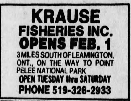
https://www.newspapers.com/image/99072019
-------------------------------------------------------------------------
1985
MARCH 27
![]()
WANTED ... EXPERIENCED FISHERMAN. Krause Fisheries Inc. Telephone 326-3896 between 6:00 p.m. and 7:00 p.m. ...
The Leamington Post, March 27, 1985, p. 9
http://ink.scholarsportal.info/viewer/cecil/focus/ink/newspapers/lp/reel87/00625
-------------------------------------------------------------------------
1986
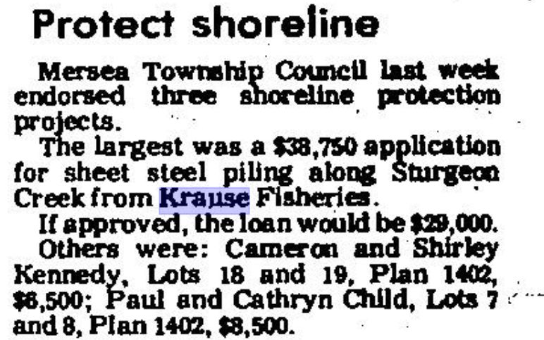
Protect shoreland .. Mersea Township Council last week endorsed three shoreline protection projects ... The largest was $38,750 application for sheet piling along Sturgeon Creek from Keause Fisheries. If approved, the loan would be $29,000 ...
JUNE 11
Leamington Post, June 11, 1986
http://ink.scholarsportal.info/viewer/cecil/focus/ink/newspapers/lp/reel89/01058
SEPTEMBER 9
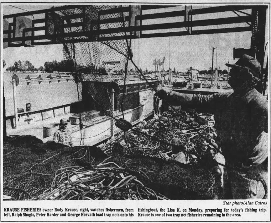
KRAUSE FISHERIES owner Rudy Krause, right, watches fishermen,
from left, Ralph Shuglo, Peter Harder and George Horvath load trap nets onto his
fishingboat,
the Lisa K, on Monday preparing for today's fishing trip. Krause is one of two
trap net fisheries remaining in the area.
https://www.newspapers.com/image/504169357
DECEMBER 10
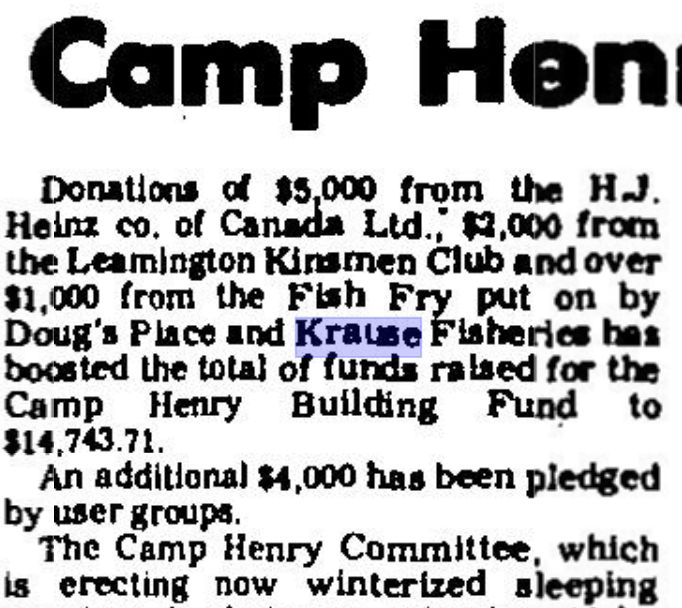
Donations of $5,000 from the H.J. Heinz co, of Canada Ltd., $2,000 from the Leamington Kinsmen Club and over $1,000 from the Fish Fry put on by Doug's Place and Krause Fisheries has boosted the total funds raised for the Camp Henry Building Fund to $14,743.71 ...
Leamington Post, December 10, 1986, p. 5B
http://ink.scholarsportal.info/viewer/cecil/focus/ink/newspapers/lp/reel90/01117
-------------------------------------------------------------------------
1988
FEBRUARY 10
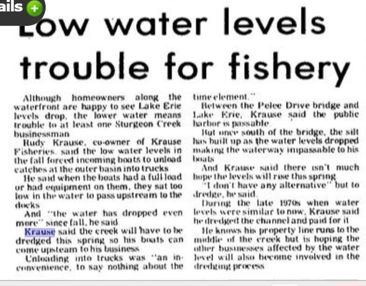
Low water levels trouble for fishery
Although homeowners along the waterfront are happy to see Lake Erie levels drop, the lower water means trouble to at least one Sturgeon Creek businessman
Rudy Krause, co-owner of Krause Fisheries, said the low water levels in the fall forced incoming boats to unload catches at the outer basin into trucks
He said when the boats had a full load or had equipment on them, they sat too low in the water to pass upstream to the docks And "the water has dropped even more' since fall, he said
Krause said the creek will have to be dredged this spring so his boats can come upstream to his business
Unloading into trucks was "an inconvenience, to say nothing about the time element."
Between the Pelee Drive bridge and Lake Erie, Krause said the public harbor is passable
But once south of the bridge, the silt has built up as the water levels dropped making the waterway impassable to his boats
And Krause said there isn't much hope the levels will rise this spring
"I don't have any alternative" but to dredge, he said
During the late 1970s when water levels were similar to now, Krause said he dredged the channel and paid for it
He knows his property line runs to the middle of the creek but is hoping the other businesses affected by the water level will also become involved in the dredging process
The Leamington Post, February 10, 1988
http://ink.scholarsportal.info/viewer/cecil/focus/ink/newspapers/lp/reel93/00268
DECEMBER 27

Dredging support
Jerry Pickard, Liberal MP for Essex-Kent has pledged his support of efforts to dredge Sturgeon Creek in Mersea Township
Low water levels have complicated operations for two marinas located at the mouth of the creek and for Krause Fisheries ...
The Leamington Post, December 27, 1988, p. 2A
http://ink.scholarsportal.info/viewer/cecil/focus/ink/newspapers/lp/reel96/00835
-------------------------------------------------------------------------
1989
MAY 9

KRAUSE FISHERIES INC.
Commercial Fisheries
PRODUCERS - PROCESSORS - WHOLESALE & RETAIL
FRESH & FROZEN FISH
Quality Lake Erie Products
Bevel Line at Sturgeon Creek,
on the way to Point Pelee National
Park
PHONE 519-326-2933 LEAMINGTON, ONTARIO
The Leamington Post, May 9, 1989
http://ink.scholarsportal.info/viewer/cecil/focus/ink/newspapers/lp/reel98/00364
SEPTEMBER 30
CONGRATULATIONS
WINDSOR
RACEWAY
from
KRAUSE FISHERIES INC.
Fresh Frozen Fish
Production and processing
326-2933
[Rudy owned race horses]
The Windsor Star, September 30, 1989, p. 79
https://www.newspapers.com/image/504197527
-------------------------------------------------------------------------
1995
JULY 26
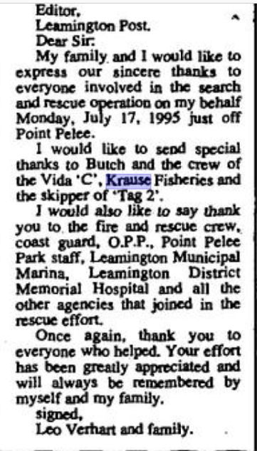
Rescuers Praised for Help
... thanks to everyone involved in the search and rescue operation on my behalf, July 17, 1995 just off Point Pelee ... I would also like to send special thanks to Butch and the crew of the Vida "C", Krause Fisheries and the skipper of "Tag 2" ... Leo Verhart and family.
The Leamington Post, July 26, 1995, p. 5A
http://ink.scholarsportal.info/viewer/cecil/focus/ink/newspapers/lp/reel123/00130
-------------------------------------------------------------------------
1996
OCTOBER 16
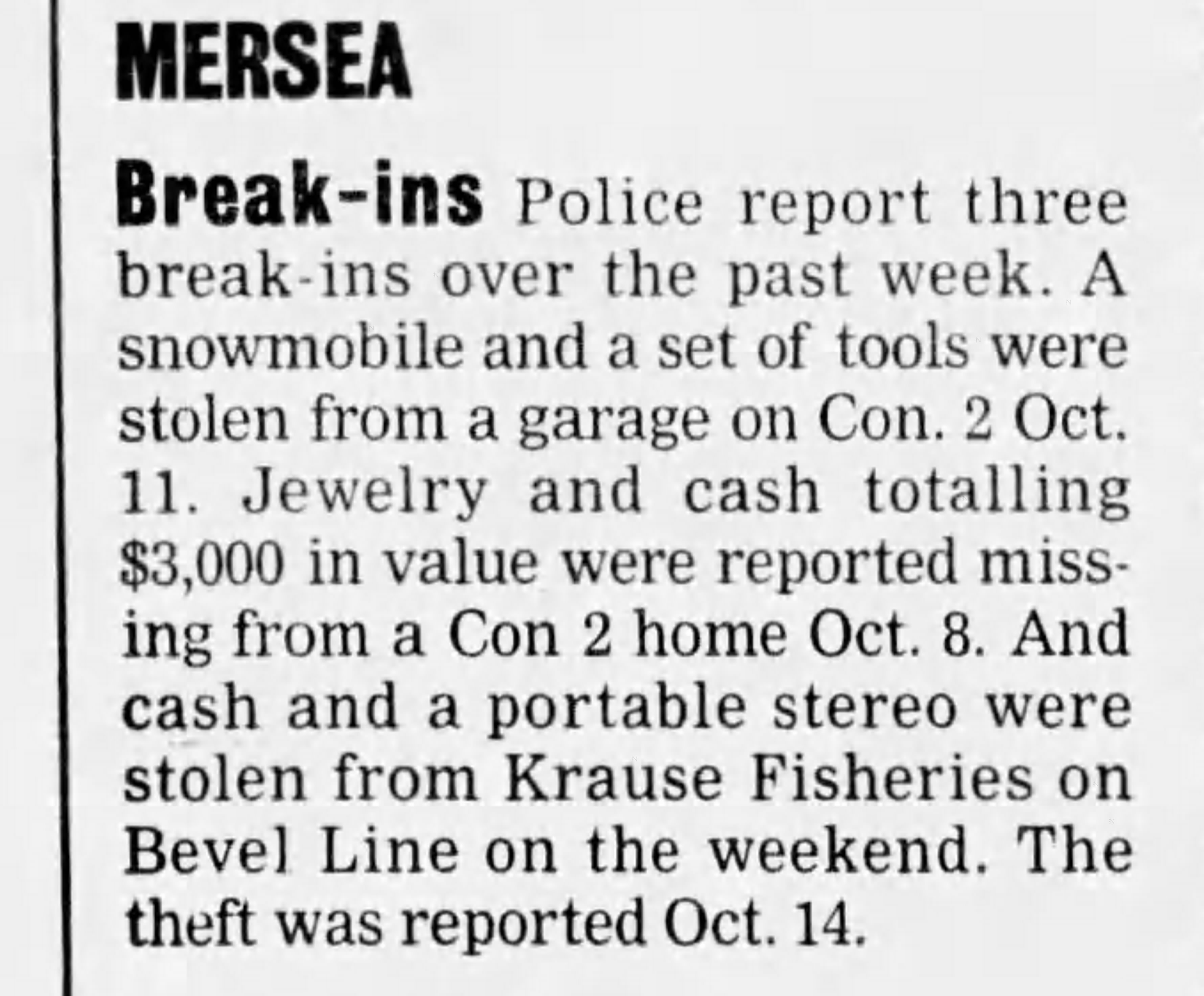
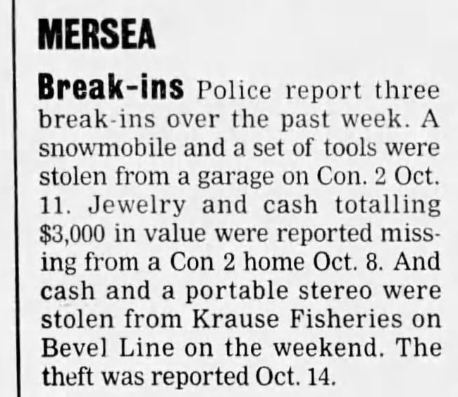
Break-In
The Windsor Star, October 16, 1996, p. 4
https://www.newspapers.com/image/505845689 - p. 4
https://www.newspapers.com/image/505845726 - p. 8
-------------------------------------------------------------------------
2000
[Krause Fisheries, 588 Bevel Line Rd, Leamington N8H 3V4, Ontario]
A 17.5 kg, 90 cm Chinese Bighead carp was caught on west side of Point Pelee on October 16, 2000 by commercial trap net fisherman Rudy Krausse. [Sic: Karl Rudy Krause]
This is the first time a bighead carp has been caught in the Ontario waters of Lake Erie and Ontario in general. Ohio Department of Natural Resources has had two reports of bighead carp being caught in Lake Erie - one was caught in 1995 and a second one was caught in the spring of 2000 in Sandusky Bay.
Bighead carp being examined in MNR’s Wheatley Fisheries Station
http://www.web2.mnr.gov.on.ca/MRN/peche/binary/LkErieSummer2001.pdf -
LAKE ERIE FISHERIES NEWS (Information on the fish stocks of Lake Erie from the
Lake Erie Management Unit of the Ministry of Natural Resources Summer ), Summer 2001
-----------------
NOVEMBER 20
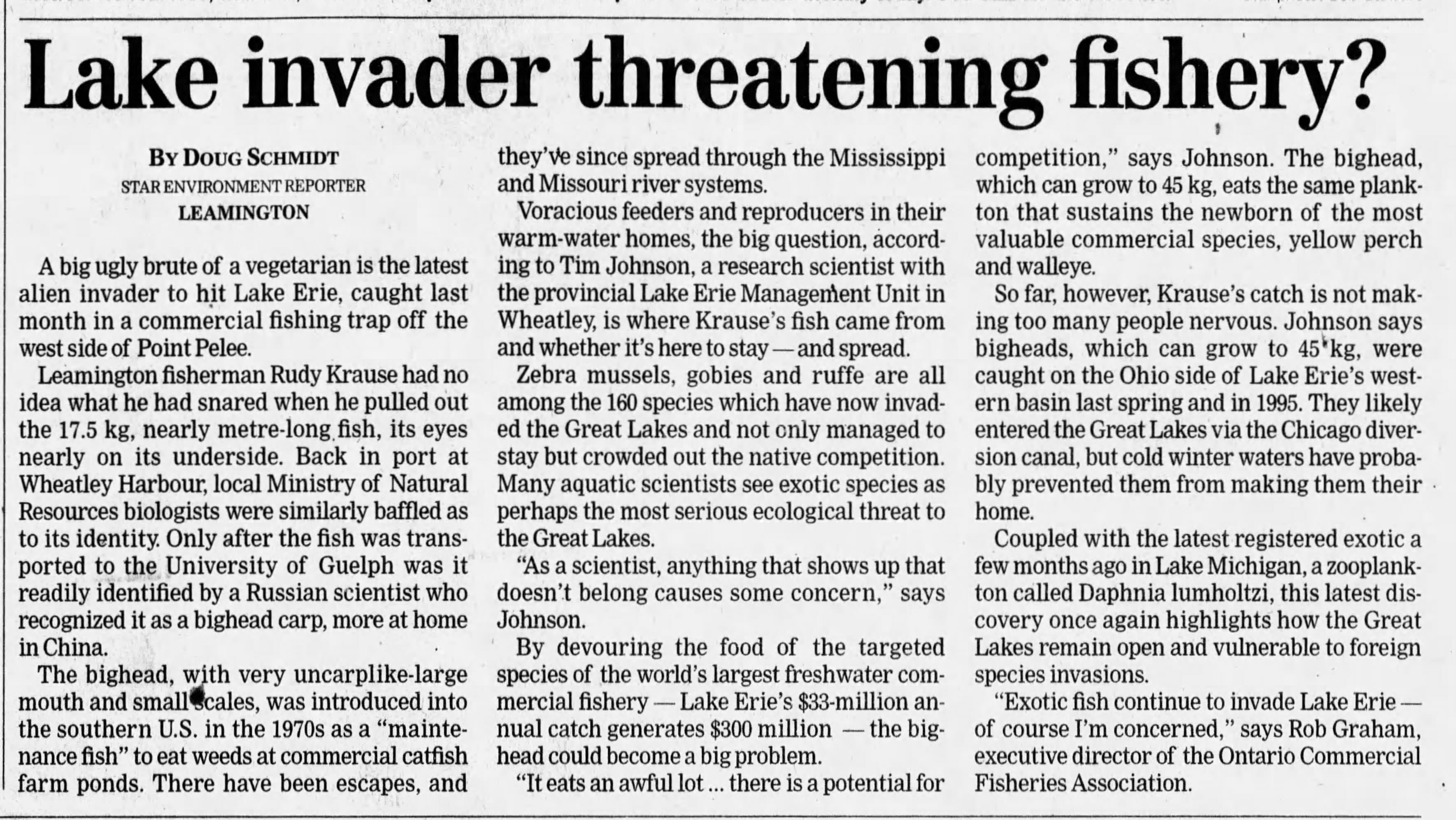
The Windsor Star, November 20, 2000, p. 5
https://www.newspapers.com/image/505078696
-------------------------------------------------------------------------
2002
OCTOBER 9
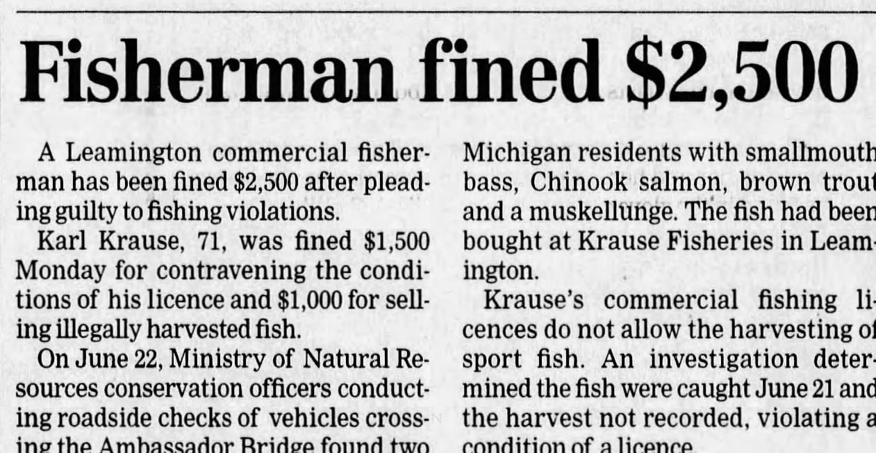
FISHERMAN FINED $2,500
https://www.newspapers.com/image/505708762
-------------------------------------------------------------------------
2017
APRIL 7
PROCEEDING COMMENCED UNDER subsection 8(2) of Ontario Regulation 586/06 of the Municipal Act, 2001, S.O. 2001, c. 25, as amended ....
Referred by: Town of Leamington Objector: Krause Fisheries Inc. Objector ....
Subject: To permit local improvements, including the construction of a sanitary sewer along Pelee Drive from Bevel Line Road (County Road 33) at Seacliff Drive East to the entrance of Point Pelee, and for new sanitary sewer connections to each property ....
Heard: May 2016 and January 2017 in Leamington, Ontario .....
(5) Mr. Paul Krause, principal and owner of Krause Fisheries Inc. (“Krause objection”) was another objector. Materials filed with the Board reveal that the Krause objection was based on the following reasons:
a. The charge is excessive and inequitable as is the method by which it was assessed, namely by equivalent residential unit. No justification was given as to why it is assessed as the equivalent of 10 residential units.
b. The property is a vacant industrial building, formerly used as a fishery processing plant that is located on a protected wetland area on which development is restricted. The project will have little to no benefit to their property.
c. The property's market value is not much more than the assessed value suggesting that the assessment is grossly unfair .......
[9] On behalf of the Krause objection, I heard from the following witnesses: a. Mr. Paul Krause ...
[13] Of those who testified, no objector actually objected to the project itself. The concerns were only with respect to the charges attributable to each property. In fact, Messrs. Krause and Macksoud were sincere to state that they could see the benefit of the proposed infrastructure works ...
[15] Before I provide my analysis concerning my decision on the objections, I provided an oral ruling with respect to an objection raised by counsel to the Krause objection on a procedural matter ....
[21] To return to my decision on the merits of this matter, I relied primarily on the evidence of Messrs. Botham and Molliconi to come to my conclusion. It should be noted that no expert engineering evidence was called to challenge the expert evidence of these two witnesses. Although Counsel on the Krause objection did a commendable job in cross-examination, it was not sufficient to undermine the opinions provided by these gentlemen. ...
[24] The essence of the concerns raised by the Krause objection can be summarized as follows: the Krause property is significantly constrained as there is a Provincially Significant Wetland (“PSW”) on the property and the lands are located in a floodplain area regulated by ERCA. Ms. Wiebe could not rationalize how the Municipality could allocate 10 Equivalent Residential Units (“ERUs”) given the extensive limitations to development of this property ....
[30] Mr. Tanner explained that a PSW is not an automatic freeze to development. He testified that the standard 120 metres (“m”) buffer often applied along the boundary of a PSW can be reduced if proper Environmental Impact Statements (“EIS”) are submitted. The buffer, he suggested was not a prohibition to development. ....
[32] Further Ms. Wiebe conceded that she had not been in attendance when the Municipality’s engineering experts gave their opinions. She understood that the Municipality had allocated a deduction for the assessment cost for the Krause property given the constraints and she understood that the development envelope identified by the municipal experts after taking into account all the constrained areas was approximately 1.5 acres.
[33] Mr. Molliconi had actually calculated 11 ERUs for a 1.5 acre parcel of developable land. Ms. Wiebe did not dispute the hard calculations; she disputed the likelihood of the parcel ever getting developed. The property had been a fishery many years ago but that industry had long ceased.
[34] A few years ago the property was up for sale citing development potential. Mr. Krause explained that his negotiations with a First Nations in this area did not bear any fruit. He was candid to say that the negotiations had been verbal and undertaken without the benefit of lawyers. Certainly Mr. Krause does not see the possibility of development on his parcel but as Mr. Tanner stated, someone else might.
[35] Also the notion that a fishery could be re-established on the Krause property was not dismissed entirely – Ms. Wiebe simply suggested that the possibility was remote. ....
[41] Finally, I see no reason for me to interfere with the methodology implemented by the Municipality to allocate ERUs to individual properties. I agree with the intent to achieve fairness and equity and that this calculation was used to achieve that balance.....
https://www.omb.gov.on.ca/e-decisions/fi150006-Apr-07-2017.pdf
-------------------------------------------------------------------------
KRAUSE NOTES
Pelee Island (41°47', 82°40'). Many lake sturgeon were caught around the island in early May and June, and spawning was believed to occur here (Rathbun and Wakeham 1897). Point Pelee (41°55', over hard clay, gravel or 1954; Rathbun and Wakeham at the point in June, but OE-2 Rondeau Harbour (42°15', 81°53') ... p. 6
HERRING Lake herring migrated from the deeper waters of the eastern portion of the lake, such as the deep hole off Long Point (42°33', 80°10’), to spawn in shallow water in the western basin (Hile, pers. comm. 1979; Langlois 1948, 1954; Moore 1894; Rathbun and Wakeham 1897; Scott 1951; Trautman, pers. comm. 1979; Wickliff 1936). It was also hypothesized, however, that herring did not migrate from one end of the lake to the other but that the stock was composed of several races (Koelz 1926). Historically, the run began on the Canadian shore near Rondeau (42°15’, 81°53’) and was more pronounced along the shores west of Point Pelee (41°55', 82°30’) and Vermilion (41 °26’, 82°22’). The run along the southern shore of the central basin was believed to be ill-defined, because it was so obstructed by gillnets that the fish had to move along the Canadian shore until deflected southward by Point Pelee (Rathbun and Wakeham 1897). A part of the run continued south to Kelleys Island (41°36’, 82°42'), Huron (41°24', 82°33'), and Vermilion; another portion passed around Point Pelee and spread out over the area west of the islands (Moore 1894). A large number also moved up into the Detroit River ... p. 24
WHITEFISH Historically, on about the first of October, lake whitefish began to migrate from the eastern basin of Lake Erie along both the north and south shores to the rocky shoals at the western end of the lake to spawn (Cole 1905; Downing 1904, 1910; Ferguson 1957; Kerr and Kerr 1860-1898; Kumlien and True 1887; Leach 1923; Milner 1874b; Moore 1894; Rathbun and Wakeham 1897; Smith and Snell 1891; Trautman 1957; Wright 1955). Lake whitefish are believed to have moved clockwise around the lake on their spawning migration, often passing to the west through the islands area and back along the Canadian shore (Wolfert, pers. comm. 1979). Lake whitefish passed through the western basin and into the Detroit River and, until the early 1900s, into Lake St. Clair and the St. Clair River to spawn; they returned via Pigeon Bay (42°00', 82°40') which borders Point Pelee on the west (Kerr and Kerr 1860-1898; Keyes 1894; Milner 1874c; MSBFC 1887, 1895; Reighard 1910; Trautman 1957). In Lake Erie, lake whitefish spawned for 18-60 days in late October to December when temperatures were generally 43-53°F (Fish 1929; Kerr 1874; Klippart 1877; Koelz 1929; Langlois 1945b, 1954; Milner 1874a; Price 1940; Rathbun and Wakeham 1897; Stockwell 1875a; Van Oosten and Hile 1949; Wickliff 1928b, 1933a, 1936, 1957; Wickliff and Miller 1929). Spawning usually does not begin until the temperature drops to at least 46°F (Lawler 1965) ... p. 28
Point Pelee (41°55', 82°30'). Much of the remnant lake whitefish population spawns at Point Pelee (Ferguson 1957) ... p. 34
COHO SALMON In 1933, coho salmon fingerlings were stocked in Pickerel (41°26', 82°57') and Cold (41°27', 82°46') creeks, tributaries of Sandusky Bay; these plantings were unsuccessful (Parsons 1973). Annual plantings began in Ohio, Pennsylvania, and New York waters of Lake Erie in 1969 and in Michigan waters in 1974 (GLFC 1973a,b, 1975, 1976, 1978 in press; NYDEC 1977a; ODNR, undated). Spawning runs have developed in several tributaries, -primarily in the eastern and central basins, but little natural reproduction occurs. Significant numbers of coho salmon are observed during September of each year, when they school near stream mouths (Shea 1972). An annual clockwise migration occurs between the eastern and central basins. In January and February, juvenile coho salmon concentrate near warm water discharges at Lorain (41°28', 82°11') and Cleveland (41°30', 81°43'), in May-August they concentrate between Point Pelee (41°55', 82°30') and Port Stanley (42°39', 81°13'), and in September and October, as adults, they move back to their home streams (Baker and Scholl 1971c; Shea 1972). Spawning runs enter a number of Lake Erie tributaries ... p. 35
CHINOOK SALMON In 1873-80, chinook salmon fry were planted in Ohio tributaries to Lake Erie, mainly in the Maumee River, and also in five Michigan tributaries. In 1933, yearlings were planted in Pickerel (41°26’, 82°57’) and Cold (41°27’, 82°46’) creeks, tributaries of Sandusky Bay; only one survivor was reported (Parsons 1973). Plantings resumed in Ohio Waters in 1970, and were begun in Pennsylvania waters in 1971, and in Michigan and New York waters in 1973 (GLFC 1973a, 1975, 1976, 1978 in press; NYDEC 1977a). Spawning runs have developed in several tributaries, primarily in the eastern and central basins, but little natural reproduction occurs. Significant numbers of chinook salmon are observed in September when they school near stream mouths (Shea 1972). An annual clockwise migration occurs between the eastern and central basins. In January and February chinook salmon concentrate near warm water discharges at Lorain (41°28’, 82°11') and Cleveland (41°30’, 81°43’), in May to August they concentrate between Point Pelee (41°55', 82°30') and Port Stanley (42°39', 81°13’), and in September and October, they move back to home streams (Shea 1972). Spawning runs enter a number of Lake Erie tributaries ... p. 38
[Lake Trout] Point Pelee (41°55', 82°30') and Pelee Island (41°47', 82°40'). Rocky areas at the point and on the east side of the island may have provided limited spawning habitat (Moenig, undated) ... p. 47.
RAINBOW SMELT Rainbow smelt eggs planted in Crystal Lake (44°40', 86°10'), Michigan, in 1912 are believed to be the source of rainbow smelt found in all of the Great Lakes, except Lake Ontario. The first reported capture of smelt in Lake Erie occurred in 1935 at Port Dover (42°47', 80°12'), Ontario (Van Oosten 1937a). The first spawning run in Lake Erie occurred in 1940 in a drainage ditch west of Blenheim (42°18', 82°00'), Ontario (Roseborough 1962). Most of the successful spawning in Lake Erie occurs on sandy shoals along the Canadian shore (Applegate and Van Meter 1970; Scott 1967; Slastenenko 1958; USBCF 1966). Adults move inshore and into streams in late March and early April and move back to deeper waters just after spawning (FWS 1979d). The western basin has few streams suitable for spawning, and, along the north shore, runs do not occur west of Point Pelee (41°55', 82°30') (Ferguson 1955; Regier 1963). Some rainbow smelt migrate into the western basin in the fall, spawn there in the spring, and then return to the central basin. Small concentrations of eggs have been recovered throughout the western basin on mud bottom; these eggs may have been spawned elsewhere on sandy bottom, which is the preferred spawning substrate in Lake Erie (Wolfert, pers. comm. 1979). Most hatching occurs May 1-15 at 50°F (Comm. Fish. Rev. 1961a) ... p. 48
Ontario The first smelt spawning run in Lake Erie occurred along the Canadian shore of the central basin in 1940 in a tributary west of Blenheim (42°18', 82°00') (Roseborough 1962). In the early 1940s, spawning occurred at Point Pelee (41°55', 82°30'). Egg collections have documented spawning along the entire northern shore of the central and eastern basins (Ferguson 1954; Regier 1963). Most spawning occurs on beaches and shoals in 10 ft or less of water. Few stream spawning populations remain, although runs also enter certain unpolluted and unobstructed tributaries (Applegate and Van Meter 1970; Ferguson 1954; USBCF 1966; USDI 1967). Rainbow smelt apparently prefer to spawn in smaller streams that have barrier bars or riffles near the mouth. They also spawn on gravel or bedrock along the north shore off Long Point (42°33', 80°10') and at Morgans Point (42°51', 79°21'), where there are strong currents (Regier 1963). Spawning runs usually occur in April or early May (Berst 1954; MacCallum and Regier 1970; Mahon, pers. comm. 1979; Nsembukya-Katuramu 1978; Regier 1963). Usually the spawning run begins at Point Pelee about the middle of April and lasts approximately 2 weeks; peak spawning occurs at 38-41°F. Subsequent runs follow the shore east of Point Pelee; spawning runs occur in the eastern basin about 2 weeks later than at Point Pelee (MacCallum and Regier 1970; Regier 1963). It has also been reported, however, that the spawning peaks occur throughout the lake at about the same time (late April) and that there is no progression from one end to the other (Berst 1954; Ferguson 1954, 1955). Along the Canadian shore, YOY inhabit the inshore waters in the spring (MacCallum and Regier 1970). Fry are very abundant inshore at depths of 20 ft during mid-summer; they begin moving offshore in late summer (Ferguson 1965; Chen 1970). In 1962, YOY moved offshore from the spawning areas in the central and eastern basins and were collected by June in waters as deep as 50 ft (MacCallum and Regier 1970). OE-1 Point Pelee (41°55', 82°30'). Spawning aggregations occur in 10 ft or less of water; spawning occurs on the current-swept beaches in April and early May (Regier 1962, 1963; Thomasson 1963). Point Pelee has large spawning runs in April, which usually last for 2 weeks (Ann Arbor News 1979b; Environ. Can. 1977a; MacCallum and Regier 1970; Regier 1962). The largest runs occurred during the late 1950s (Krause 1967). In 1959, spawning runs occurred at Point Pelee Park (41°58', 82°32') and the Learnington Dock (42°01', 82°36') in April (Roseborough 1962). Eggs were collected on the gravel bar that extends south off the tip of the point. Most eggs were deposited in water less than 10 ft deep in an area that extended at least 2,000 ft out from the tip of the point (Regier 1962). Until approximately 1944, major runs occurred in Sturgeon Creek (42°01', 82°34') (Ferguson 1954, 1955). Fry are abundant along the point during the summer (Ferguson 1955). In 1962, YOY were collected near Point Pelee; ... p. 54
[EMERALD SHINER] ... Point Pelee (41°55', 82°30'). In 1975, YOY were captured in beach seines off the west beach of Point Pelee (Paine 1976). ... p. 82
[COMMON SHINER ] ... Point Pelee (41°55', 82°30'). In 1929, one larva was found in the lake south of Point Pelee and east of Pelee Island (41°47', 82°40') on June 19 (Fish 1932). ... p. 83.
[SAND SHINER] ... Point Pelee (41°55', 82°30'). In 1929, larvae and postlarvae were abundant around Point Pelee in August (Fish 1932). ... p. 89
[WHITE BASS] ... Point Pelee (41°55', 82°30'). The shoals along the entire shoreline of the point are important spawning areas (Environ. Can. 1977a). Young- of-the-year were collected on the northwest beach on the point (Paine 1976). ... p. 135.
[SUN FISH] ... Point Pelee (41°55', 82°30'). The marshes of Point Pelee National Park (41°58', 82°32') are important spawning areas (Environ. Can. 1977a). ... p. 141.
[BLACK BASS] ... Point Pelee (41°55', 82°30'). The marshes of Point Pelee National Park (41°58', 82°32') are important spawning areas (Environ. Can. 1977a). ... p. 150.
[WALLEYE ] ... Point Pelee (41°55', 82°30'). The entire shoreline of Point Pelee National Park (41°58', 82°32' ) is a spawning area (Environ. Can. 1977a). Until recently, large numbers of ripe walleyes moved onto the reefs off the point and onto the gravel and sand areas along the west shore (Julien 1967; Krause 1967; Tiessen 1967); by about 1950, these areas were degraded by domestic and cannery wastes from Leamington (42°01', 82°36') and neighboring towns (Regier et al. 1969). In the spring, adults were first taken by fishermen about 15 mi SE of Point Pelee; the fish then moved towards the shore areas of Pelee Island (41°47', 82°40') and Point Pelee (Krause 1967). ... p. 183.
[http://www.scribd.com/doc/1589902/USGS-volume09 - USGS: volume 09 - C.D. Goodyear, Atlas of Spawning and Nursery Areas of Great Lakes Fishes, Volume IX, Lake Erie, September, 1982. - Krause, W., Jr. 1967. Notes of interview conducted by H. A. Regier, June 9.]
Canadian fishermen recall runs of ripe walleyes to sand and gravel areas on the west shore of Pt. Pelee and also along the north shore of Lake Erie near Kingsville (W. H. Krause, personal communication). These areas have been used by few, if any, walleyes in recent years. The grounds off Pt. Pelee have become progressively modified over the past 20 years by a black, malodorous deposit noticeable on trap net anchors. ....
THE ECOLOGY AND MANAGEMENT OF THE WALLEYE IN WESTERN LAKE ERIE .... May, 1969 ... http://www.glfc.org/pubs/TechReports/Tr15.pdf
JOHN T. LOOP/ ROBERT LIVINGSTON/ WILLIAM SETTERINGTON
John Ellis
DeLaurier started a Fishery on Lot 9 and sold it to John Loop
Henrietta O'Neill,
In Search of a Heart
(Friends of Point Pelee, 2000), p. 27.
1921
1921 Census: Family 125
Loop, John T, fisherman
Livingston, Robert, fisherman
The body of Jackson was found Monday morning on the west beach, near John Loop's fishery, about two miles west of the point.
http://ink.ourontario.ca/browse/lp -Leamington Post, July 28, 1921, p. 1
John Loop and William Setterington Fish Shanty and Log House, located on the west of Point Pelee.
http://ink.ourontario.ca/browse/efp - The Essex Free Press. June 3, 1932 - Page: 3
FOR SALE - Half interest in Point Pelee fishery, owing to poor health. John T. Loop, P.O. Box 1083, Leamington ...
http://ink.ourontario.ca/browse/lp -Leamington Post, December 15, 1932, p. 1
JOSEPH LOOP (b. October 20, 1839 -d. ),
HENRY LOOP
IRA LOOP
JOE LOOP
He then entered the fishing industry, with his brothers Henry and Ira, locating first at Point Pelee, where they operated one pound, and later at Kingsville, where they had three pounds. This business was continued for fourteen years, the brothers supplying both wholesale and retail dealers in Detroit and adjoining areas ...[Joseph leaves fishing] ... His fondness for the water soon drew him back to the fishing business, and he established himself on thge east shore of Point Pele, beginning with one pound, and finally controlling four. He spent ten years in this industry, and then sold out to Frederick Kline, of Sandusky ...
[Commemorative biographical record of the county of Essex, Ontario : containing biographical sketches of prominent and representative citizens and many of the early settled families ( Toronto, J.H. Beers, 1905), pp. 316-317 - http://www.ourroots.ca/toc.aspx?id=3107&qryID=7812a62b-c8a9-43a4-8924-f51b6c8db63a]
Loop Jr. and Loop Sr.
Click on the 1851 Images above to enlarge them
ENTIRE MAP - PDF
Canada. Point Pelee or
South Foreland, Lake Erie. Plan shewing the Boundaries
as marked on the ground, of the Land to be vested in the Ordnance at Point Pelèe,
on Lake Erie,
in the County of Essex & Township of Mersea, as surveyed by Mr. John A.
Wilkinson Provl.
Land Surveyor in the month of May, 1851. [cartographic material].
SOURCE: 1851- Library and Archives of Canada: ROYAL ENGINEERS OFFICE Wilkinson, John A. Wilkinson, Berdoe A. Gordon, Alexander. Canada. Point Pelee or South Foreland, Lake Erie. Plan shewing the Boundaries as marked on the ground, of the Land to be vested in the Ordnance at Point Pelèe, on Lake Erie, in the County of Essex & Township of Mersea, as surveyed by Mr. John A. Wilkinson Provl. Land Surveyor in the month of May, 1851. Microfiche Number: 16794 Ecopy Number(s): n0016794 n0016794k Call Number: H1/440/Point Pelee/1851 Record No.: 14339
[See also: Plan of the Reserve at Point Pelee in the township of Mersea, surveyed by Alexander Baird, Provincial land surveyor, dated September 10, 1851]
The Loop Fishery
The loop name has been well-established in the fishing industry of Wheatley and the Point Pelee area for over a century ...
Family historical records note that Benjamin Franklin Loop was a resident of New Yoek State during the American Revolution. His desire to remain loyal to the King compelled him to move to Canada and eventually to settle at Point Pelee. His three sons, Henty, Ira, and Joe, engaged in pound net fishing in the Point Pelee and Kingsville areas of Lake Erie ...
Rita Lobzun [Karen Adamson-Editor], Open Books, A Historical Sketch of Commercial Fishing in Wheatley - Ontario, After 1980, p. 16] - http://images.ourontario.ca/Partners/CKPL/CKPL0027490551T.PDF
[According to Urias "Ria" Loop] My father Ire Loop fished at Point Pelee and came to Kinsville ....
The Windsor Star, February 11, 1948, p. 8 - https://www.newspapers.com/image/500954258
GEORGE
MCLEANPhilip Girardin sold his fishing rights to McLean.
[Henrietta O'Neill, In Search of a Heart (Friends of Point Pelee, 2000), pp. 45-48]
Future research:
http://www.bgsu.edu/colleges/library/cac/ms/page43262.html - The
Historical Collections of the Great Lakes - seven microfilm reels of records
for the McLean Brothers Fisheries Company in Wheatley, Ontario - documents
the activities of a Canadian Lake Erie fishing company for the years
1908-1960.
By now, the Federal Park was determined that no private property should remain in the area, but my husband [William Krause] was not about to sell the Fishery or our home. We went to court and since McLean who had been the original owner from whom it was purchased testified to that fact, the government lost the case and appealed it.
Around 1903, Philip Girardin began fishing near Lot 15. His fishing rights were sold to McLean, then McLellan and in 1937, became the basis for the Krause fishery ...
Henrietta O'Neill, In Search of a Heart (Friends of Point Pelee, 2000), pp. 45-48
Sale of Fisher by George McLean to James McClellan
http://ink.ourontario.ca/browse/lp -Leamington Post, September 21, 1922, p. 4
1921
1921 Census: Family 115
McLean, George, fisherman
JAMES MCLELLAN
HAROLD "MAC' MCLELLAN [H. E. MCLELLAN]
... Philip Girardin [sold] His fishing rights ... to [George] McLean, then [James] McLellan and in 1937, became the basis for the Krause fishery ...
[Henrietta O'Neill, In Search of a Heart (Friends of Point Pelee, 2000), pp. 45-48]
Krause had purchased the fishery business and part of the disputed lot in December, 1937, from James E. and Harry McLellan and in that contract certain buildings are described as "erected on government lands adjacent to the fishery."....
Windsor Star, May 17, 1956, p. 5 - https://www.newspapers.com/image/501484420/?terms=%22windsor%2Bstar%22%2B%22krause%22
H. E. MCCLELLAND OF POINT PELEE
VICE- PRESIDENT,
ESSEX COUNTY LAKE ERIE FISHERMAN'S ASSOCIATION
http://ink.ourontario.ca/kr/reel26/00019-x0-y0-z1-r0-0-0?query=pelee+smith%20%20&p=1 - January 14, 1937, Kingsville Reporter, p. 6
McClellan Fishery
Harold "Mac" McClellan began fishing in the 1920's, when employed by James W. Grubb at Point Pelee ...
"Mac" worked for a number of years at the Grubb fishery ...
In 1937, "Mac" having operated his own fishery for a number of years, sold his business to William Krause of Point Pelee, and moved to Wheatley ...
Rita Lobzun [Karen Adamson-Editor], Open Books, A Historical Sketch of Commercial Fishing in Wheatley - Ontario, After 1980, p. 16] - http://images.ourontario.ca/Partners/CKPL/CKPL0027490551T.PDF
McClellan Fishery
Harold "Mac" McClellan began fishing in the 1920's, when employed by James W. Grubb at Point Pelee. One experience, which he related, is still very clear to him and provides further proof that even the most experienced fishermen were often fooled by the weather and Lake Erie's unpredictable nature.
The incident occurred on a Good Friday when the crew set out to drive stakes into the lake bed in preparation for the pound netting season. Jim Grubb had been rather dubious about going out on the lake on that particular day and was perhaps a little superstitious. With only a few stakes left to drive, the east wind suddenly changed into a "northwester". Rough seas made it too difficult to continue their work so the men decided to head for the shore, towing the scow with its men on board behind the boat. Several times the tow line broke, forcing the men to abandon the scow and board the open wooden boat. By continuously bailing water they were able to reach the shore where their anxious wives were waiting. The abandoned scow was struck by a freighter, but was later salvaged when other fishing tugs towed it in to shore.
"Mae worked for a number of years at the Grubb fishery and was also a member of the Point Pelee Volunteer Rescue Squad, which saved many lives during Its years of service. The dramatic rescue of the victims on the boats. the "N. J . Nessen" and the "Kelly's Island", are but two of the many rescue missions carried out by these brave men.
In 1937. "Mac", having operated his own fishery for a number of years, sold his business to William Krause of Point Pelee, and moved to Wheatley to operate a feed mill and coal business.
Rita Lobzun [Karen Adamson-Editor], Open Books, A Historical Sketch of Commercial Fishing in Wheatley - Ontario, after 1980, p. 16
http://images.ourontario.ca/Partners/CKPL/CKPL0027490551T.PDF
1921
1921 Census - Family 129
Grubb, James, fisherman
John Murkly, fisherman
Harold McLellan, fisherman
Thomas Epplett, fisherman
Filiman Mooney, fisherman
1931
1931 CANADA CENSUS
1931 Census - Family 248
Harold McClellan, Fisherman, Pound Net
https://central2.bac-lac.gc.ca/.item/?id=e011636925&app=census1931&op=img - Page 22
-------------------------------------------------------------------------
H. E. McLellan of Point Pelee has disposed of his fishery to a Wheatley man and within a short time will move to Wheatley where he will take over a grain elevator formerly owned by his father. Last evening between 30 and 35 friends and neighbors gathered at Mr. McLellan's home on Point Pelee to bid him and his family farewell. During the evening they were presented with an indirect-lighting lamp. Mr. McLellan thanked his friends and neighbors for their beautiful gift, after which dainty refreshments were served.
http://ink.ourontario.ca/browse/lp -The Leamington Post. December 23, 1937 - Page: 5
MOONEY
Click on the 1851 Images above to enlarge them
ENTIRE MAP - PDF
1911
The 1911 Census:
Mooney, Ira http://data2.collectionscanada.ca/1911a/e080/e001985788.pdf
Province/Territory: Ontario, District Name: Essex South, District Number: 68, Sub-district: Mersea, Sub-district Number: 25 - Page 1 - Point PeleeMooney, Henry http://data2.collectionscanada.ca/1911a/e080/e001985788.pdf
Province/Territory: Ontario, District Name: Essex South, District Number: 68, Sub-district: Mersea, Sub-district Number: 25 - Page 1 - Point Pelee
NATINSKY
Natinsky ...
[Henrietta O'Neill, In Search of a Heart (Friends of Point Pelee, 2000), pp. 45-48]
OLMSTEAD
Olmstead bought Goldbaum license but never used the buildings.
[Henrietta O'Neill, In Search of a Heart (Friends of Point Pelee, 2000), pp. 45-48]
ADAM OPER
In June 1898 Adam Oper was a well-known Point Pelee fisherman.
Rita Lobzun [Karen Adamson-Editor], Open Books, A Historical Sketch of Commercial Fishing in Wheatley - Ontario, After 1980, p. 2]
1901
The 1901 Census, Sub district Mersea, Essex (South/Sud), Ontario, District 60, Subdistrict Number: K-1:
Oper Adam, Male, Head, Married, born Sep 22 1849, age 51
-
http://automatedgenealogy.com/census/View.jsp?id=50638&highlight=3&desc=1901+Census+of+Canada+page+containing+Adam+Oper
The body of Charlie Barnes was found lashed to the boat opposite Oper's fish shanty near the end of Point Pelee ...
http://ink.ourontario.ca/browse/wer - The Windsor Evening Record. November 16, 1898 - Page: 1
POST FISH CO
William Grubb will operate Capt. Post's
fishery on the east beach this summer, it is said. He will be assisted by
Ned Cassidy. http://ink.ourontario.ca/browse/lp -Leamington Post,
April 2, 1936, p. 2
POINT PELEE PARK TO BE ENLARGED ... GOVERNMENT ACQUIRES JOE POST PROPERTY ... ABOUT 178 ACRES ... On the premises there is a concrete block house, another large house and other farm buildings ... The Post property is located on the east side of the point, and runs almost to the extreme southerly limit ..."
http://ink.ourontario.ca/browse/lp -Leamington Post, July 7, 1938, p. 1
The products of this large fishery are contracted by Post & Co of Sandusky, Ohio ...
Commemorative biographical record of the county of Essex, Ontario : containing biographical sketches of prominent and representative citizens and many of the early settled families (Toronto, 1905), p. 580
http://www.ourroots.ca/e/page.aspx?id=640974
CARL RIBBLE AND MIC GRUBB [RIEL OR RILE GRUB]
R&G
Leita Girardin sold the fishing rights in 1962 to Ribble and Grubb who operated north of the Parks gates until the death of Riel [Rile] Grubb in 1972.
[Henrietta O'Neill, In Search of a Heart (Friends of Point Pelee, 2000), pp. 45-48]
NOTE: Riel Hillier Grubb, Birth: 02 Jan 1911, Point Pelee, Mersea Tp, Essex, Ontario, Canada Death: 17 Sep 1972, Point Pelee, Mersea Tp, Essex, Ontario, Canada Parents: James Grubb and Sarah Mooney (1) - http://www.werelate.org/wiki/Family:Riel_Grubb_and_Evelyn_Musson_%281%29
"Council accepted a request of Mrs. Leita Girardin to sell three acres of property in Point Pelee Park in two parcels ..."
http://ink.ourontario.ca/browse/lp -Leamington Post, November 7, 1963, p. 1
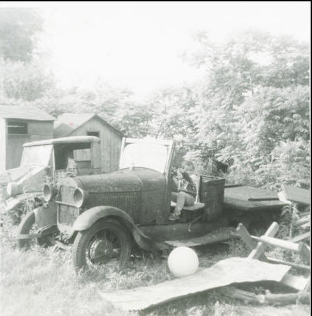
"Mark Ribble circa 1966 sitting in the 1927 Model A that was used by Ribble & Grubb Fisheries for tarring nets. The fishery property was located about 300 metres south of the Boardwalk on the same side of the road. "
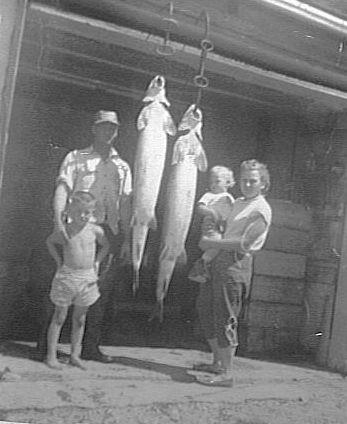
This would have been located just inside the gates on the lake side of the road, probably just before where the parking lot/orientation display is now.
Photo and Description © Mark Ribble
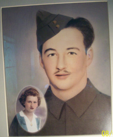
Carl and Betty Ribble
[Editor's Note: Mark's description of fishery activities, tar vat et al,
at R&G Fishery is identical to Krause Fishery activities while my family fished
out of Point Pelee]
Memories of tar and tar dust
As with most people of my generation, I remember during my early years, wondering aloud what life would be like as an adult, what the year 2000 would bring and what I’d be doing when I was 50 years old.
That seemed like a lifetime ago, and it practically was.
As a kid, I’d spend my summers running around bare - foot at our place at Point Pelee with friends Steven Mail - loux and Jimmy Reid, who both came from Windsor to spend the summers at cottages that were on our property.
Danielle Mellian lived next door. Her and I used to talk about what we wanted to be when we grew up. I think she wanted to be a nurse.
Although it seemed a foregone conclusion that I was going to be a fisherman, it never did materialize. I worked a couple of summers at Krause Fisheries [then no longer at Point Pelee but operating out of nearby Sturgeon Creek] in the late seventies, but that didn’t turn into a career for me.
I had this interest in being a fireman early on, which was spurred by our occasional make-believe games on the R&G Fishery property.
Behind the fishery’s main building, which we referred to as the ‘Fish House’, was a pile of rubber boots, rubber raincoats and rain hats that somewhat resembled fireman’s gear. It was actually the rain gear that my dad and his crew wore during inclement weather on good old Lake Erie.
We’d often find an old hose and pretend we were put - ting out fires around the ‘tar vat’ which sat behind the fish house.
The tar vat was a very interesting piece of history itself.
Nowadays, you wouldn’t be able to store tar anywhere in the open, without having a fence around it and umpteen dozen padlocks on the fence. There would be WHMIS sheets everywhere.
Back then, the large square metal container sat right out in the open and held hundreds of gallons of black tar that could be heated into a bubbling liquid.
The fishing trap nets were tarred every year to prevent them rotting from being in the lake for the whole season.
Two or three days before the tarring was to take place, the heater was turned on, which transformed the vat of solid black into hot liquid tar.
I still remember the smell and can’t pass by a road paving crew today without inhaling a nose full and reminiscing about the smell that I always considered one of the more favourable smells from my childhood.
It sure beat the heck out of fish guts and muskrat pelts, which were common smells of my childhood.
On tarring day, us kids would gather around to watch the guys do their magic with the tar. One-by-one, the nets were loaded onto a pallet-like platform and lowered from an overhead winch and pulley into the vat of hot tar.
I can’t remember how long they left them in there but it was fun to watch them lift the nets out of the tar and load them onto the back of the old Model A.
From there, the Model A drove slowly up and down the open grass field as two or three men walked behind pull - ing the net off the back so it would lie evenly on the grass. Memories of tar and tar dust (Continued on Page 10)
Memories of tar and tar dust (Continued from Page 4)
After the fishing season was over in the fall, the nets were ‘pulled’ and brought into the ‘twine shanty’ for repairs. A small crew stayed on for the winter months to mend the nets by hand with a spool of nylon twine in one hand and a plastic or wooden twine needle in the other.
The smell of tar dust filled the air and your nostrils. After you were in there for a few hours, you’d blow your nose and all of that black dust would come out onto the Kleenex, or in those days, your handkerchief.
I’m surprised we all survived that but we did.
The bounty of Lake Erie back then usually included yellow perch, pickerel, silver bass, carp, sheephead and mullets (suckers) with plenty of catfish thrown in.
They threw back the garbage fish, the ones my dad called sawbellies and ale - wives.
Although I didn’t often get to tag along on the fishing boat, I did go out a few times on nice days. Being the youngest child, I came along toward the end of my dad’s active fishing career.
However, I learned a lot about hard work, the lake and its fish.
As a kid, I could tell you what a Buffalo Carp looked like and if someone asked me to describe a mud-pout, I could do that. I can still look at a catfish and tell you if it is a channel cat or a bullhead.
In the spring, the smelters would arrive at the park in droves, armed with seine nets of all kinds, waders and tin garbage cans.
It took just a few dips along the shore to get those cans teeming with the silvery Lake Erie delicacies.
We would stay open late at R&G Fishery to sell smelt to those who were unlucky or too impatient to wait for a spot on the beach to open up.
We sold smelt ‘on the whole’ or dressed, late into the evening, as long as cars were still driving in and out of the park.
It was all part of life, growing up ‘Pelee’.
All of this is stuff that I miss when I think of my childhood. I’m sure we all have fond memories of the things we used to do as a kid.
Our kids and grandkids will have memories to pass on as well. They won’t be memories of tar dust or smelt fishing, but they will be memories nonetheless.
Mark Ribble, Rib's ramblings, "Memories of tar and tar dust" in http://www.southpointsun.ca/images/sun_web_august_5.pdf - August 5, 2015, pp. 4. 10
At one time, Krause Fisheries and R&G Fishery operated close to each other just south of the Marsh Boardwalk.
R&G built a retail store and twine shanty about 200 metres south of the Boardwalk on the same side, while Krause Fisheries operated on the lake side of the road, launching their boats from the beach, a little further south of R&G ...
Southpoint Sun, February 5, 2025, p. 16
https://issuu.com/southpointsun/docs/southpoint_sun_-_february_5_2025
ROBSON ?
1901
The 1901 Census, Sub district Mersea, Essex (South/Sud), Ontario, District 60, Subdistrict Number: K-1:
Inice Robson, fisherman, p. 16
[Source: http://www.collectionscanada.gc.ca/databases/census-1901/index-e.html . See also: http://automatedgenealogy.com/census/District.jsp?id=60 ]
SETTERINGTON AND CAMPBELL
FISHERYThe fishermen of Point Pelee started operations last week in the Setterington and Campbell Fishery.
http://ink.ourontario.ca/browse/lp -Leamington Post, March 1, 1917, p. 2
SID TILBURY AND SMITH
Karl Rudy Krause recalls that his father first purchased the license of McLellan and then further north that of Sid Tilbury where they operated their Fishery until 1969.
Edwin HAROLD Stockton (January 26, 1917 - , who did a lot of work for Krause Fisheries) of Wheatley (The Meadows of Wheatley - 2009) recalls that the owners were Tilbury and Smith
1901
In 1901, a home child, named Sidney Tilbury, age 10, arrived in Dr. Barnardo's party, in Quebec. Accordingly, 239 went to Toronto, 68 went to Winnipeg, 20 went to Russell, Manitoba and 3 went to Peterborough, Ontario.
Sidney TILBURY (52468)
Given Name(s): Sidney
Surname: TILBURY
Gender: M
Age: 10
Year of Arrival: 1901
Ship: NUMIDIAN
Date of Departure: 1901-07-18
Date of Arrival: 1901-07-20
Port of Arrival: Quebec
Party: Barnardo Homes
Children travelling together: Q01AS
Type of Records: Passenger Lists
Microfilm Reel Number: T-480
Reference: RG 76 C1a
Source: Library and Archives Canada
Database Item Number:
52468
LIST OF CHILDREN WHO ARRIVED IN 1901 .... (NAMES FROM THE LAC DATABASE) ... Sidney TILBURY Numidian 912 ...
1904
Sidney Tilbury attended S.S. 9, South Gosfield School in 1904 - Grade Three
http://ink.ourontario.ca/wer - The Windsor Evening Record. March 4, 1904 - Page: 6
1911
Sidney Tilbury, age 17, according to the 1911 Census was living with the Thomas Wigle family in Essex South, 17 Gosfield South, was single, a Thomas John Barnardo Home Boy, from England, born in July 1893 who arrived in 1902 and was a laborer.
1921
1931
(Tilbury was not a fisherman at this time)
Name Sidney Gilberg [Sic Sidney Tilbury]; Gender Male; Marital Status Married; Age 39 according to the 1931 Census,; Estimated Birth Year abt 1892; Residence Date 1931; Home in 1931 Kingsville, Ontario; Canada Relation to Head Head; Can Speak English Yes; Can Speak French No; Can Read and Write Read and Write; Class of Worker Own account/Employé à salaire ou gages; Enumeration District Essex South; Sub-District Number 0045 - Kingsville (Town); Home Ownership Owned; Materials of Construction Wood; Owned Radio Yes; Household Members: Sidney Gilberg [Tilbury], 39, Head; Grace Gilberg [Grace Tilbury], 33, Wife; Elda Gilberg [Elda Tilbury], 7, Daughter
c. 1938-1939
"Tilbery Fish[ery]"
1941
JUNE 12
Tilbury Fishery ....
http://ink.ourontario.ca/browse/lp -Leamington Post, June 12, 1941, p. 18 [Actually January 16, 1941, p. 11]
-------------------------------
1955
OCTOBER 25
Mr. and Mrs. H. E. Tilbury, Patricia St., who visited their niece, Miss Elda Tilbury, in Toronto, friends in Windsor, Ont., and Mr. and Mrs. Sidney Tilbury, in Kingsville, Ont., during a three weeks’ vacation, have returned to their home on Patricia St.
https://numerique.banq.qc.ca/patrimoine/details/52327/2994613 - Sherbrooke Daily Record, October 25, 1955 - Page 8
1957
JUNE 6
Sidney Tilbury lived in Kingsville, Ontario, in 1957 - http://ink.ourontario.ca/kr -The Kingsville Reporter. June 6, 1957 - Page: 8
-------------------------------
1963
FEBRUARY 7
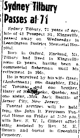
Sydney Tilbury of Kingsville - Commercial Fisherman until his retirement in 19[50?]
http://ink.ourontario.ca/kr -The Kingsville Reporter. February 7, 1963 - Page: 1
GEORGE YOUNG
Young ...
[Henrietta O'Neill, In Search of a Heart (Friends of Point Pelee, 2000), pp. 45-48]
Young, George http://automatedgenealogy.com/census11/SplitView.jsp?id=89087&frag=e080/e001985792&dir=1911a - 1911 Census
Lot 9, Point Pelee, farmer
INICE WILKINSON
1901
The 1901 Census, Sub district Mersea, Essex (South/Sud), Ontario, District 60, Subdistrict Number: K-1:
Inice Wilkinson, fisherman, p. 16
[Source: http://www.collectionscanada.gc.ca/databases/census-1901/index-e.html . See also: http://automatedgenealogy.com/census/District.jsp?id=60 ]
JOS. WRIGGLESWORTH
1910
JULY 28
Jos. Wrigglesworth got four [sturgeons] one day last week,
each of which is worth a lot of money ....
http://ink.ourontario.ca/browse/lp -Leamington Post, July 28, 1910, p. 1
MERSEA TOWNSHIP FISHERMAN
1851/1852
1851 Census or 1852 Census
Province of Canada
Mersea Township Fishermen
No Fishermen Were Noted Even For Point Pelee
https://www.bac-lac.gc.ca/eng/census/1851/Pages/1851.aspx
http://automatedgenealogy.com/census52/index.jsp?locale=en
http://automatedgenealogy.com/census52/Pages.jsp?sdid=86
https://search.ancestry.com/search/db.aspx?dbid=1851canada
Point Pelee
==

http://data2.collectionscanada.gc.ca/e/e094/e002347808.jpg - Pg. 41
==
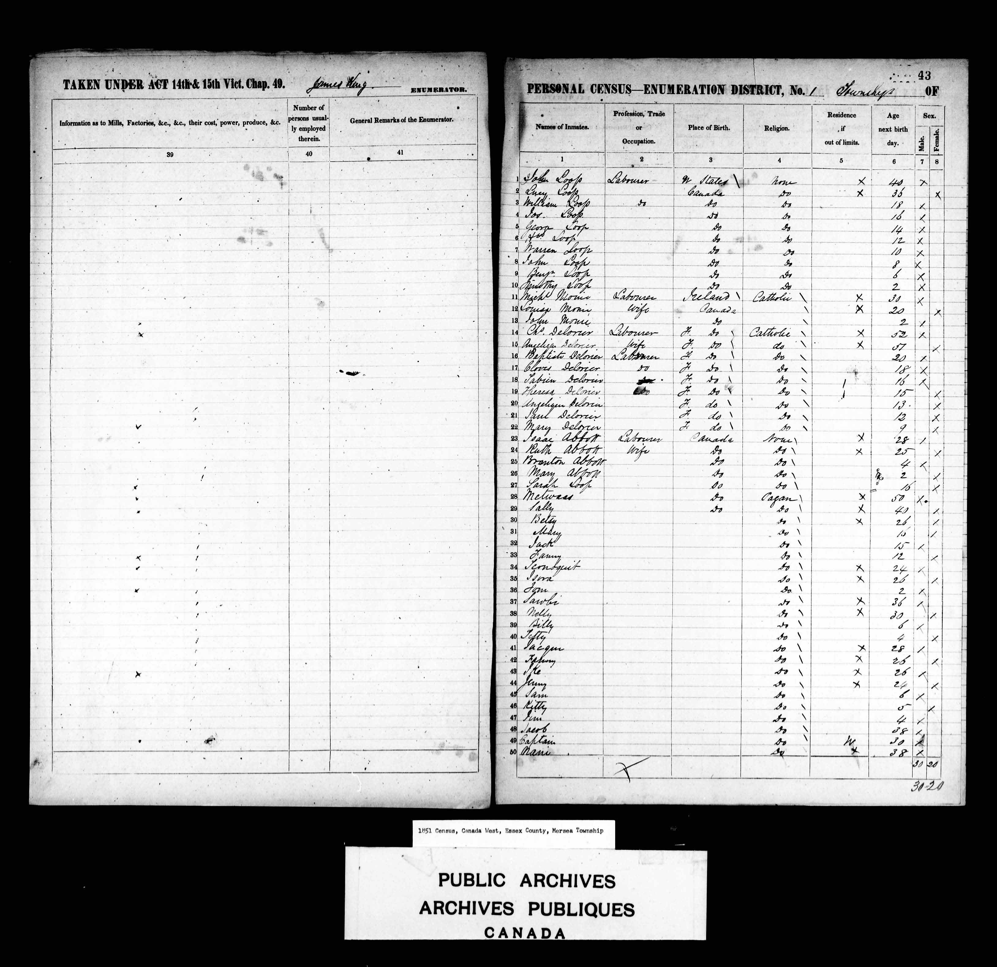
http://data2.collectionscanada.gc.ca/e/e094/e002347810.jpg - Pg. 43
-------------------------------------------------------------------------
1861
1861
CensusMersea Township Fishermen - Enumeration District No. 1
Apparently No Fishermen Were Noted
https://www.bac-lac.gc.ca/eng/census/1861/Pages/1861.aspx
https://search.ancestry.com/search/db.aspx?dbid=1861canada
https://www.familysearch.org/search/collection/1460164
Point Pelee
==
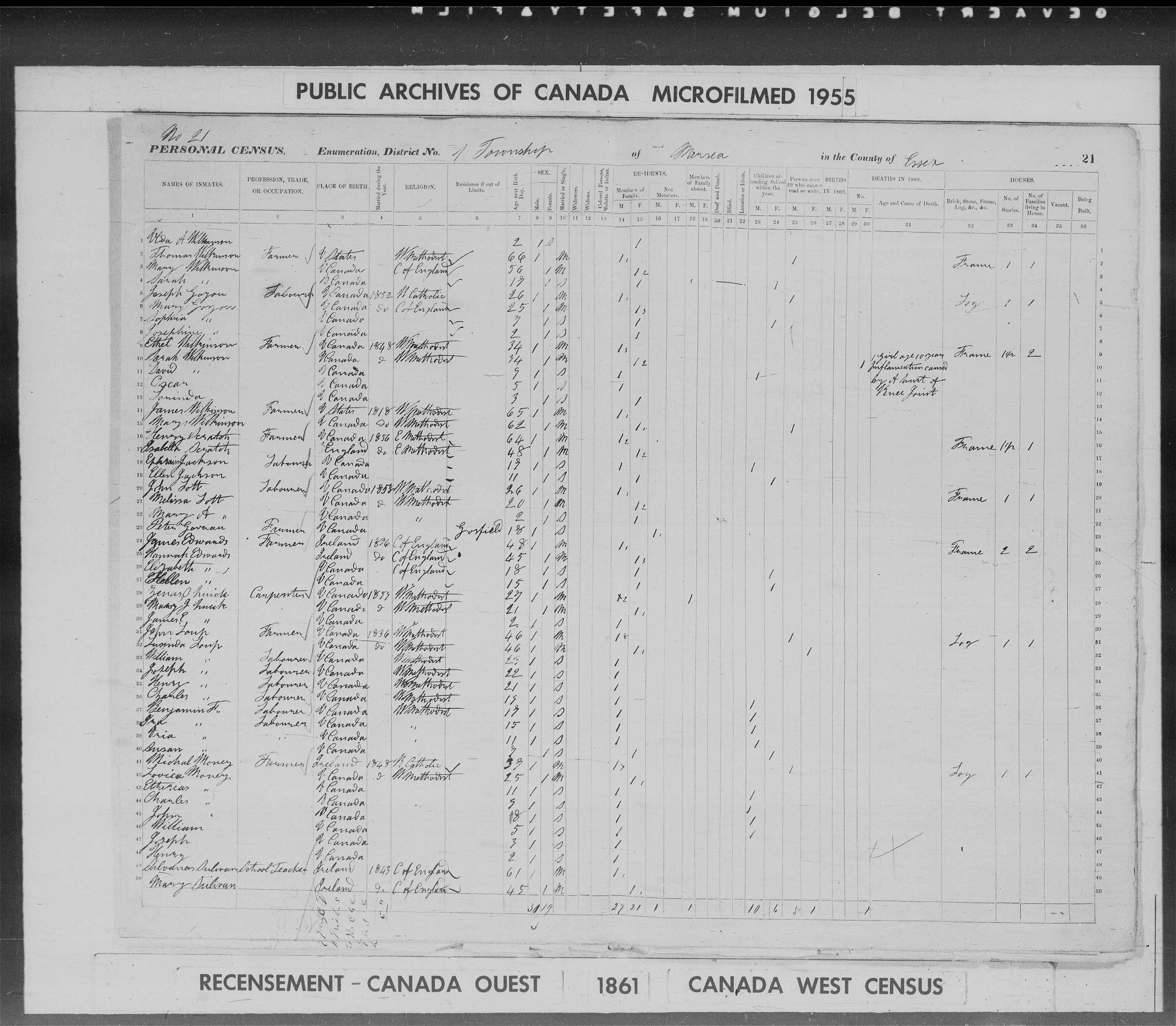
http://data2.collectionscanada.gc.ca/1861/jpg/4107404_00517.jpg - Pg. 21
==
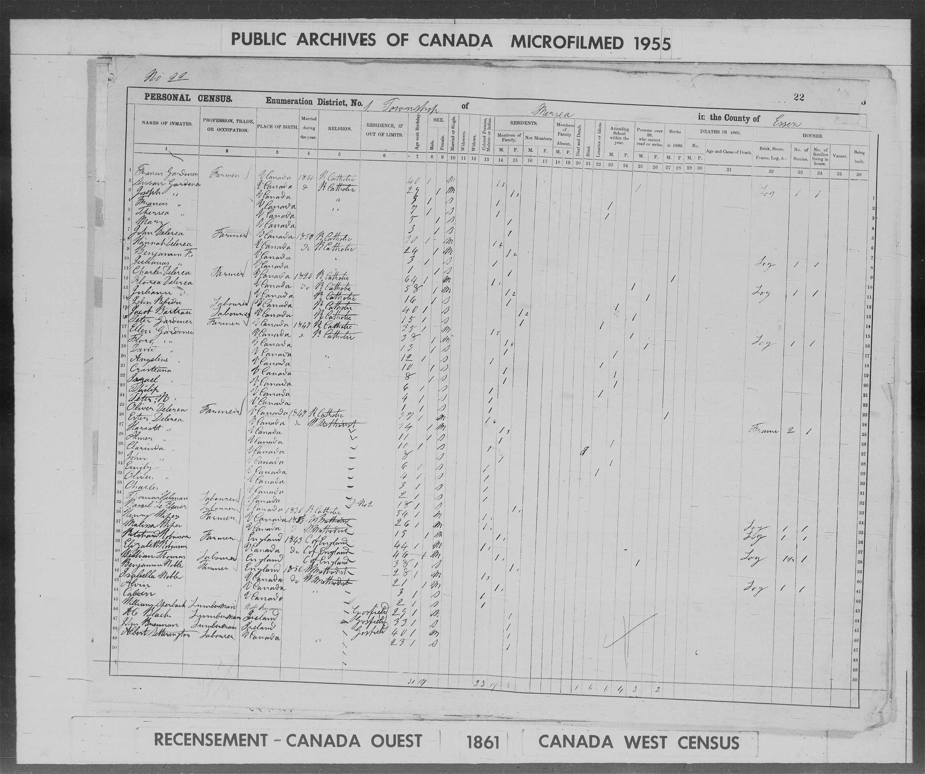
http://data2.collectionscanada.gc.ca/1861/jpg/4107404_00519.jpg - Pg. 22
-------------------------------------------------------------------------
1871
[Includes Point Pelee]
"Fisherman"
==
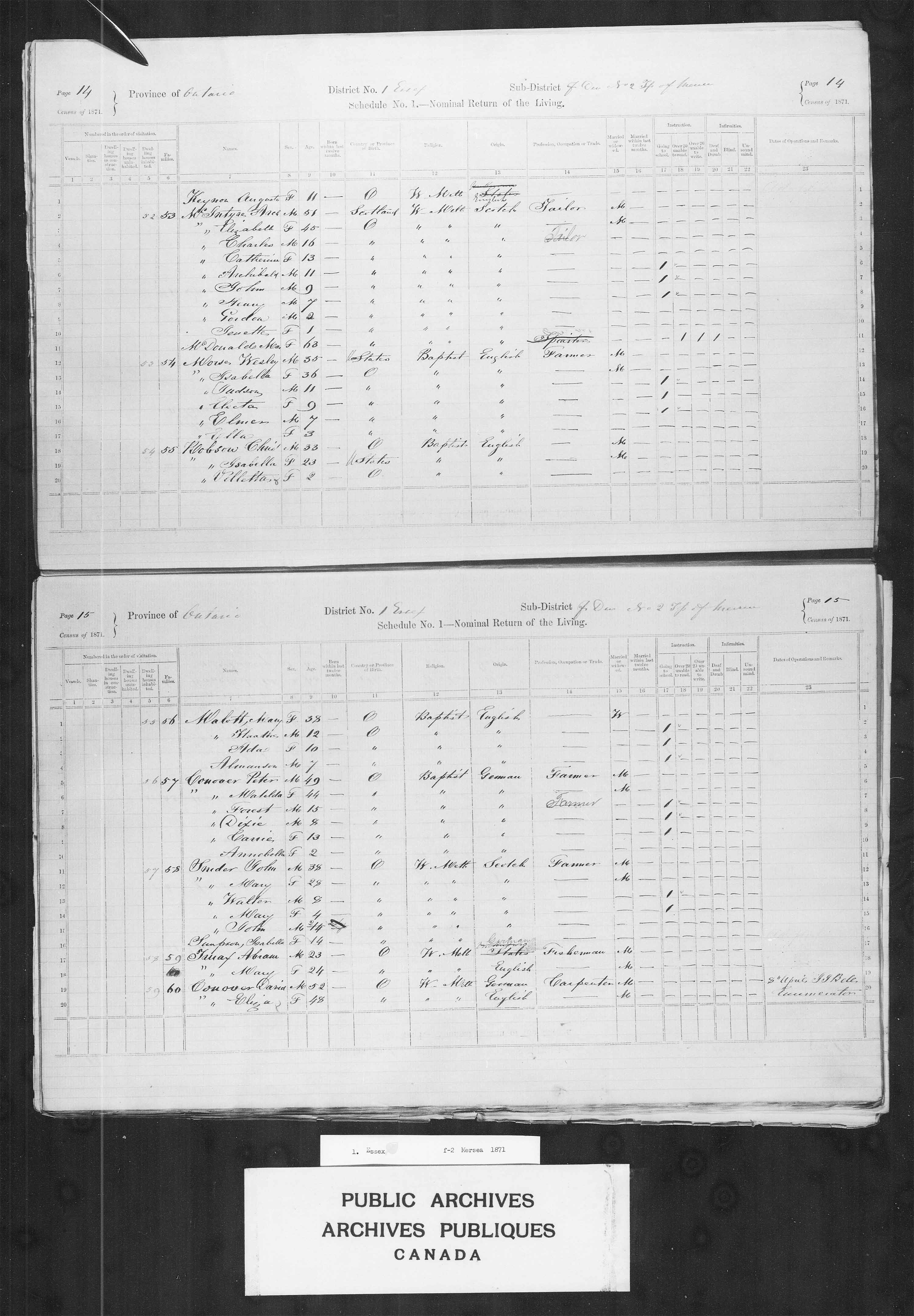
TRUAX, ABRAM, Age: 23 | Birth place: Ontario - District: ESSEX (001), Sub-district: Mersea (F), Division: 2, Page: 15
==

BRYDGES, WILLIAM, Age: 30 | Birth place: Ontario - District: ESSEX (001), Sub-district: Mersea (F), Division: 2, Page: 75
==
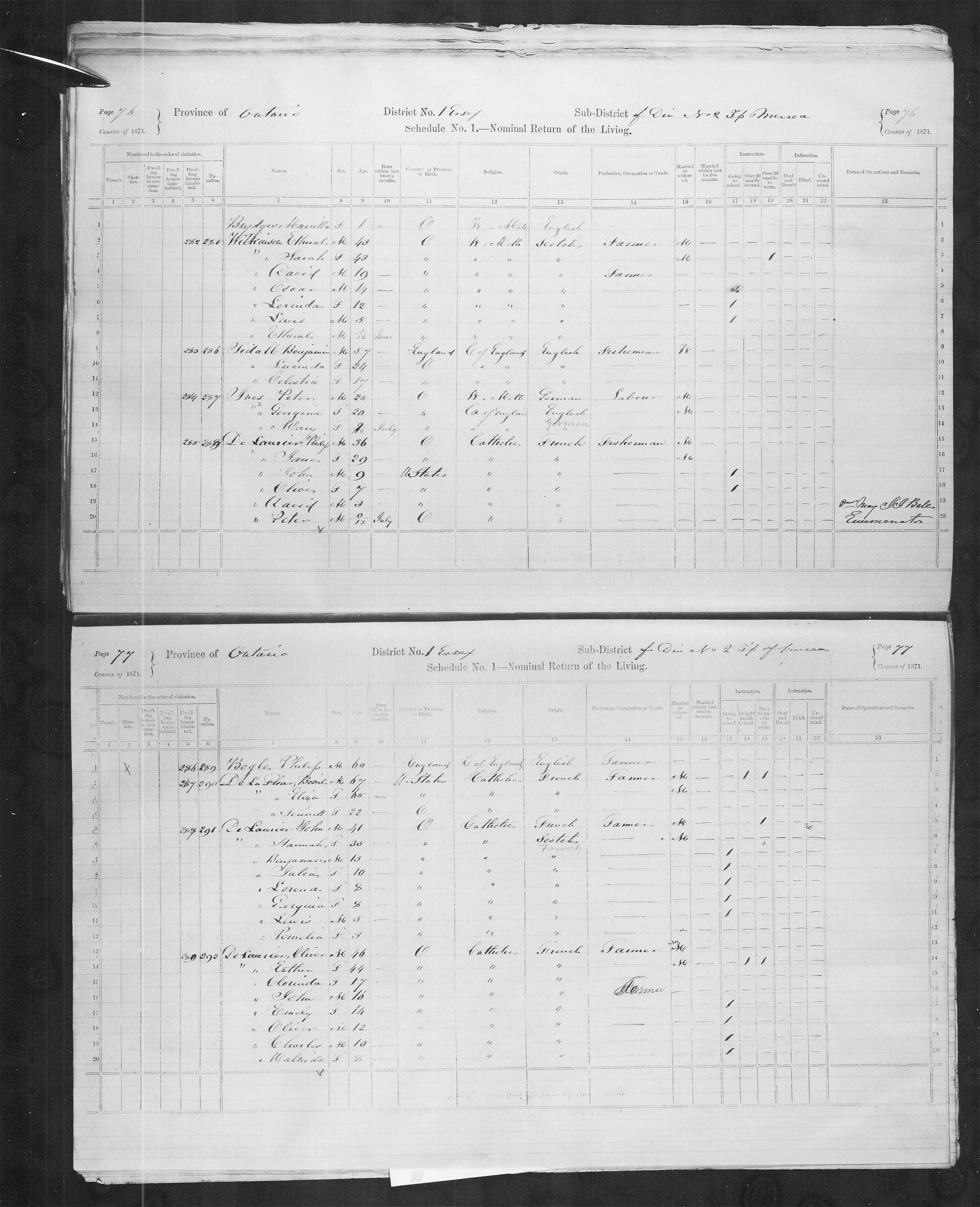
SIDALL, BENJAMIN, Age: 57 | Birth place: ENGLAND - District: ESSEX (001), Sub-district: Mersea (F), Division: 2, Page: 76
DE LAURIER, PHILIP, Age: 36 | Birth place: .... - District: ESSEX (001), Sub-district: Mersea (F), Division: 2, Page: 76
==
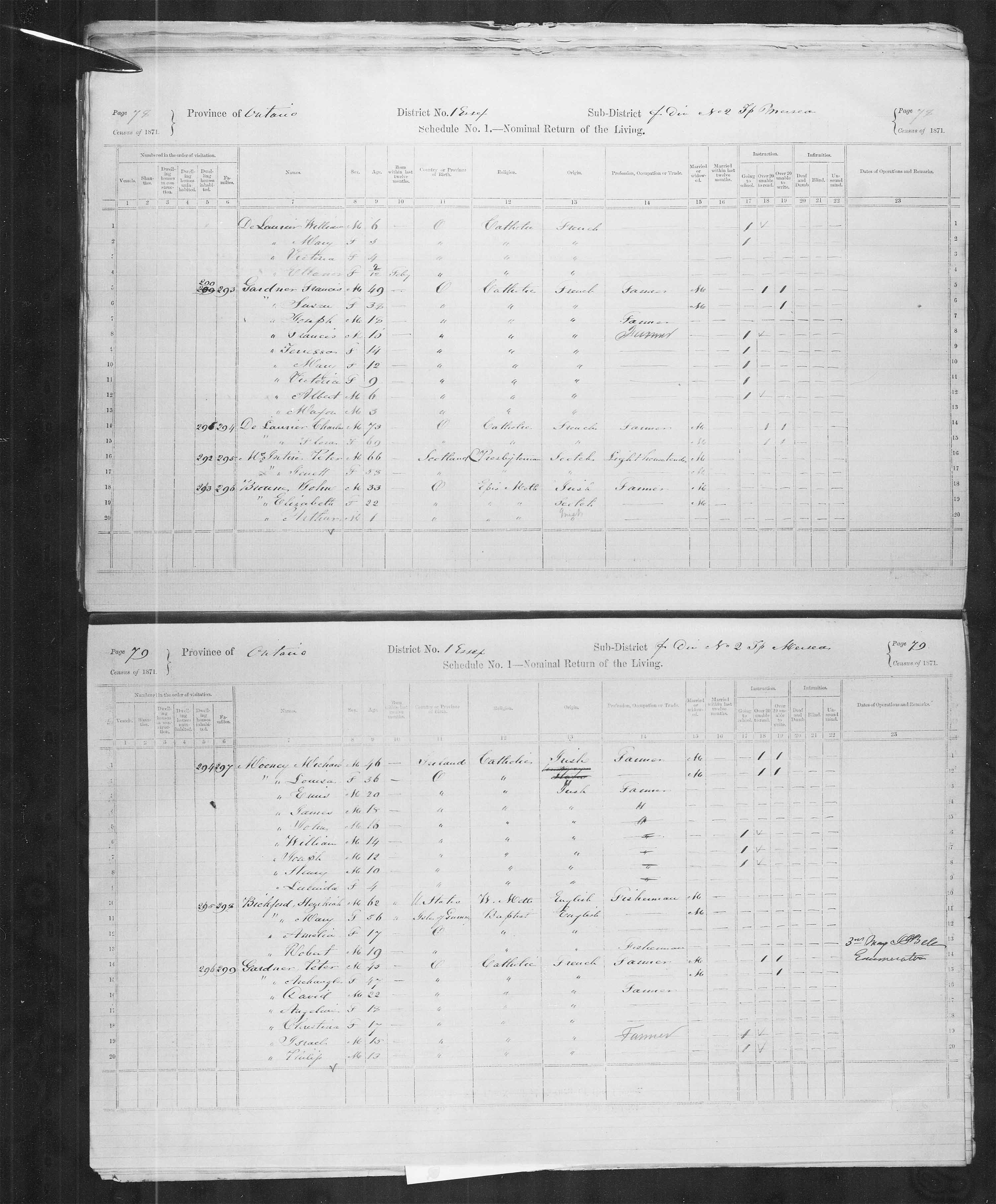
BICKFORD, HEZIKIAH, Age: 62 | Birth place: USA - District: ESSEX (001), Sub-district: Mersea (F), Division: 2, Page: 79 [HEZEKIAH BICKFORD]
BICKFORD, ROBERT, Age 19
==
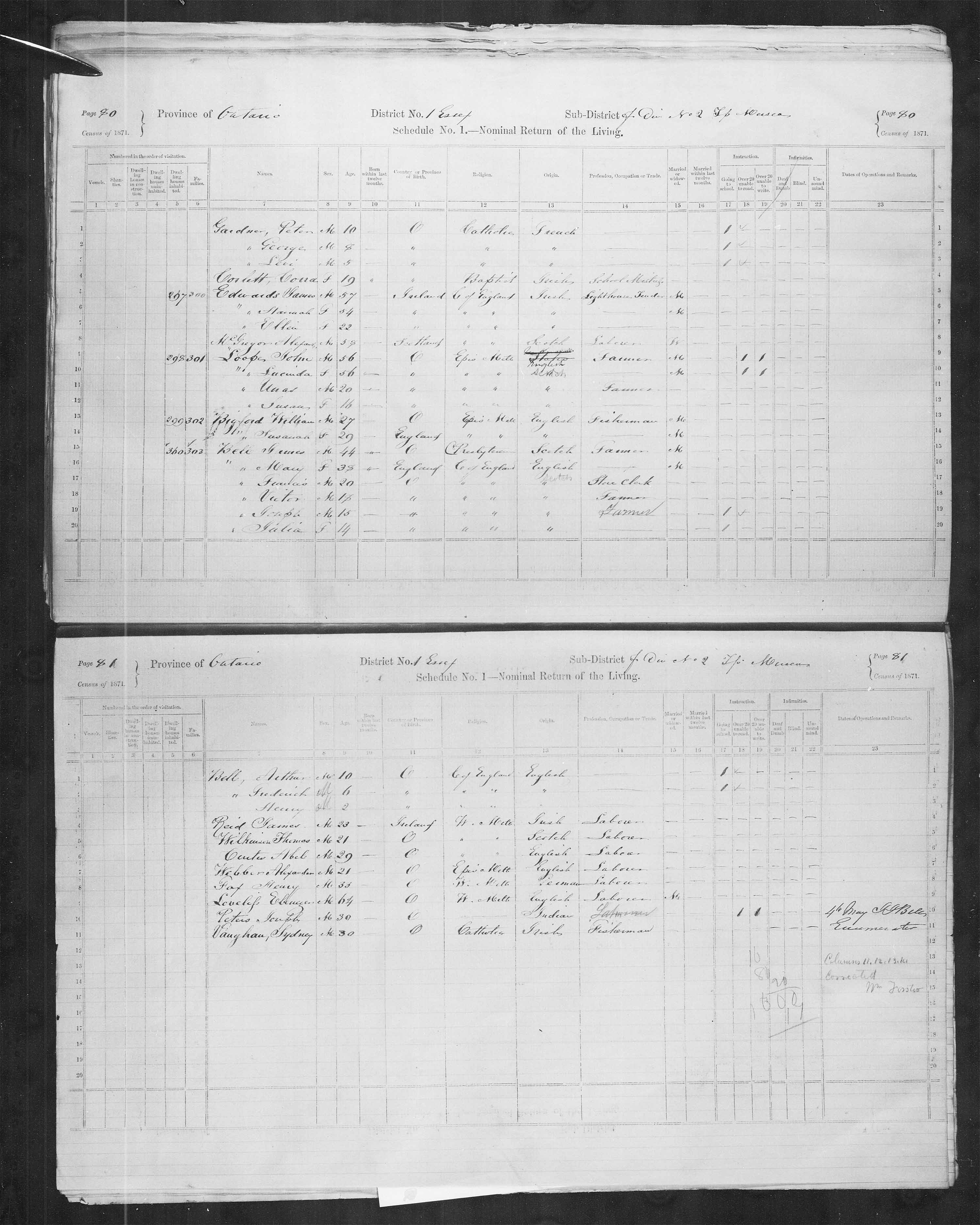
BIGFORD, WILLIAM, Age: 27 | Birth place: Ontario - District: ESSEX (001), Sub-district: Mersea (F), Division: 2, Page: 80
VAUGHAN, SYDNEY, Age: 30 | Birth place: Ontario - District: ESSEX (001), Sub-district: Mersea (F) Division: 2, Page: 81
-------------------------------------------------------------------------
1881
"Fisherman"
==
Askins, Wm. 40 Ontario Essex (181) Mersea (H) p. 53
==
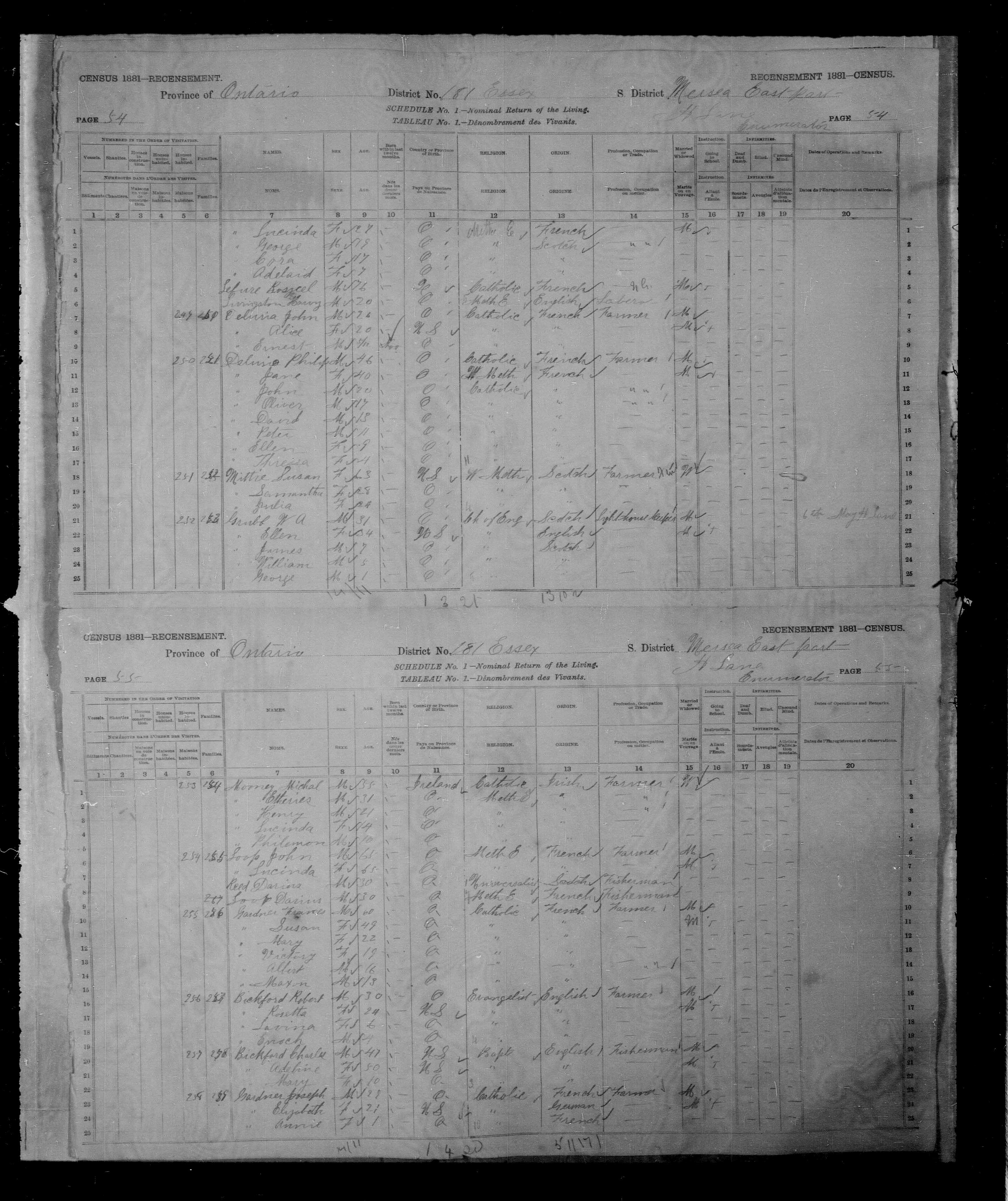
Askins, George 19 Ontario Essex (181) Mersea (H) p. 54
Reed, Darius 30 Ontario Essex (181) Mersea (H) p. 55
Loop, Darius 30 Ontario Essex (181) Mersea (H) p. 55
Bickford, Charles 47 Ontario Essex (181) Mersea (H) p. 55
==
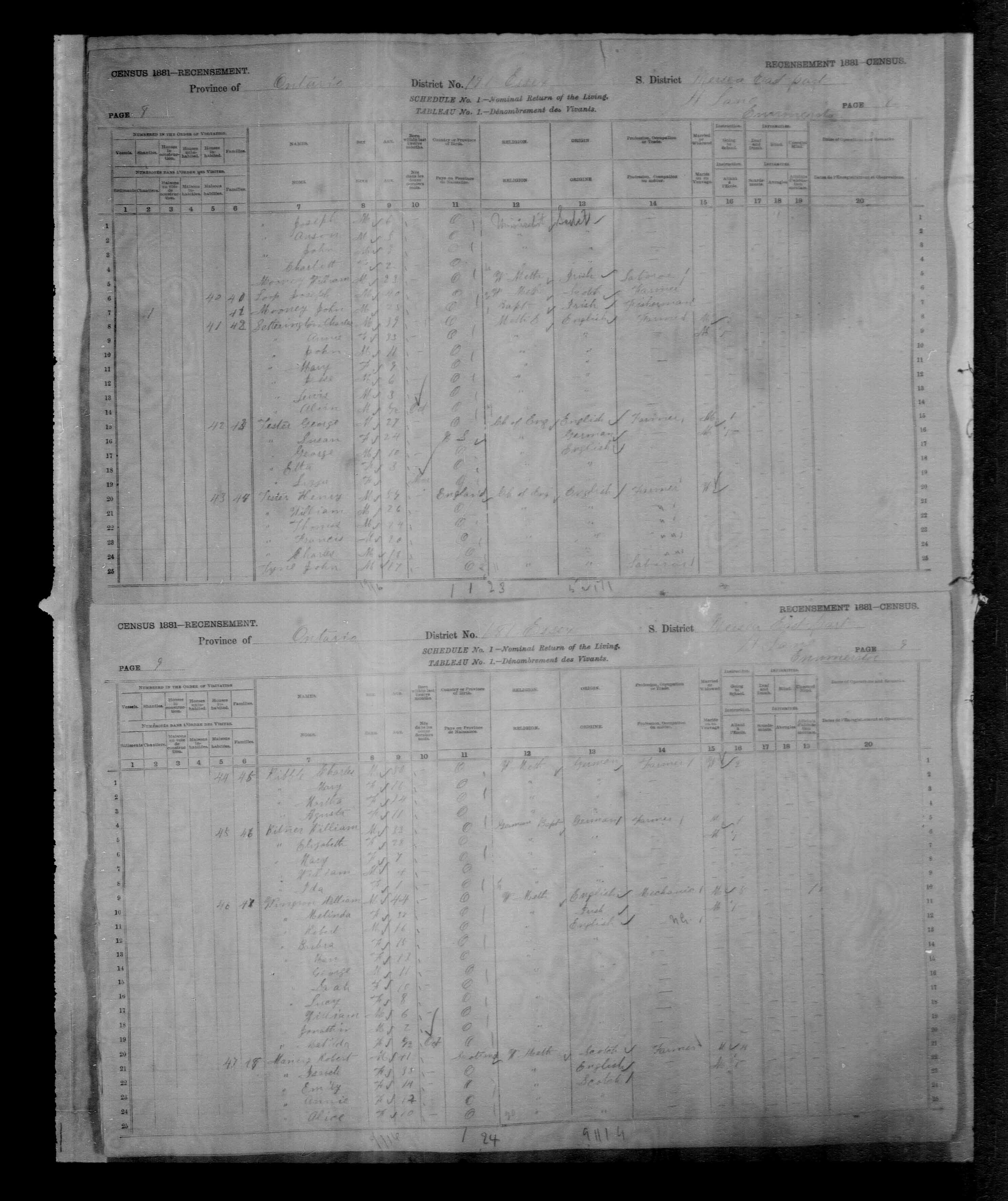
Mooney, John 25 Ontario Essex (181) Mersea (H) p. 8
https://search.ancestry.com/search/db.aspx?dbid=1881canada
https://www.familysearch.org/search/collection/1804541
-------------------------------------------------------------------------
1881
Some Mersea Township Fishermen
[
Includes Point Pelee]==
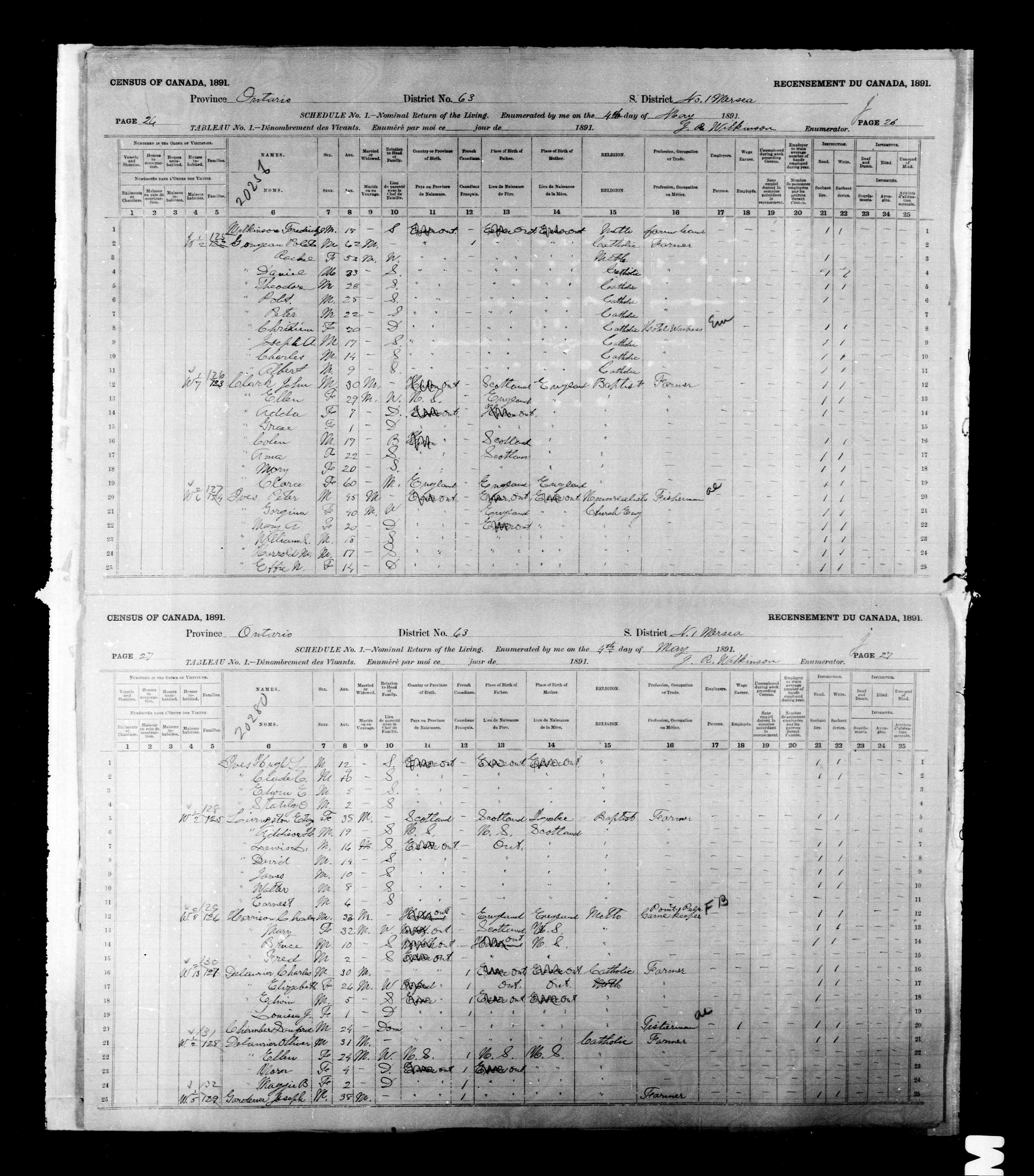
Peter Ives,
Gorgina Ives
http://central.bac-lac.gc.ca/.item/?app=Census1891&op=img&id=30953_148138-00136 - Pg. 26
==
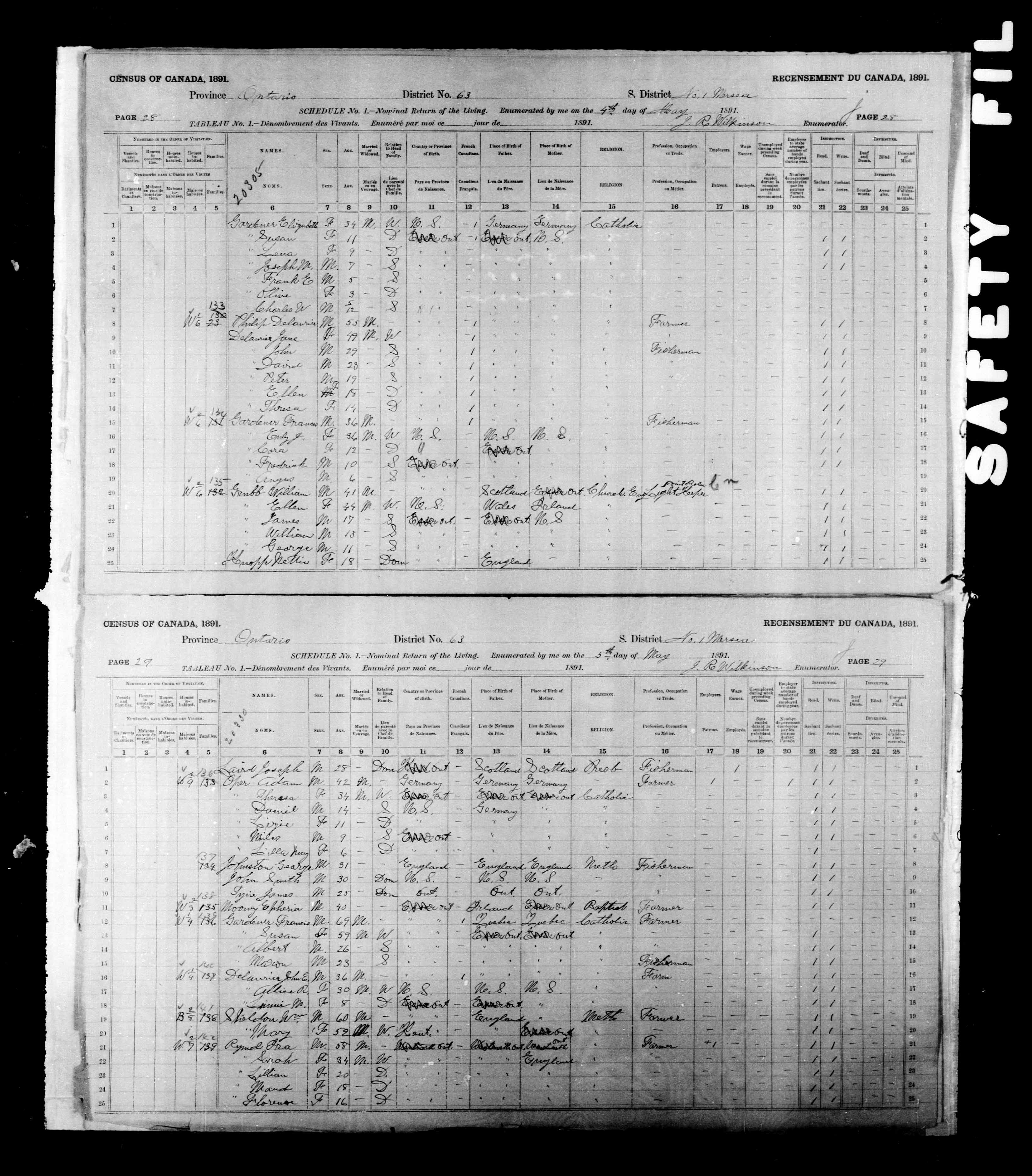
John Delaurier
David Delaurier
Peter Delaurier
Francis Gardener
Enly J Gardener
==
Joseph Laird
George Johnston
John Smith
Tyire James
Marion Gardener
http://central.bac-lac.gc.ca/.item/?app=Census1891&op=img&id=30953_148138-00137 - Pg. 29
https://www.bac-lac.gc.ca/eng/census/1891/Pages/1891.aspx
-------------------------------------------------------------------------
TURN OF THE CENTURY
The turn of the century found many area men [most mentioned here in this list were from Kent County] engaged in commercial fishing. They were, George and Enoch Mclean, T. H. Maxwell, Isaac Shaw, Alex Christie, N. Coles, F. D. (Daddy) Smith, W. J . Dawson, Chas. Healey, J . Conway, the Lamarsh Bros. , Josh Liddle, Thos. Mill,. John and Willis Curtis, H. Long, Sam and Hez Bickford and Moody and Coulson. ....
Rita Lobzun [Karen Adamson-Editor], Open Books, A Historical Sketch of Commercial Fishing in Wheatley - Ontario, After 1980, p. 2. - http://images.ourontario.ca/Partners/CKPL/CKPL0027490551T.PDF
_______________________
1901
Mersea Township Fishermen
[
Includes Point Pelee]==
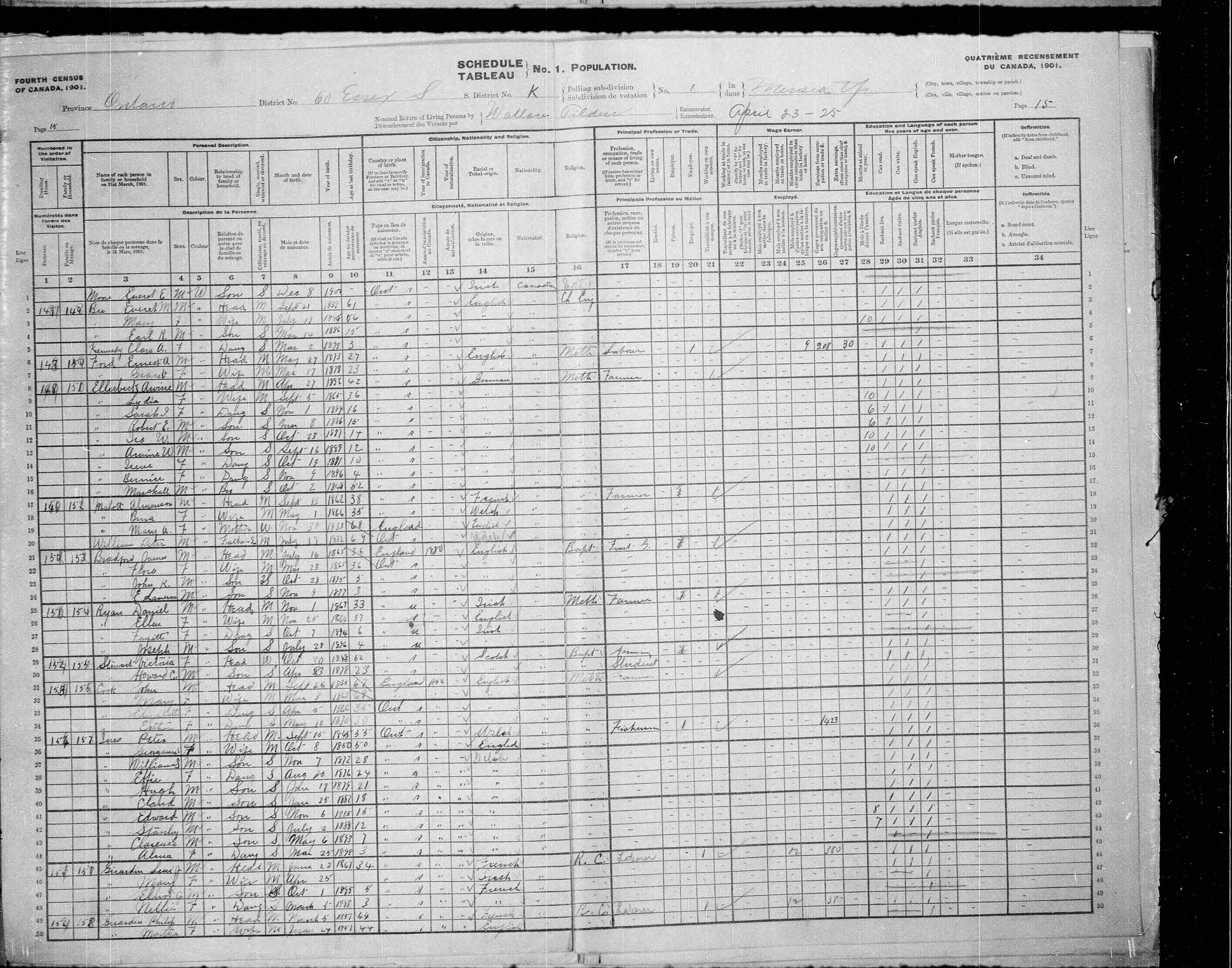
Peter Ives, Essex (south/sud), Ontario 1845
http://data2.collectionscanada.ca/1901/z/z002/jpg/z000061810.jpg - Pg. 15
==
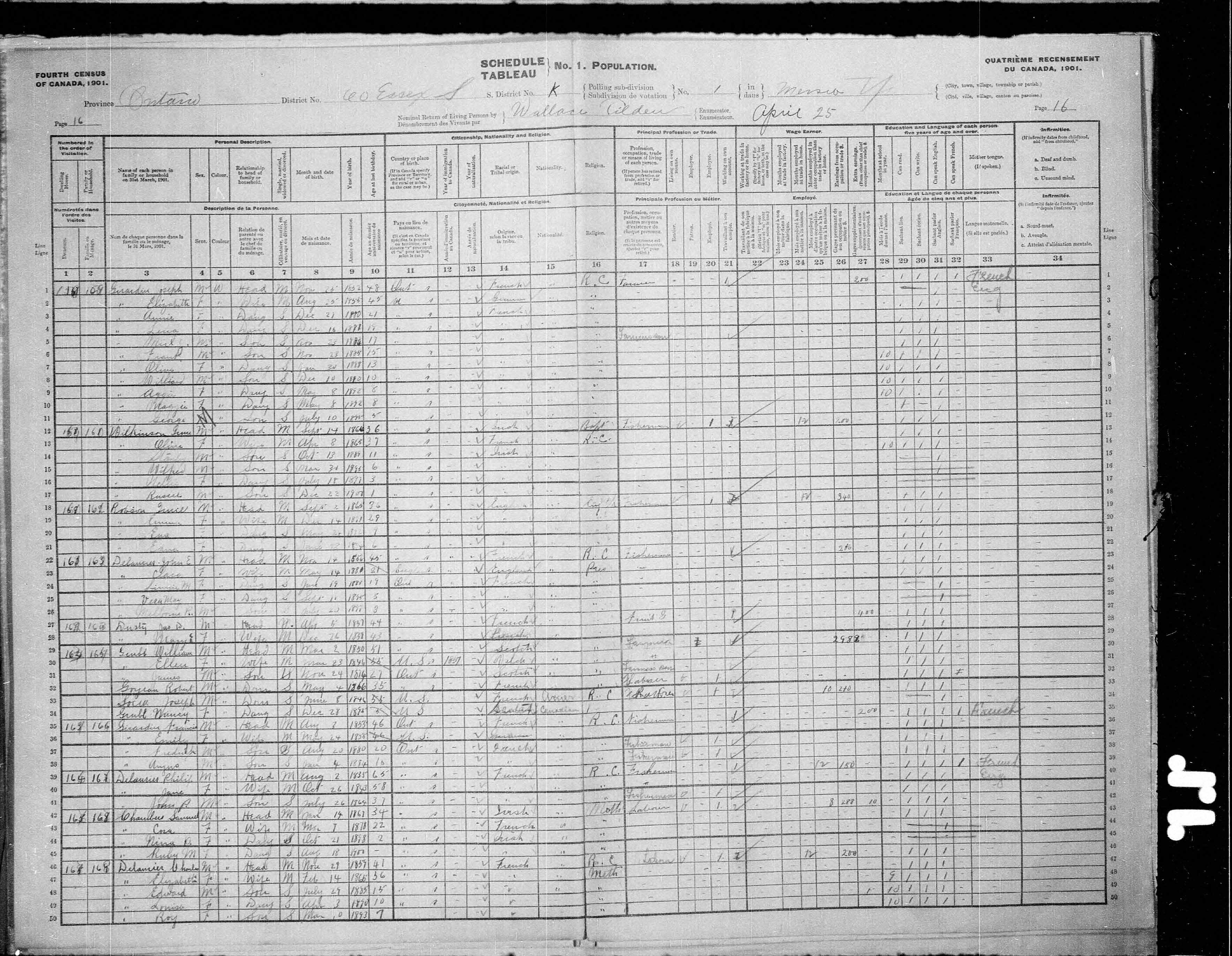
Grun Wilkinson, Mersea , Essex (south/sud), Ontario 1864
Guice Robson, Mersea , Essex (south/sud), Ontario 1865
John E Delaurier, Mersea , Essex (south/sud), Ontario 1855
Clara Delaurier, Essex (south/sud), Ontario 1880
Francis Girardin, Mersea, Essex (south/sud), Ontario 1855
Fredrick Girardin, Mersea , Essex (south/sud), Ontario 1880
Angus Girardin, Mersea , Essex (south/sud), Ontario 1884
Philip Delaurier, Mersea , Essex (south/sud), Ontario 1835
Jane Delaurier, Mersea , Essex (south/sud), Ontario 1843
John P. Delaurier Philip, Mersea , Essex (south/sud), Ontario 1864
==
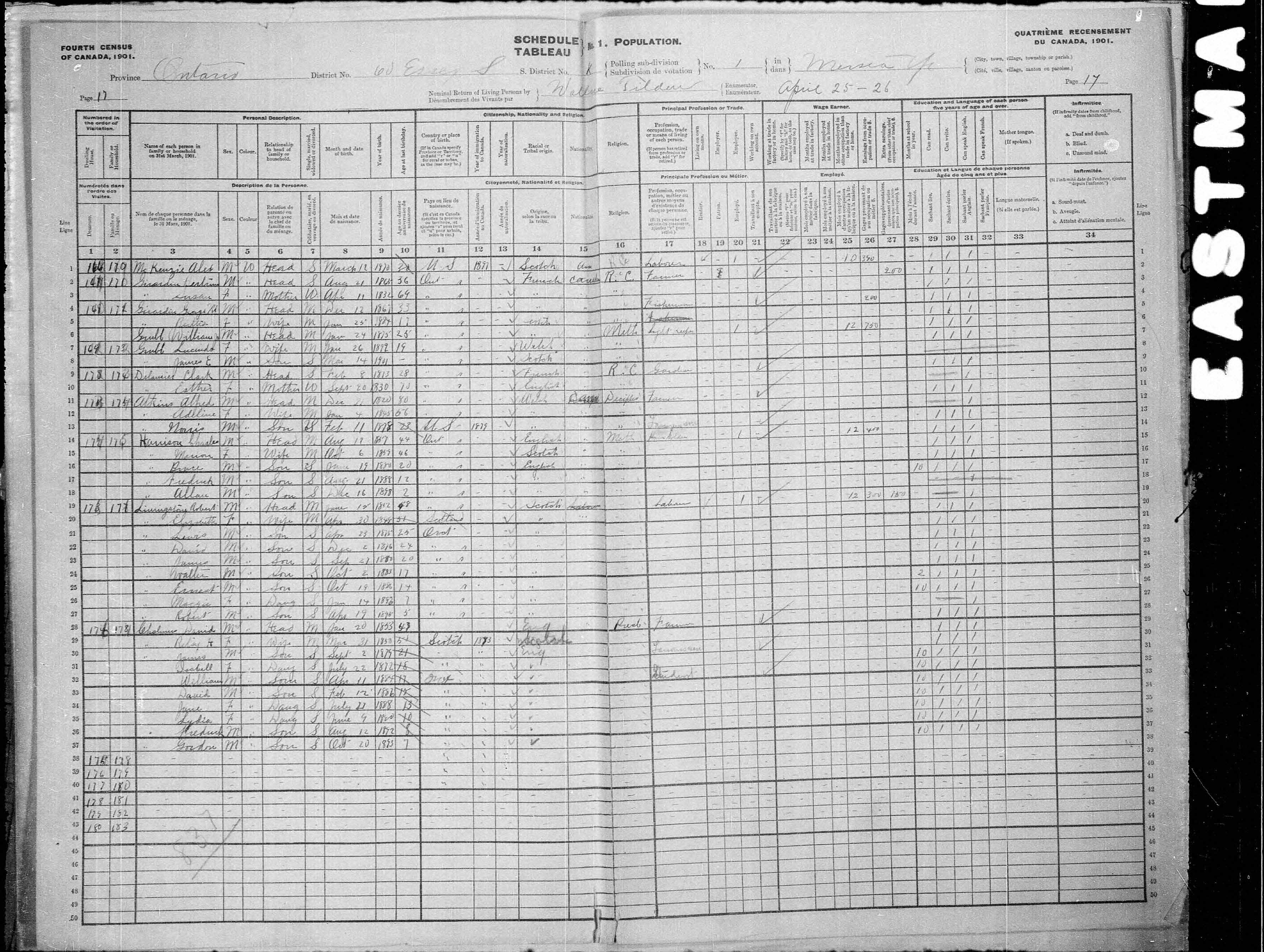
George M Girardin, Mersea, Essex (south/sud), Ontario 1867
==

Fred Johnson, Mersea , Essex (south/sud), Ontario 1865
==
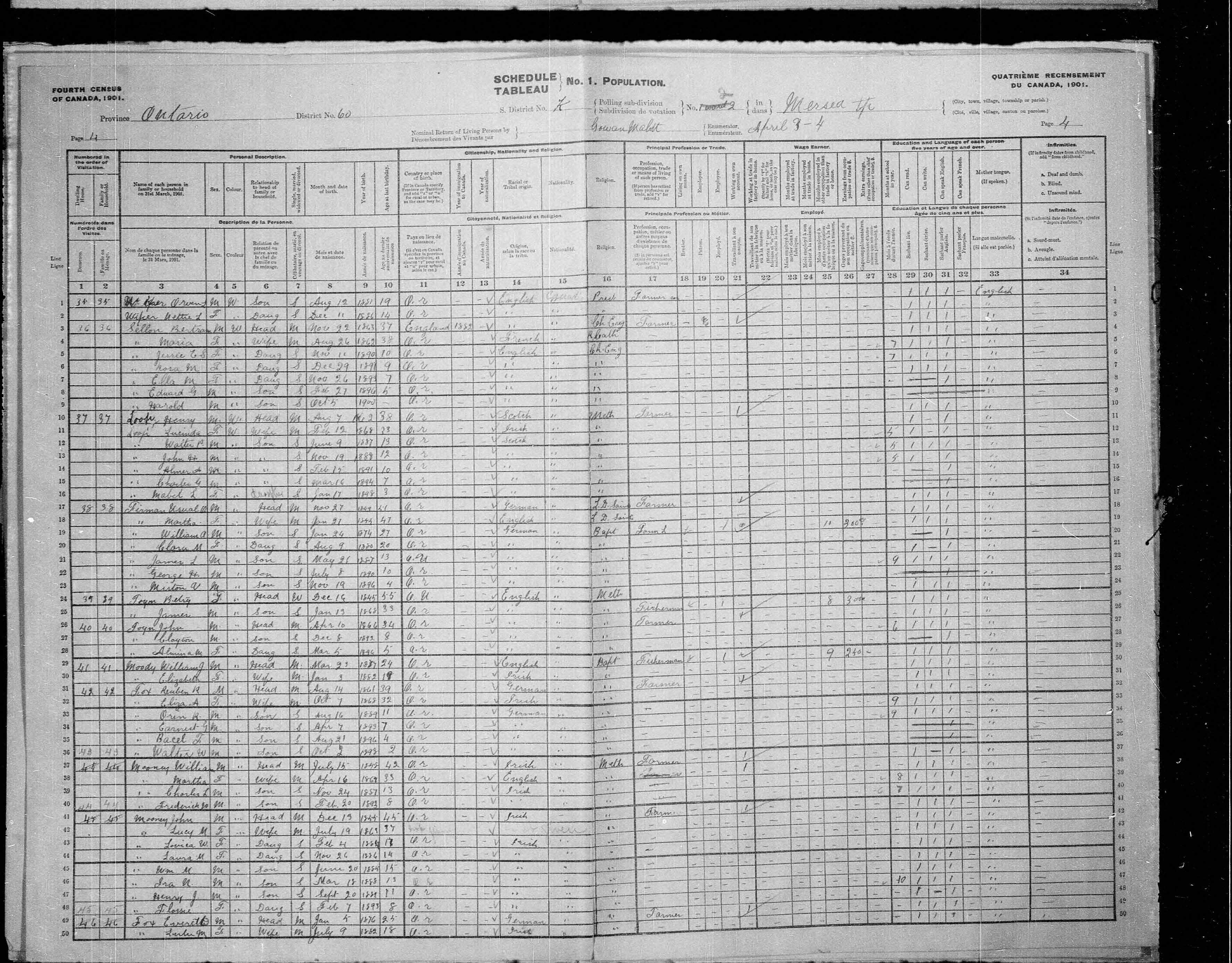
James Toyn, Mersea, Essex (south/sud), Ontario 1868
William J Moody, Mersea, Essex (south/sud), Ontario 1877
http://data2.collectionscanada.ca/1901/z/z002/jpg/z000061821.jpg - Pg. 3
https://www.bac-lac.gc.ca/eng/census/1901/Pages/1901.aspx
https://search.ancestry.ca/search/db.aspx?dbid=1901canada
https://www.familysearch.org/search/collection/1584557
-------------------------------------------------------------------------
1911CanadaCensus-e001985791.pdf - Pg. 4
McMullin, Josiah
http://automatedgenealogy.com/census11/SplitView.jsp?id=89086
Province/Territory: Ontario, District Name: Essex
South, District Number: 68, Sub-district: Mersea,
Sub-district Number: 25 - Page 4 - Fishing - Appears
to be at Point Pelee
#004766-98 (Essex Co): Josiah
McMULLEN, 40, widower, farmer, Mersea twp., same,
s/o James & blank, married Eliza TILDEN, 39, Mersea
twp., same, d/o Charles TILDEN & Annie ROBERTSON,
witn: William TILDEN of Mersea twp & Mrs. A. TISDALE
of Kent Co., 20 April 1898 at Blythewood, Mersea twp
- http://homepages.rootsweb.ancestry.com/~maryc/essex98.htm
- 1869-1925 Ontario Archives, microfilm MS 932
Goyau, ?
http://automatedgenealogy.com/census11/SplitView.jsp?id=89086
Province/Territory: Ontario, District Name: Essex
South, District Number: 68, Sub-district: Mersea,
Sub-district Number: 25 - Page 4 - Fisherman - Was
living with McMullin, Josiah and identified as
fishing - Appears to be at Point Pelee
Atkins, Norris
http://automatedgenealogy.com/census11/SplitView.jsp?id=89086
Province/Territory: Ontario, District Name: Essex
South, District Number: 68, Sub-district: Mersea,
Sub-district Number: 25 - Page 4 - Fishing - Appears
to be at Point Pelee
Lees?, Stanley
http://automatedgenealogy.com/census11/SplitView.jsp?id=89086
- Fishing
Province/Territory: Ontario, District Name: Essex
South, District Number: 68, Sub-district: Mersea,
Sub-district Number: 25 - Page 4 - Fishing -
Appears to be at Point Pelee
==
1911CanadaCensus-e001985792.pdf - Pg. 25
Woollson? Frederick.
http://automatedgenealogy.com/census11/SplitView.jsp?id=89087
Province/Territory: Ontario, District Name: Essex
South, District Number: 68, Sub-district: Mersea,
Sub-district Number: 25 - Page 5 - Fishing
- Appears to be at Point Pelee
Surrens? Gordon
http://automatedgenealogy.com/census11/SplitView.jsp?id=89087
Province/Territory: Ontario, District Name: Essex
South, District Number: 68, Sub-district: Mersea,
Sub-district Number: 25 - Page 5 - Fisherman -
Appears to be at Point Pelee
Passmore John
http://automatedgenealogy.com/census11/SplitView.jsp?id=89087
Province/Territory: Ontario, District Name: Essex
South, District Number: 68, Sub-district: Mersea,
Sub-district Number: 25 - Page 5 - Fisherman -
Appears to be at Point Pelee
Murphy, John.
http://automatedgenealogy.com/census11/SplitView.jsp?id=89087
Province/Territory: Ontario, District Name: Essex
South, District Number: 68, Sub-district: Mersea,
Sub-district Number: 25 - Page 5 - Fishing - Living
with John Passmore - Appears to be at Point Pelee
Ainslie, Verne.
http://automatedgenealogy.com/census11/SplitView.jsp?id=89087
Province/Territory: Ontario, District Name: Essex
South, District Number: 68, Sub-district: Mersea,
Sub-district Number: 25 - Page 5 - Fishing - Appears
to be at Point Pelee
Livingston, Frederick
http://automatedgenealogy.com/census11/SplitView.jsp?id=89087
Province/Territory: Ontario, District Name: Essex
South, District Number: 68, Sub-district: Mersea,
Sub-district Number: 25 - Page 5 - Fishing - Living
with Verne Ainslie - Appears to be at Point Pelee
==
1911CanadaCensus-e001985798.pdf - Pg. 4
Hillman, Jonas -
http://automatedgenealogy.com/census11/SplitView.jsp?id=89092
Province/Territory: Ontario, District Name: Essex
South, District Number: 68, Sub-district: Mersea,
Sub-district Number: 26 - Page 4 - Fisher
1911CanadaCensus-e001985807.pdf - Pg. 6
Derbyshire Randy -
http://automatedgenealogy.com/census11/SplitView.jsp?id=89100
Province/Territory: Ontario, District Name: Essex
South, District Number: 68, Sub-district: Mersea,
Sub-district Number: 27 - Page 6 - Wheatley -
Fisherman
1911CanadaCensus-e001985808.pdf - Pg. 7
Maxwell, Henry -
http://automatedgenealogy.com/census11/SplitView.jsp?id=89101
Province/Territory: Ontario, District Name: Essex
South, District Number: 68, Sub-district: Mersea,
Sub-district Number: 27 - Page 7 - Wheatley -
Fisherman
==
1911CanadaCensus-e001985839.pdf - Pg. 2
Otto Fox -
http://automatedgenealogy.com/census11/SplitView.jsp?id=88836
- Province/Territory: Ontario, District Name: Essex
South, District Number: 68, Sub-district: Mersea,
Sub-district Number: 30 - Page 2 - fisherman
https://www.bac-lac.gc.ca/eng/census/1911/Pages/1911.aspx
http://automatedgenealogy.com/census11/District.jsp?did=68
-------------------------------------------------------------------------
1921
1921 Census
Canada
Mersea Township Fishermen
[Includes Point Pelee]
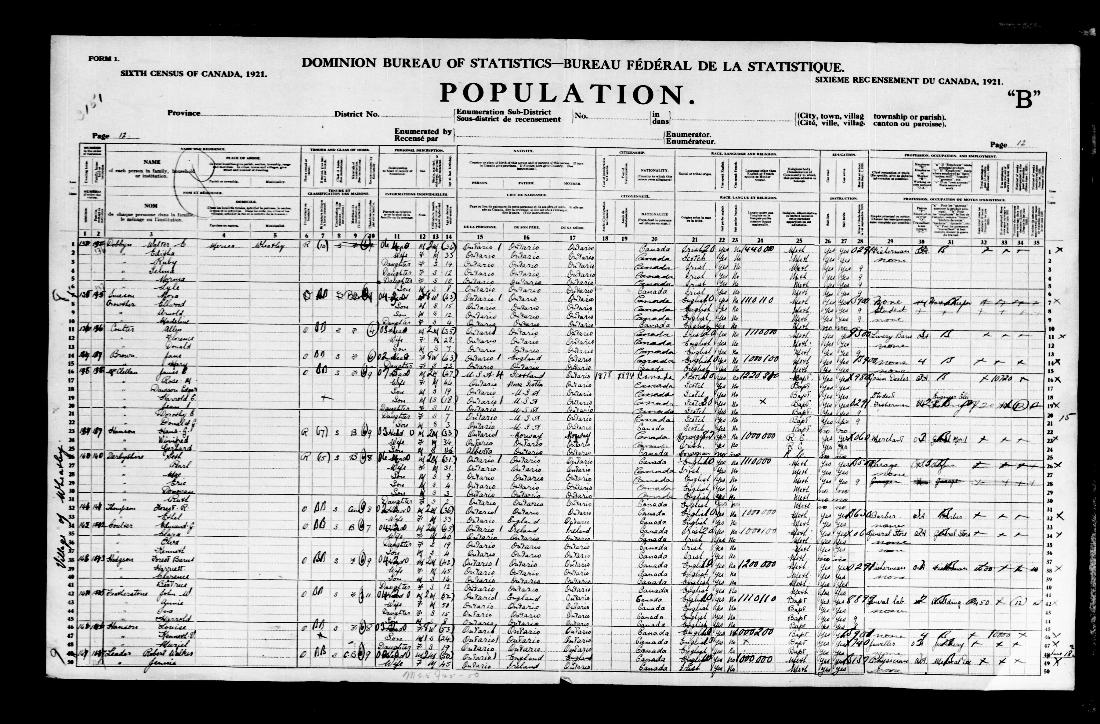
Mersea, Wheatley
Walter E Dobbyn, [Mersea] Essex South, Ontario abt 1885 Ontario Head
Mersea, Wheatley
Harrold E McClellan, [Mersea] Essex South, Ontario abt 1903 Ontario Son
Mersea, Wheatley
Forest Burns Hodgson, [Mersea] Essex South, Ontario abt 1879 Ontario Head
==
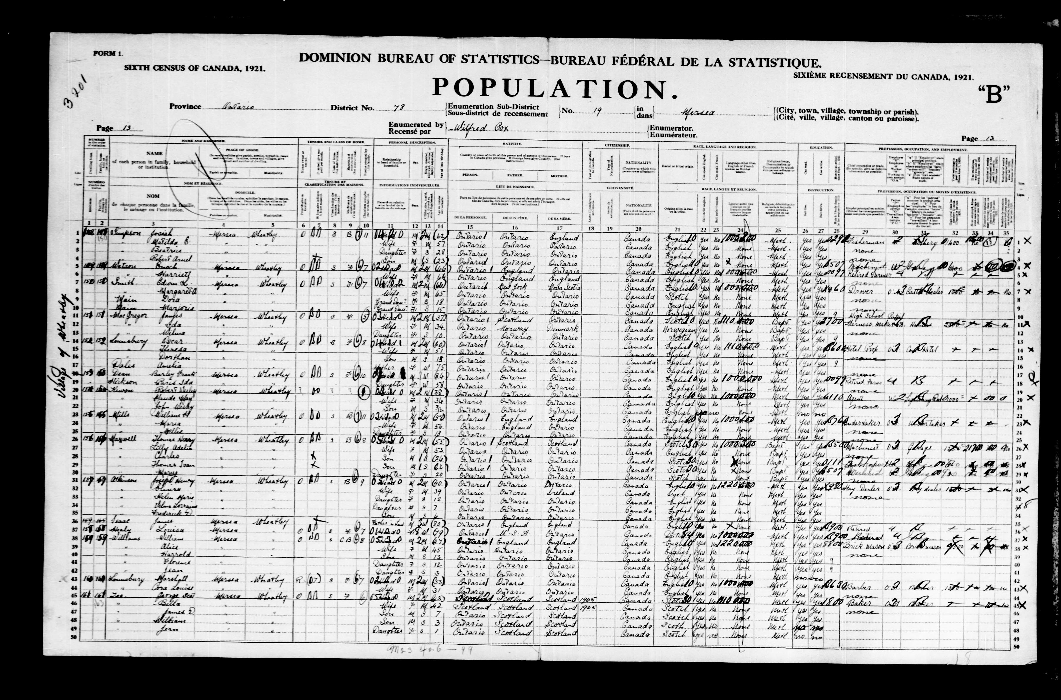
Mersea, Wheatley
Josiah Simpson, Mersea, Essex South, Ontario abt 1859 Ontario Head
==
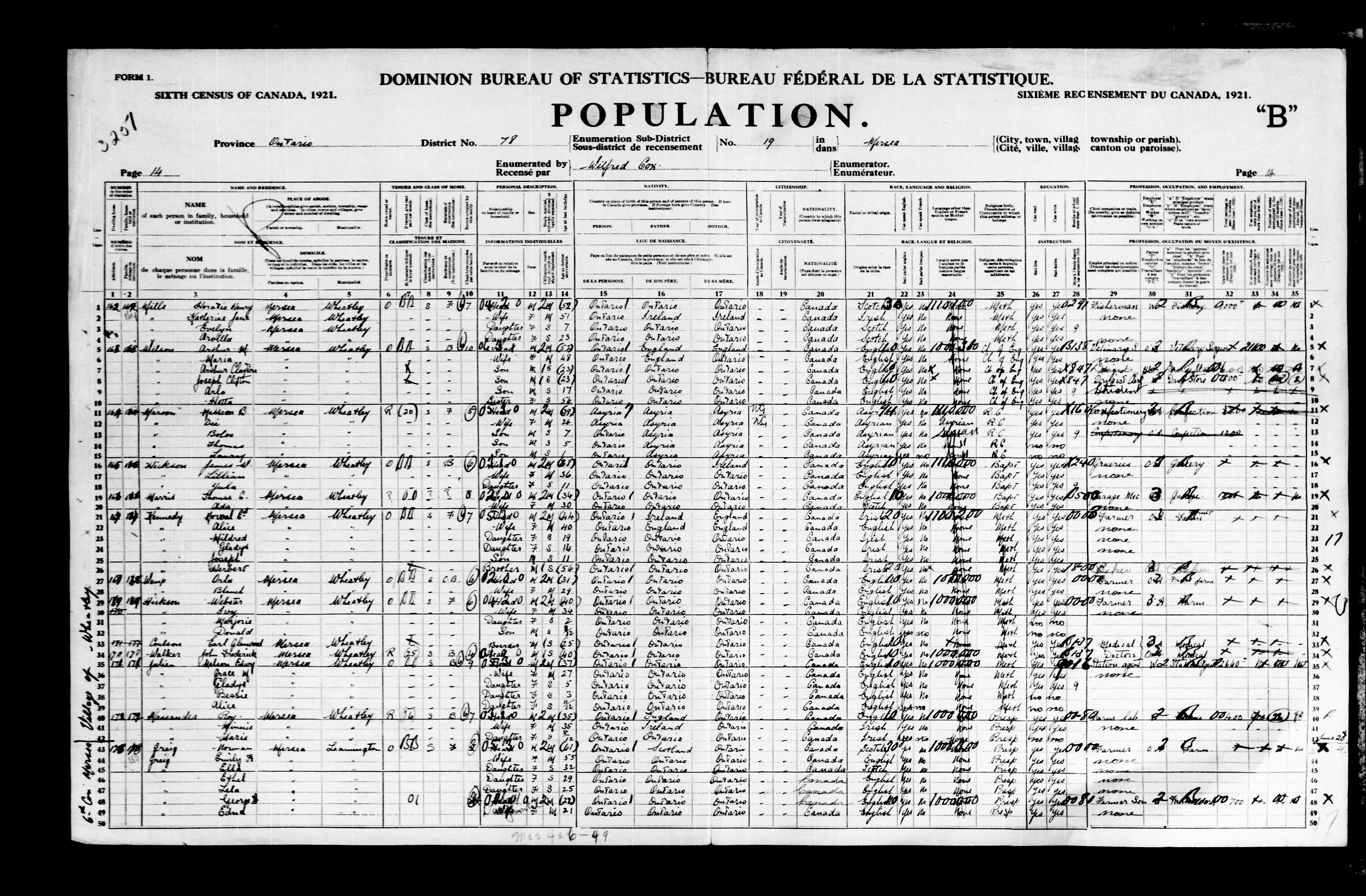
Mersea, Wheatley
Horatio Henry Mills Mersea, Essex South, Ontario abt 1869 Ontario Head
==
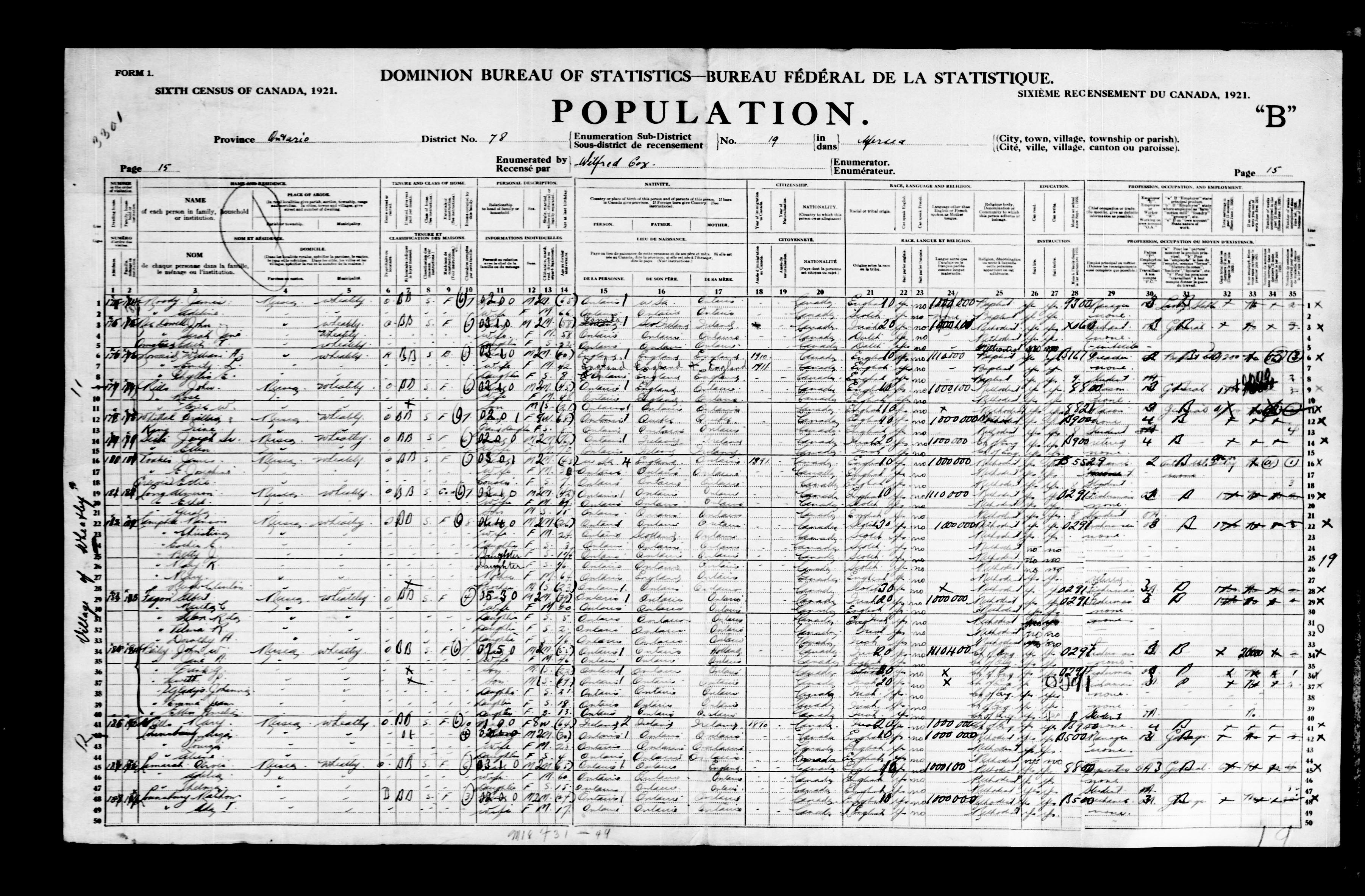
Mersea, Wheatley
Almeron Long Mersea, Essex South, Ontario abt 1879 Ontario Head
Mersea, Wheatley
Albert Fagon Mersea, Essex South, Ontario abt 1882 Ontario Head
Mersea, Wheatley
Vanson Campbell Mersea, Essex South, Ontario abt 1895 Ontario Head
Mersea, Wheatley
Lugh Clinton Campbell Mersea, Essex South, Ontario abt 1898 Ontario Brother
Mersea, Wheatley
John W Bailey Mersea, Essex South, Ontario abt 1866 Ontario Head
Mersea, Wheatley
Frank G Bailey Mersea, Essex South, Ontario abt 1899 Ontario Son
Mersea, Wheatley
Hewett P Bailey Mersea, Essex South, Ontario abt 1902 Ontario Son
==
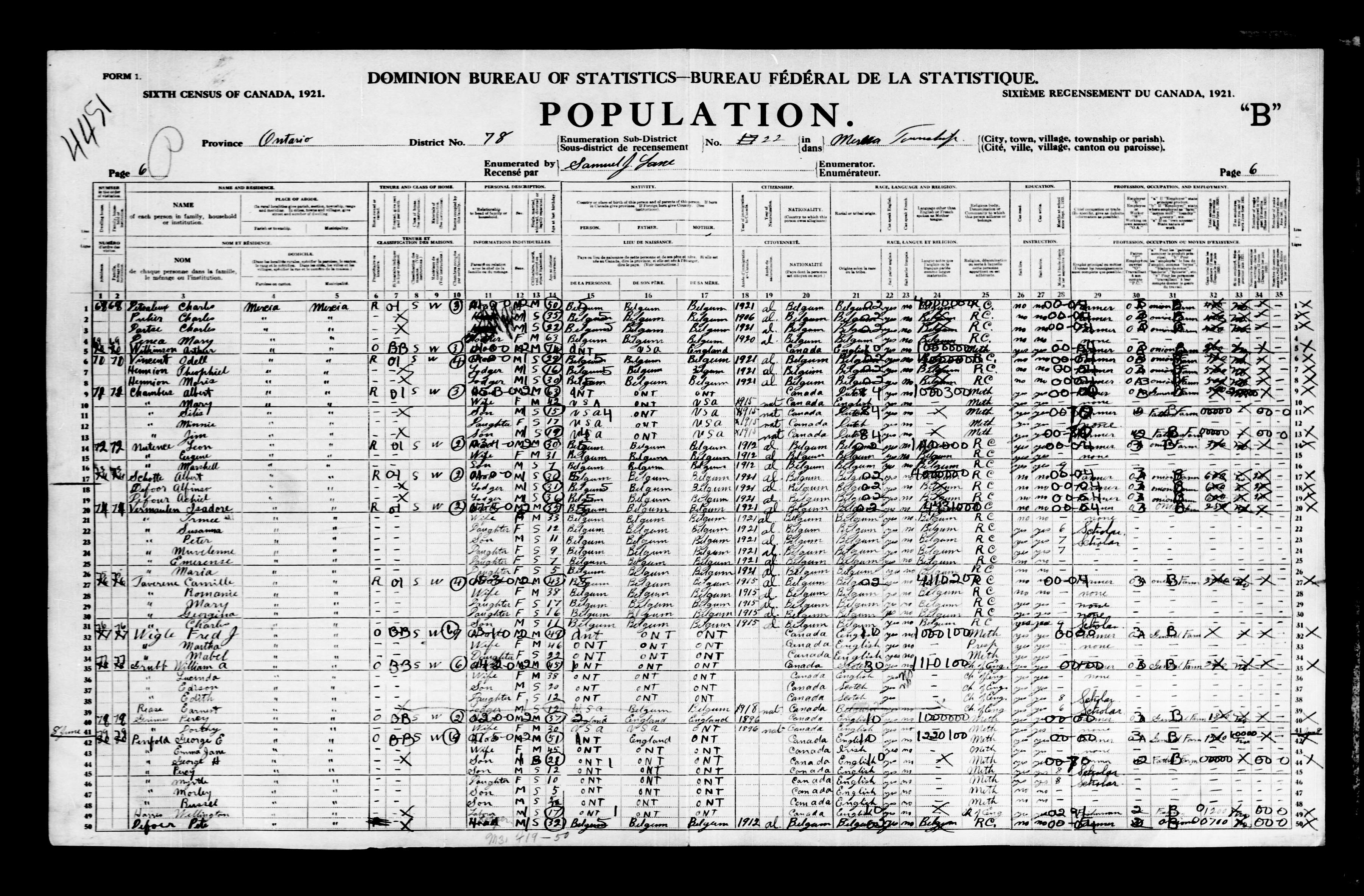
Mersea, Mersea
Willington Harris Mersea Township, Essex South, Ontario abt 1904 Ontario Laborer
==
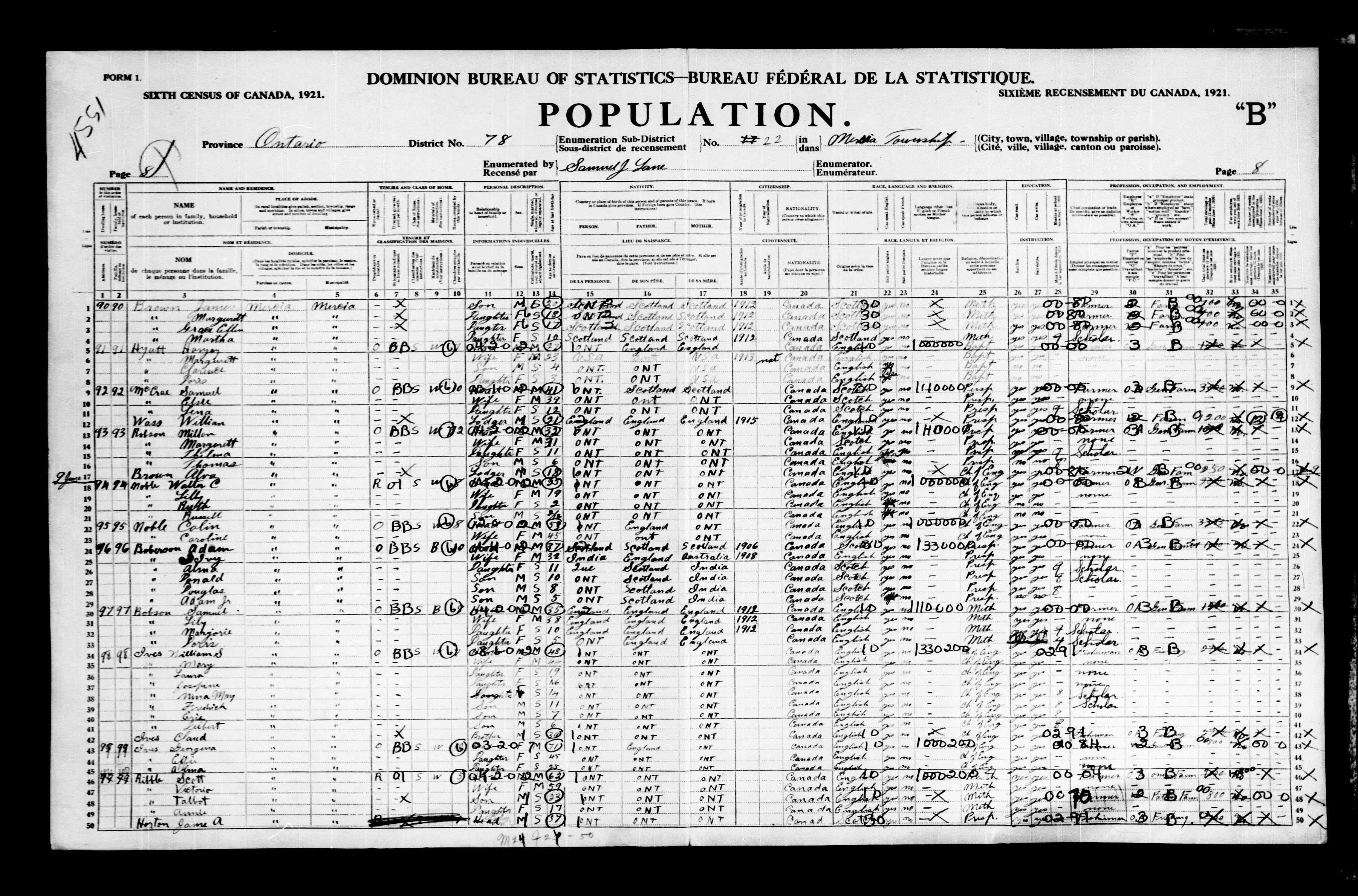
Mersea, Mersea
Claud Ives Mersea Township, Essex South, Ontario abt 1891 Ontario Brother
Mersea, Mersea
Jame A Horton Mersea Township, Essex South, Ontario abt 1864 Ontario Head
Mersea, Mersea
William S Ives Mersea Township, Essex South, Ontario abt 1873 Ontario Head
==
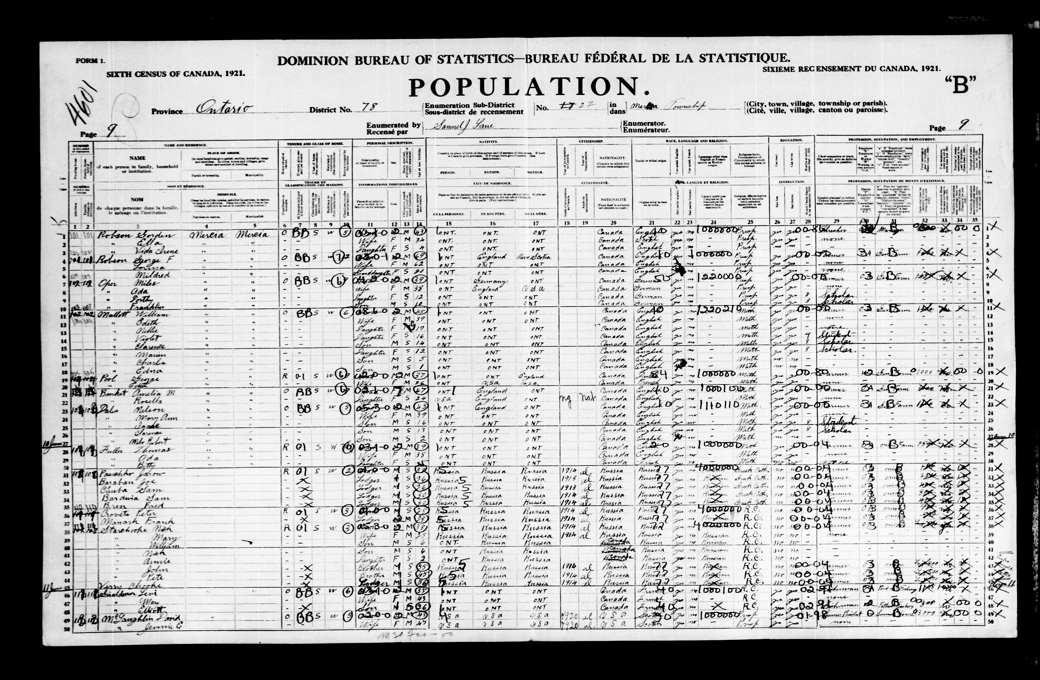
[Mersea, Mersea]
Levi Girardeau [Mersea Township], Essex South, Ontario abt 1866 Ontario Head
[Mersea, Mersea]
Elliott Girardeau [Mersea Township], Essex South, Ontario abt 1895 Ontario Son
==
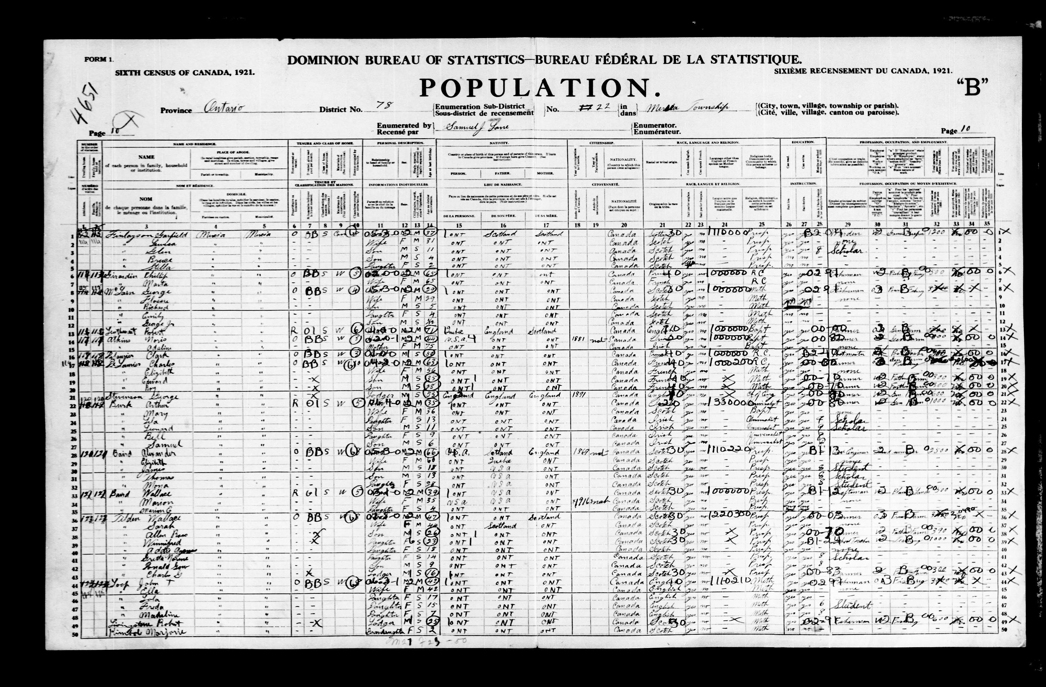
Mersea, Mersea
Phillip Girardin Mersea Township, Essex South, Ontario abt 1856 Ontario Head
Mersea, Mersea
George McLain Mersea Township, Essex South, Ontario abt 1892 Ontario Head
Mersea, Mersea
John Toop [John T Loop] Mersea Township, Essex South, Ontario abt 1879 Ontario Head
Mersea, Mersea
Robert Livingstone Mersea Township, Essex South, Ontario abt 1896 Ontario Lodger
==
Mersea, Mersea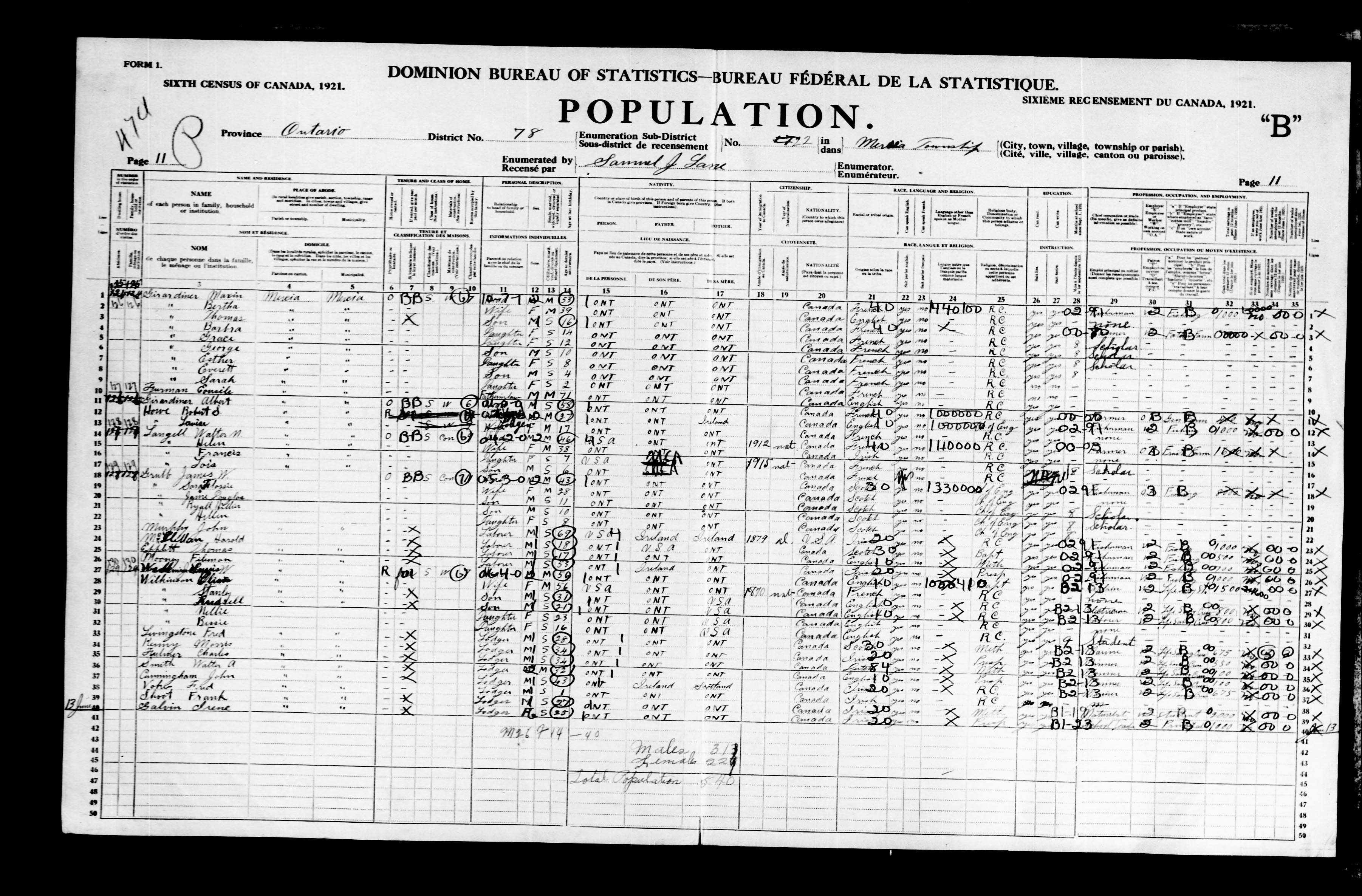
Maxin Girardiner Mersea Township, Essex South, Ontario abt 1868 Ontario Head
Mersea, Mersea
Robert S Howe Mersea Township, Essex South, Ontario abt 1894 Ontario
[Mersea, Mersea]
James W Grubb Mersea Township, Essex South, Ontario abt 1878 Ontario Head
Mersea, Mersea
John Murphy Mersea Township, Essex South, Ontario abt 1852 USA Laborer
Mersea, Mersea
Harold McMillan Mersea Township, Essex South, Ontario abt 1903 Ontario Laborer
Mersea, Mersea
Thomas Epplett Mersea Township, Essex South, Ontario abt 1904 Ontario Laborer
Mersea, Mersea
Fileman Mooney Mersea Township, Essex South, Ontario abt 1868 Ontario Laborer
==
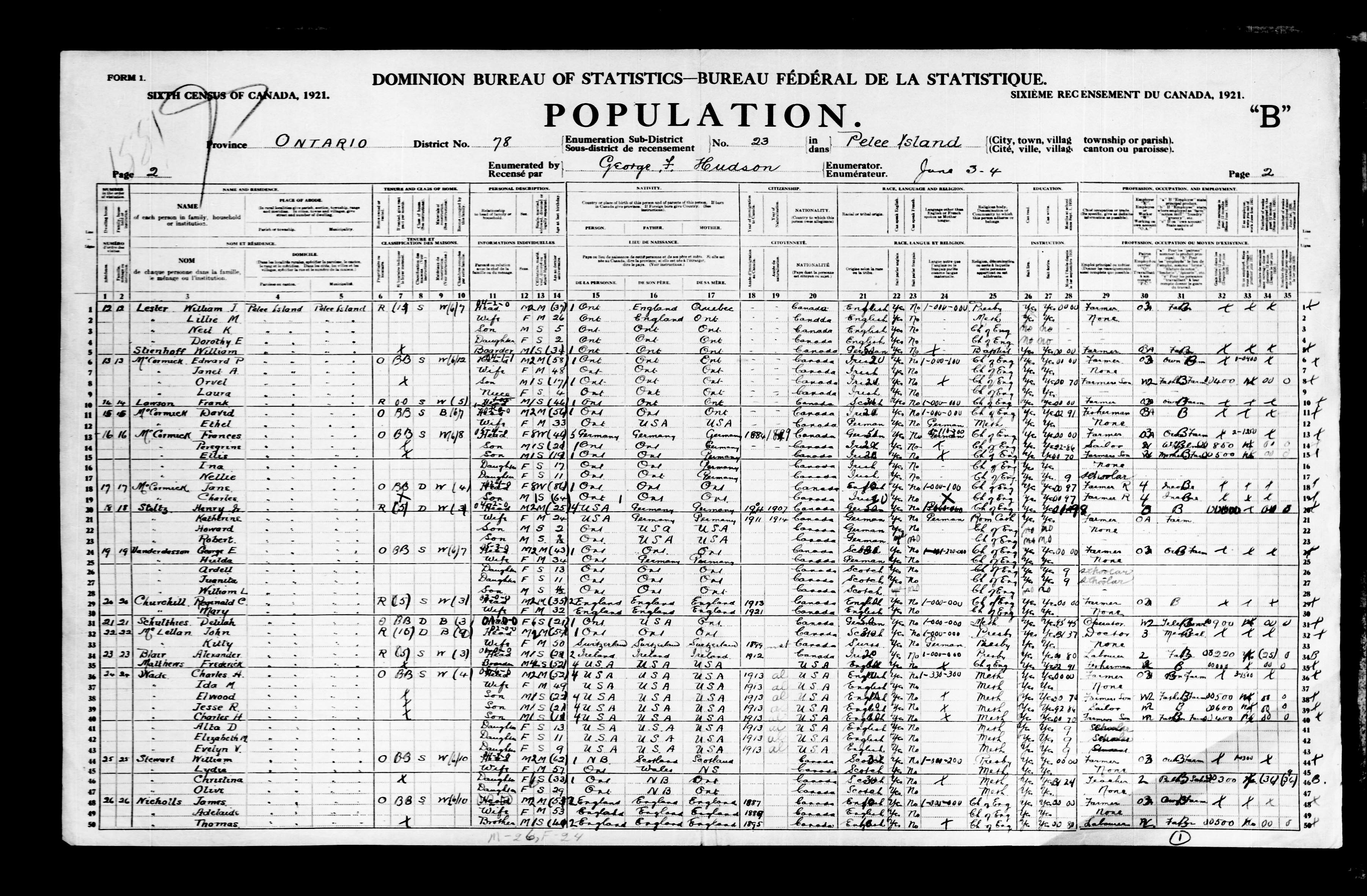
Pelee Island
David McCormick Pelee Island, Essex South, Ontario abt 1865 Ontario Head
Pelee Island
Frederick Matthews Pelee Island, Essex South, Ontario abt 1869 USA Boarder
==
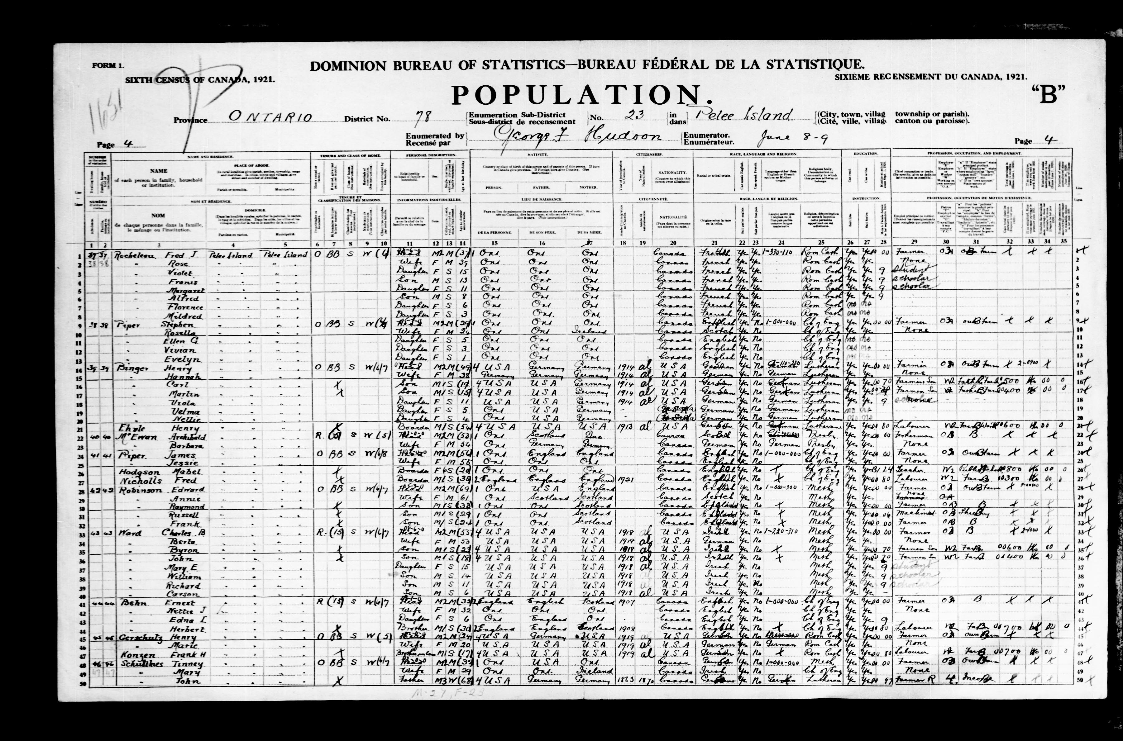
Pelee Island
Archibald McEwan Pelee Island, Essex South, Ontario abt 1868 Ontario Head
==
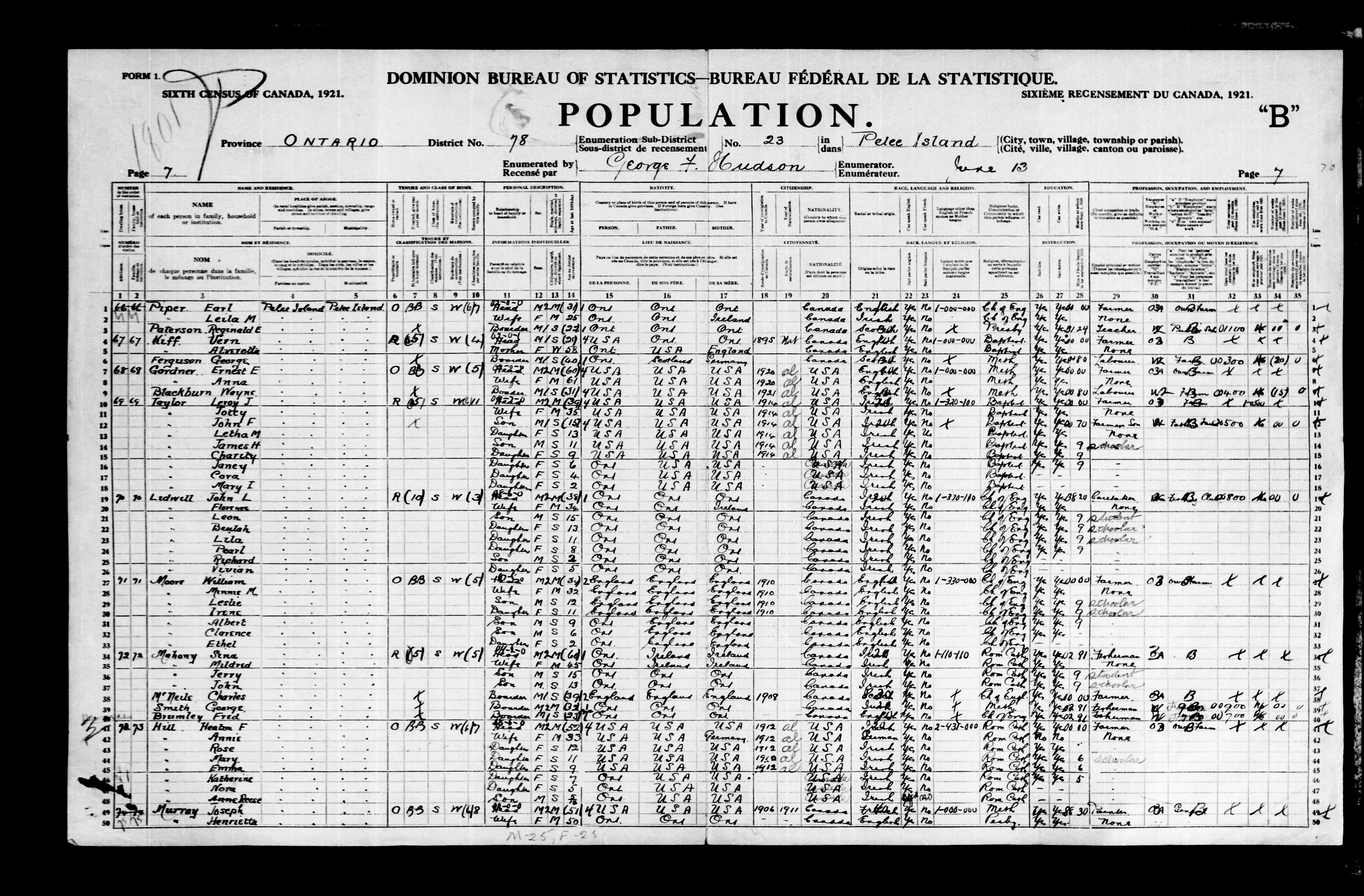
Pelee Island
Sina Mahony Mildred Pelee Island, Essex South, Ontario abt 1861 Ontario Head
Pelee Island
George Smith Pelee Island, Essex South, Ontario abt 1889 Ontario Boarder
Pelee Island
Fred Brumley Pelee Island, Essex South, Ontario abt 1898 Ontario Boarder
==
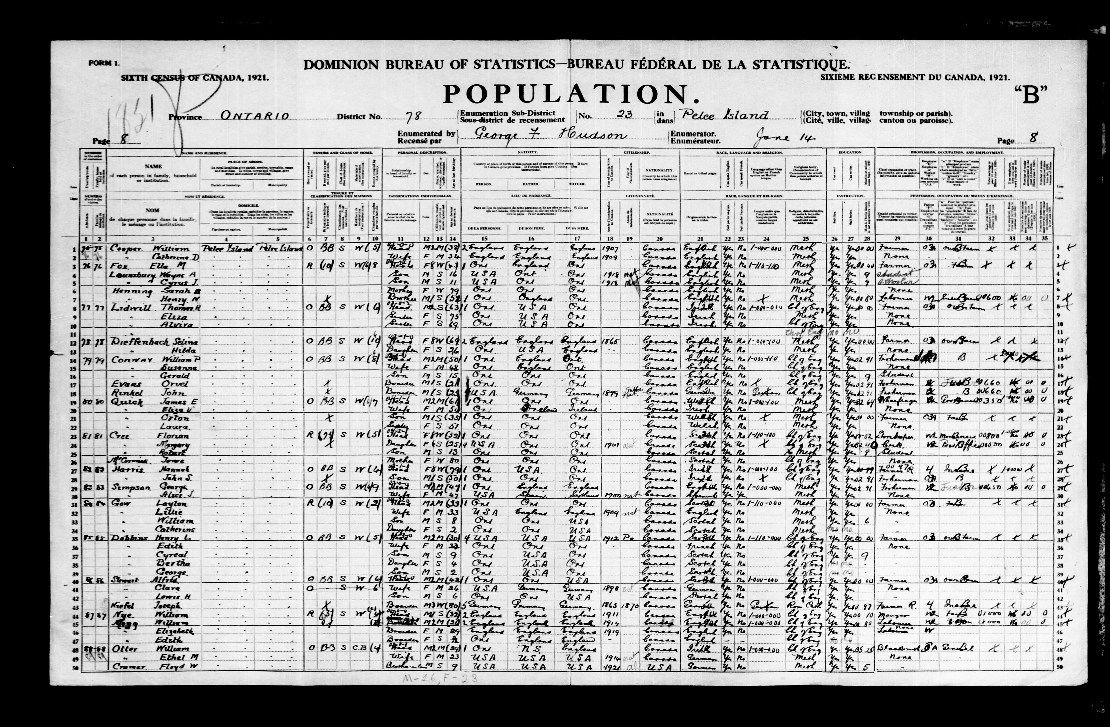
Pelee Island
William P Conway Pelee Island, Essex South, Ontario abt 1871 Ontario Head
Pelee Island
Orvel Evans Pelee Island, Essex South, Ontario abt 1900 Ontario Boarder
Pelee Island
John Rinkel Pelee Island, Essex South, Ontario abt 1896 USA Boarder
Pelee Island
John S Harris Hannah Pelee Island, Essex South, Ontario abt 1871 Ontario Son - Pg. 8
Pelee Island
George Simpson Pelee Island, Essex South, Ontario abt 1874 Ontario Head
==
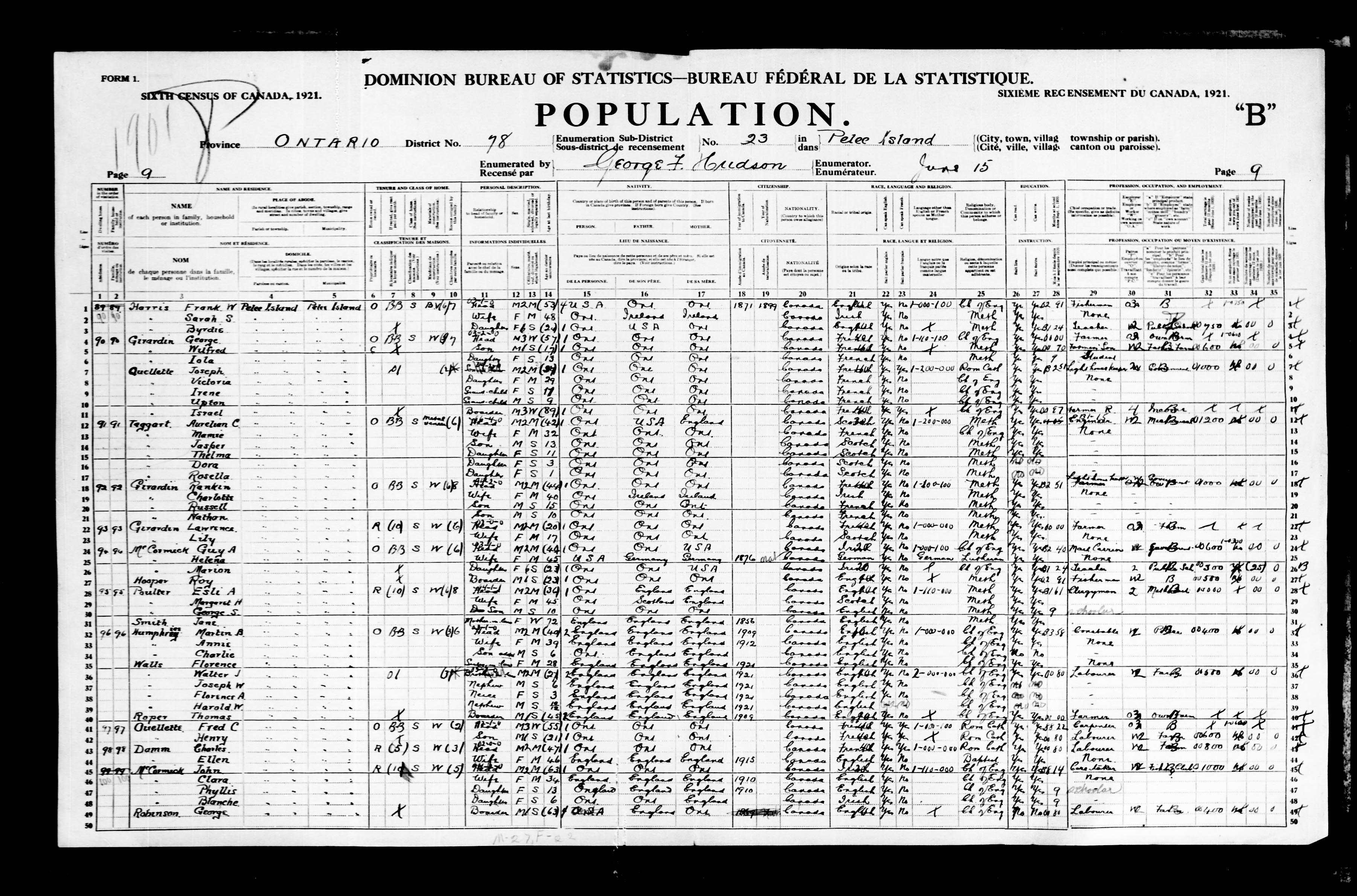
Pelee Island
Farnk W Harris [Frank W Harris] Pelee Island, Essex South, Ontario abt 1868 USA Head
Pelee Island
Roy Hooper Pelee Island, Essex South, Ontario abt 1898 Ontario Boarder
==
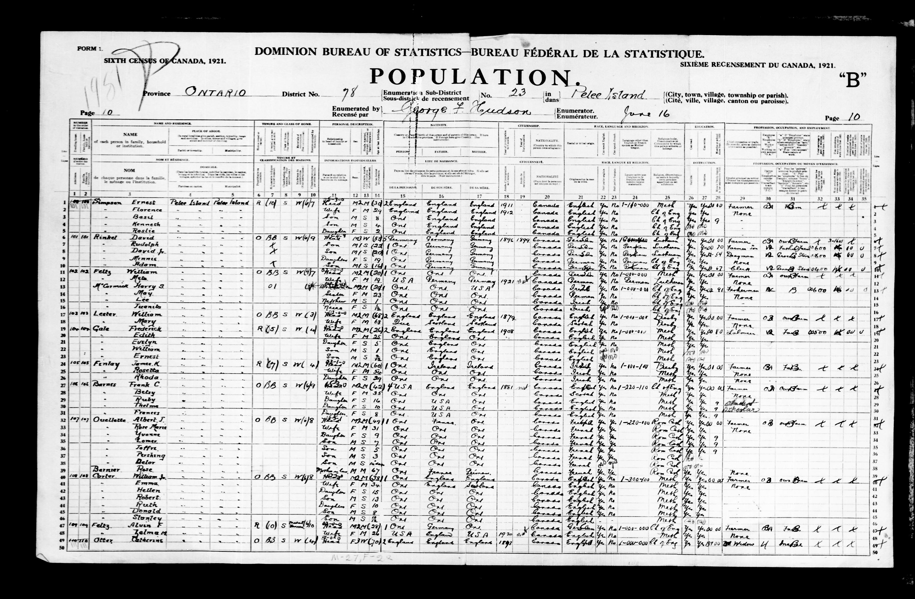
Pelee Island
Harry S McCormick Pelee Island, Essex South, Ontario abt 1901 Ontario Brother-in-law
==
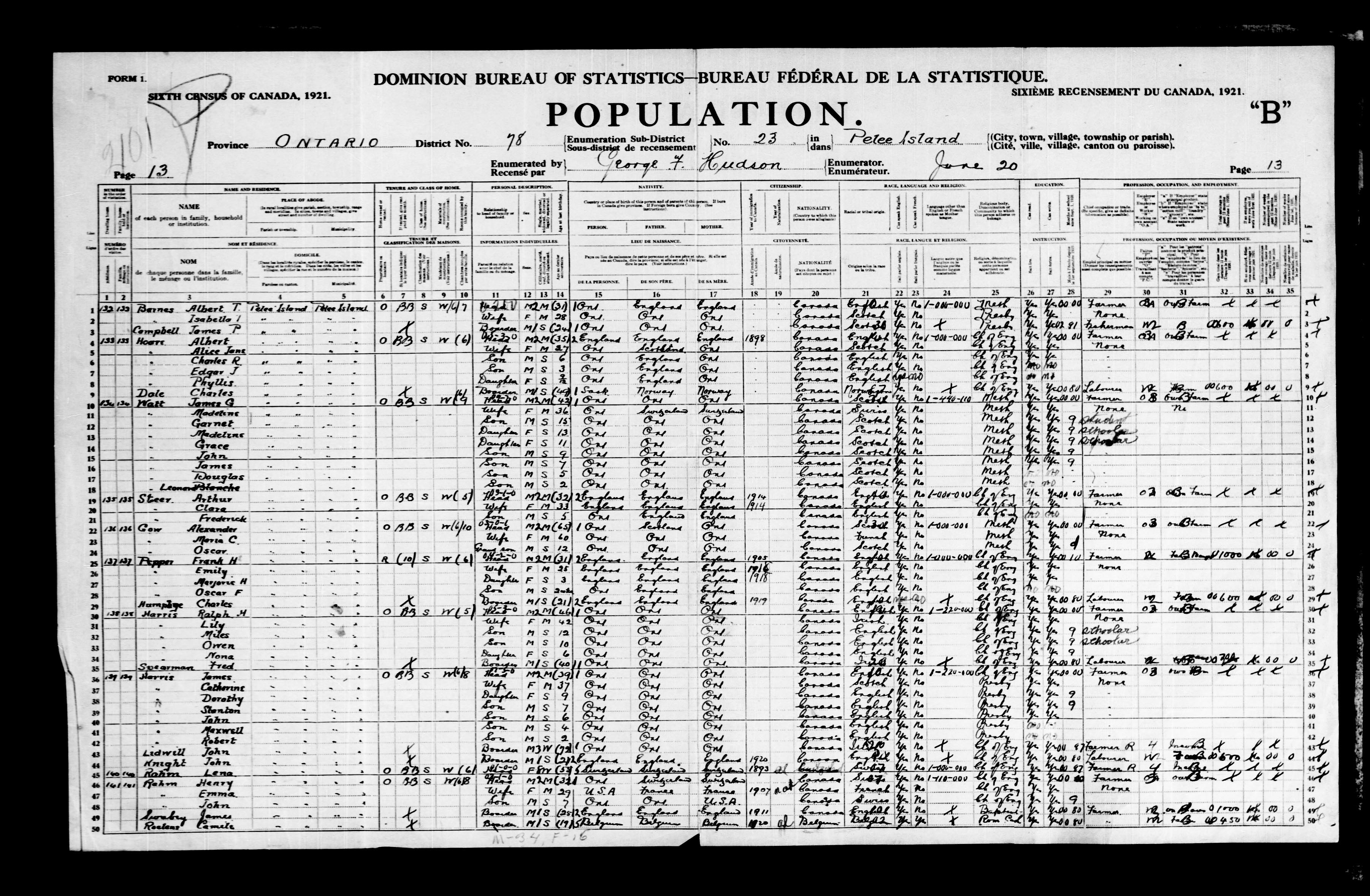
Pelee Island
James P Compbell Pelee Island, Essex South, Ontario abt 1897 Ontario Boarder
==

Pelee Island
Elmo Deiffenbach Pelee Island, Essex South, Ontario abt 1873 Ontario Head
==

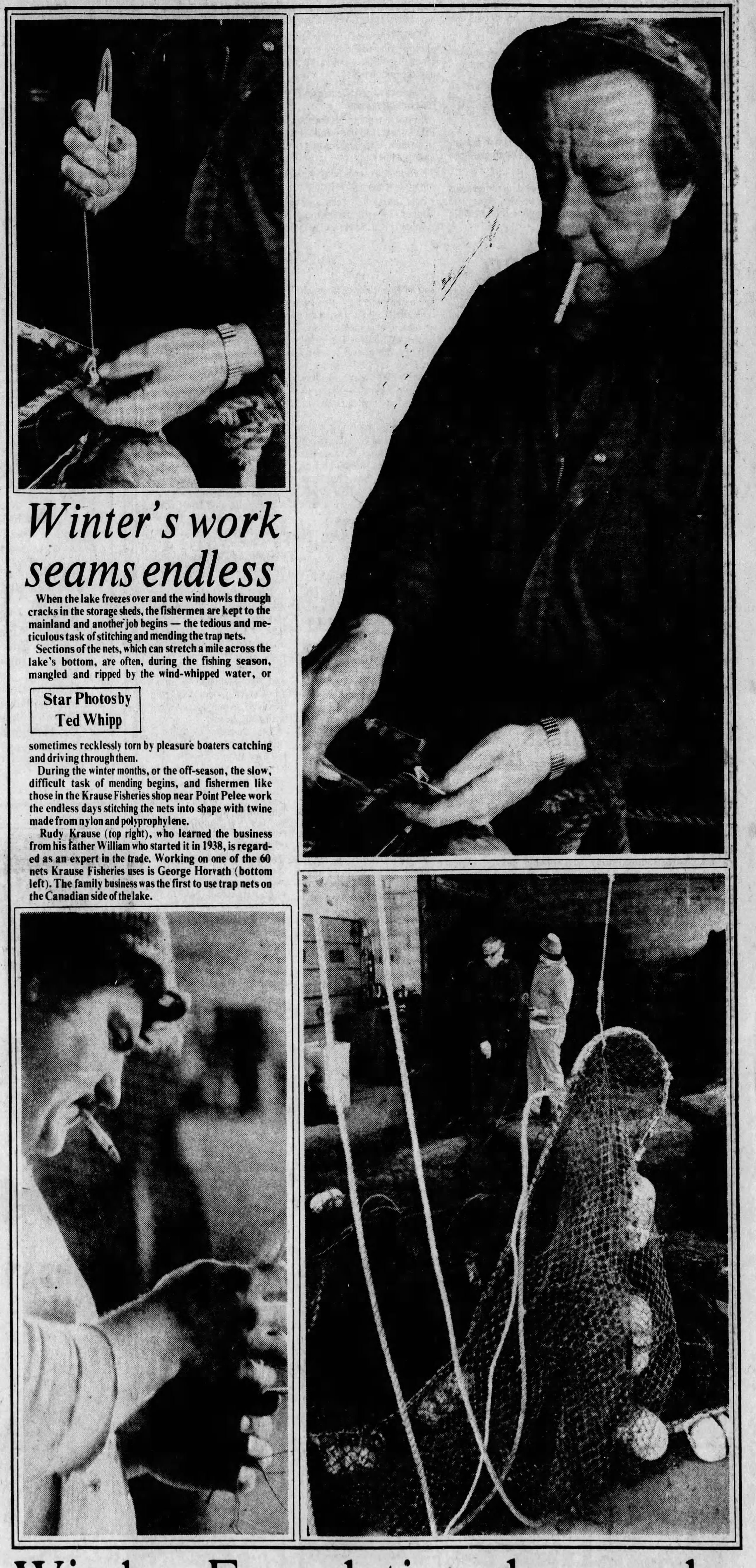
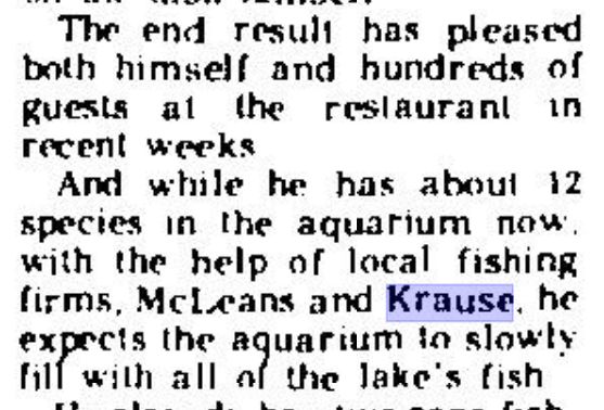
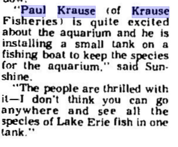
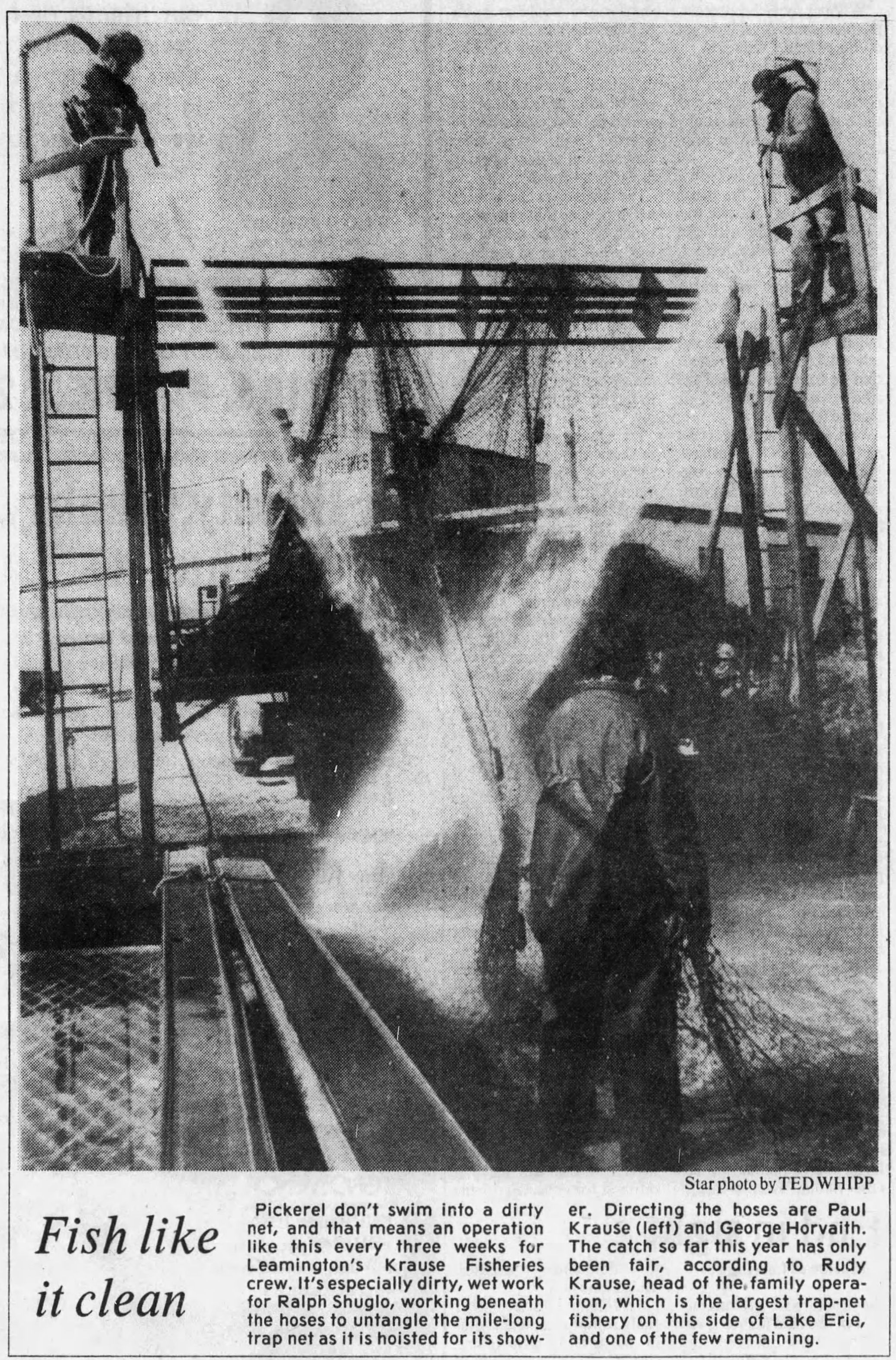
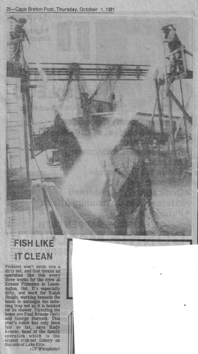
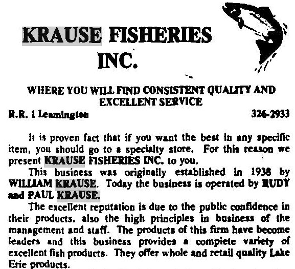
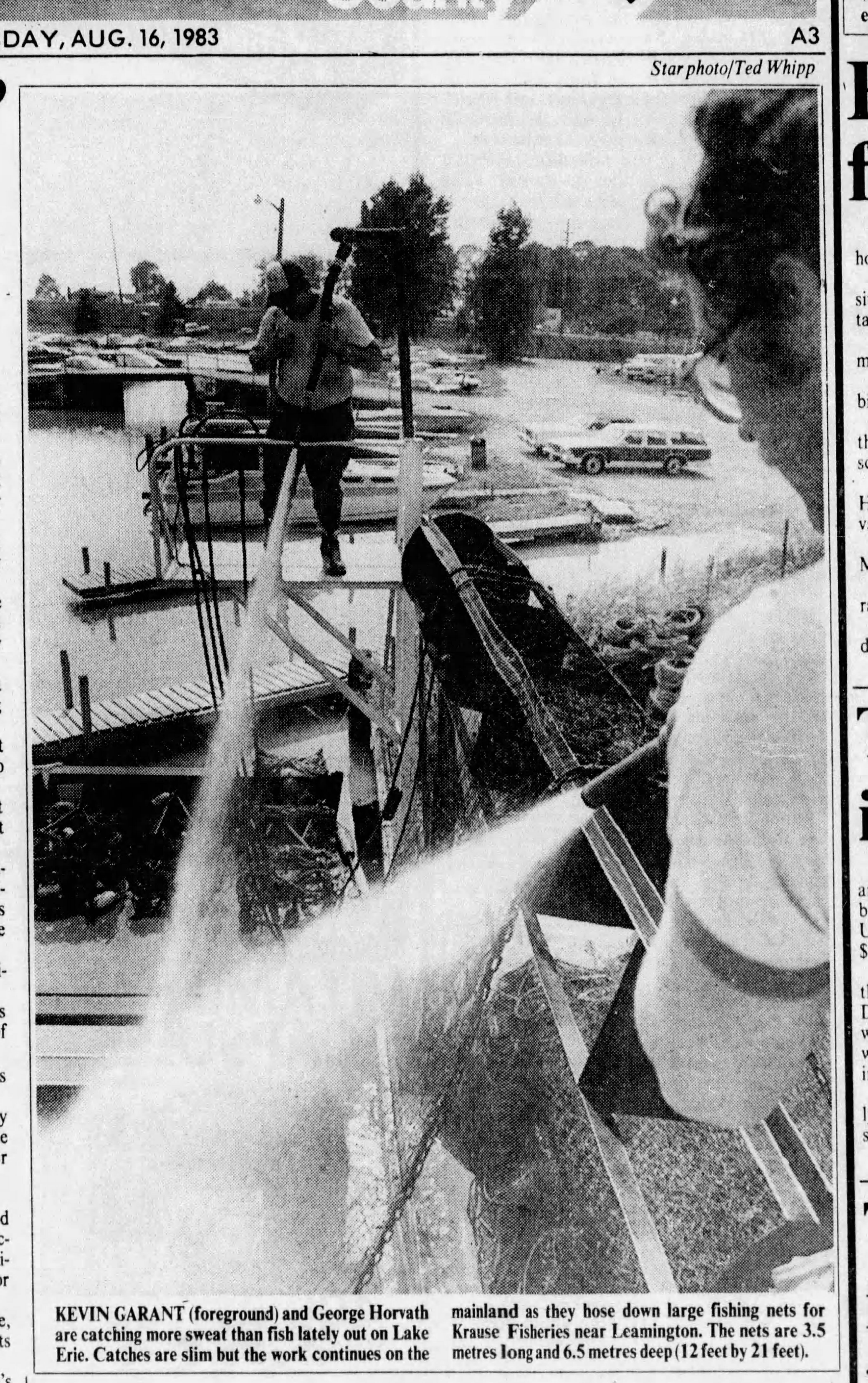
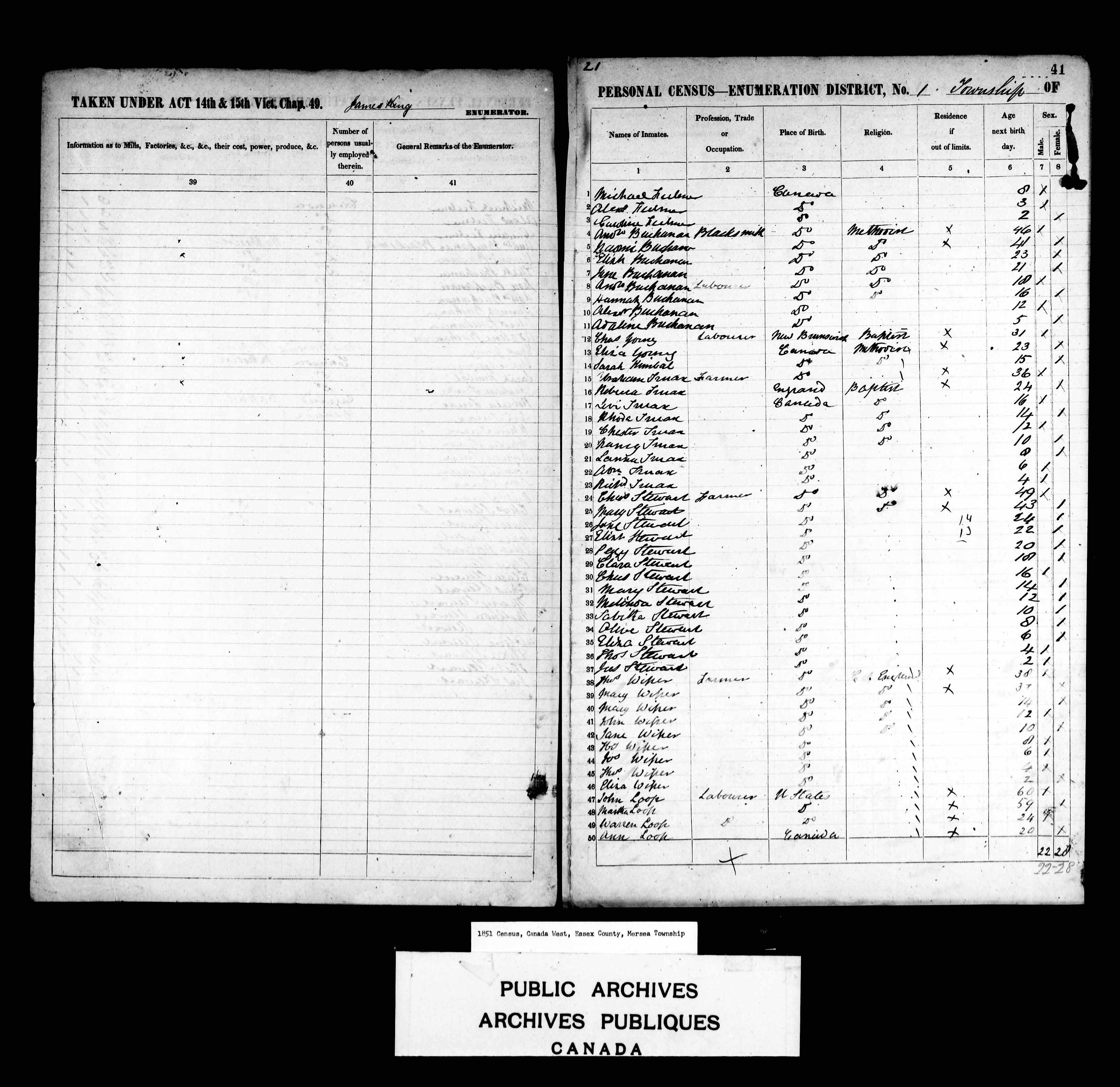
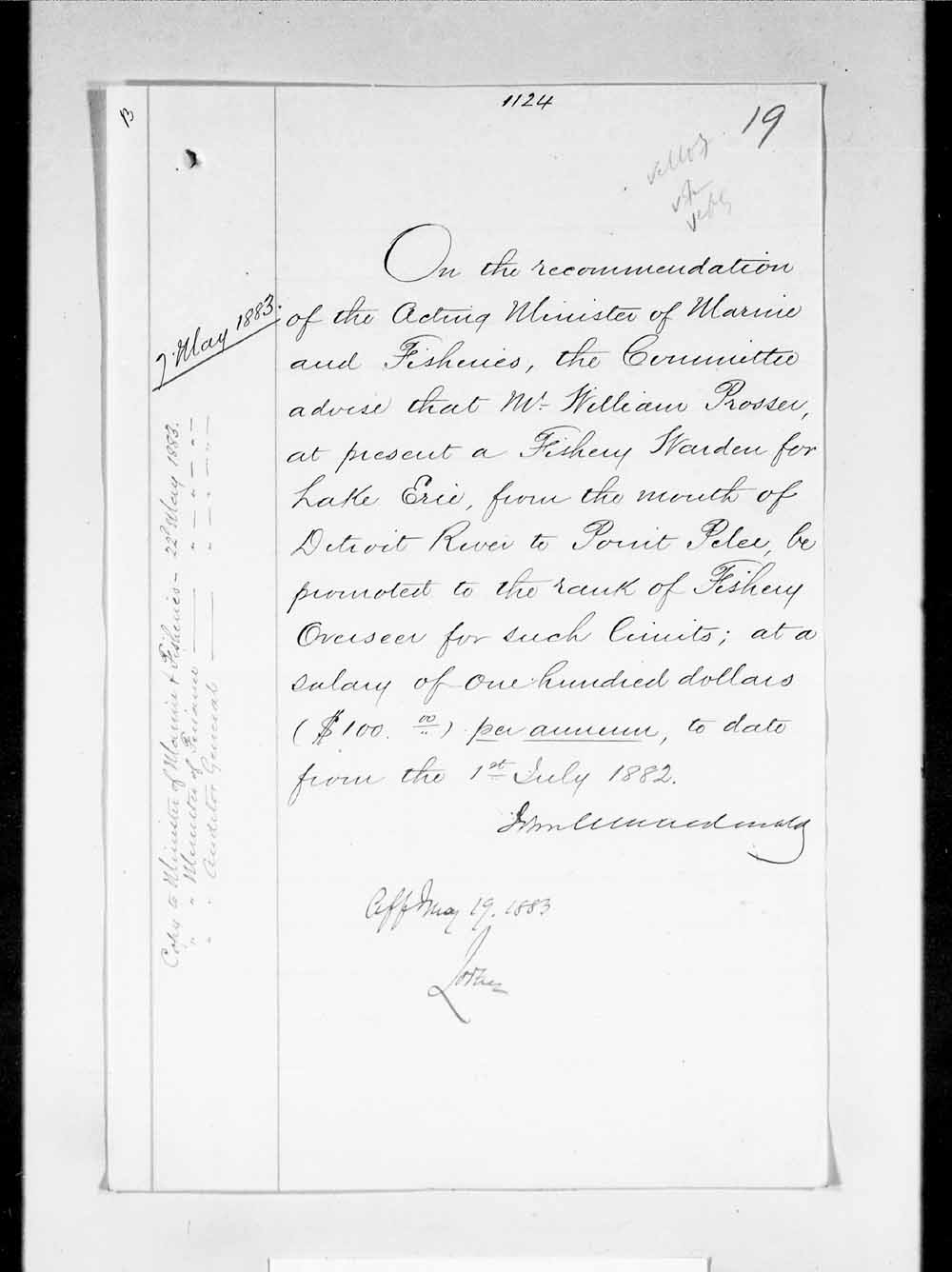
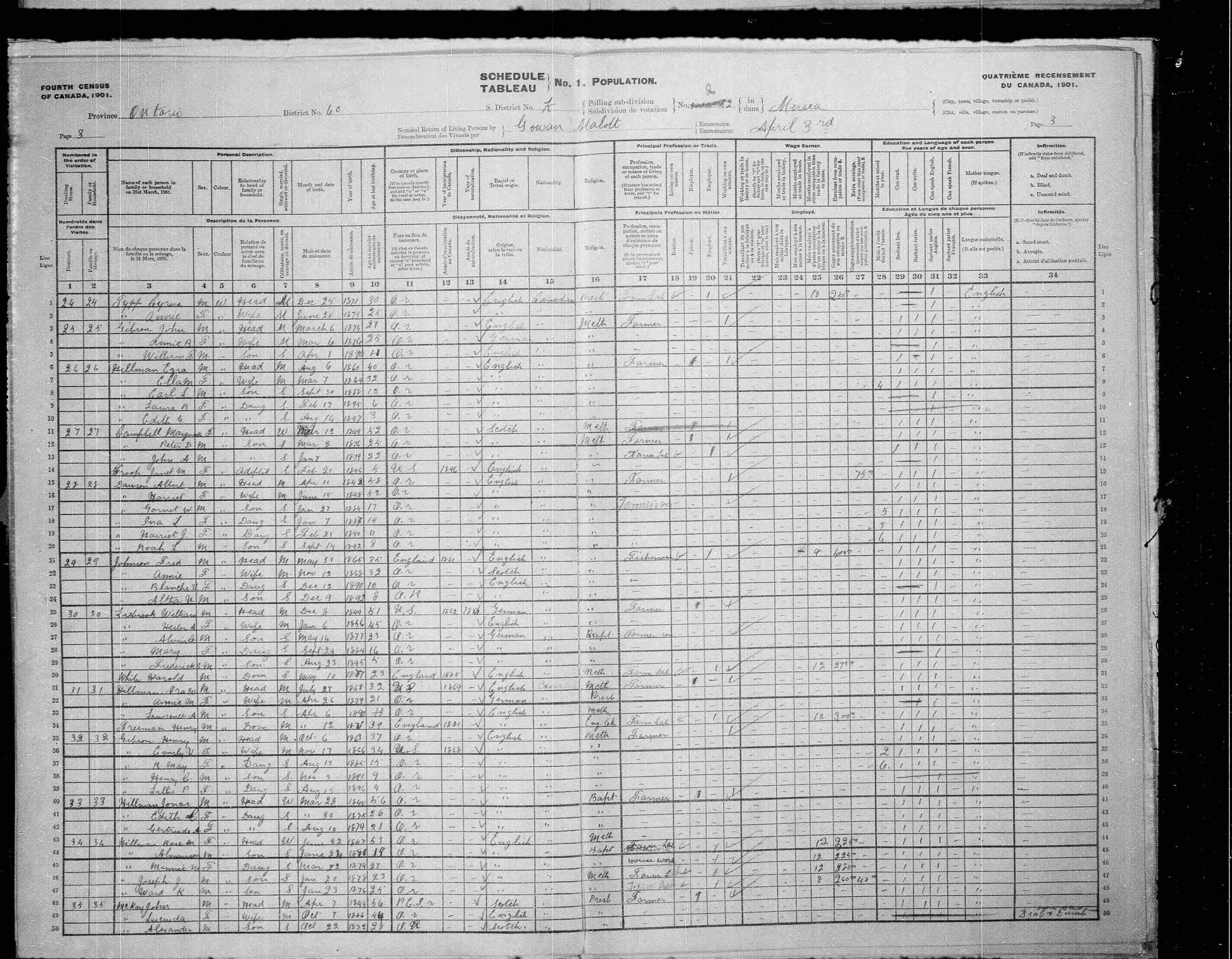